You may have heard about the “bomb cyclone” and the “atmospheric river storm” that affected the Western United States two weeks ago. With fifteen years of work in the meteorological field, I was surprised to see this term all over the news, while unfamiliar with it. I looked it up and learned that what reporters are calling “bomb cyclone” is a rapid cyclogenesis, and “cyclogenesis” is a term I know. It’s the formation of atmospheric rotation. Rapid, or explosive, cyclogenesis is dangerous due to the speed of the drop in atmospheric pressure. This can cause severe storms and high precipitation. I imagine that my meteorology training in the Air Force and then later with the National Weather Service, avoided teaching me to use such a fear-inducing word as “bomb.” But these days where news is mostly drama and entertainment – even when it’s a weather report – the word bomb will get more eyes on the screen and more clicks. *sigh*
“Atmospheric river” is also a term I didn’t use when I forecasted the weather, but the concept is very familiar. The one I dealt with most often has its own name, the Pineapple Express, an atmospheric river that pulls airborne water vapor from the Pacific tropics northeastward toward the Pacific Northwest Coast. When conditions are right, that influx of ingredients (warmth, moisture) can boost coastal storms bigger than they would have been otherwise. Furthermore, due to the direction of the atmospheric river, that warm water vapor gets pushed over our Coastal mountain range – and then the Cascade Range next. The sharp drop in temperature causes decreased evaporation and increased condensation. In other words, it gets very wet. The entire coast-facing slopes are drenched, and if it’s cold enough, the precipitation falls as snow.
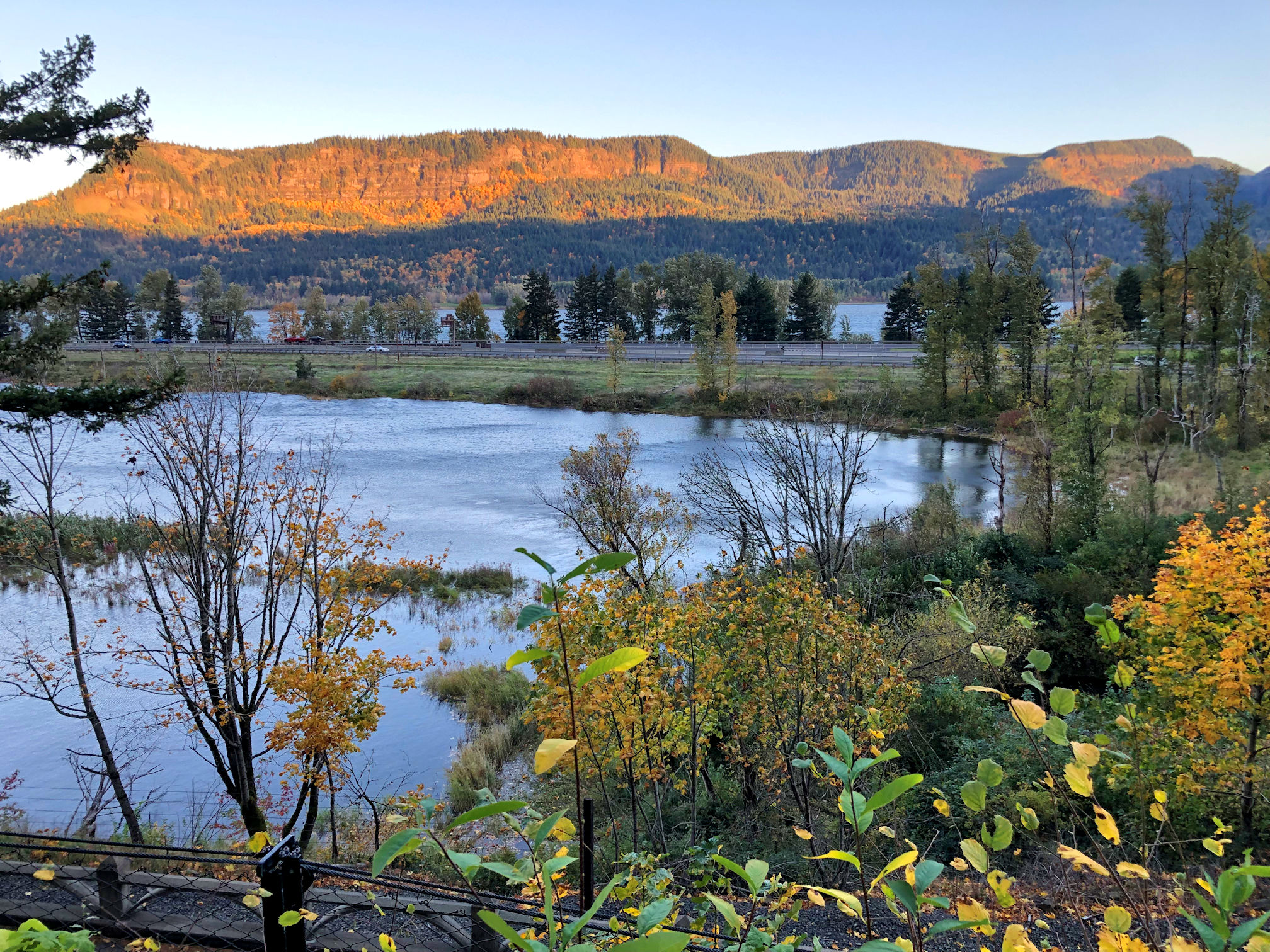
With these two meteorological phenomena occurring together, you can guess that it was wet here. Now, I am used to rain. The Oregon Coast is famous for it. But this rain was relentless. A heavy, steadfast fall of soaking rain that fell day after day after day, morning, noon, and night. We are so used to rain around here that the usual drizzle and off-and-on rainfall that lasts from November through May doesn’t stop people in their daily activities. People go outside in the rain just as often as dry days, to get exercise, go to the park, hike the trails, do yardwork, etc. Most people don’t even bother with umbrellas, and if they change gear at all, it’ll be just to throw on a hat. Portlanders make fun of out-of-towners who we can spot because they are the ones in slickers and carrying umbrellas. But the Bomb and River rain was something else. I whined to my friends and gazed forlornly out the windows. I only left my house to feed the chickens. My poor bedraggled hens had wet feathers stuck to them as they went through their usual scratching and foraging activities. My cat Racecar used her litterbox exclusively, though she really prefers to relieve herself outside. She wouldn’t go outside for nuthin.’

Pedro had a no-kids weekend and we would both be free, so we checked the weather and saw that Saturday and Sunday, sunny skies were forecast. It was hard to imagine. Each day we checked and the forecast remained consistent. We decided to go for a hike. The forecasters were spot on, and Saturday morning dawned brilliantly blue with exceptionally clear skies. It was almost unreal.


I recommended a hike right in the heart of the Gorge. It’s been a long time since I’ve been on some of the best trails in the Columbia River Gorge. An idiot 15-year-old threw a smoke bomb (a type of firework) into a canyon in 2017 for fun, and surprise, surprise, it started a wildfire that burned nearly 50,000 acres of forest centered in the most popular tourist, camping, hiking, vacationing area outside of Portland. Naturally, the trails were closed for years and didn’t open till just before the pandemic, when they were closed again due to the popularity of the region. I thought it was time to go back there, especially since Pedro said he was not familiar with the Gorge waterfalls trails.
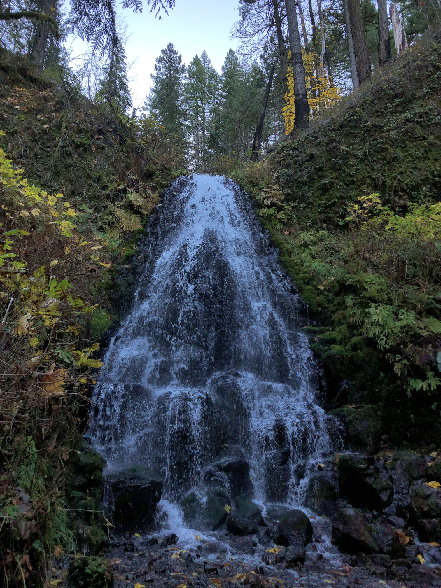
We decided to go on the Wahkeena Falls Loop Trail, a six-mile trail that climbs to 1,751 feet (534 m) at its highest point, and passes lots of waterfalls. I forgot to bring my camera!! So these are all iPhone shots.

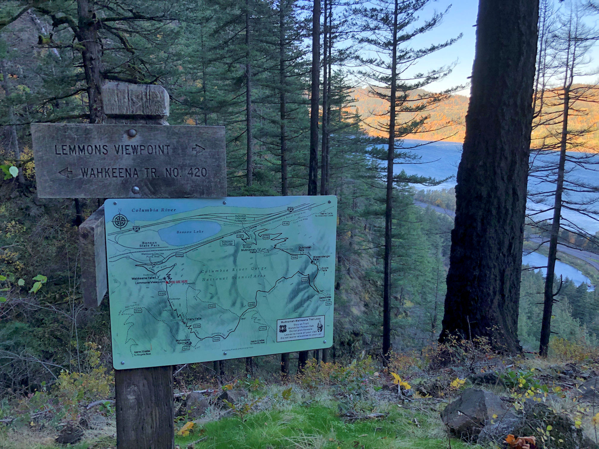
I had seen on the Multnomah Falls website and on hikers’ comments on the AllTrails app, that a portion of this loop trail was closed. I was really hoping that it would be opened in time for our hike. After the fire, the soil stability was ruined on these steep slopes, and the trail was in danger of sliding away and putting lives at risk. This was the reason for the trail repair and closure. According to the signs, it was supposed to be opened by today, but it looked like we were not in luck, since the warning signs were still posted. We left early because we planned to park at Multnomah Falls, the most visited tourist spot in the state of Oregon. The parking lot frequently closes due to being full. It was a sunny Saturday so we played it safe and arrived at about 8:15 a.m. The parking lot was rather empty.

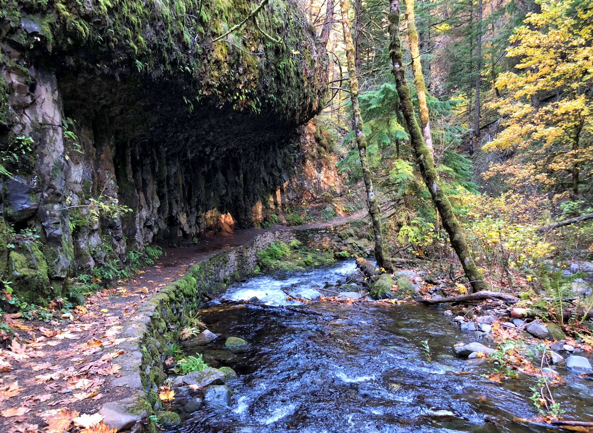
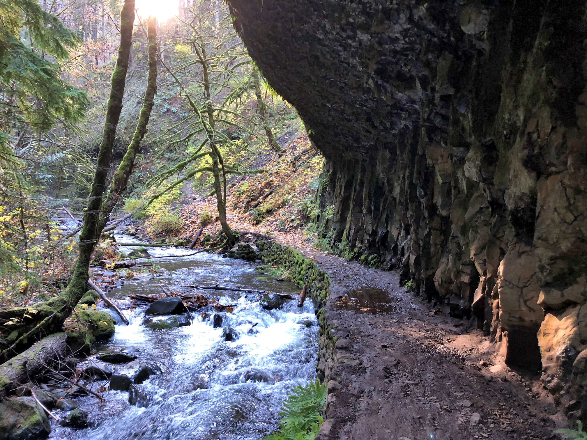
We started at Wahkeena Falls which is close to the road and the trail is paved, with an alternate ramp approach so people using wheelchairs aren’t blocked by the stairs. We followed a man using a wheelchair until we came to a tree across the trail and the three of us working together managed to get the tree up and out of the way. The name “Wahkeena” is a dubious transliteration of the Yakama name of the falls into English.
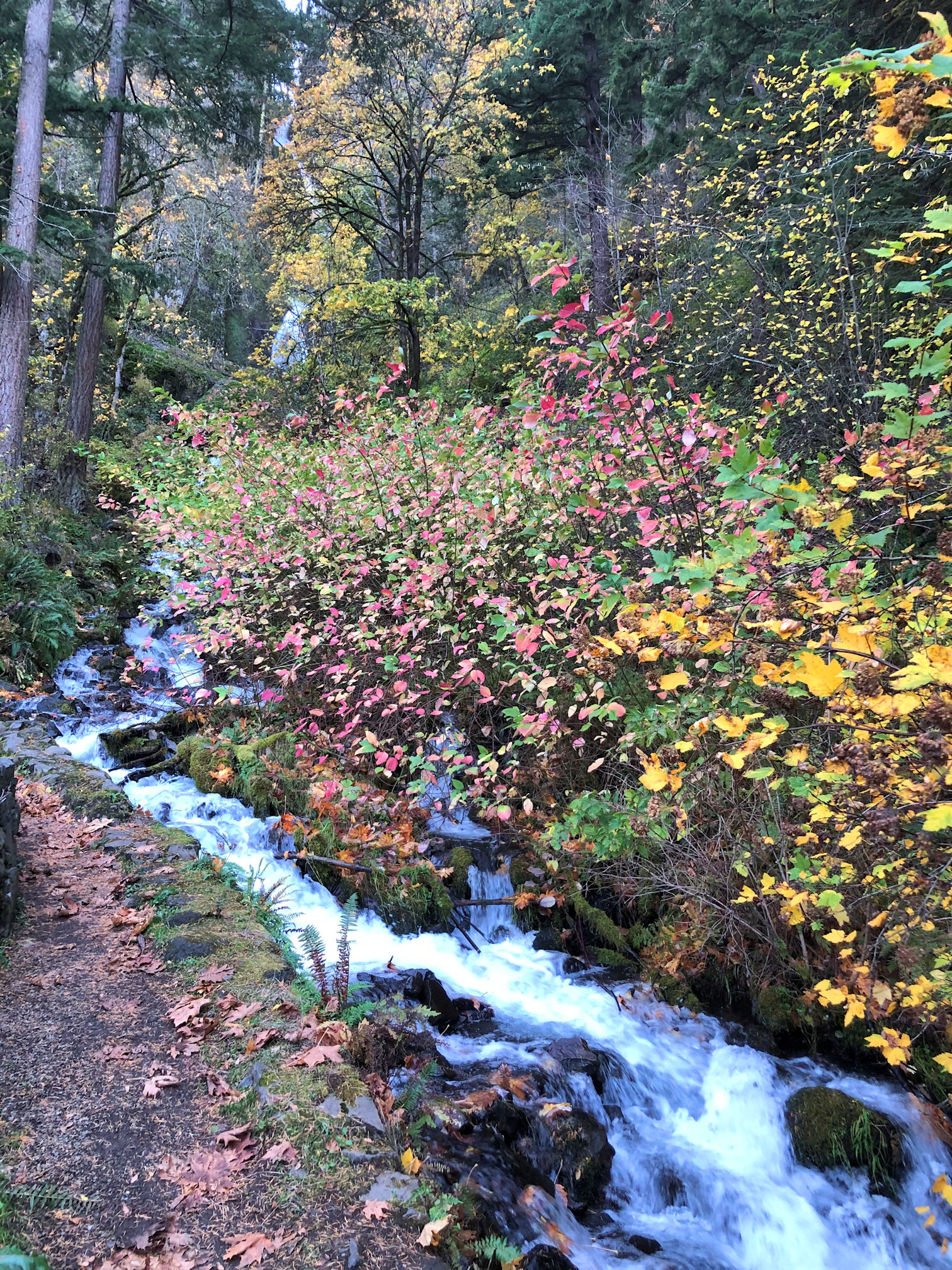


The trail is paved all the way up the side of Wahkeena Falls to an overlook point at the top of the cliff. The switchbacks were tough, but all that climbing was exactly what we needed. During the days and days of rain, it had been quite warm here, in the 50s (10-15 C). But without the protective cloud blanket, the overnight low had dropped significantly and it was near 40 degrees (4 C). We were so cold at first, but warmed up when we climbed the steep mountain trail.


Here’s a post with great photos of the hike up to the top of Beacon Rock.


Driving into the Gorge and gasping at the outstanding clearness of the skies, I originally thought we should change our hike plans and find a mountaintop to climb to that would give us a view of volcanic peaks. On this day we could see for miles and miles! But as we drove into the Gorge, the winds whipped up and my car was buffeted around the highway. I gave up the idea of wanting to be on an exposed ridge. When we walked from the car to the trail, we were again tossed around, and while the trail was still in view of the river, the winds continued to pummel us.
Predictably, the dead timber all around us was having difficulty standing up to the wind. While on the trail that morning, we actually witnessed a tree crashing down! We heard more crashes periodically, and had to climb over multiple trees that had collapsed across the trail. We came across another hiking couple as we were crossing one log, and they exclaimed to us that they had watched that one come down. “Be careful!” we warned each other, as we went on our way. Pedro began planning a strategy for dodging a falling tree if necessary.


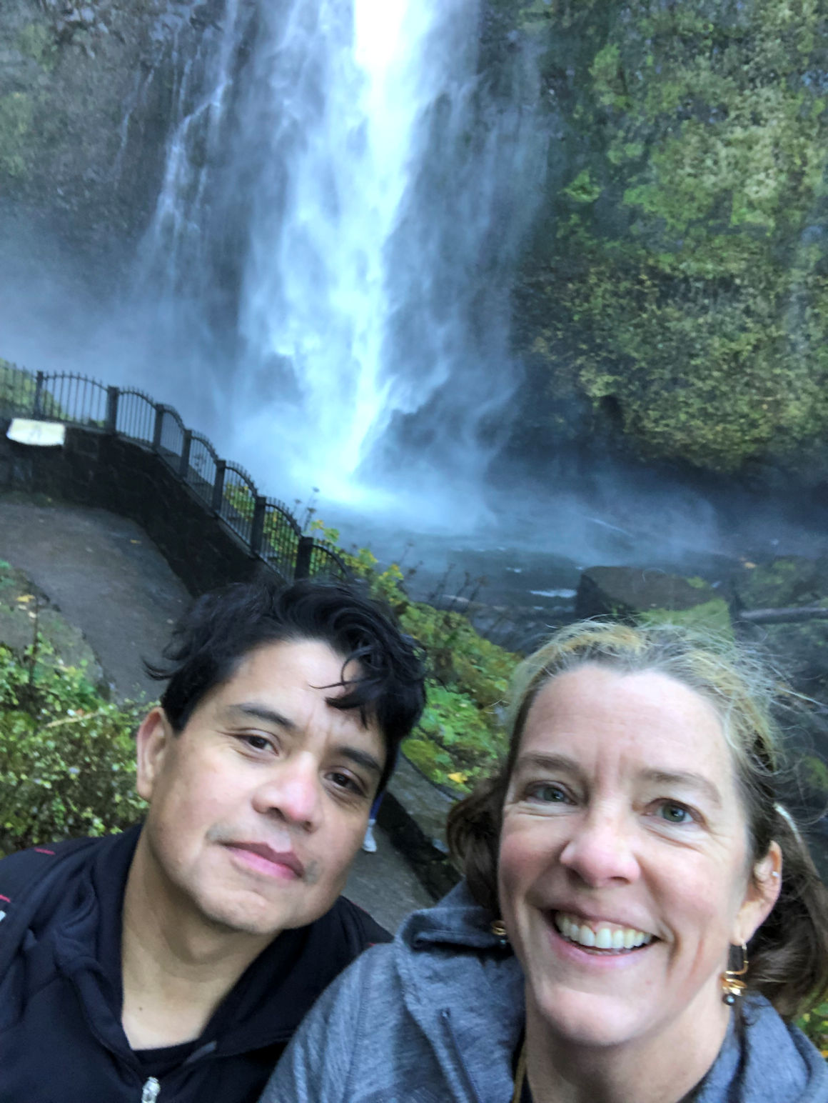
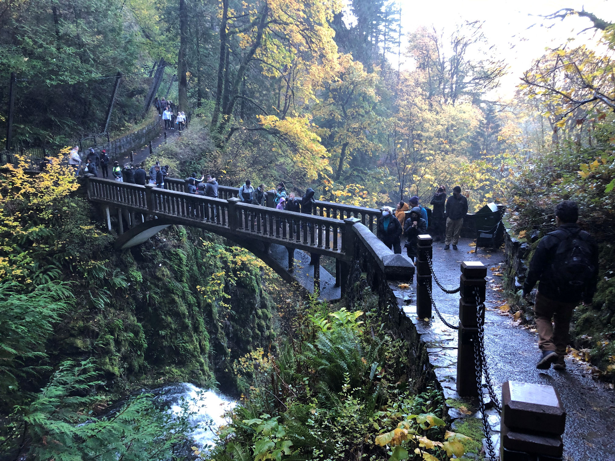
After a few hours of hiking, we had wound our way back to the edge of the mountain and views of the Gorge again. The winds whipped up once more. Soon we found the trail leading to the overlook point above the massive Multnomah Falls. The falls is the tallest in the state of Oregon at 620 ft (189 m). My stomach did flip-flops as we looked over the edge. Here, I’ll do that to you as well. Hold onto something, then watch this video:


Near the top of the falls viewpoint, there was a hazard ribbon stretched across the trail, and yet another sign posted, warning hikers that the trail was closed. So disappointing. But when we arrived at the overlook, there was a couple standing there enjoying the view. The woman was in house slippers. This is common on a typical tourist day. Folks on a road trip will say, “Wow, lets stop here just for a minute!” They get out in their pajamas, or whatever they were wearing in the car, and the waterfall is so spectacular they spontaneously decide to hike the one mile to the top wearing what they have on. I was certain she could not have just hiked for two hours as we did, while only wearing slippers. So I walked right up to the lady and asked questions. Turns out, the trail was OPEN! Apparently all the barriers had been removed at the bottom. But no employee had yet hiked to the top to remove the top one, so they had just climbed over it.
Pedro and I were starving by this time, so we backtracked along the trail till we could get safely to the river’s edge and ate some of the lunch we had packed. Then we decided to skip the rest of the lunch and go to the bottom and see if the Lodge restaurant was open.


When we returned to the parking lot, it was almost full, and we were glad for having arrived early. Sunday was another sunny day as forecast. And it has been raining every day since. Welcome to winter on the Oregon Coast.
This post was very long! If you skimmed it and didn’t read all the words, I understand. If you want to see some photos of when Tara and I visited these falls when they were caked in ice, please follow this link. There you can also see great pics of the Multnomah Lodge, that seepy wall all frozen in place, and some of the same sights from this post, only frozen and white. It’s pretty cool.

More splendid scenery and an impressive video. It is to be hoped that your informant was wearing more than just slippers.
Ha ha ha!! I know, right? I thought she would be cold, but she seemed fine. No, as you guessed, she was wearing clothes, and a knee-length down coat, but on her feet were slippers. Glad you liked the video. Just watching it makes my stomach jump again.
A magnificent hike and post. Thank you for the video, it puts it in the perspective, even if it made me hold my breath. Now I understand why you completely ignored the highest waterfall in Europe when I kept showing it to you high above that parking lot, and you only had your eyes for the Soča river. 😀 Such wonderful colours and happy you two, all I need. I hope you’re back to your normal rain by now.
Thank you! Yes, our rain is back to the usual now, and it’s much better. Thank you for being the first person to tell me about the Bomb and the River, so I could educate myself. I can recall that waterfall in my mind. I don’t recall it was the highest in Europe, ha ha! Clearly I was smitten by the Soca River that day. I apologize for completely downplaying the waterfall when you were being so good to show it to me. I do make the mistake of comparing things in my mind, when it would be better to enjoy them for what they are.
Hihi, nothing to apologize for, especially after seeing these! We all compare, it’s natural.
It doesn’t get prettier than that!
SO pretty. And in November too, when it could seem bleak out.
Quite beautiful. Thanks for the hike.
Thank you for coming along. ❤
🙏🏻🌹
How lucky that you had this reprieve from the constant rain to do this splendid hike, Crystal. I wouldn’t have left the house unless it was absolutely necessary too in a deluge like that. Love the photos and glorious autumn colours.
Yes! We got SO lucky! A weekend of brilliant sun, right in between weeks of rain and rain. It’s these little victories that help us make it through the winter. My chickens hate the rain. I feel so bad for them. They hide under the chicken house where the dirt is dry, or else stay inside their home all day. I try to tell them “At least it’s not snowing!” But it doesn’t make them happier.
I haven’t been there in a very long time but it’s so beautiful. Makes me heartsick to see all the burn. We used to take visitors there all the time. Great explanation of the weather terms. I think you got a lot more rain out of that system than we did. I always worried because my house was so low in the area that we would flood. No worries now. My hiking days are long gone but had I ever had that opportunity, Multnomah falls would be a beautiful place to hike.
Glad you could follow my weather explanations. I just can’t help myself and always want to teach. I can see how you would worry about being in a low-lying area, but you stayed safe and now you won’t have to worry about that particular disaster. (Just different disasters! Ha!!)
Yes, it’s painful to see all that forest burnt. It’s the first time I’ve hiked in there since the fires. Next I want to see the Eagle Creek trail, which was always one of my favourites, but I believe that is the trail where the fire began. Oh! The photos I sent you long, long ago of the waterfalls I saw – those were from Eagle Creek trail. Multnomah is always a good place to take visitors, at any fitness level, because it’s amazing if you just walk to the base of it on the paved patio, and it’s amazing if you go up to the bridge, and it’s amazing if you hike the mile to the top!
I’ve been there many times and walked way up. No longer an option.