I love being surprised, and that goes for just about anything. That includes randomly choosing a trail to hike, and having it turn out to be packed with views, challenges, variety, and shared with a great hiking partner.

Arno asked if I had any suggestions on where to go for our Sunday hike. I pulled out a map of the Tillmook State Forest that I had purchased a few years ago. The forest is west of Portland, between the city and the coast. We found what looked like a promising 8 1/2 mile loop, and drove out highway 26 past Forest Grove and turned onto highway 6. If we had continued, we would emerge from the trees in the town of Tillamook, where they make the best cheese on this side of the country!
It was a chilly day, but lucky for us the trail began by heading directly up the side of the mountain. Soon we were comfortably warm, helped now and then by a sunbeam breaking through the clouds.


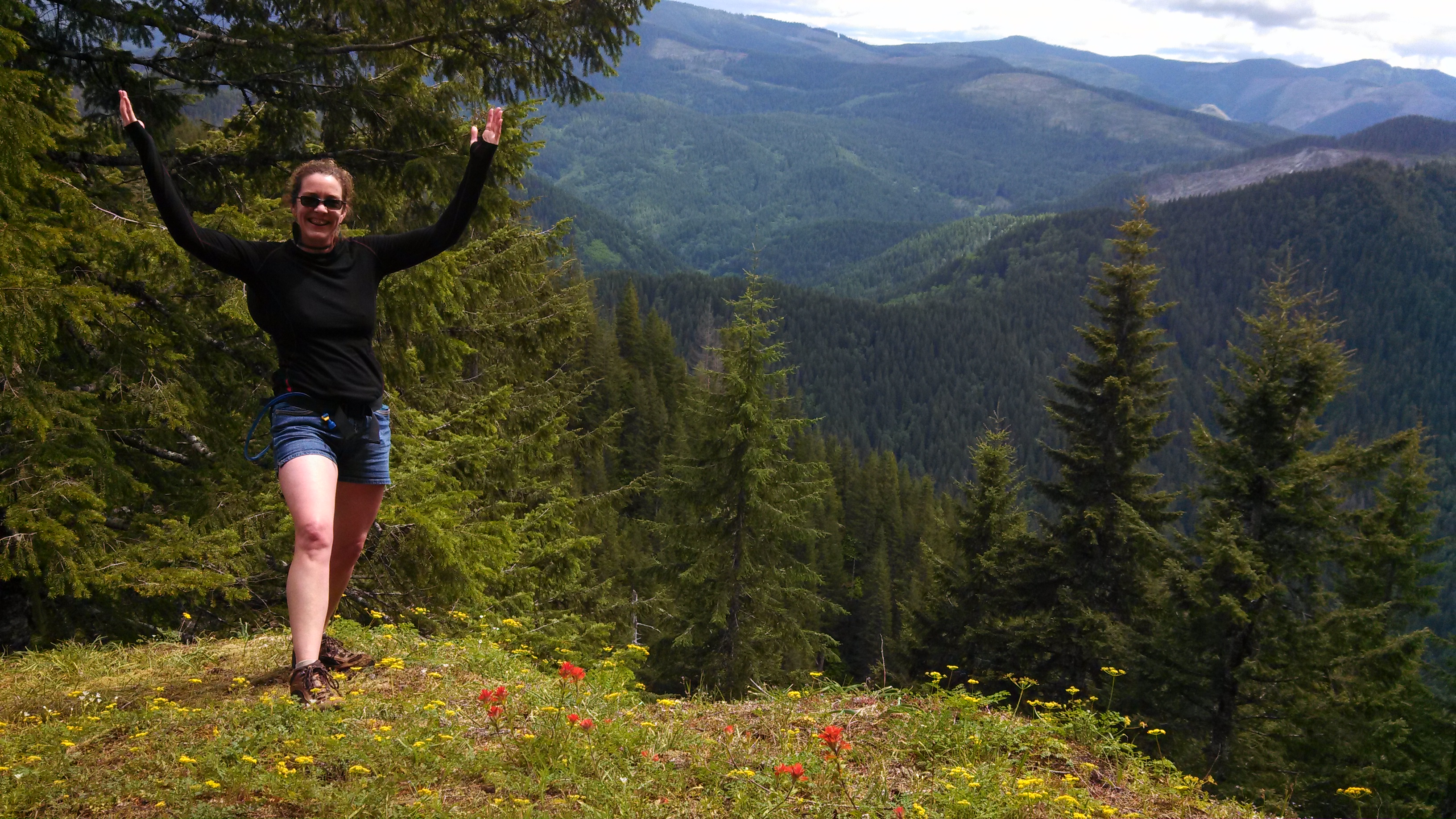
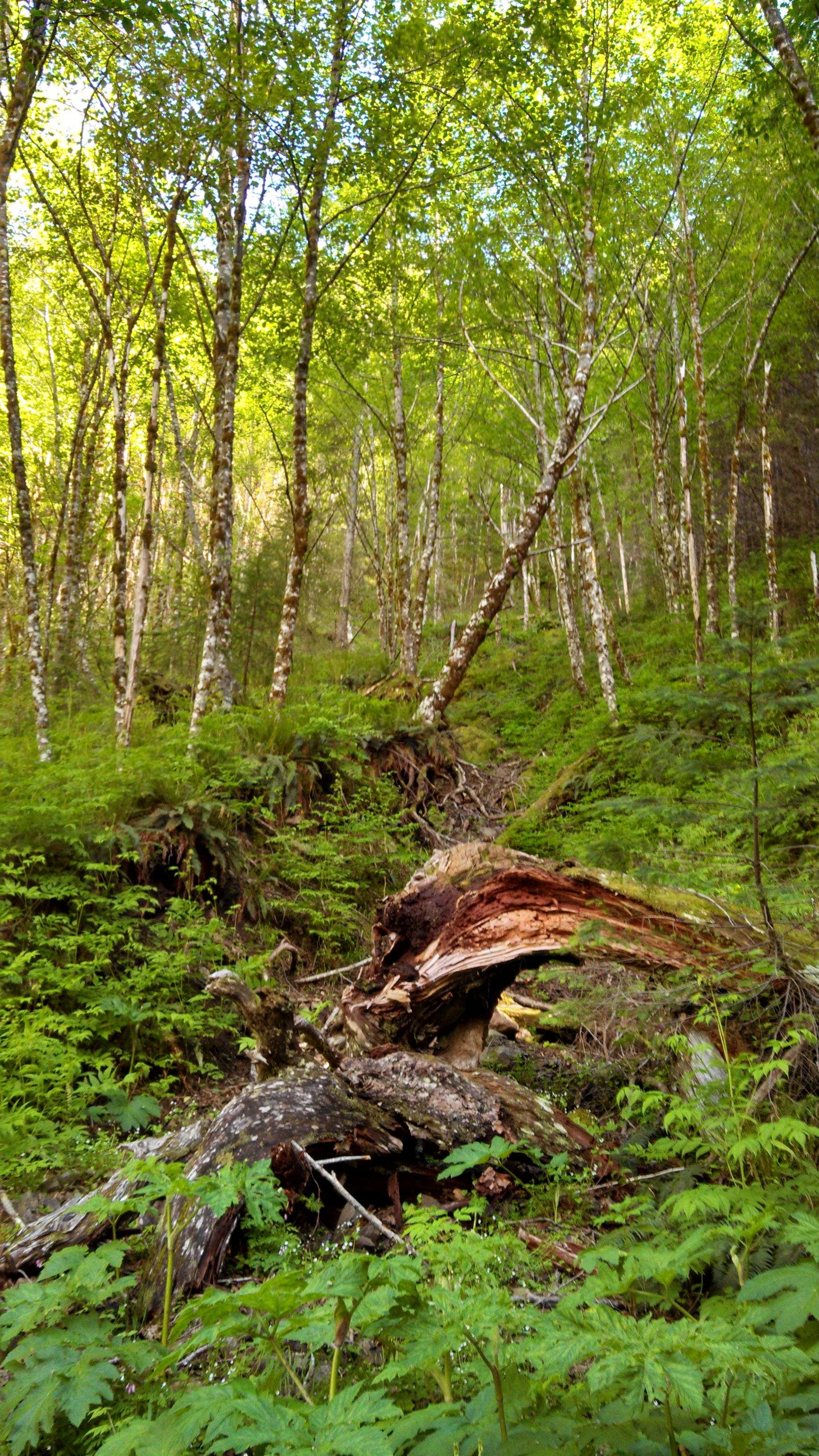
We could not stop ourselves from remarking on how beautiful the trail was. The trail itself was in great shape. Obviously the Mazamas (a mountaineering group based in Oregon) had done a great job maintaining the trail. But it was the scenery beside the trail that caught our attention time and time again. In the cooler forest and higher elevation, spring is in full swing, and there is a profusion of wildflowers in dozens of varieties. The type of forest changed from rainforest ferns and moss to alpine coniferous to sundappled deciduous.
Since we climbed so steeply and so quickly, we were greeted with profound views of the surrounding peaks and valleys. Elk Mountain is new enough so that much of our trail passed exposed rock cliffs that have not yet eroded into soils. I think that makes a mountain more interesting. It also made our trail exciting, because there were times when we walked along a rock ridge that dropped off on both sides, or we walked along a narrow ledge between a wall on one side and a crevasse on the other.

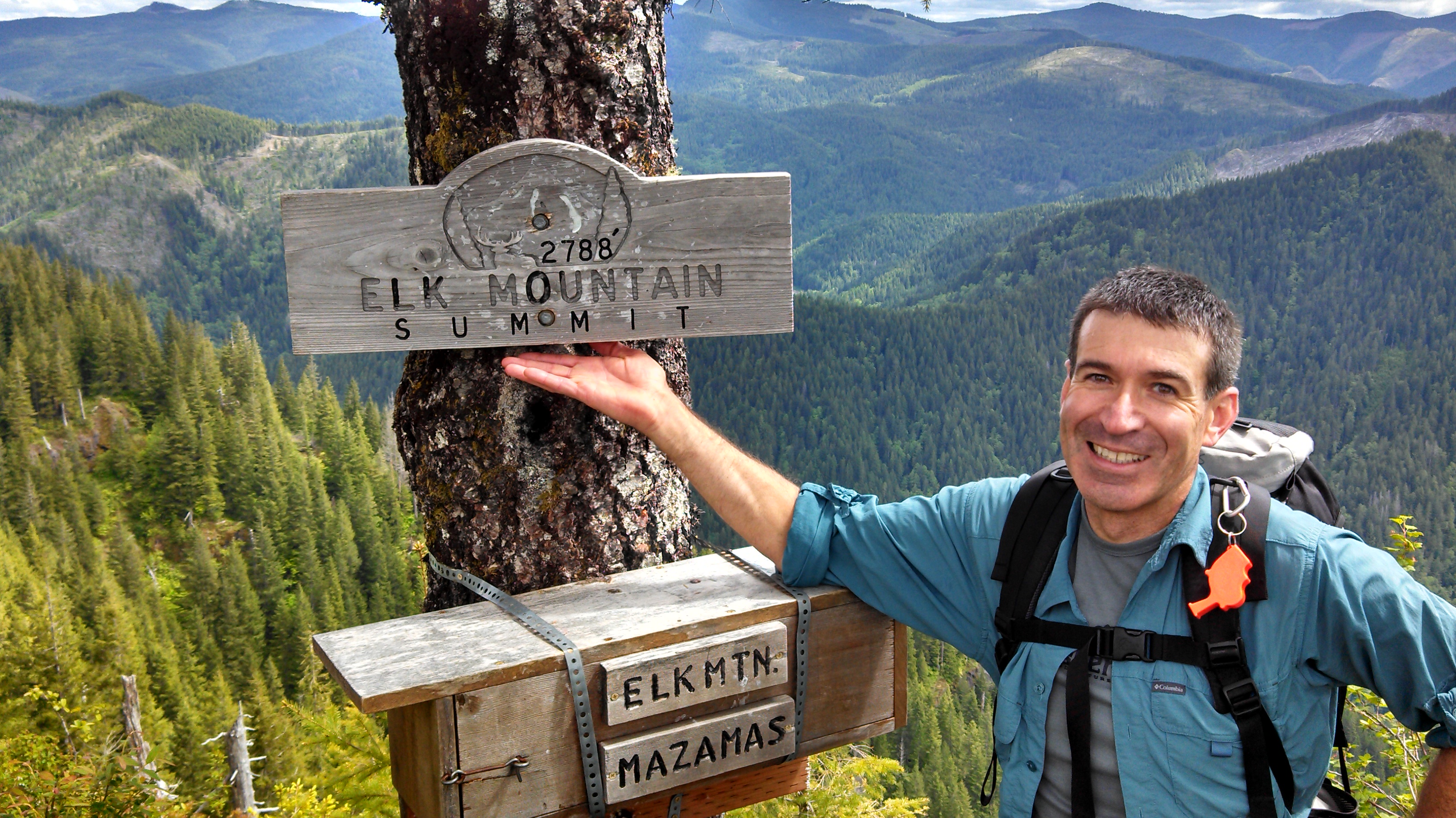
It took 2 1/2 hours to get to the top, and I was exhausted. Almost 2000 feet in 1 1/2 miles – whew! We found a place off the trail and ate lunch. While we ate, we looked at the map and were somewhat confused to see the summit labeled over 2700 feet, when we had just found a sign posted that read: 2500 feet. After lunch, around a corner, we saw that we had NOT reached the summit yet! After a discouraged sigh, I plodded forward up the steep, steep trail, and we finally made it to the top.
I’ve been in physical therapy for months, trying to fix a bum knee. I have a sharp pain when I run, and when I go downhill. It was the downhill that concerned me next, and Arno is nursing his own joint issues. My knee felt great, so off we went. And I did very well for another couple of miles. The descent started more ruggedly steep than the ascent. It’s more of a scramble getting down the back side of the mountain.

Then the trail meets an old logging road and gets smoother. The road is so old there are 20-year-old trees and shrubs growing right through the center of it, so please don’t imagine an actual “road.” The point is: no more scramble. And it’s that gradual decline that wastes my knee. But Arno felt good and I was so happy to be in the forest, that it only mildly dampened my spirits.
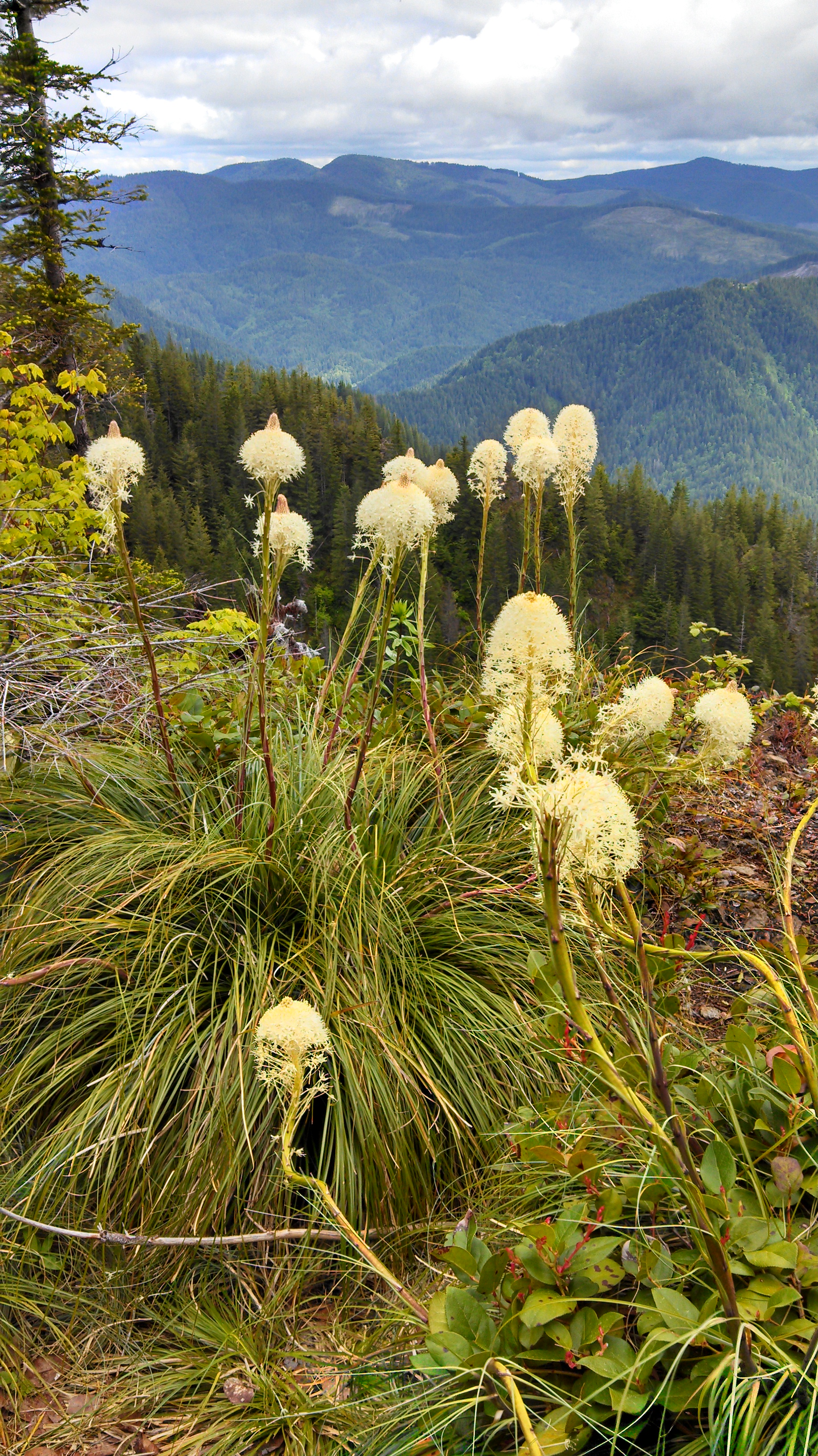
The flowers were amazing! There are carpets of small lavender-hued blossoms, Indian paintbrush, taller deep purple blooms like snapdragons, yellow, white, red, orange. I need to find my flower book that I used to hike with. Bear grass and columbine, daisies and buttercups. Every view was filled with explosions of color. There is nothing like spring in the mountains.
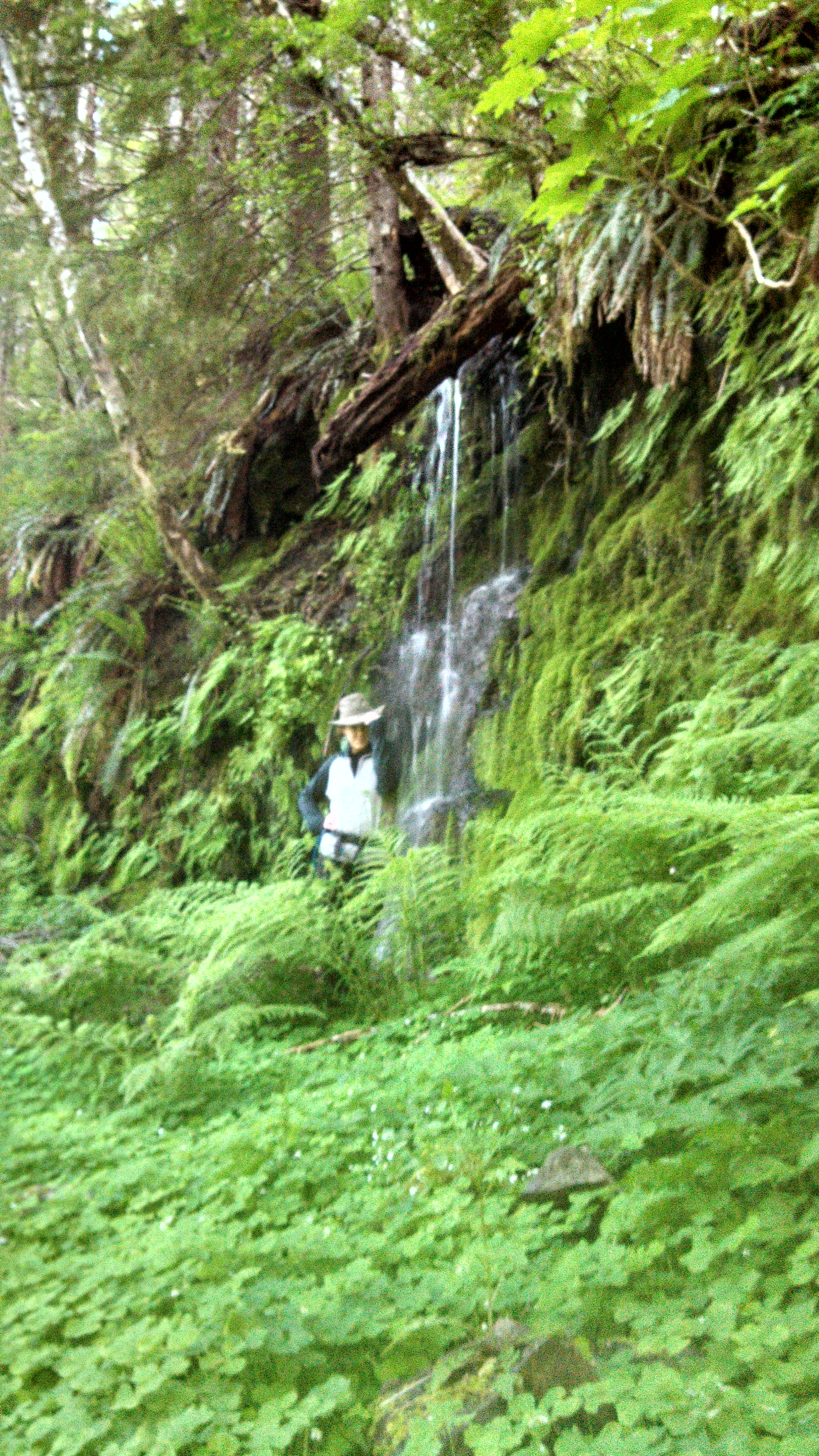
We reached the far northern point of the trail where it curves around the headwaters of the West Fork of Elk Creek, then followed the creek down down down till it met with the main branch, and we walked along the riverside in the bottom of the canyon. We were smart to approach the loop in the way that we did, and thus spent all our excitement on the grueling climb. Five hours in, all we had left was a gorgeous stroll along the river.
Well, ok, not simply a stroll, but an unrelenting downhill path. I walked backwards. I walked with my legs splayed out, stepping on the outside of the trail rather than in the middle. It all worked to ease the knee pain. Arno’s joints cooperated the whole time.
The very last hour was a flat walk along a trail so smooth and wide it would accommodate a wheelchair. (Arno joked that when I got old and my knee wouldn’t allow hikes anymore, he would push me in my chair along Elk Creek.) Without the dense canopy, the remaining sunlight reached through to us at the valley floor. Finally, at hour six, we returned to the trailhead and the truck. There is a lovely campground near there, and we have decided to bring the kids back, since the trail along the river is easy enough for unmotivated teenagers, and also has some promising swimming holes!


It is beautiful nature. I would have love to be up there Crystal.
Prayson I feel more spiritual in a place like than than anyplace man could ever build. I know you would love it. Are there place to hike where you live?
In Tanzania, we used to hike, and swim down river and into the caves. Here in Copenhagen, Denmark, they have forests but man-manipulated, which are okay. Out and south of the city, in Køge, we have a summer house close to a natural forest and a sea that we enjoy taking a week to rest here and there.
That photo of the birches is wonderful, and those views are stunning! I had to chuckle at your description of when you realized you had not reached the summit!
That’s an impressive day of hiking (bad knee / joints and all)!
And can you believe it? I forgot my camera again. Those were phone photos. I am lucky phones have decent cameras these days or my blog would really suffer. ha ha!