
{Disclaimer: forgive the length! This is one of the times when I found it difficult to resist including lots of photos and descriptions.} Arno made us another fabulous breakfast while I took more photos of the stunning and surprising pinnacles. I even did some of my physical therapy exercises, trying to keep Jessica and Tyler from Therapeutic Associates happy.
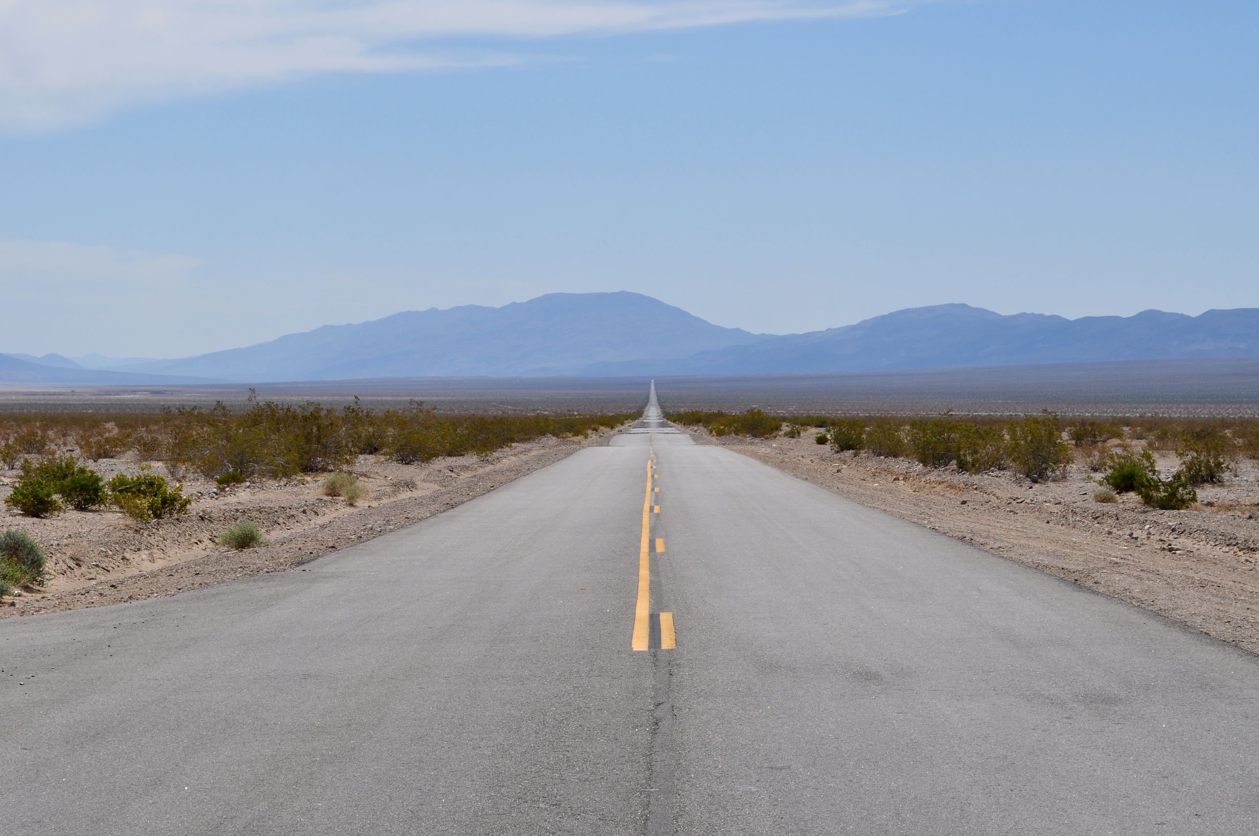
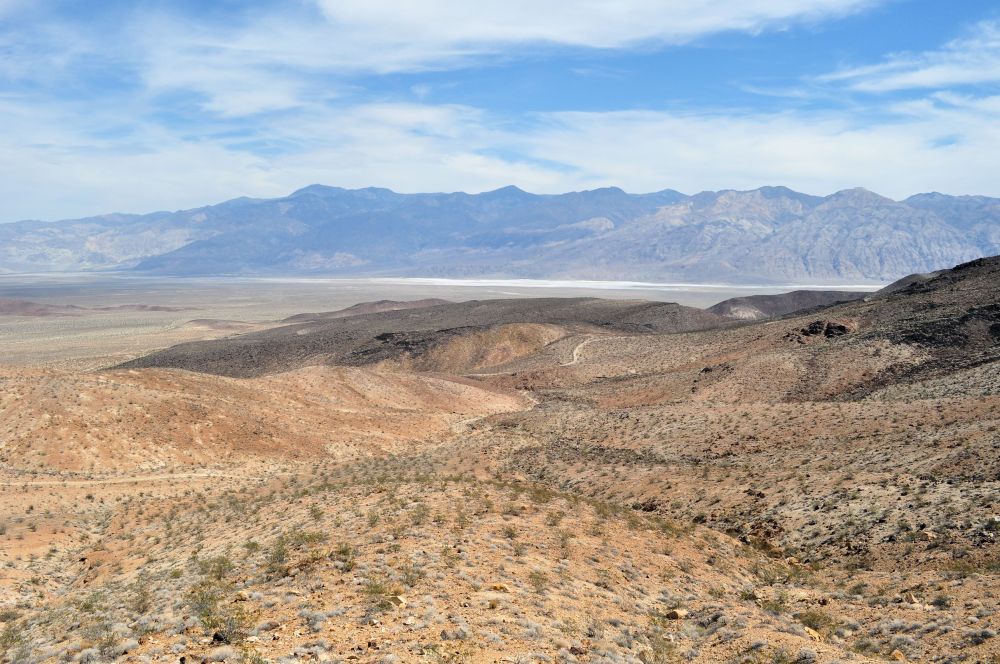
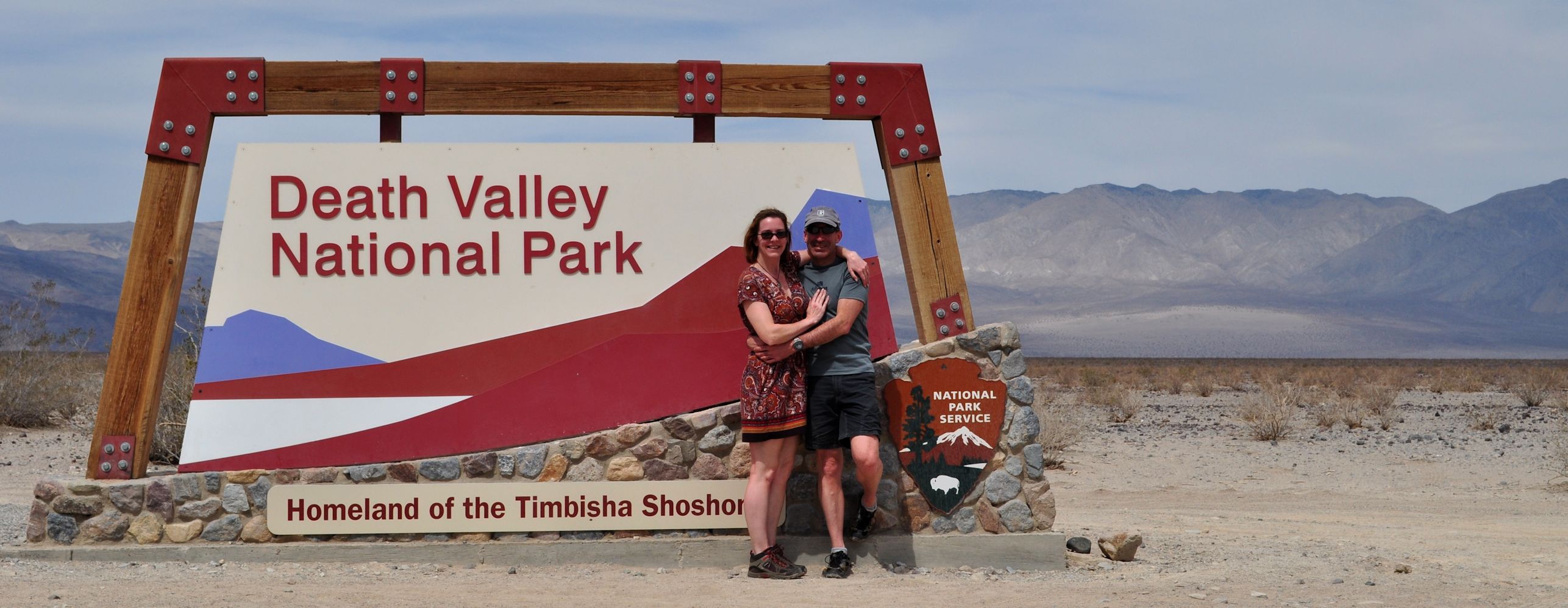
We drove along very straight and empty desert highways (so typical in the West), and finally made it into Death Valley National Park, the driest, hottest, lowest spot in the United States. One must drive miles into the place before coming to a park office that will allow an entrance fee to be paid.
At Stovepipe Wells Village we saw our first park campground, which was basically pitching a tent on a gravel parking lot – bleh. Unacceptable. We pulled in at the visitor’s center and Arno headed for the door, while I headed out back because I had spotted a National Weather Service Cooperative Weather Observer (COOP) thermometer shelter. I popped off the latches and opened the door to see what equipment they had. Sadly, only max and min thermometers. Sometimes more interesting equipment will be housed in one of these, such as as barograph, or a thermograph. The shelter made me happy enough though, bringing back memories of my 11 years with NWS, often very active in the COOP program.
Arno bought the year pass for all the parks, hoping we would be able to use it later. I am really hoping to take advantage of that. We are frugal enough to go to a park just because we bought the pass, so it can be a bit of reverse psychology to force me into exploring our amazing United States. How truly fortunate we are to live in a country that wants to, and is able to, set aside humongous areas simply for public enjoyment. If we were a tiny Cyprus or Liechtenstein or Andorra, we could not afford this luxury.

Near the office was access to a large area of sand dunes, so off we went across the dunes, and benefited from springtime blossoms to brighten up the view.
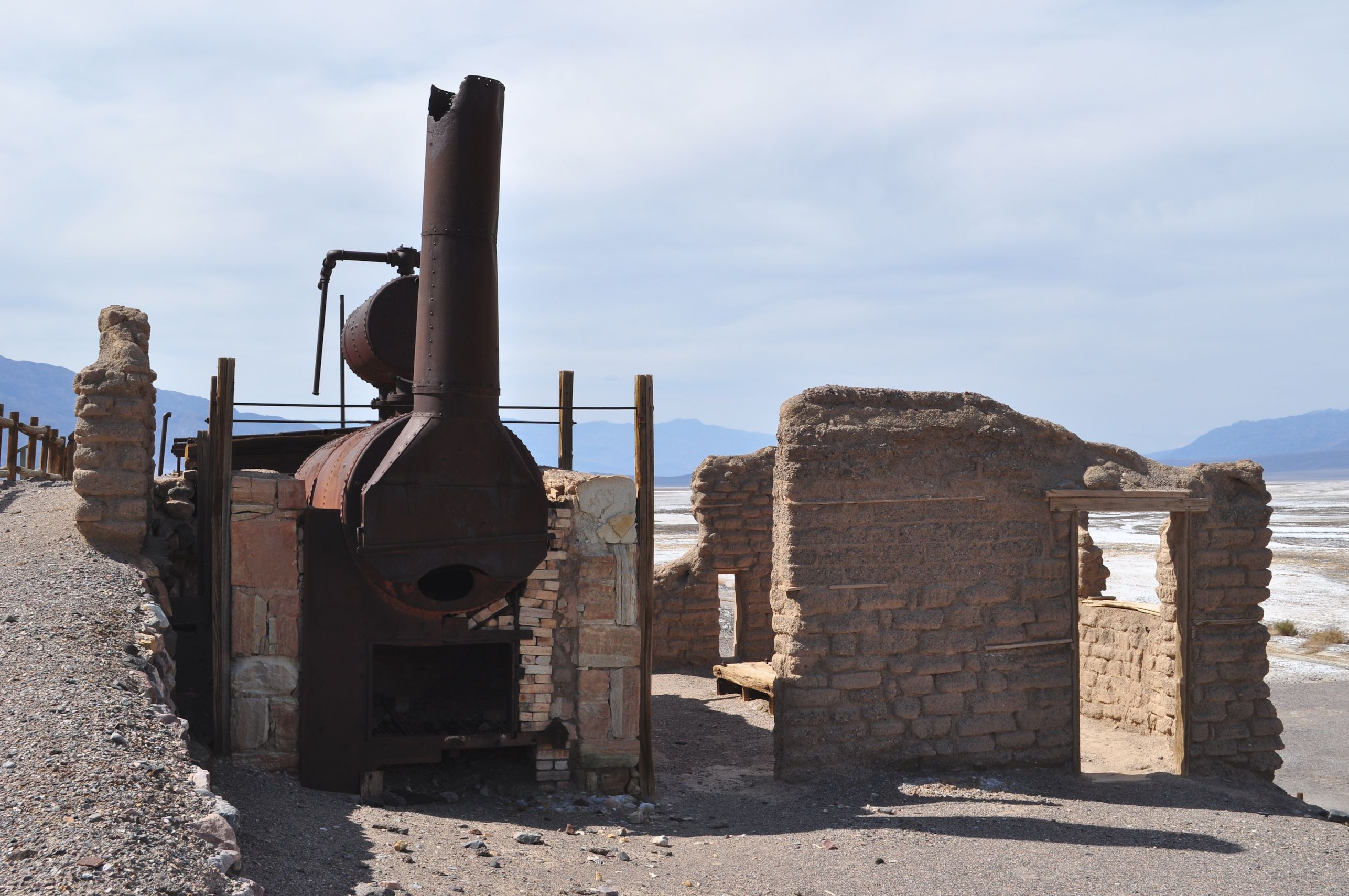
After that, we explored some remains of a Borax mining operation, with an old wagon famous for the days when borax was moved from the desert using the famous 20-mule teams. It was getting hot, but neither of us minded much, since desert heat had been part of our goal all along. As we walked through the ruins, I told the story of when I accidentally brushed my teeth with Borax. I come from a remarkable family in many ways, and yes, it turns out to be a family where a teenager could mistake a mason jar of borax for a mason jar of baking soda. I didn’t die, so that proves it wasn’t a poisonous substance, but I did complain to Mom that the soda tasted pretty bad that day. (turns out she had been cleaning, and left the jar of powder on the counter by the sink)
By that time we had finally reached the population center of the park, Furnace Creek. There is a small forest there (startlingly unexpected after all the dried out desolation), with a large visitor’s center and camping, and even a posh resort. Just beside all the touristy stuff is Timbisha Shosone lands, where native Americans continue to inhabit lands they have occupied for more than 10,000 years. At the center we got information on where to camp and not be on a gravel parking lot with hundreds of other tourists. At the general store, we bought ice cream and awesome Tilley hats to protect our skin from the sun.
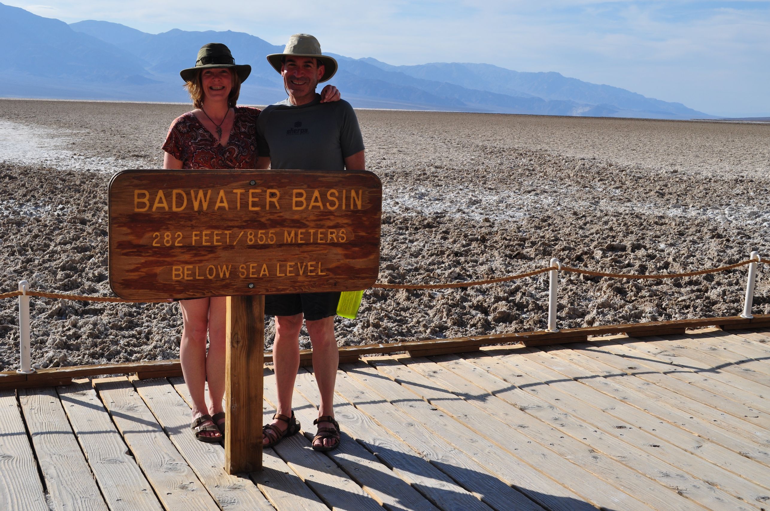
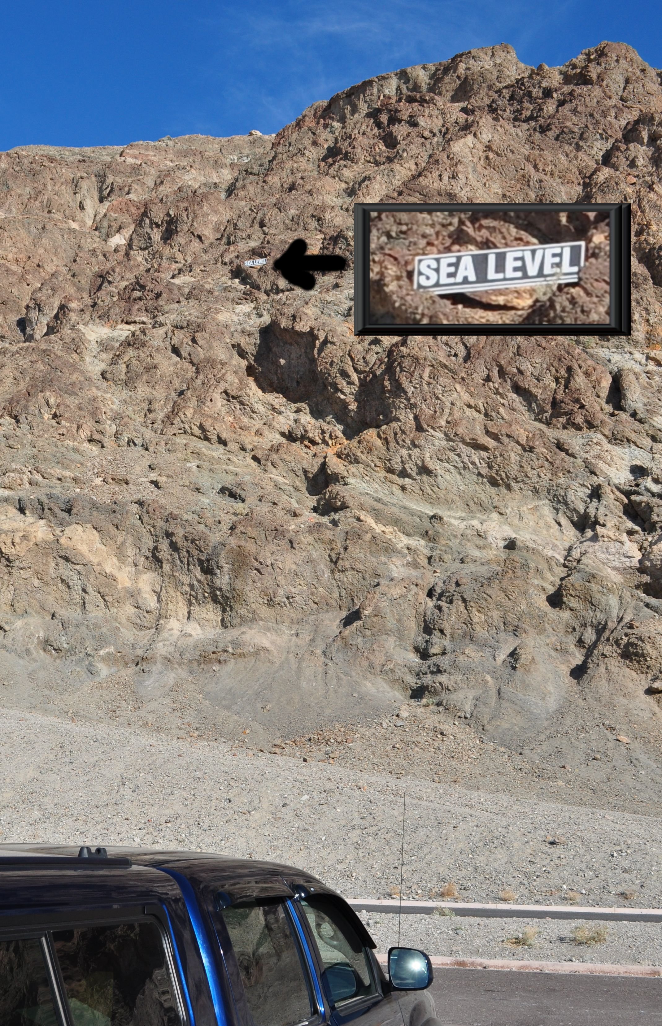
Obviously (well, to me at least) the main attraction of Death Valley is the fact that one can stand on dry land below sea level. Moses ain’t got nuthin’ on southern California. So our next stop was to visit the place itself. We got lucky in the parking lot (no, not that kind of lucky…) when we turned around – away from the basin – and spotted a sign mounted waaaay up on the rock face at the point of sea level. It was helpful to understand just how far -282 feet really is.
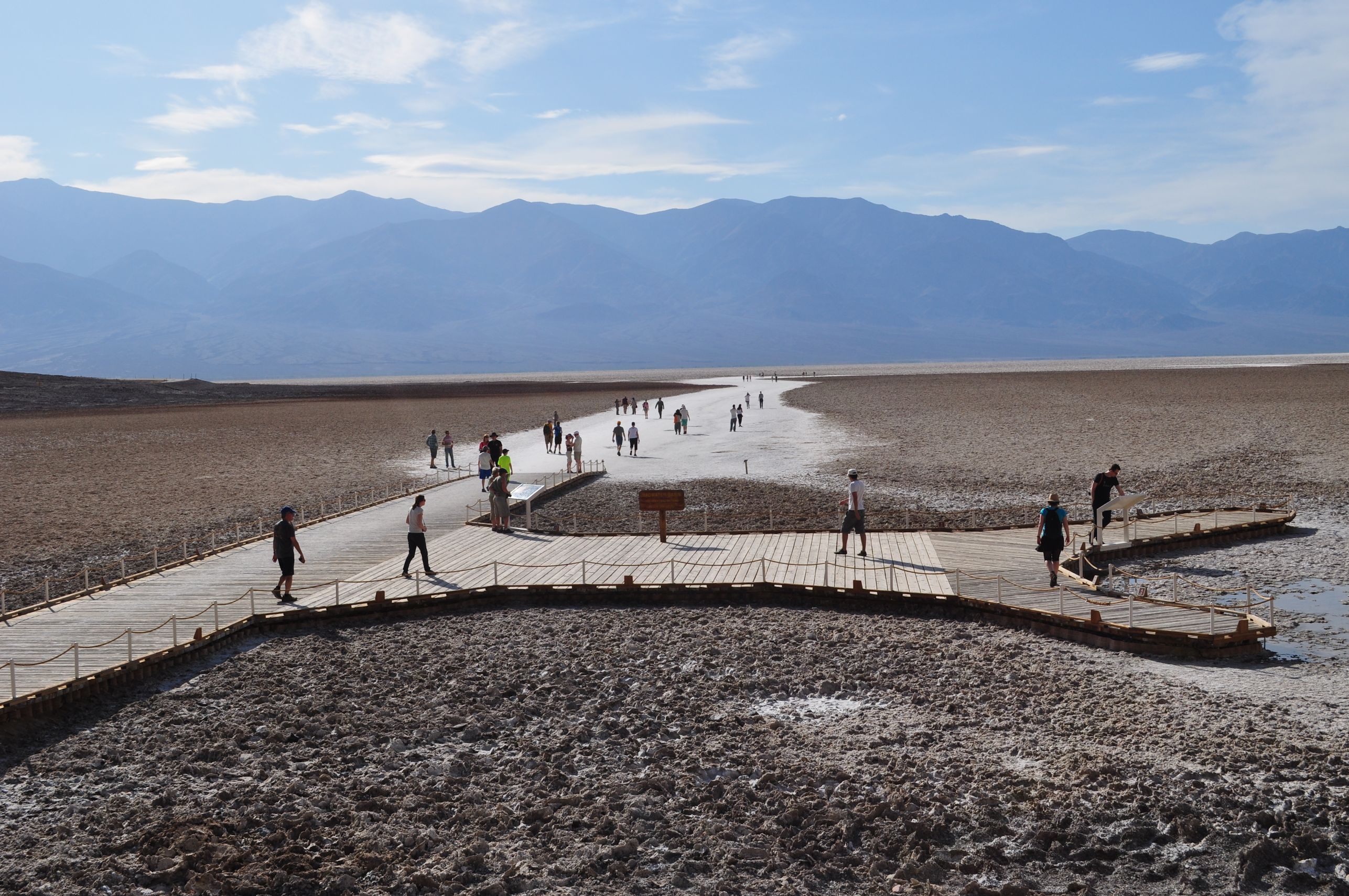
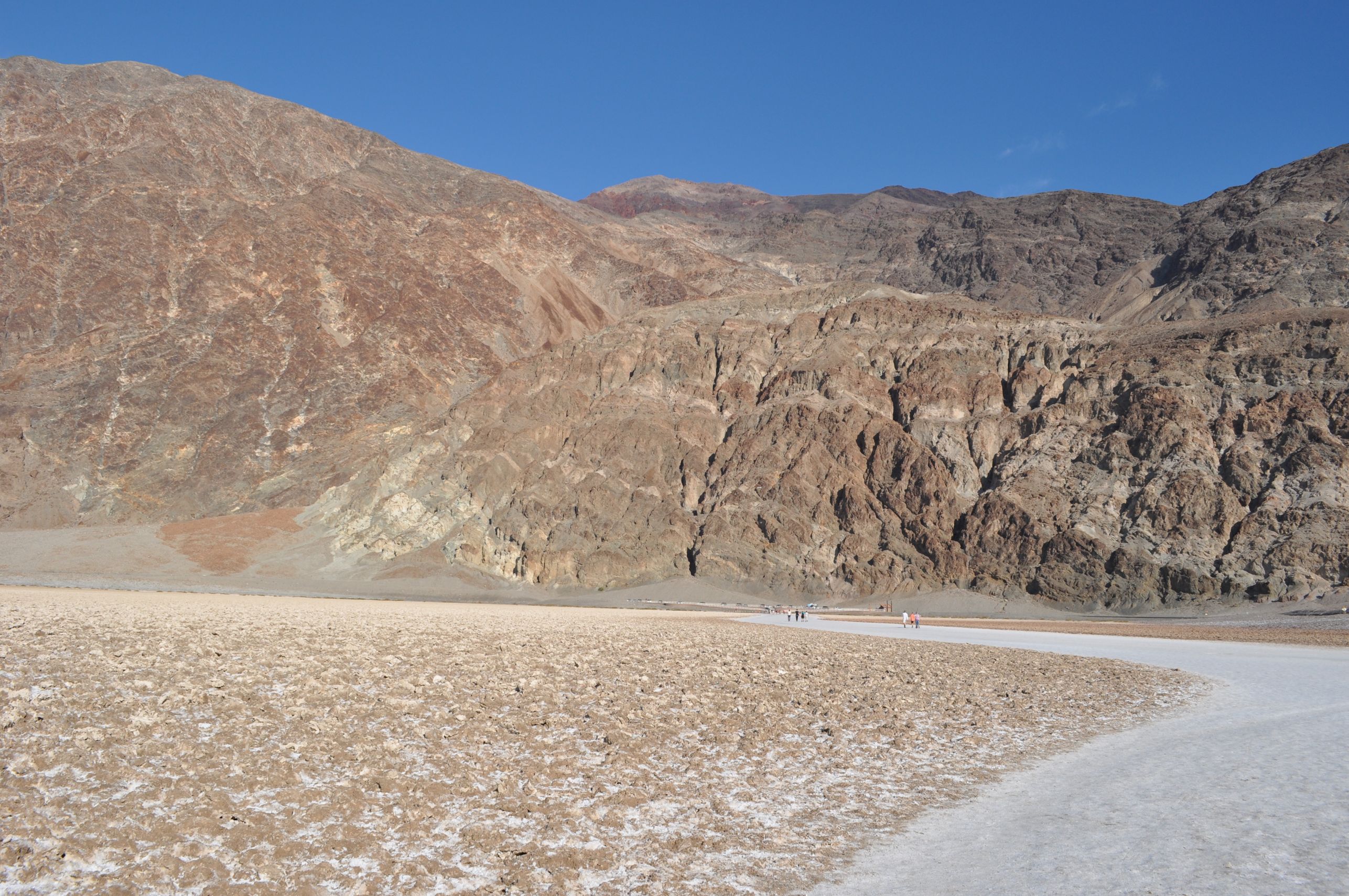


We walked out into Badwater Basin and by that time we were suffering from the heat. The temp at the visitor’s center in Furnace Creek stated 91 degrees, but I’ll bet it was hotter than that out in the basin itself. Pedestrians had worn a wide, hard-packed path out away from the parking lot at the base of the mountains. Arno and I lamented that so much of the fascinating mineral formations had been crushed by millions of shoes. We tentatively approached the edges, careful not to crush anything new, and investigated crystalline formations at the edges. In places where people had crushed it flat, new lacy snowflakes were often forming again on top of the flat area. Nature proving that persistence rules. I was reminded of a blog acquaintance who is obsessed with fractals, one of my favourite examples of natural mathematical artistry.


We headed back toward Furnace Creek, and along the way stopped to hike a short trail to a natural bridge. Then we took a little paved detour called the Artist’s Drive, just to see what we could see. It offered us truly remarkable views of striations in mountain faces, and layers dripping over one another to look like a giant pile of melting ice cream. The road itself was a riot. It was a narrow one-laned twisty, curvy rollercoaster road that was like a theme park ride. Near the end, we passed several vehicles pulled over, and couples in lawn chairs up on the slopes, waiting and watching for the impending sunset. It reminded us to get a move on, since we were hoping to set up camp in daylight.
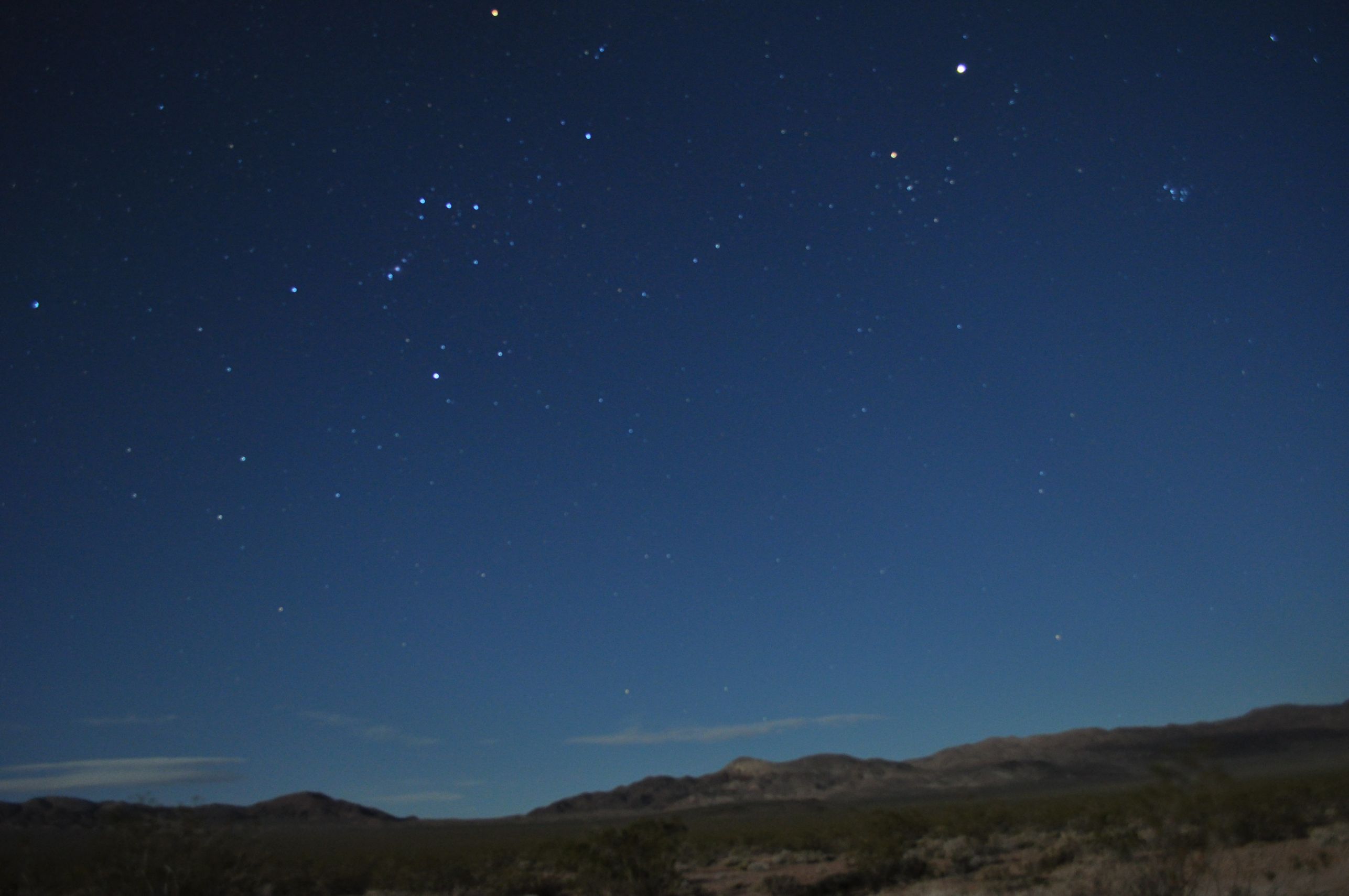
We had been told at the Visitor’s Center about dispersed camping along the backcountry roads (read: gravel or dirt) on the southeast side of the park. When we were almost to Furnace Creek, we turned right and went south into the Greenwater Valley. It was higher elevation, below Coffin Peak, and the temperature dropped into the 70s up there. MUCH more indicative of a good night’s sleep. And also, with the scattered plant life, a much more scenic valley than the Badwater Basin. We were not quick enough to set up camp in light, but we managed anyhow with headlamps. Arno cooked another in a series of mouthwateringly great meals while I set up the tent and inflated the mattresses We ate, and watched the stars, and I couldn’t help but take some more night time photos before we were fully exhausted and dropped into our sleeping bags for the night.

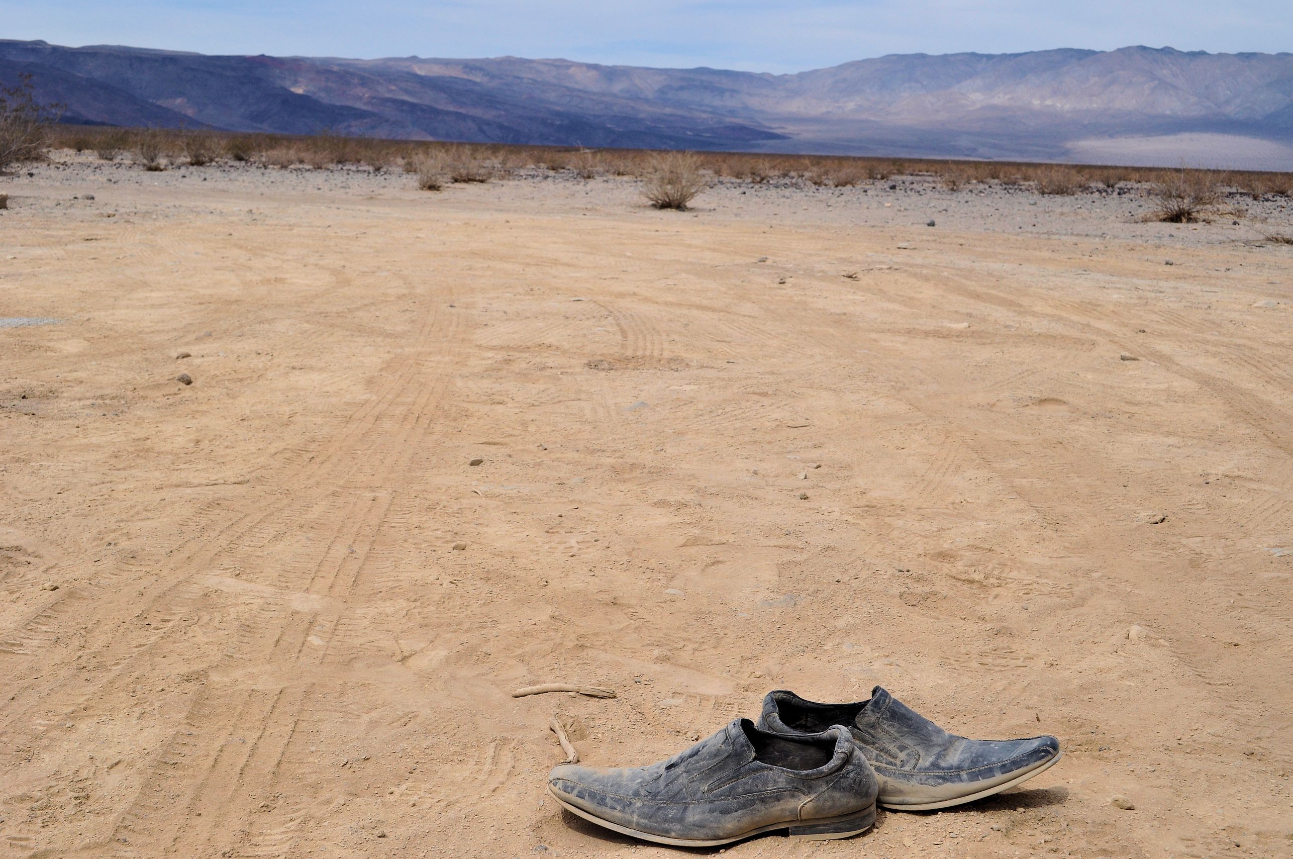
WOW!! I want to ride the bike on that one way road. Love the straight road photo and the shoes.
Frankly, I’m so glad you included so much commentary … fascinating!!
You would love that little road. It’s the kind where you leave your stomach at the top for a little while, when you go over the hump. Lots of fun. Thanks for the encouragement on leaving all the photos and words. It’s just too hard to cut them out.
Your photos show the beauty of the place. I like all your commentary as well..
Thank you!