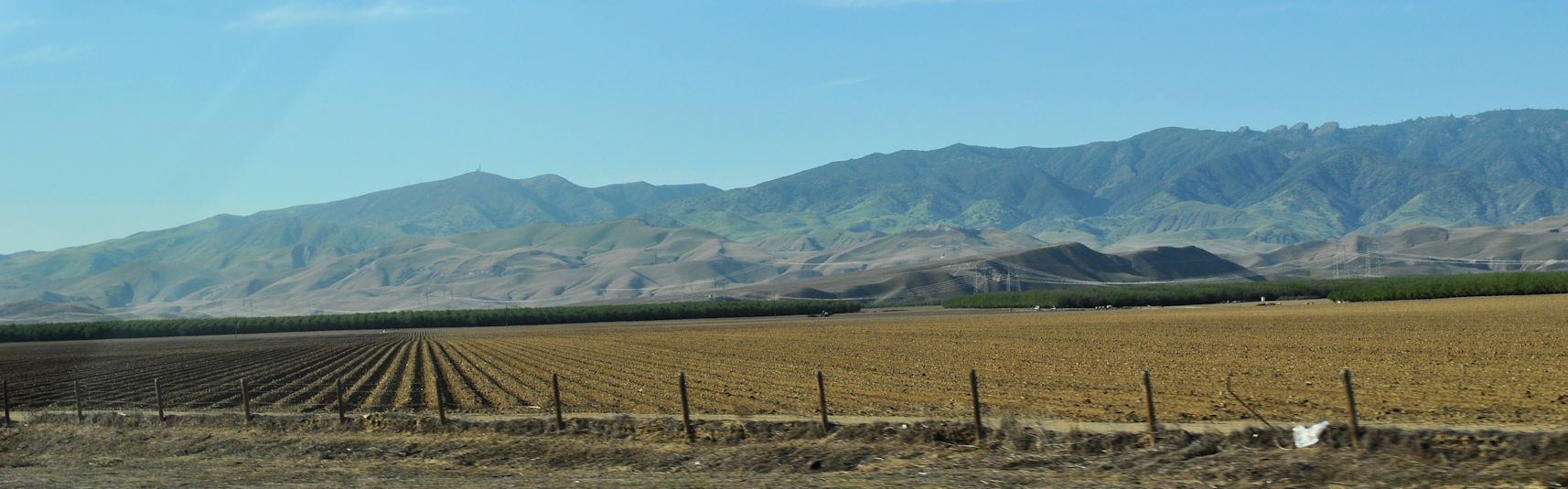
Tuesday we hit the freeway with the intent to make some miles. We zoomed through the Central Valley and saw acres upon acres of crops. There were political signs up about water rights. The battle for water rights must be permanent in this area, since it’s always dry, they get much of their water from somewhere else (e.g. diversion from the Trinity & Klamath Rivers into the Sacramento River), and since an enormous quantity of America’s food comes from right here in this big valley.

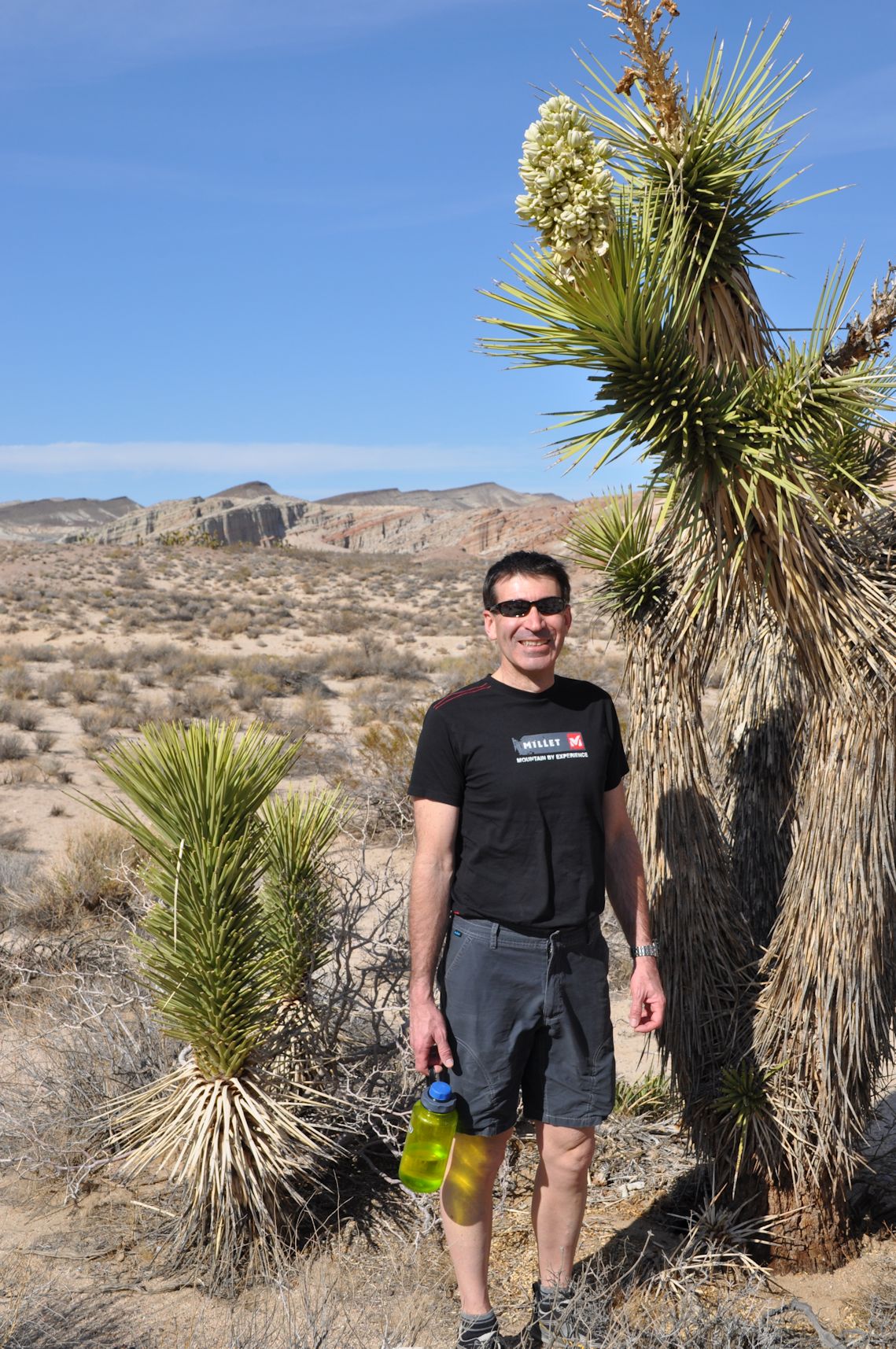
We reached Red Rock Canyon State Park relatively soon, since it is a little over an hour east of Bakersfield. I asked Arno to stop at the short trail named for Rudolph Hagen, right at the entrance to the Ricardo Campground. I love that Arno is always game to pull over and take pictures, or hike, or climb, or explore. I had been looking forward to visiting this place since my spring break trip two years ago in the rain and cold. Today’s visit was gorgeous and warm!

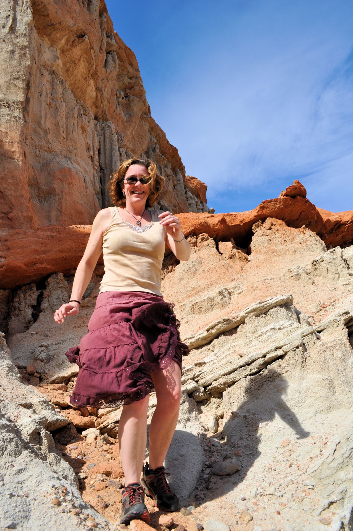
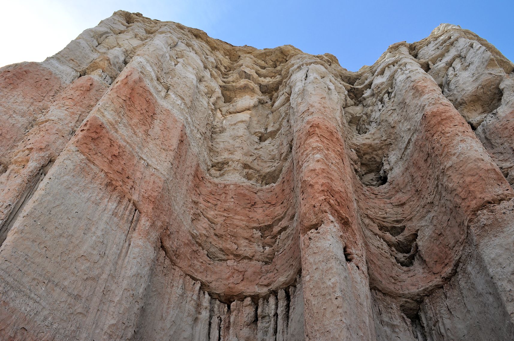
I’m a sucker for geological intrigues, and find so much satisfaction in discovering unexpected rock formations and the queer things the wind and rain have done to them. Here we saw lots of angles jutting from the earth, columns holding up tables of rock, and curtains of rock walls.
Then we were off again to try and get as close as we could to Death Valley before it got too dark to set up a tent. We got to a town called Ridgecrest and filled the tank with the idea of having plenty of gas upon entering the park.
Arno was excited to see China Lake Naval Weapons Center and China Lake Naval Air Weapons Station, and had me get a photo of the F4 Phantom as we passed the entrance.
We had asked at the gas station and the attendant told us there was no place to camp between there and the park. But just as we were leaving town, we spotted the Maturango Museum and information center, and pulled into the parking lot at 5:32 pm. There was a man with a name tag on his khaki shirt, walking away from the building and toward the parking lot. “Are you closed?” we asked. “Yes,” he answered. “What do you need?”
So we explained that we just wanted a place to pitch a tent before it got dark. “Let me ask Mary,” he said. “You can follow me.” He knocked at a locked Employees Only side door and Mary let us in and introduced herself. The man introduced himself as Harris. We thanked them for taking pity on us, even though they were closed. We explained what we wanted for a campsite (we’re fully self-contained and simply need a piece of land). As she came up with some ideas, Mary also asked us where we were headed, and we told her. She disappeared into the back for awhile, and came back loaded with brochures, a map, and a Death Valley National Park publication (you know, the kind you always get at the entrance of a national park).
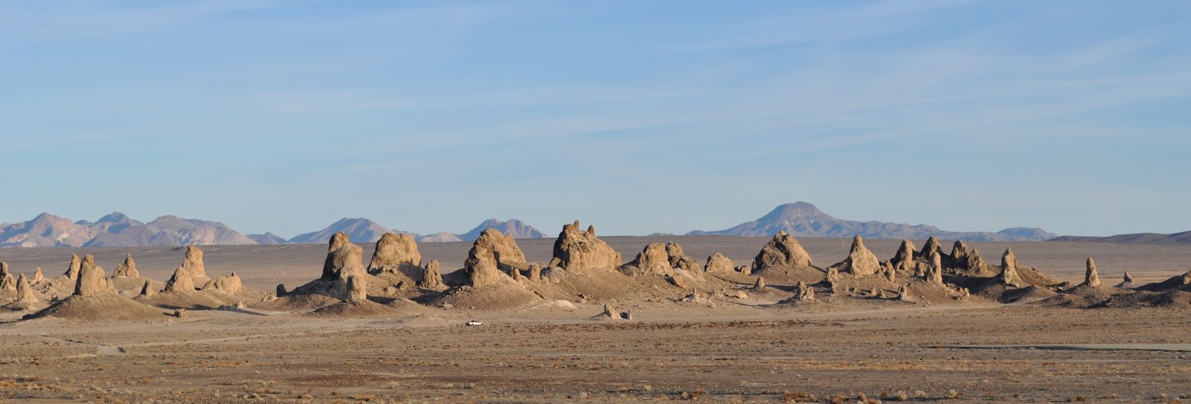
One of the sheets she brought out was of a local point of interest she thought we might be interested in: the Trona Pinnacles.
“Oh!” Harris and Mary said almost at once, “You could camp at the Pinnacles.”
Mary told us how to get there and said people camp there all the time. We thanked them again, gathered up all our brochures (including one of wildflower identification – how thoughtful!) and left. Before leaving Ridgecrest, I sat in the cab of the pickup and wrote some postcards and birthday cards for my niece nephew, and brother, and we mailed those off before leaving town.

We found the Pinnacles without much trouble, and they were truly remarkable. On the way, I read the brochure to Arno and we discovered that they are 10,000 to 100,000 year old tufa (calcium carbonate) formations from back when the area was the site of a huge lake, now called the Searles Dry Lake Basin. These formations are caused when a spring beneath the lake bubbles up mineral rich water into an akaline lake, and it forms a cone around the spring, much like stalactites and stalagmites in a cave. The cone builds higher and higher over the years, but remains below water level. It’s only when the water disappears that the tufa formations become visible.

The temperature was pretty warm, but the wind was crazy wild. We drove for some time until we found a place where we could tuck the tent in the shelter of one of the larger pinnacles. Then I ran around with my camera and took photos.
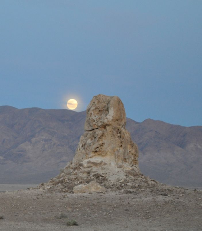

The moon rose full tonight, so I played with the tripod and night time setting. My camera pulls in so much light, the photos make it look like it was still daytime, but you can see the stars that prove it was night. The wind raged for a few hours, then finally dropped off during the night. The moon rose higher and higher and lit up the tent almost as bright as a spotlight. When we woke in the morning, it was dead calm and we had an easy time making scrambled eggs and bacon for breakfast before we left the most amazing dry lake bed I’ve ever slept in.

Hello, I may have just missed it while reading the article, did you explain Where the Trona pinacles are located? I’m familiar with Red Rock and have stayed in the campground one time when I couldn’t get to my friends property just north of there. His place was a silica mine long ago and for a long time it was a Opal mine that was open to the public until the caretaker died in 1979 and then it went back to being private property, but being a friend of the owners I have my own set of keys and know the rules and the property boundaries. I have a variety of tents for camping up there different times of the year, including a Large dome tent that I put a smaller but still a 4 man tent inside for when I go in late January through early March! With the two tents and two rain fly’s I can get it to stay as warm as 50 at night! and still keep it in the 70’s all day. Maybe you can pick me up and be my guide?
Sounds like you’ll have to be my guide, with keys to the property and everything. 🙂 That’s pretty clever putting a tent inside another tent.
To get to the Pinnacles, leave Ridgecrest, CA on highway 178 toward Trona. Before you get to the town of Trona, turn right onto a dirt road. It’s not clearly marked, but if you’re watching for the road, you’ll see the sign.