
Ok, so I teased and said my upcoming post would be about Lava Beds National Monument. And that’s true, because Petroglyph Point is a part of the National Monument – a tiny disconnected piece of land – but the attraction here is petroglyphs, obviously, and not lava.
I know I keep bringing this up, but when I researched my paternal grandfather’s people last year, the Modoc people, it had a great impact on me. An emotional connection that I probably created myself, but it’s there nonetheless. Ever since then I have been dying to go and take a look at the Lava Beds because that is the location of the final Great Battle, when 60 Modoc men and their families held off the U.S. Army and gained the sympathy of the United States for a time. I had never seen the spot, and I wanted to know the place better.
While planning the trip, Pedro (who knows the area) mentioned a wall of petroglyphs nearby. He used to ride his bike over there. I had never heard of this site, and eagerly agreed to add it to our itinerary. Imagine my pleasure when we arrived and discovered that these are Modoc petroglyphs. Well, of course they are because this is Modoc Land. I don’t know why I didn’t think of it earlier.
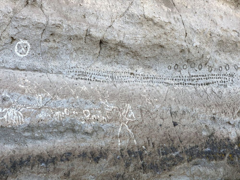
The approach is on a gravel and dirt road, and the destination is a large rock formation jutting out from the landscape. Thousands of years ago, this desert was a large lake. Modocs are traditionally people who spend a lot of time on the water. They built canoes of wood and of tule reeds to hunt waterfowl, fish, and collect wocus seeds. They also took their canoes over to this island and carved into it with sticks and rocks. The island, now called Prisoners Rock, was created about 275,000 years ago when cinders erupted through the shallow water of ancient Tule Lake. Ash and steam erupted time and again, forming hills of tuff layer by layer. Because the level of the lake changed over time, archaeologists have had a hard time dating the rock art. Estimates are between 6,000 and 2,000 years ago, and whatever the date, there must be generations of expression captured here.
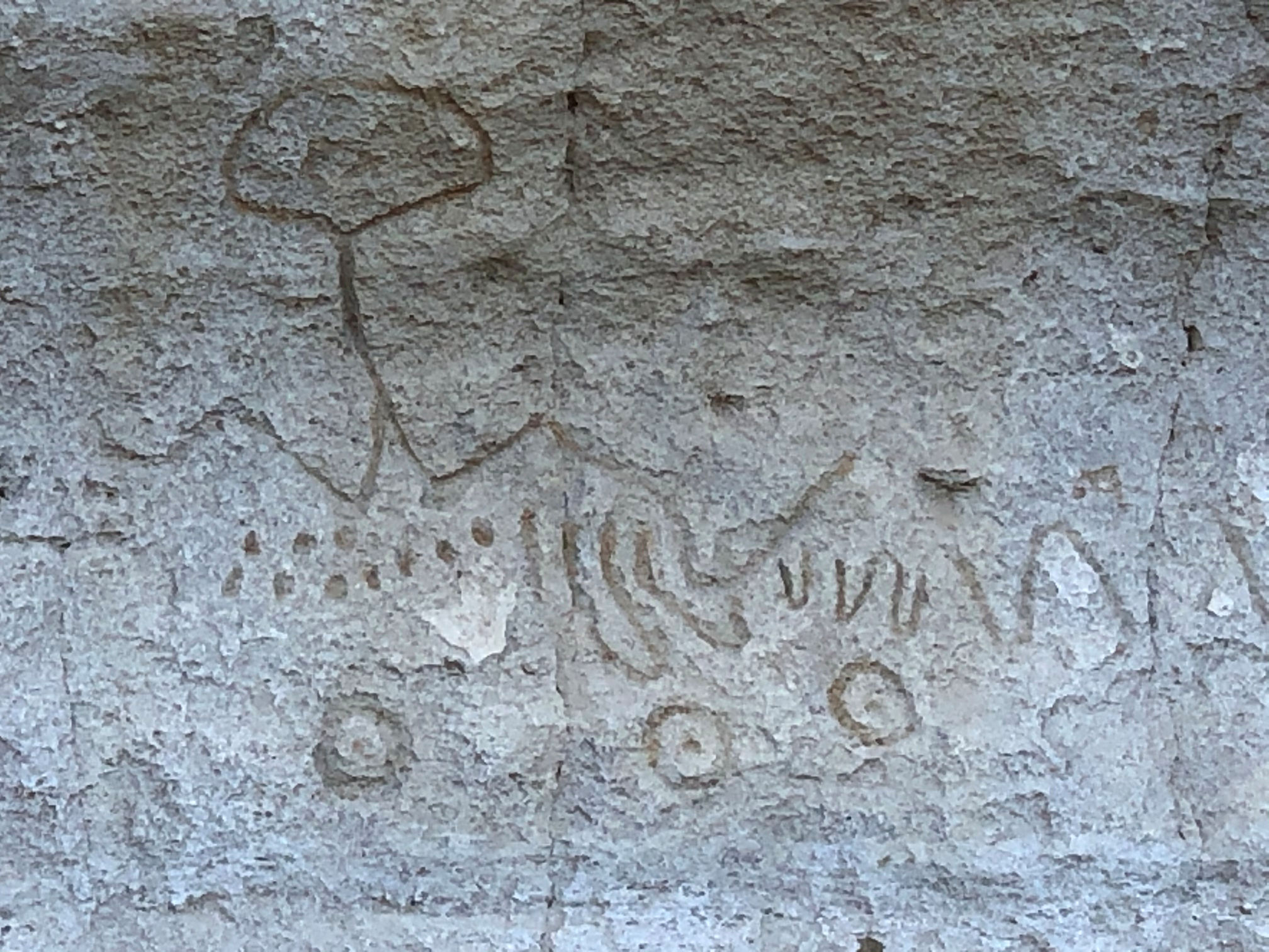
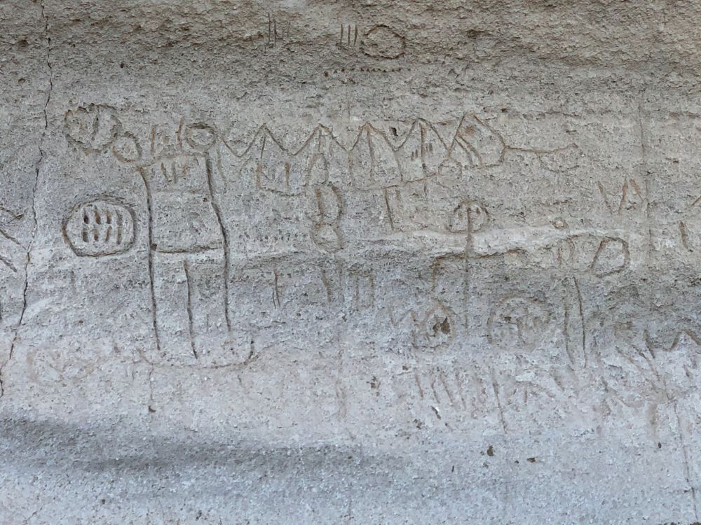
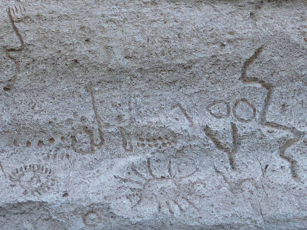
A couple of websites note that this spot is remarkable because there are less people depicted than usual for petroglyphs and it consists almost entirely of geometric shapes. I’m not sure what they mean because these, like all the sites I’ve seen, include a mix of figures and geometric shapes. You take a look and see what you think. They include: figures that I don’t recognize (but they remind me of spiders and worms and aliens and people), shapes, dots, chevrons, circles, etc. My Cherokee friend Joe encourages me not to try to translate Native wall art by guessing how the shapes resemble things I know, and to try to feel them and understand them that way. I don’t get it. But I try.


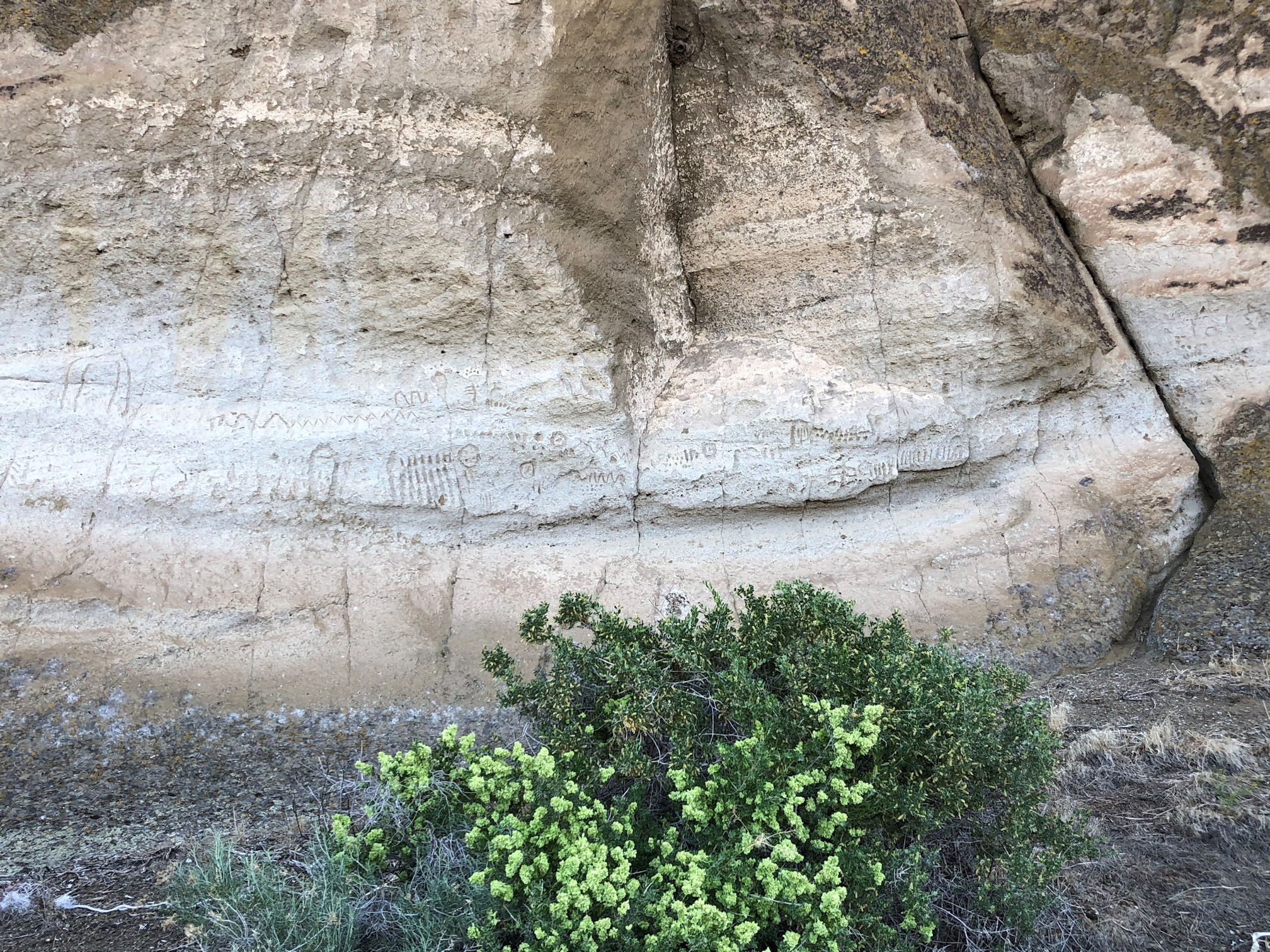
Where we parked, the markings on the walls were faded, and spread apart from each other. We walked south along the wall and the art became more and more outstanding and crowded.


Aren’t they wonderful?
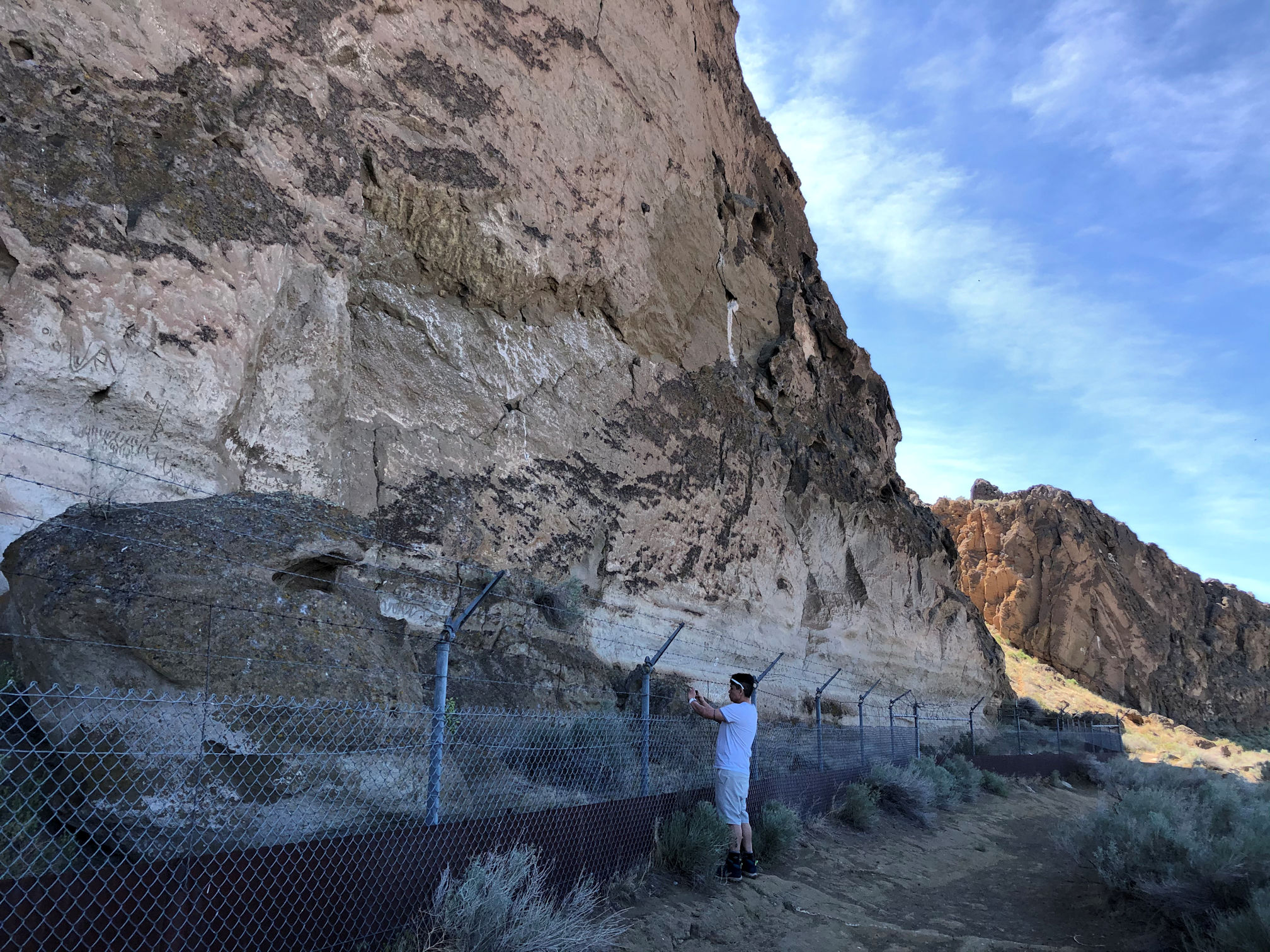
To protect this precious resource, the Parks have separated the public from the art. The fence was actually built in the 1930s, and thank goodness for that forethought because who knows how many additions and subtractions would show up if we silly humans were allowed to touch the carvings.
Over 5,000 individual carvings have been counted on this rock face alone, and there are many more in the area. There is a short trail leading to more art at the back side of this rock, and we talked to other visitors there with us that day, who had visited Castle Rock and found more art up there.


Very near to this place is the Tule Lake Segregation Center National Historic Landmark, and nearby Camp Tulelake in California, both used to incarcerate Japanese Americans forcibly removed from the west coast of the United States. I read that a few Japanese characters are carved into the boulders at Petroglyph Point by interned Japanese-Americans during World War II. I did not see the Japanese characters.

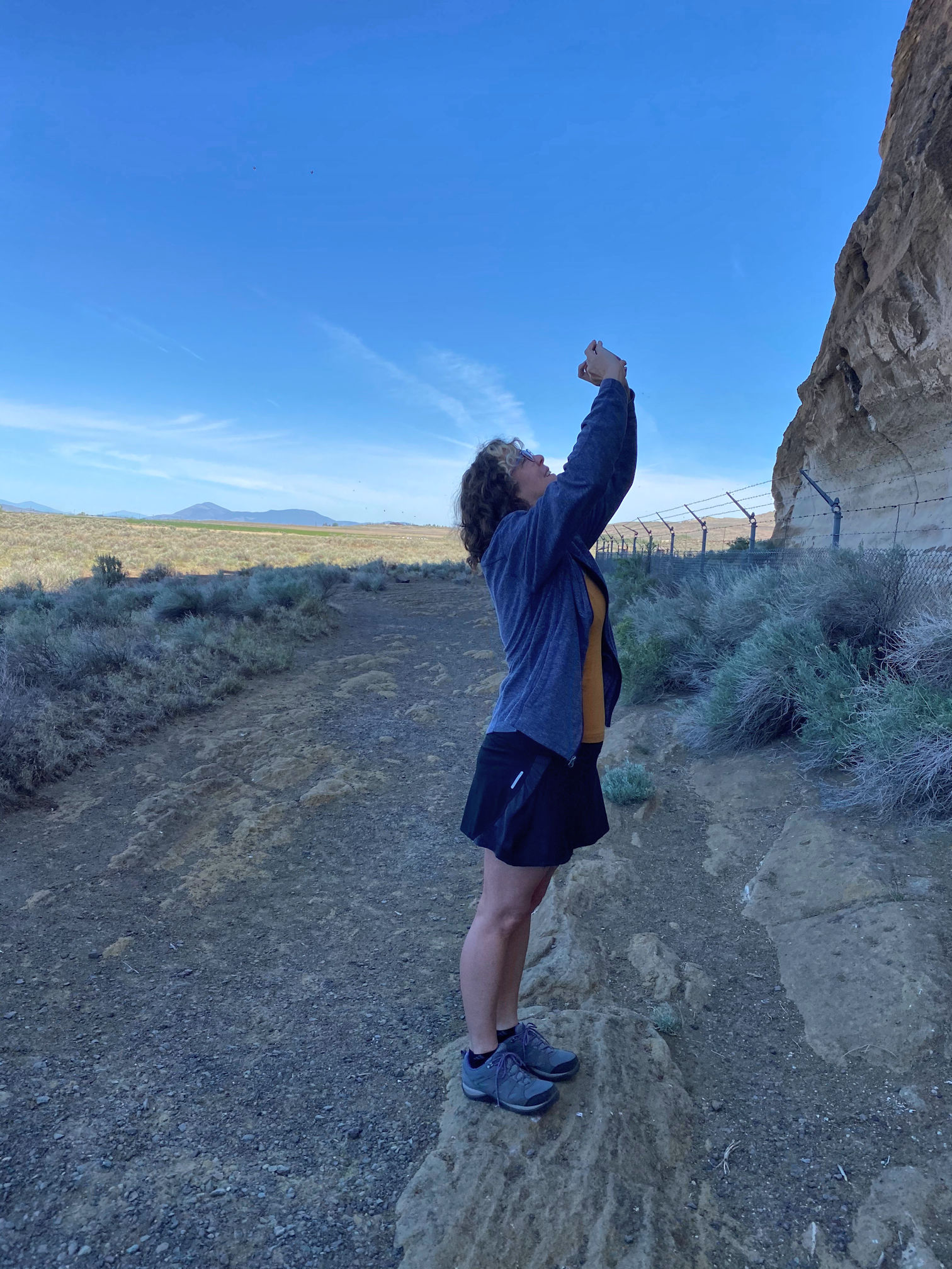
The photos might seem to evoke a peace and quiet desert beauty. This is deceiving. The entire time we stood there, the air was filled with a cacophony of sound, as thousands of Cliff Swallows tended to their young. The skies were filled with never-ending to and fro of bird parents frantically flying out to find food and bring it back to their screeching young. After our brains got used to the ruckus, it was actually kind of cool. These birds all live in mud apartments above the petroglyphs.
.
.
.
.
.
.

they are wonderful and appreciate seeing you in action to get some shots
Thank you! It’s nice having a travel partner to help with the shots. When I travel alone it’s hard to get any images of myself and I’m just no good at selfies.
😊🌺🌸
Of course you have a deep emotional contact with your Modoc origins. You did well with the phone. If only someone could put the effort into interpreting these images as have been done in other, better known, cultures
Thank you, Derrick. You are quite right about the interpretation. The National Monuments website says that no one has ever done ethnography on the Modoc people to try to collect origin stories or cultural explanations for the markings on the rocks. I’ll bet there is some valuable knowledge still held there among the elders.
Indeed
Fascinating! How you stumbled upon more Modoc mysteries! I love swallows and the fact that the walls are well protected. So this is tuff made from volcanic ash? We have entire town made from that over here: Pitigliano, Sovana, Sorano, all are tufa towns. I haven’t spotted or heard of any carvings though.
Oooh! I love tufa towns. I have only seen that in Turkey, where there are multiple places where homes and churches are carved into the soft tufa rock. Yes, this landscape was formed by volcanic action. I’ll cover that more in my next post when we finally make it into the main park at Lava Beds National Monument. I’m glad the walls are protected too – for the petroglyphs and for the swallows.