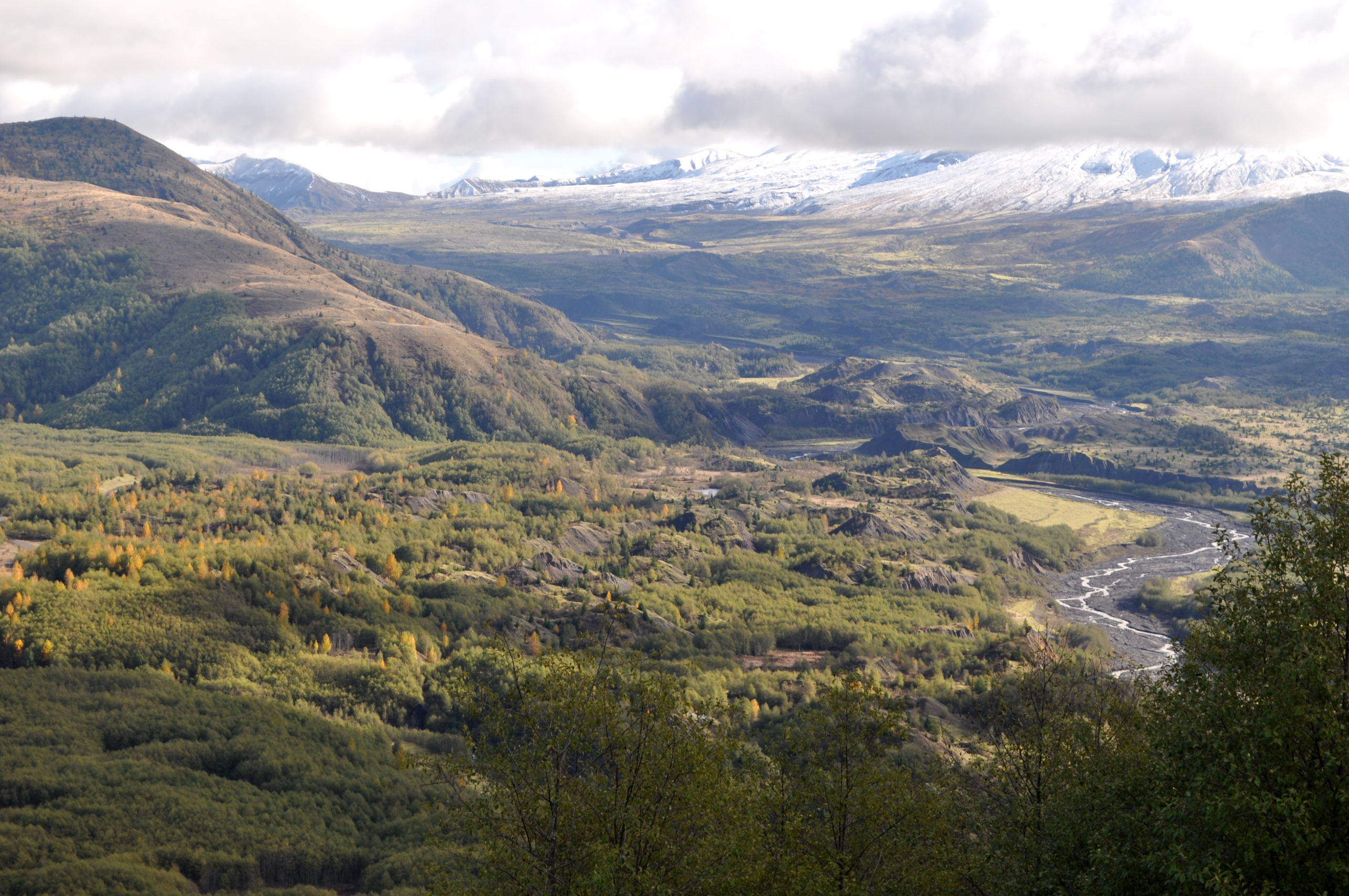
Earlier this month, my two dear friends Norman and Rodel invited me to spend the day with them. The plan was to drive up to Mt. St. Helens. That day the partly cloudy sky was slowly clearing as we made the trip, and we had fingers crossed for a mountain view when we got there. Sadly, the clouds remained clustered around the peak of Mt. St. Helens. We had a great day together, and the views were gorgeous (as you can see above), but we never did get to see the mountain.
Their idea stayed in my head. Sunday morning I had to run an errand, and as I was driving I looked from a hilltop near my home and saw crystal clear in front of me: Mt. Rainier, 80 miles distant as the crow flies, indicating that the air was very clear. I immediately looked East and saw Mt. St. Helens (38 miles) bold and clear, rising on the horizon. I made a decision right there to head back to the volcano, on this brilliantly sunny day.
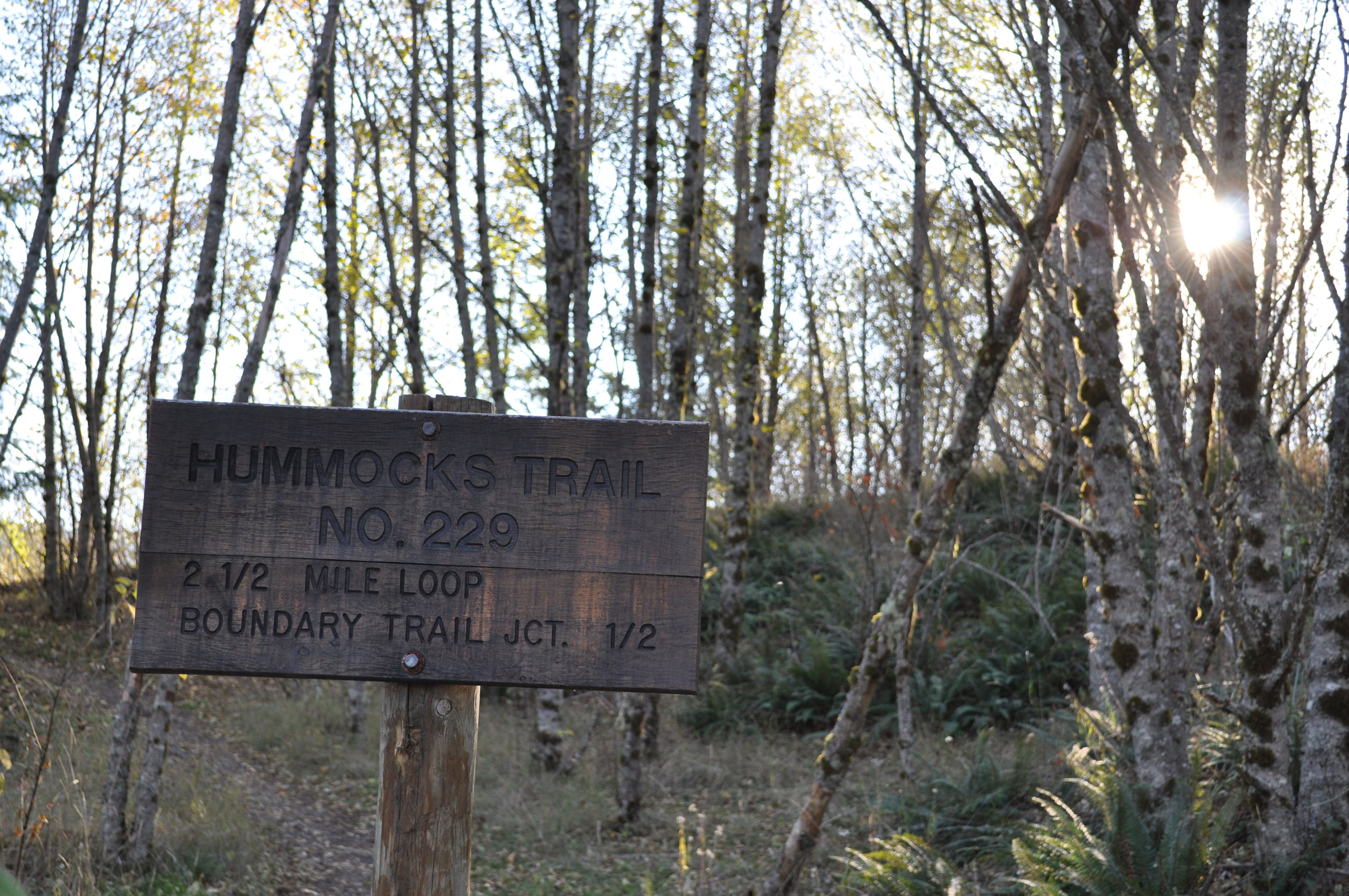
I stopped first at the Visitor’s Center, because there is a 3/4 mile trail that’s supposed to be lovely, and has a view of Mt. St. Helens. I asked an employee where to find the trail, and she asked which trail, and before I knew it she had convinced me to skip the one at the visitor’s center and to instead drive another hour down the road to the Hummocks Trailhead.
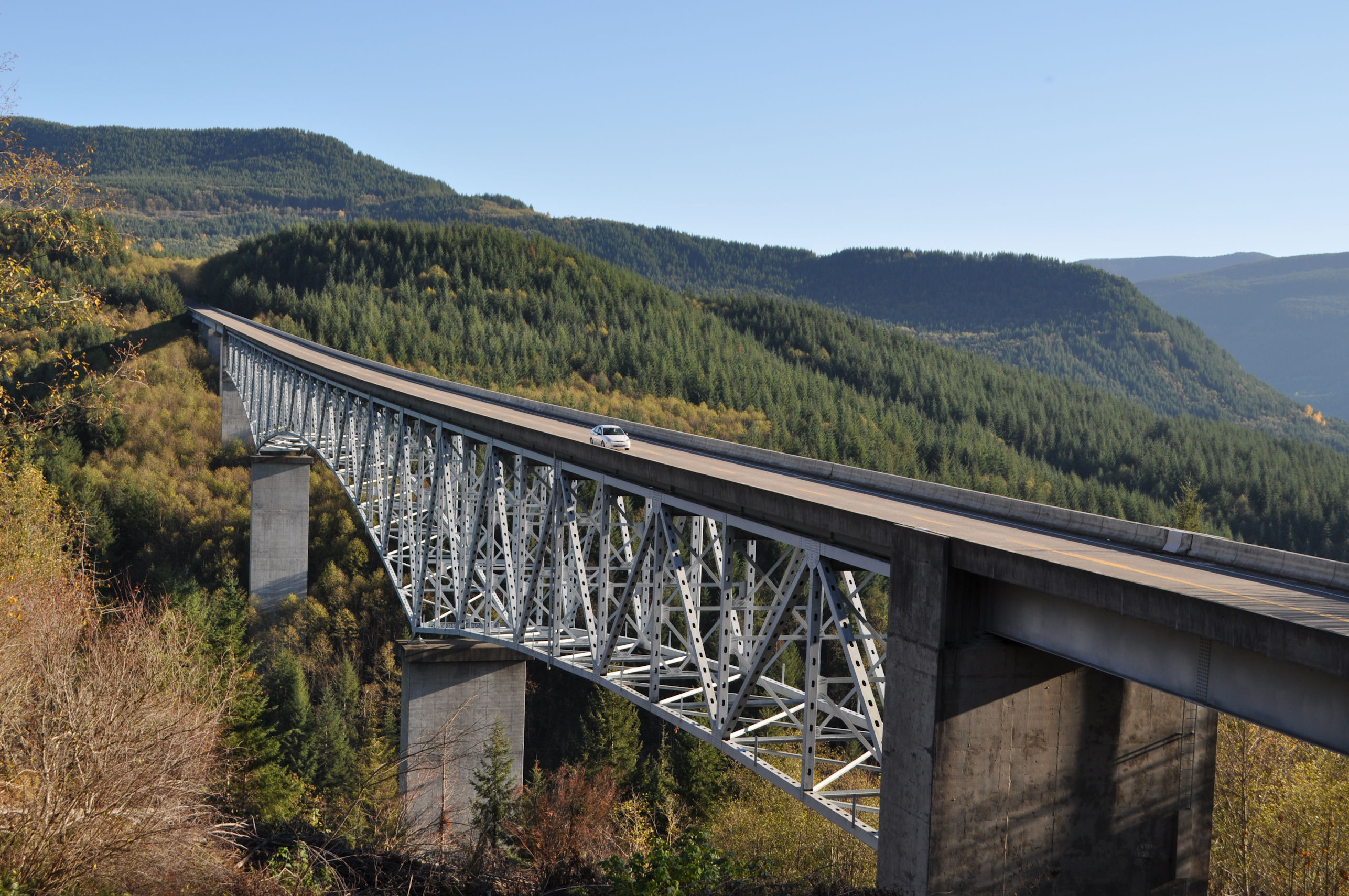
On the way I stopped for a bridge overlook. There are four similar bridges that span deep mountain canyons on the way to the mountain, with fascinating and eye-catching architecture. I like the look of the curved bridges better, but this straight one gives you an idea of what they look like.
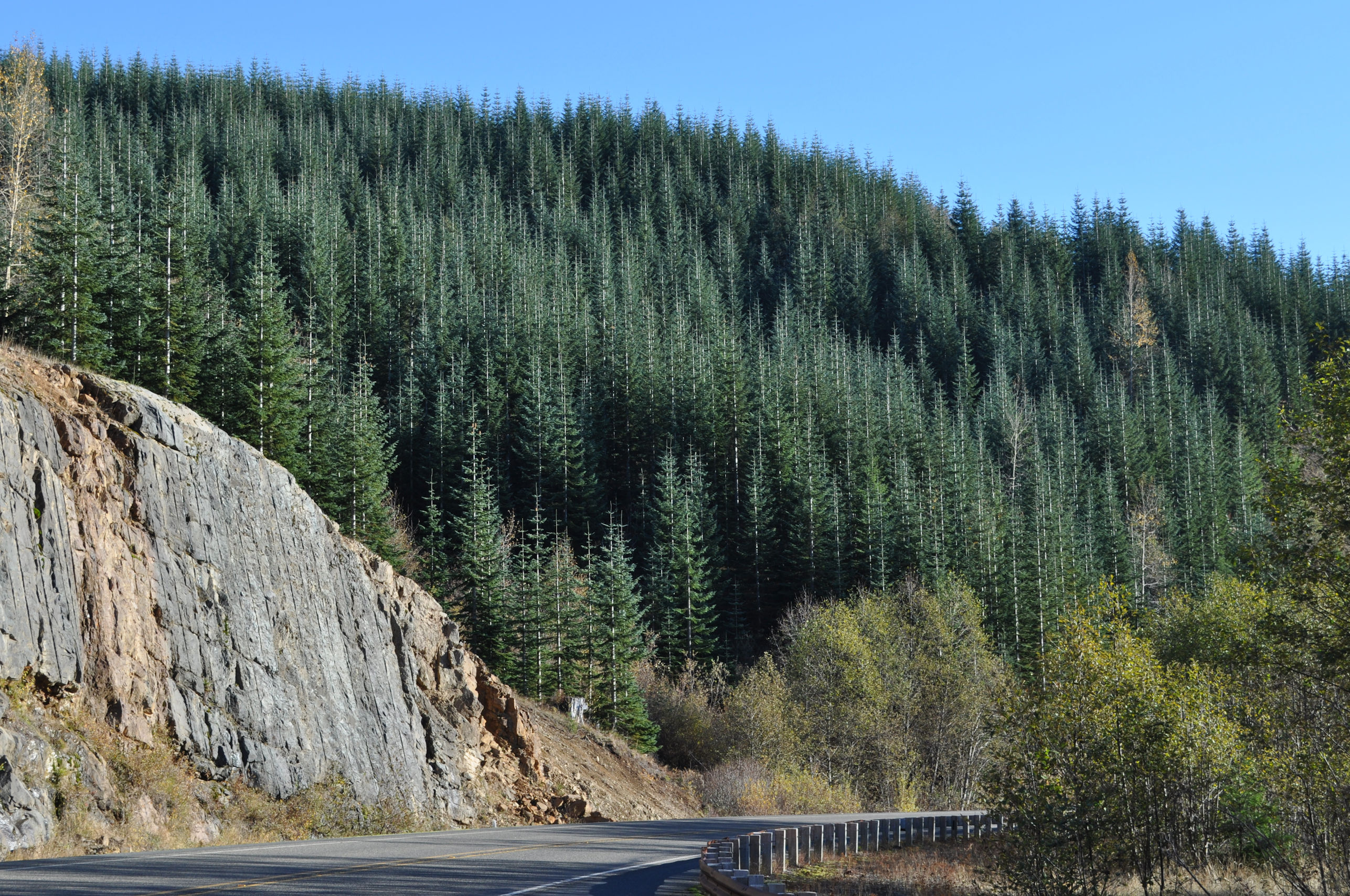
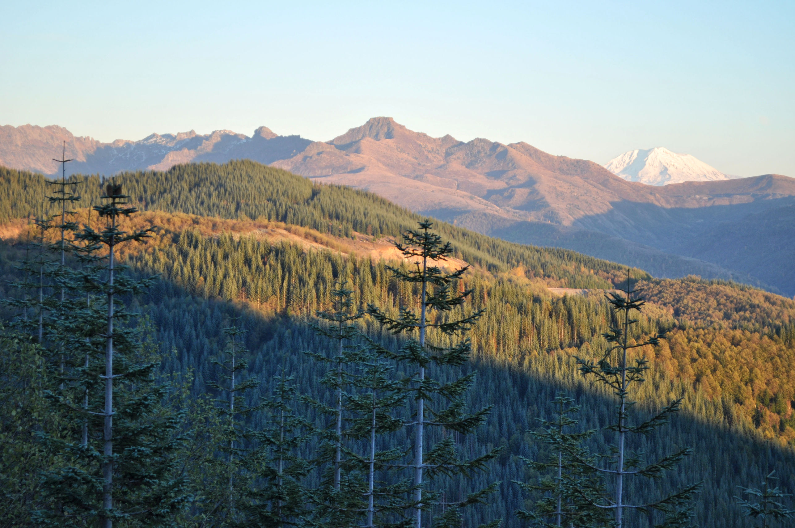
Something that always baffles me is the eye-crossing effect of looking at the forests of Noble Fir planted by the Weyerhaeuser Company. These trees are the same age and look like exact duplicates of themselves for acres upon acres. Your eyes get confused trying to make sense of what you’re seeing. A Ranger I met at the Johnston Ridge Observatory a couple years ago called them Lego Trees, and that’s apt.
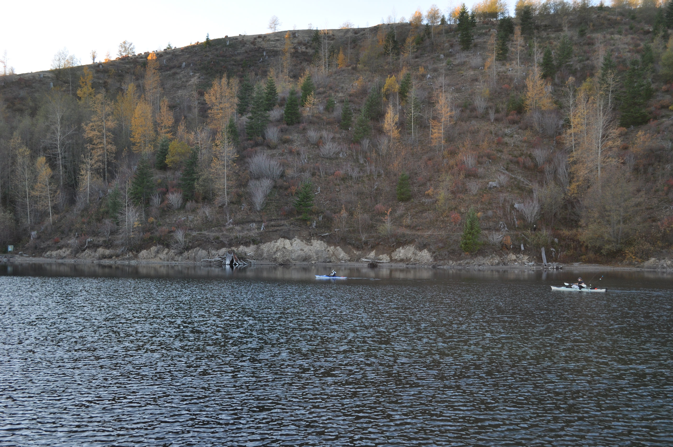
The road to the Johnston Ridge Observatory is closed for winter. But the road is open as far as the Hummocks Trailhead. It’s a clear trailhead with ample parking. On this sunny weekend day, half the spaces were filled. It makes me happy that so many people want to get outside and do things in November. During the winter I’m more inclined to curl up with my laptop and a blanket. Maybe I’m projecting, but I am so proud of myself when I do something ambitious in winter weather, that I am proud of all those other people too!
I arrived at 2:45 pm and moved quickly down the trail, aware that sunset is 4:30. It felt comfortably warm at about 52 degrees, but as soon as the sun set it would drop quickly to freezing. I did not want to be caught out wandering the valley after sunset.
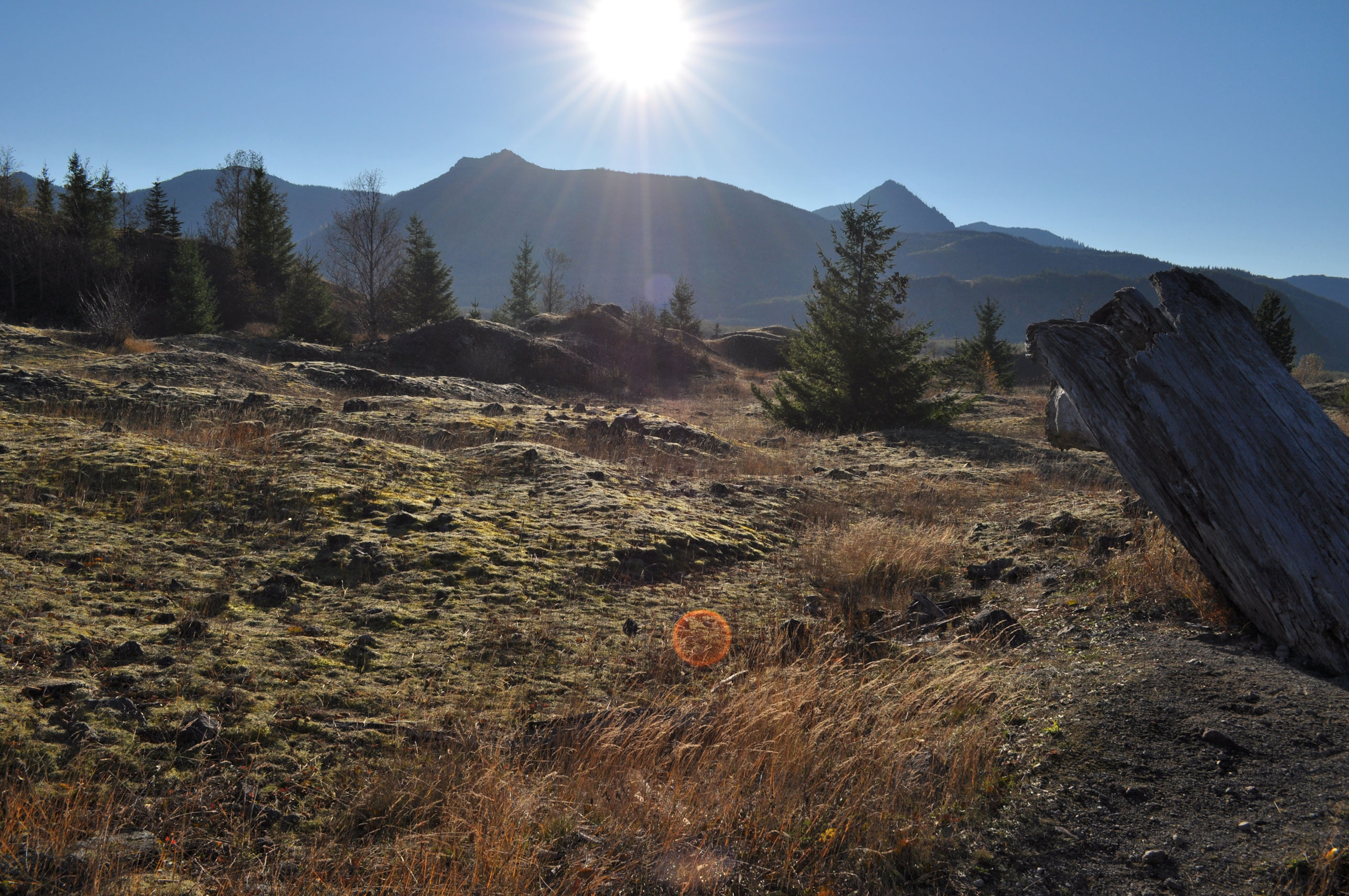
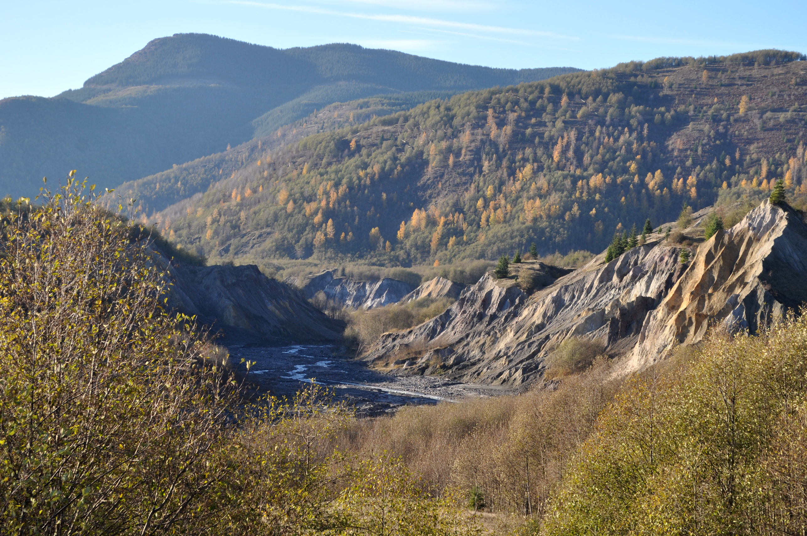
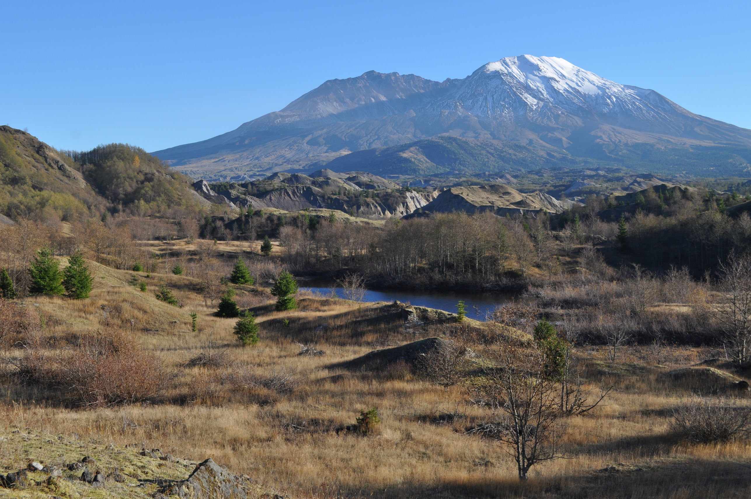
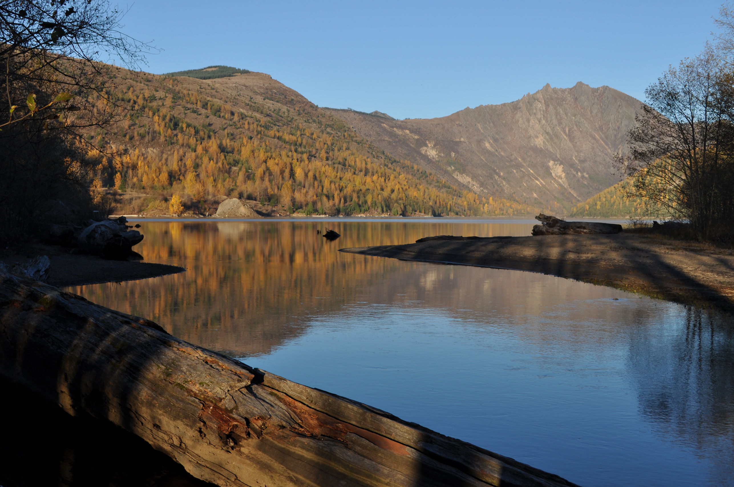
The trail was well-worn and easy to follow, and lovely. It travels through the famous Mt. St. Helens hummocks. These hummocks are big chunks of the former peak of the mountain that were blown off the top and side during the eruption in 1980. The whole valley surrounding Mt. St. Helens is filled with these mini-mountains, and scientists have tracked each one back to where its original location once was on the long-lost pointed peak. Why on earth they would do that is beyond me, but bully for them for completing such a daunting task.
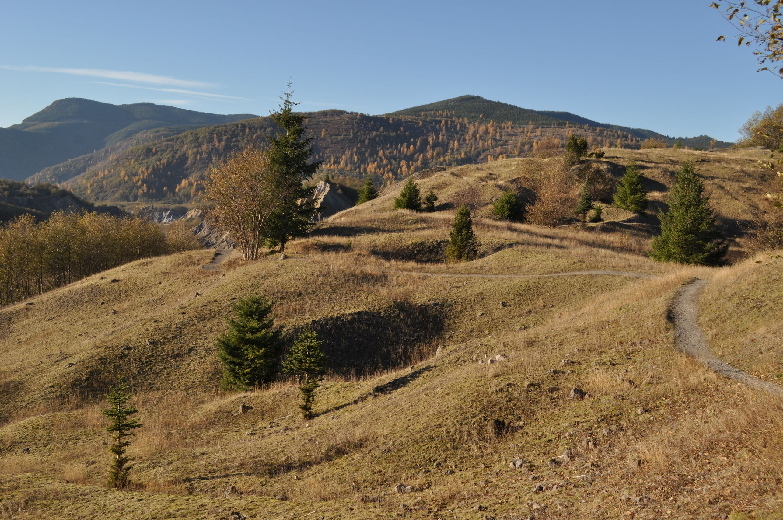
For the layperson, what may be most relevant about these hummocks is that they are remnants of a volcanic blast, they form today a most interesting landscape, and that there is a trail allowing us to get a nice close look at them and even to walk on top of them.
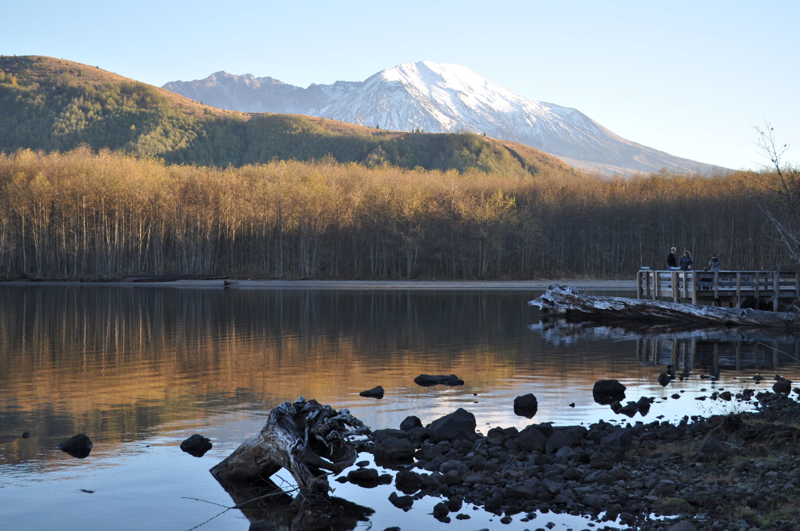
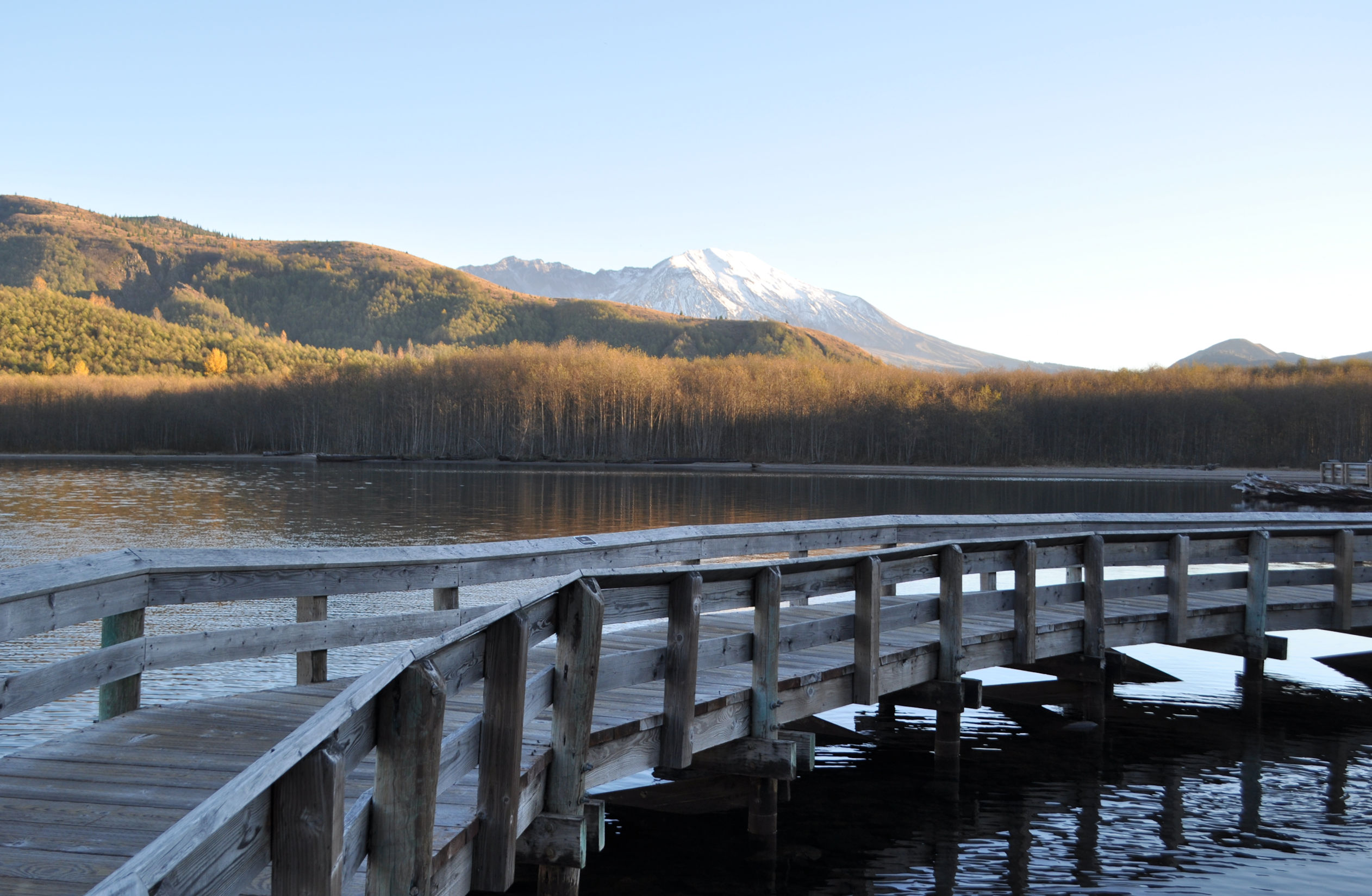
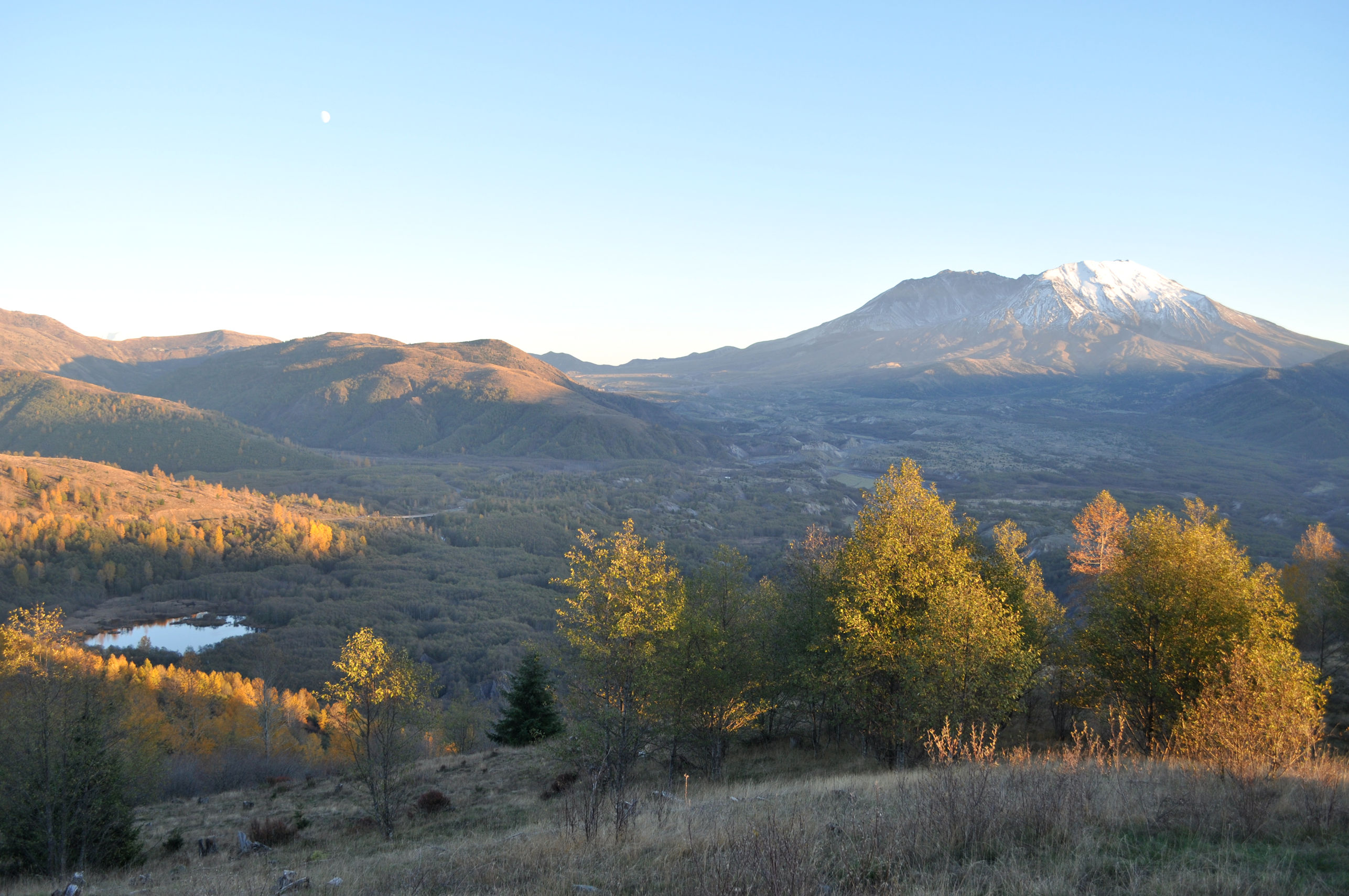
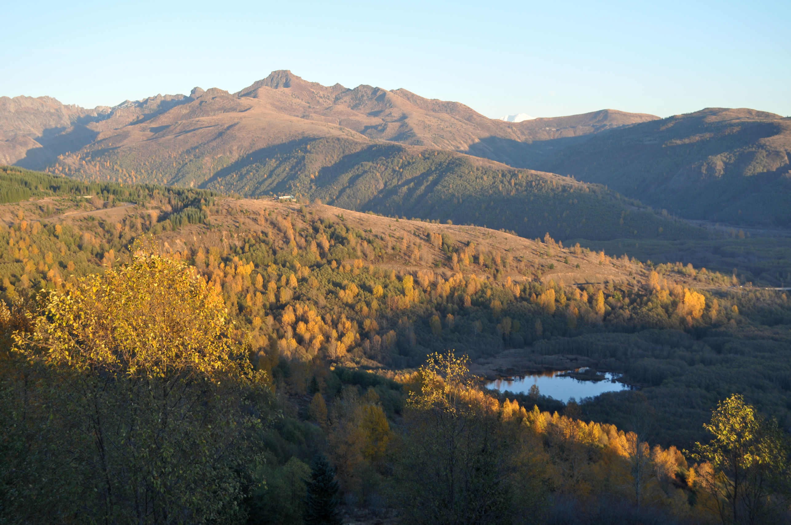
There were also stunning views of Mt. St. Helens from multiple locations.
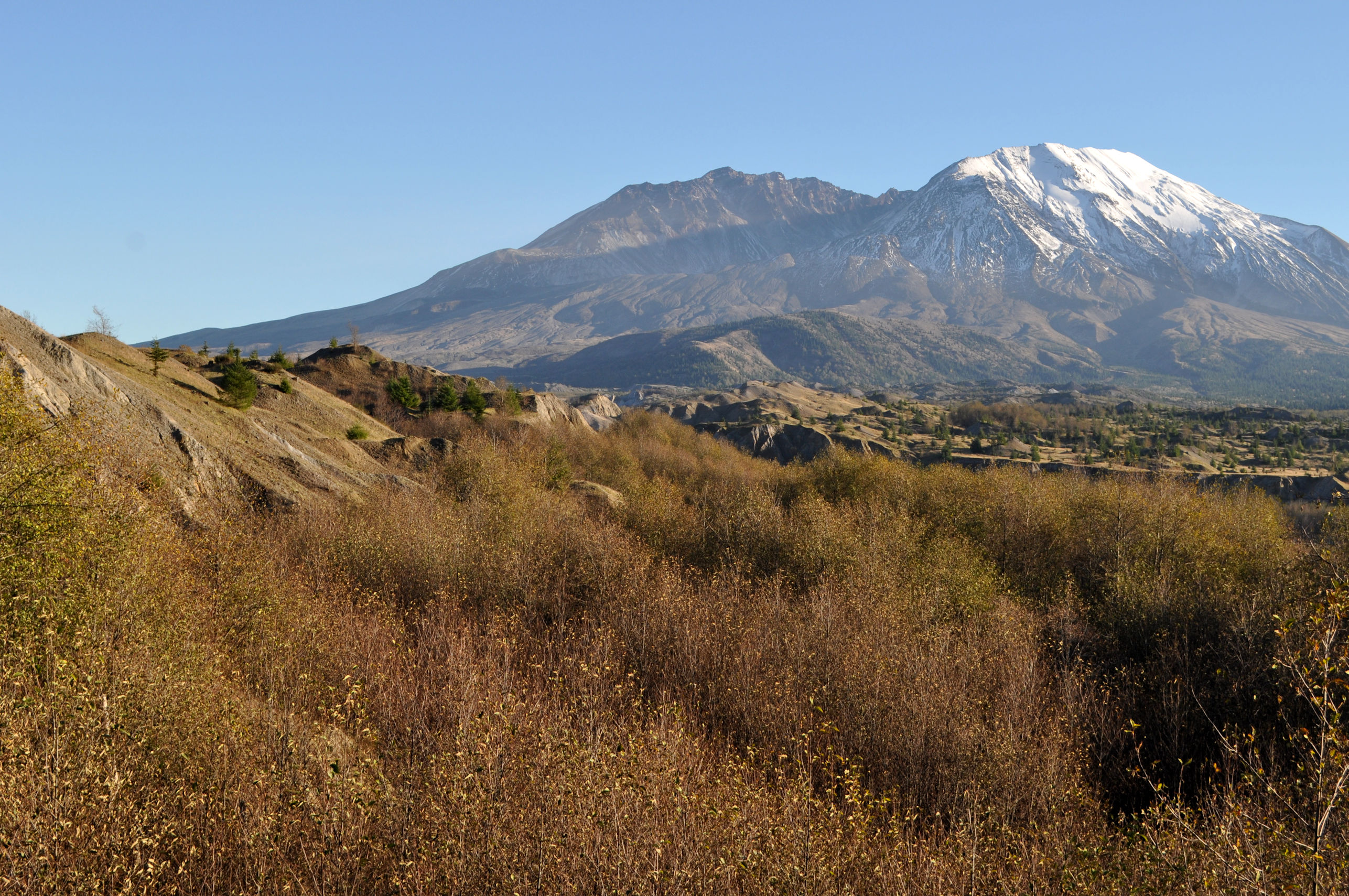
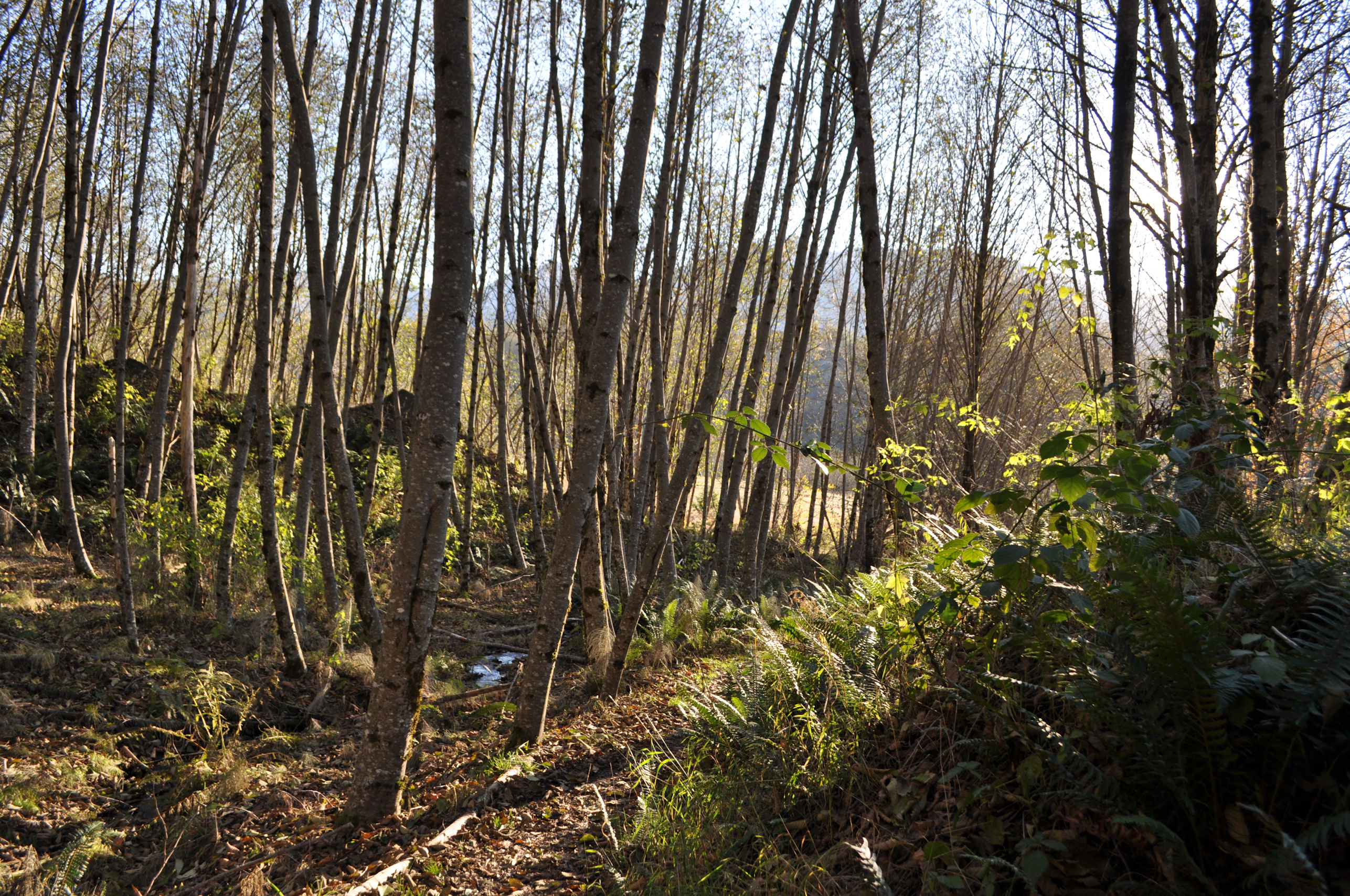
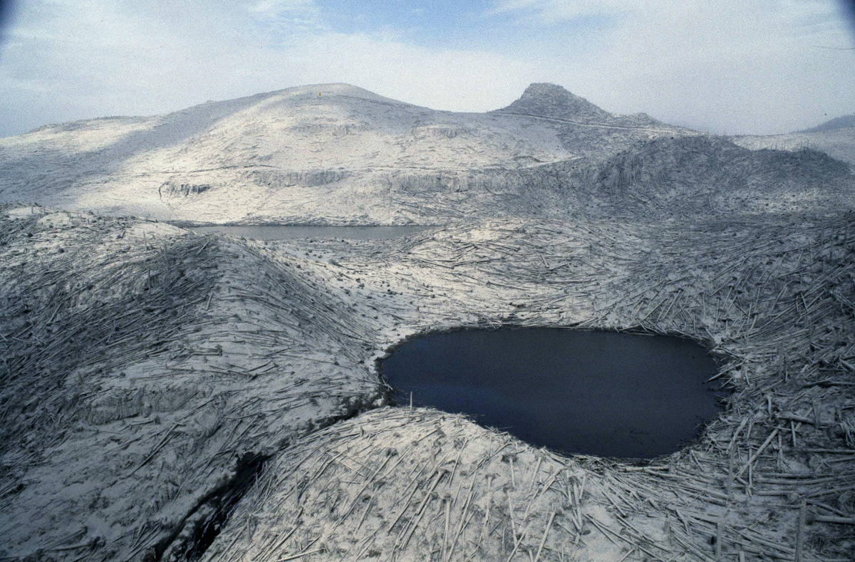
I recall the volcanic eruption from my childhood, and the aerial images of barren moonscape left in all directions for miles. Thus it is delightful for me to stand in a forest, beside a creek, and know that this has all formed since that devastating day. The size of the trees may not seem impressive at first, considering that it has been 38 years. But it’s not that the trees were cut and the forests were free to begin re-forming the next day. Today’s forests had to recover from this:
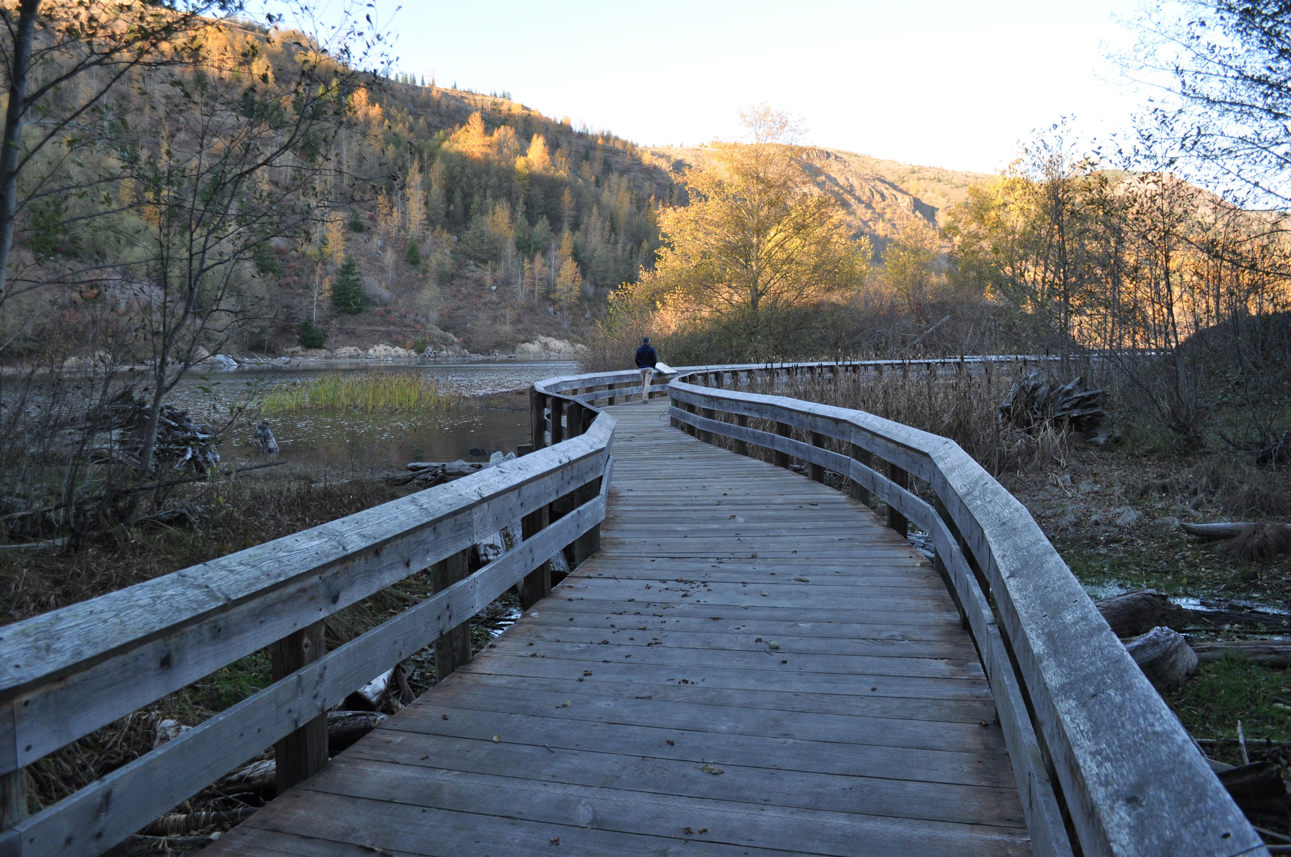
My path was through fields, streams, and forests. There were ducks on the ponds. It’s a healthy land and in a quick glance does not reveal that the old forest floor is buried beneath many feet of volcanic ash, and all this beauty before me sprung out from that poor beginning. Nature keeps me in awe.
I completed the Hummocks Trail loop with plenty of sunshine left, so I went to explore nearby Coldwater Lake.
The trail at Coldwater Lake is wheelchair accessible, a trail feature I often notice. I think possibly I’m making a list in my mind of trails I will still be able to visit when my future self needs a wheelchair. Hiking a nature trail is one of my greatest joys in life, and I’m reassured that if my legs ever stop working, I’ll still be able to hit some trails.
The sun was very low and that made all my photos warm with light despite the quickening chill in the waning day.
On my way home I stopped at the Castle Lake Overlook and spotted not only the snowy tip top of Mt. Adams, but also Mt. Rainier! The moon became visible, and an excited little boy yelled “Daddy! The sun is rising and the moon is rising AT THE SAME TIME!” He may not have had the semantics right, but his Daddy understood exactly what he was saying.


Lovely walk, thanks for taking me along.
Scientists do weird things don’t they? Who pays them to do it?
Yes, they do! I’m so glad you agree with me. I read the information sign that explained how people had mapped each hummock back to where it had originally been on the mountain, and my very first thought was “WHY?” ha ha ha. They probably had some grad student write a grant proposal that sounded good, and the National Science Foundation funded them or something. It’s very sexy: VOLCANO!
thank you for the lovely walk
Maureen, thank you for coming along with me.
Your pride well justified in this spontaneous trip
ha ha ha! Excellent! I was thinking of you again, when I went on another short November hike yesterday when friends were visiting me. We couldn’t choose the weather, so off we went. It was cold and cloudy, and once we began hiking, the rain began. And it came down steady the whole time we were out. I got soaked. And did not have a hat. And I kept a smile on my face!
🙂
I flew over Mt. St. Helens shortly after it blew up, Crystal. I was on my way to lead a backpack trek in Alaska. The devastation was incredible. A few years ago Peggy and I visited the mountain. I was amazed by the recovery. It speaks to the power of nature. My thanks for your tour. Also, I’ll add my than’s to Bones for your great post on him. 🙂 –Curt
I think you mentioned that once to me, Curt, about having flown over Mt. St. Helens. It must have been astonishing to see and I’m glad you had that opportunity. I traveled to Idaho that summer, and remember seeing people in the Idaho panhandle shoveling ash off bridges and roofs a month later. It was easily 18 inches deep in places. Those memories are why it’s so astonishing for me to see what it looks like today.
I may have mentioned also, Crystal, that I had worked with the Washington Lung Association in planning a bicycle trip at the time that featured bicycling into the area the week of the explosion. Needless to say, the trip was cancelled. 🙂 I, too, remember all of the ash. Absolutely incredible. –Curt
Also… Happy Thanksgiving.
Gobble Gobble! I hope you and Peggy had the best day. I spent the whole day exploring the area with friends and we had a great time.
We did, Crystal. And your day sounded special. –Curt
That’s quite the trek you took on a whim. It worked out for you so well. I’ve often thought about going to see it but now I don’t have to put myself through all that riding and walking. I’ll sit under the covers with my laptop and look at the pretty pictures. Thanks Crystal, for taking us along.
Mt. St. Helens is close to me, so it’s an easier trip. I’m glad you enjoyed the photos. Yes, it worked out so well.
Lovely! I’m happy to hear it’s a healthy country. I remember seeing terrible photos of the aftermath of the blast in the uncle’s book. I think my dread of volcanoes started then. I could never understand how the people of Naples can live right under a living volcano.
I have heard your sentiment before, particularly when I lived in Alaska and California where earthquakes were common – how can anyone live in a place like that? Along the west coast of the US are a whole string of volcanoes said to be “active” in that, they could blow any time. I guess when you live with it, it becomes less scary. I think of the people in Hawaii, where the volcanoes are shooting out fire and magma all the time.