Gary, this one’s for you.
When I was 10 years old, Mt. St. Helens erupted. Down south, in Steamboat, Oregon, fine powder fell for a couple days, noticeable only to those looking for it. We could drag a finger over the hood of a car and see a trail in the dust.
The sideways blast in the north slope of the mountain, coupled with prevailing West winds, blew much of the ash over to Idaho from Washington. I spent that summer with my mom in Sandpoint, Idaho, and I recall the drive up there because of seeing the devastating heaps of white-grey ash from the car windows during the trip. In the worst places, June 1980 still had many people wearing masks and shoveling the stuff with snow shovels. Like snow does in the winter, the weight of the ash had damaged roofs. Unlike snow, it would not melt away, and had to be removed by hand. I watched teams shoveling ash a foot deep off bridges, off business roofs in small towns, even plowing it with trucks.
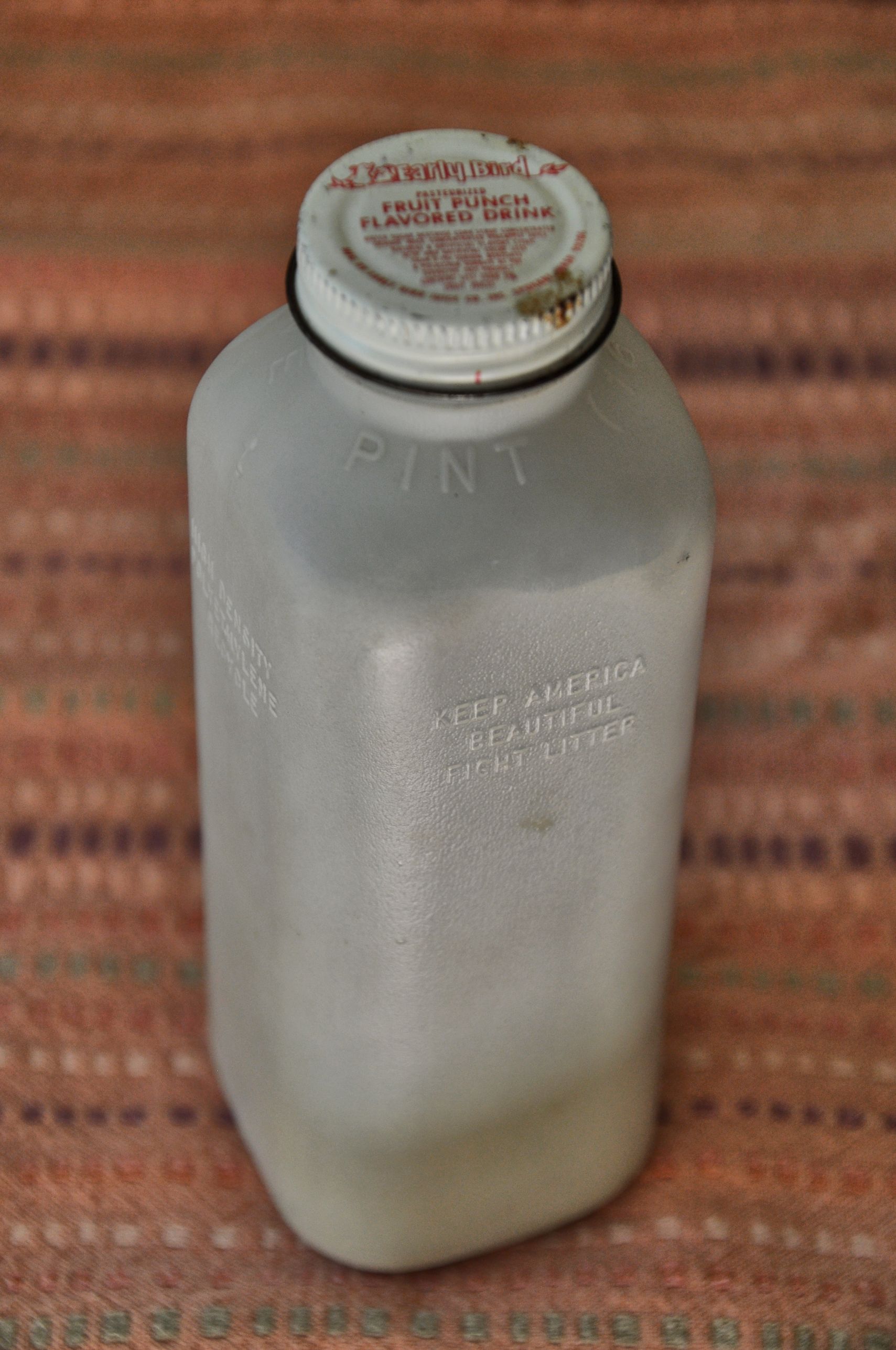
Later in June, my family went on a picnic along a north Idaho river. The river held large smooth rocks that had collected ash in irregular bowls shaped into their surface from erosion. After I finished my juice, I rinsed the plastic bottle out in the water, and set it in the sun to dry. Then, I walked barefoot through the water from rock to rock, collecting the fine powder by brushing it with my fingers into the plastic juice container. I still have that container today; one of the very few mementos of my childhood that survived the many moves across more than a dozen states in my life.
I brought my very old plastic juice container to Mt. St. Helens with me last week. I had been determined to go to the mountain since I was 10 years old. Can you believe it took me 34 years to pull it off? One thing I will say about myself: Like the tortoise, I may be slow, but I do reach my goals in the end. (…says the woman who finally made it to University in her 30s…)
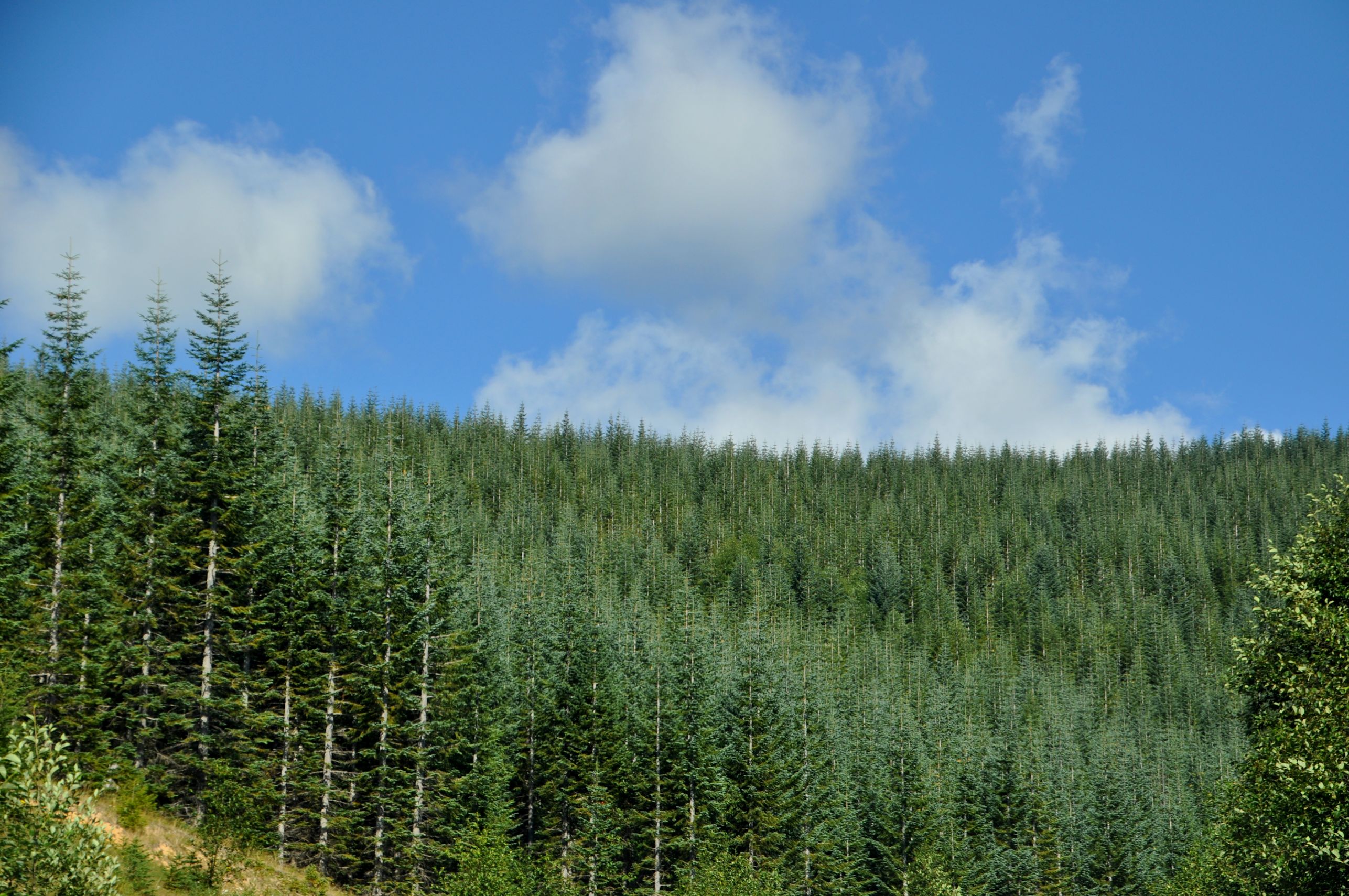
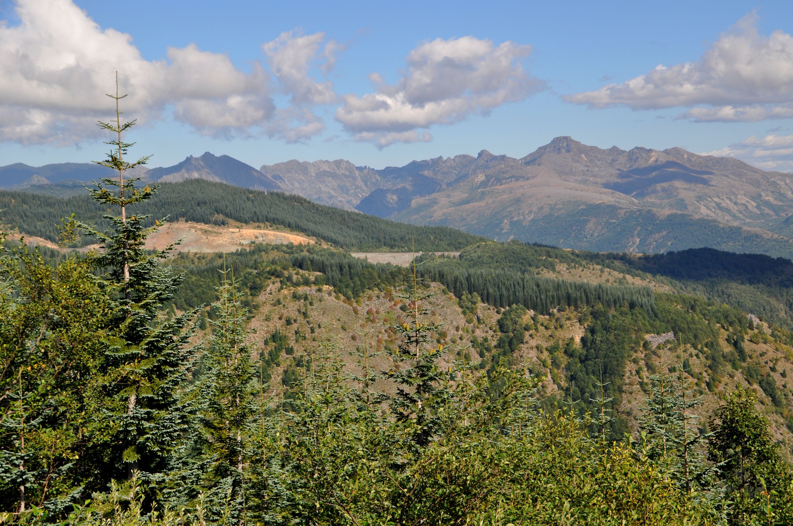
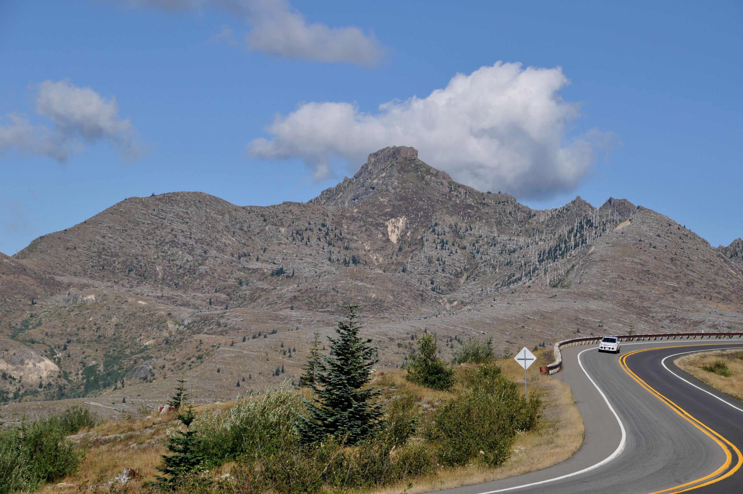
It’s an easy drive on a good road from I-5, and I was within the National Volcanic Monument in an hour, passing thickly forested hills, the homogeneous stands of Noble Fir making it obvious that the trees had been planted by the land owner there, Weyerhauser Company. There were a few vista stops, but each time I stopped, the only thing I could see was a curious, moonlike valley, and clouds obscuring anything with elevation. That was frustrating, because much of the sky was cloudless blue, and only the highest peaks around St. Helens were obscured.
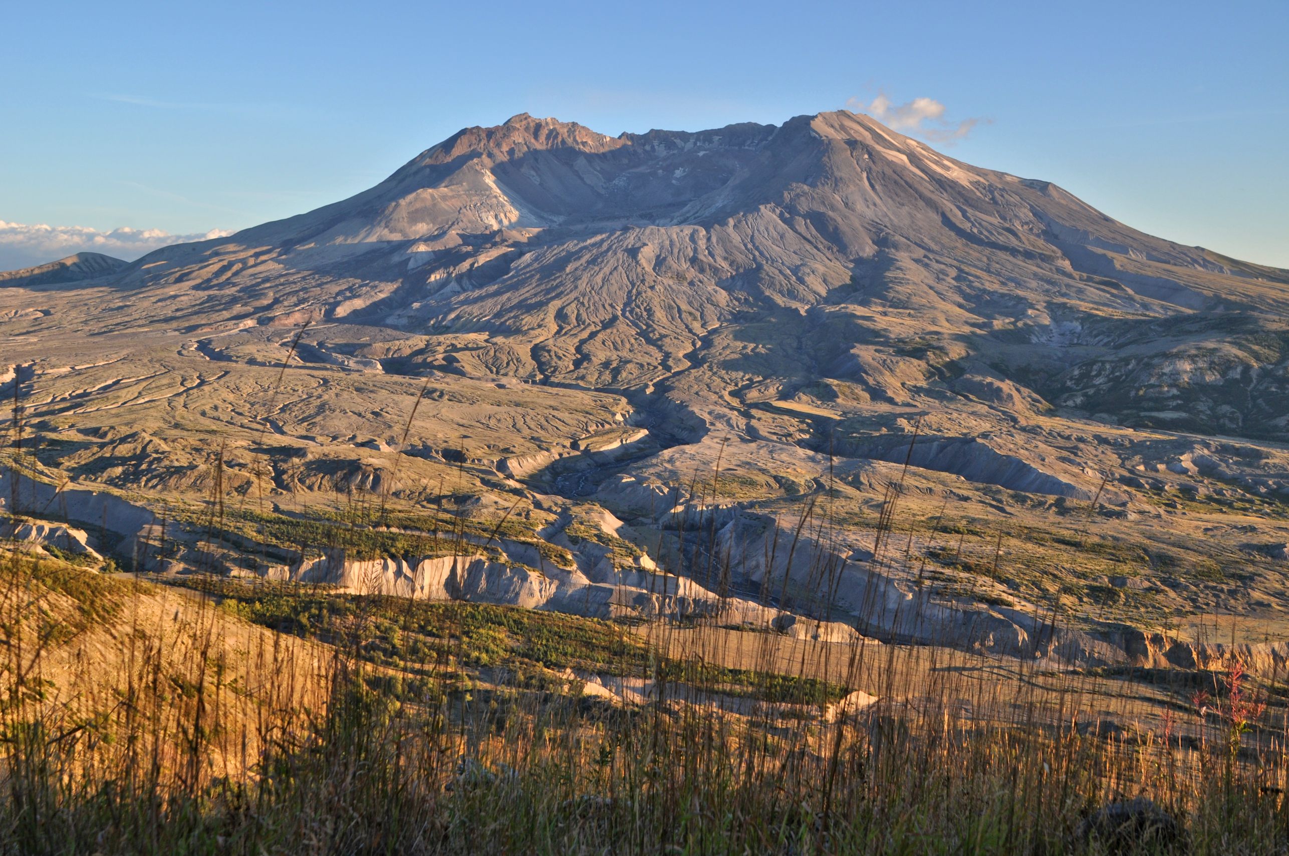
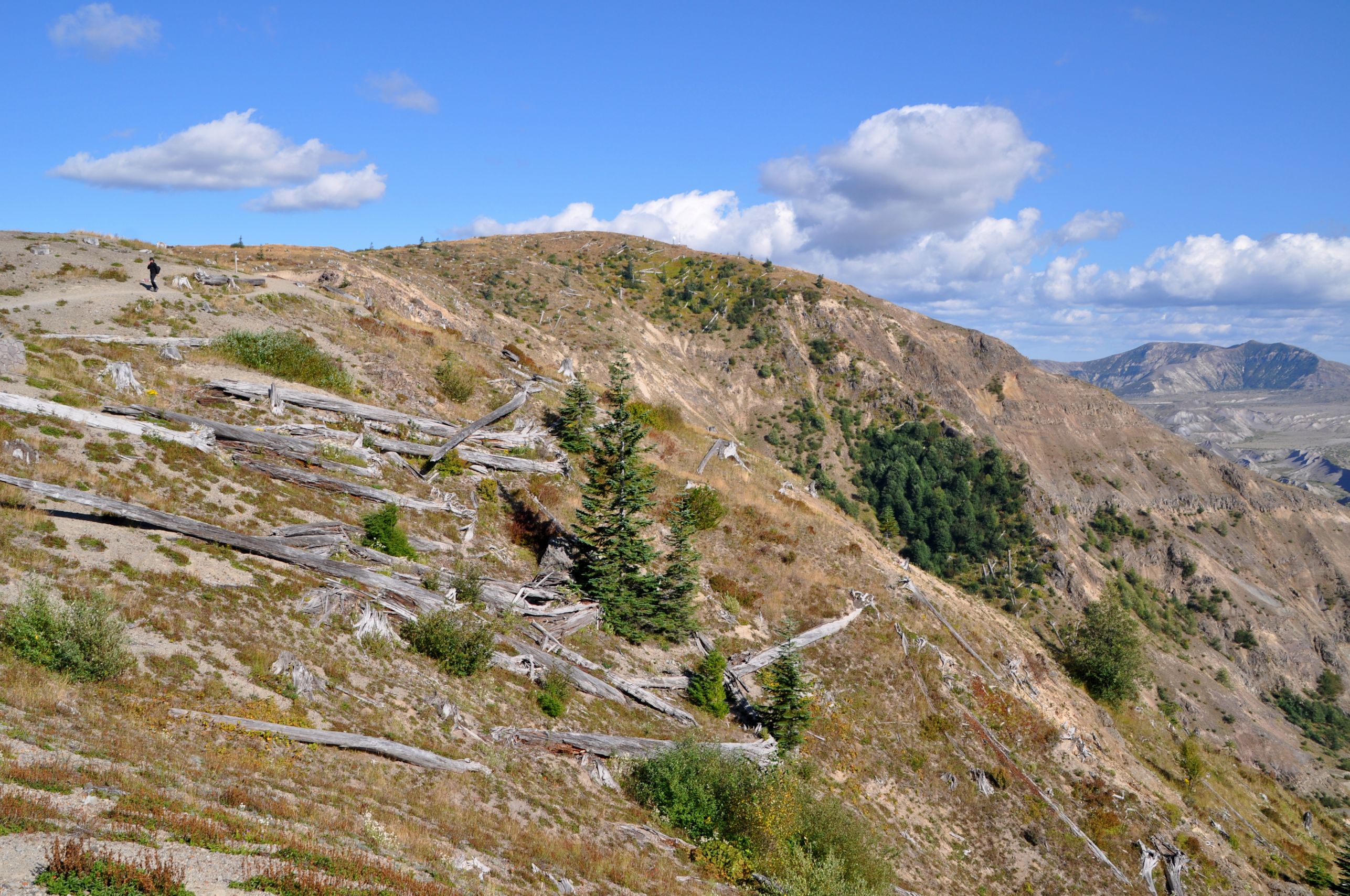
It wasn’t until I was in the immediate vicinity of the Johnston Ridge Observatory when I could tell this had been a place of devastation. Things today are lovely – truly lovely. However, not all the pieces in of the scene felt right. Humongous decaying logs laid about, on bare land with tiny trees just getting a foothold among kinnickinnick and lupine. The surrounding ridges were also mostly bare, with the silver remnants of tall trees. The wide valley had no forests, no brushy stands of willow, and the streams cut deep, sharp channels through what looked like very soft and crumbly soil. It does not look like any other place in the Pacific Northwest.

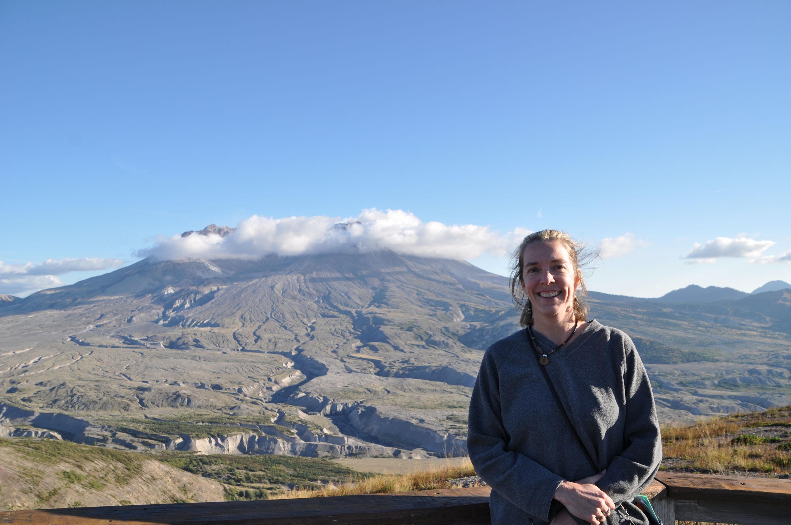
As I explained in my previous post, the clouds finally cleared away from the volcano, and I was treated to stunning views of the huge gaping crater. If the mountain had blown it’s top vertically, we at the bottom would have less to see. Since the eruption took off the north slope of the mountain, we are able to look inside at the newly forming glaciers, and the new volcanic peak growing inside the crater. You know what that growing dome means, right? Yes, this remains an active volcano.
The largest post-1980 eruption was in 2004, when steam and ash again billowed forth. For the next four years, lava continued to extrude, filling the crater floor. Seven percent of the volume lost in 1980 has been replaced by subsequent eruptions.
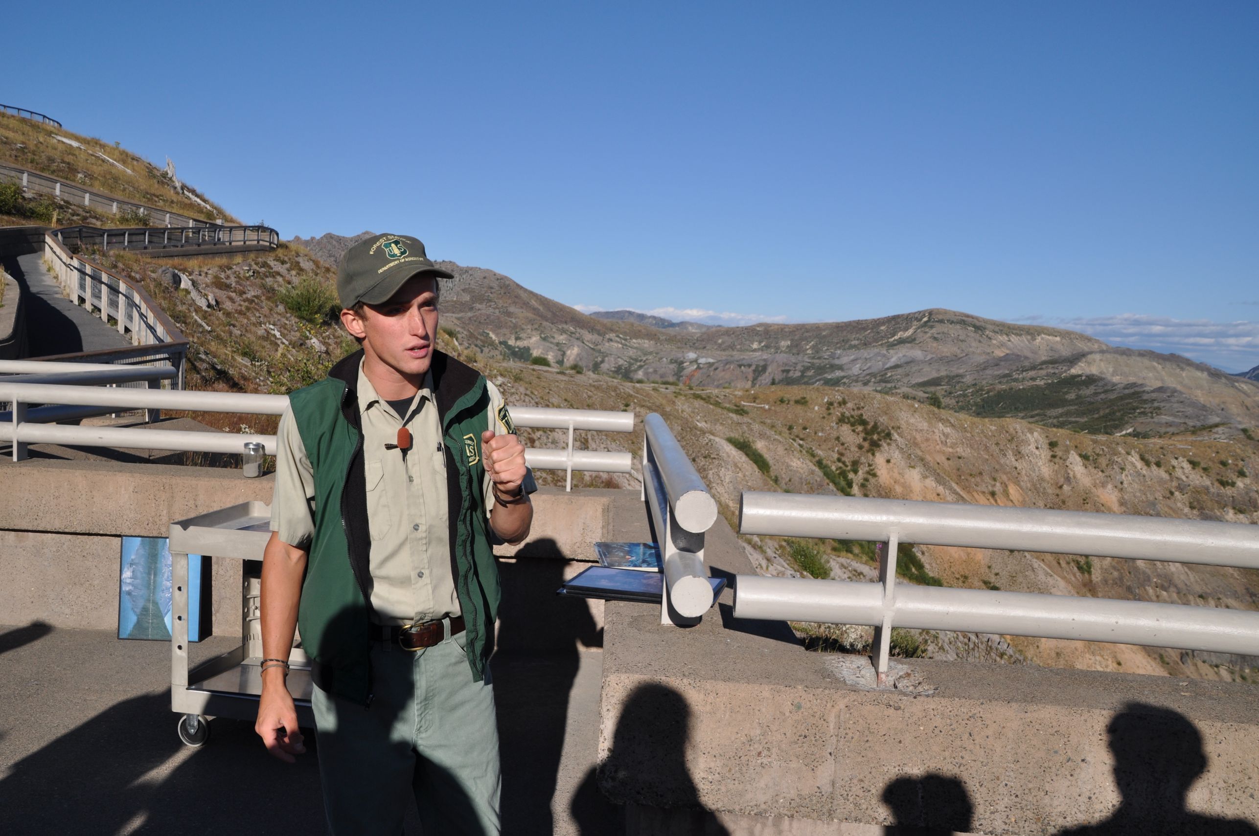
I listened to a great talk from one of the rangers there. He told the story of how exciting it was to be a vulcanologist in the time leading up to the eruption. The best data available at the time was of the Hawaiian lava flows, but they knew this would be different. The size of the resulting violent explosion took people by surprise. Luckily, scientists had convinced authorities to block access to the popular recreation area (despite loud criticism), and prevented many deaths. Sadly, 57 people died in the blast, most due to asphyxiation. The most interesting (to me) of those people was David Johnston, a geologist just crazy about volcanoes, who had observation duty that morning. He radioed headquarters, “Vancouver! Vancouver! This is it!” and then died instantly. The people who heard the broadcast, and knew his voice, said what struck them about his message was that it wasn’t a voice of fear, but of something more like boyish excitement. I’d like to believe that David Johnston died the way he would have most wanted to go.

Crystal, your photos are excellent and really show the extent of the destruction these many years later. And that story about David Johnston …
So glad you were finally able to get there!
Thanks Laurie! I’m pleased with the photos also. I was impressed with David Johnston’s story, too. I’m sad that he didn’t get a chance to study this volcano after the big eruption, because I’m sure he would have been so happy with the work. I am glad to have learned about him. Now I am eager to get back to St. Helens more frequently than once every 34 years, ha ha.