Arno and I had the idea to leave Friday after work and drive wherever our fancy took us. The weather was a factor, and we went south and east in an attempt to escape the rain. We left I-5 and went due East till we reached Sweet Home, Oregon. My deepest apologies to my aunts and uncles who live in the area, and did not receive a visit. Next time, you guys!
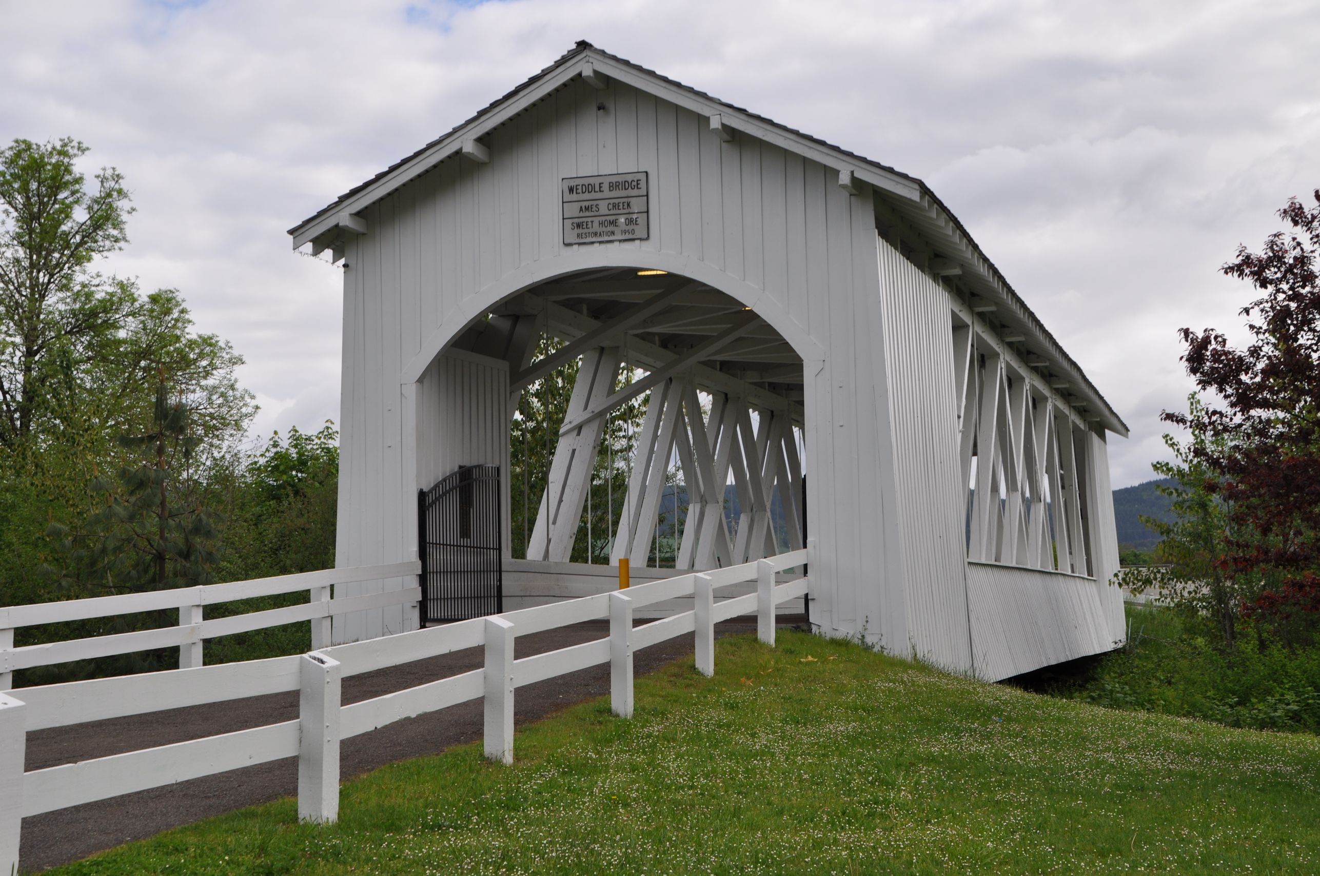
In the morning before we left town, we asked someone to tell us how to find the Weddle covered bridge. When it was replaced by a concrete bridge at its original location, the town of Sweet Home bought it and rebuilt it here in town. Most of the covered bridges in Oregon were built between 1905 and 1925, numbering as many as 450. Fifty of the historic bridges remain. I’d like to do a covered bridges trip one day.
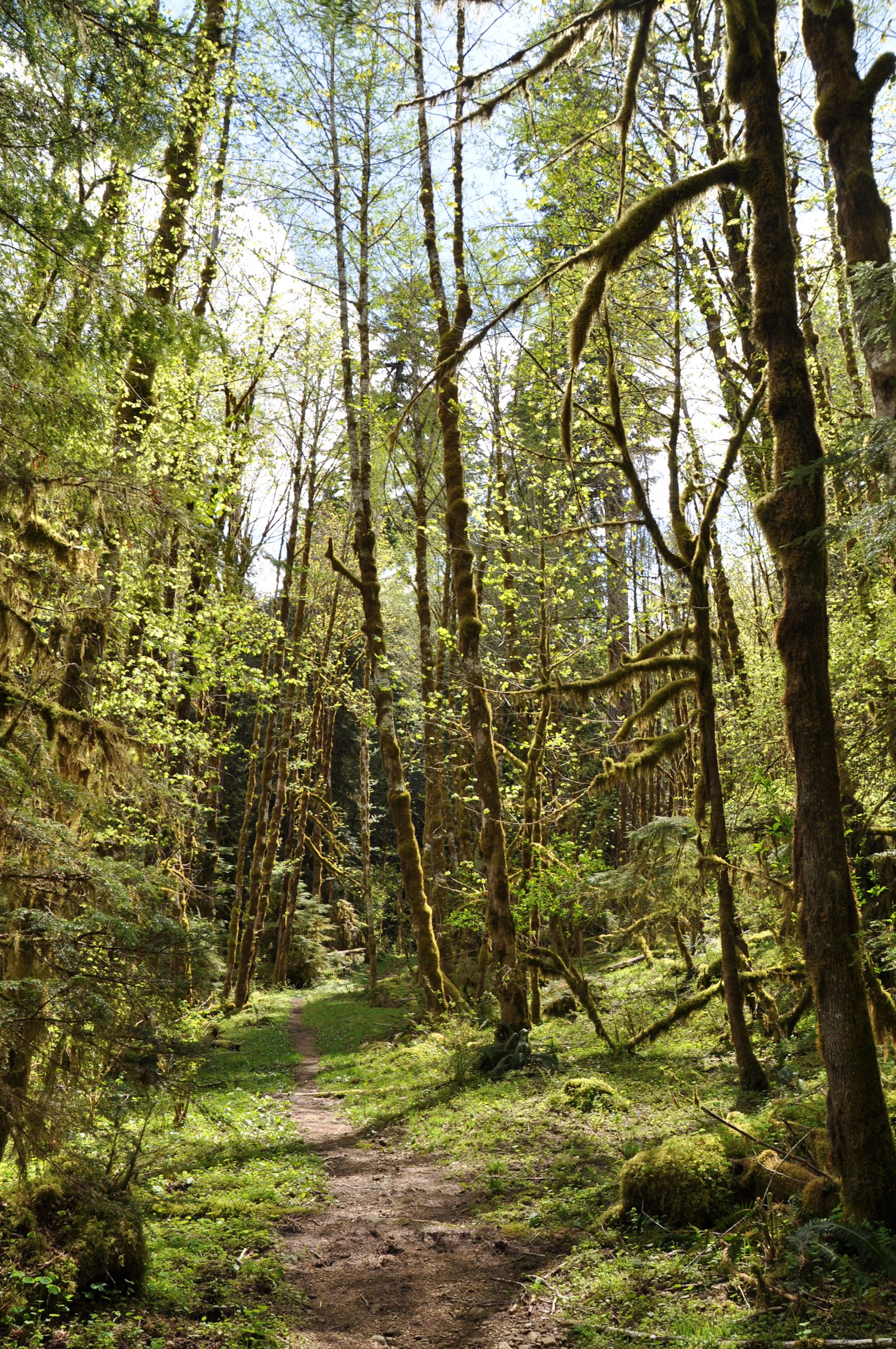
While Arno drove, I flipped through the book Bend, Overall (by Scott Cook) and picked our next stop. It was a trail to House Rock, following the old Santiam Wagon Road.

The trail was easy to find and to follow. The day had sun mixed with showers, but it remained relatively warm so our hiking was enjoyable. It was neat to think that we were walking along a road built for wagons and horses. Before we reached the rock, however, we were distracted by a side trail to a falls, which turned out to be really beautiful.
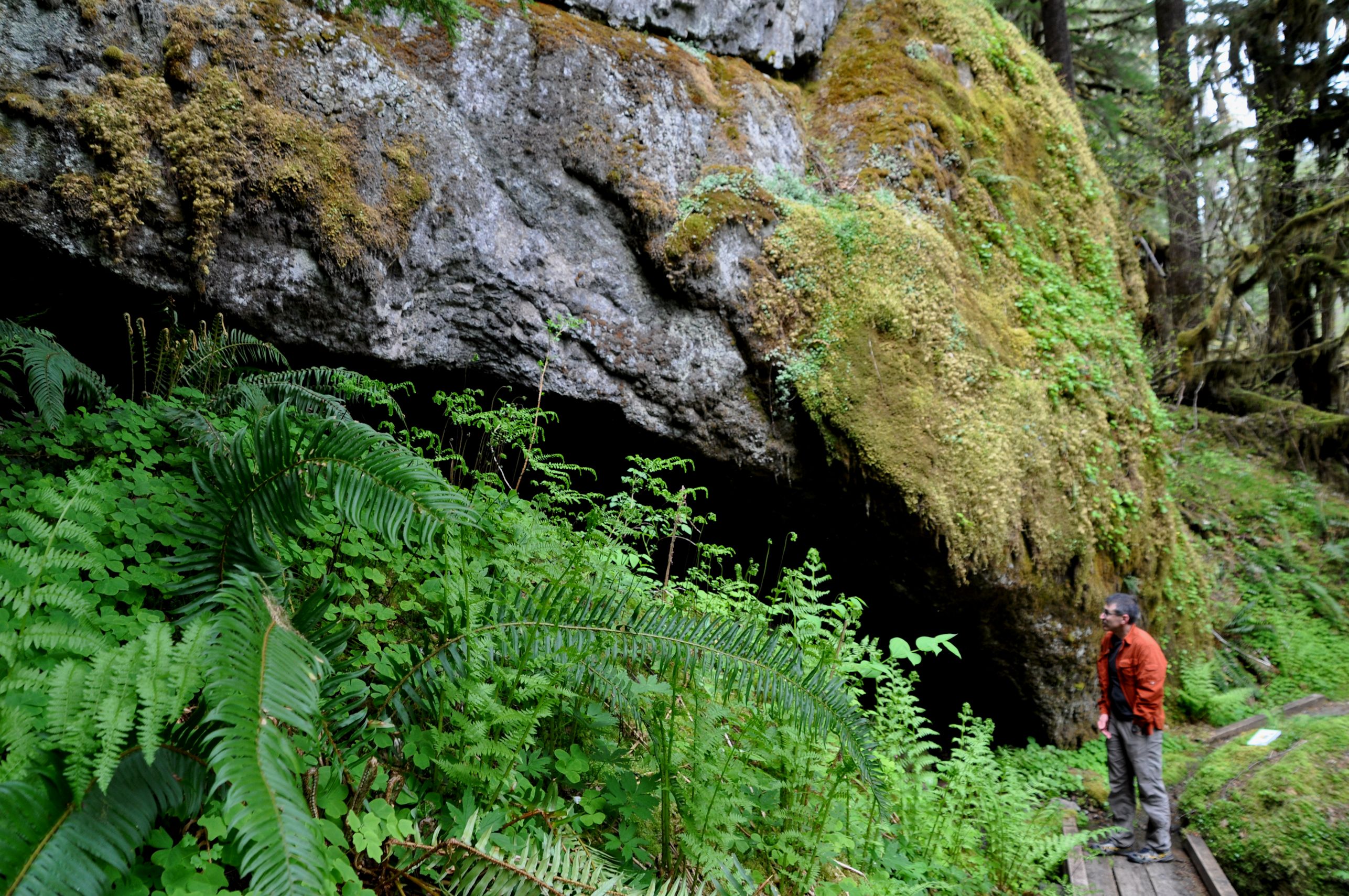
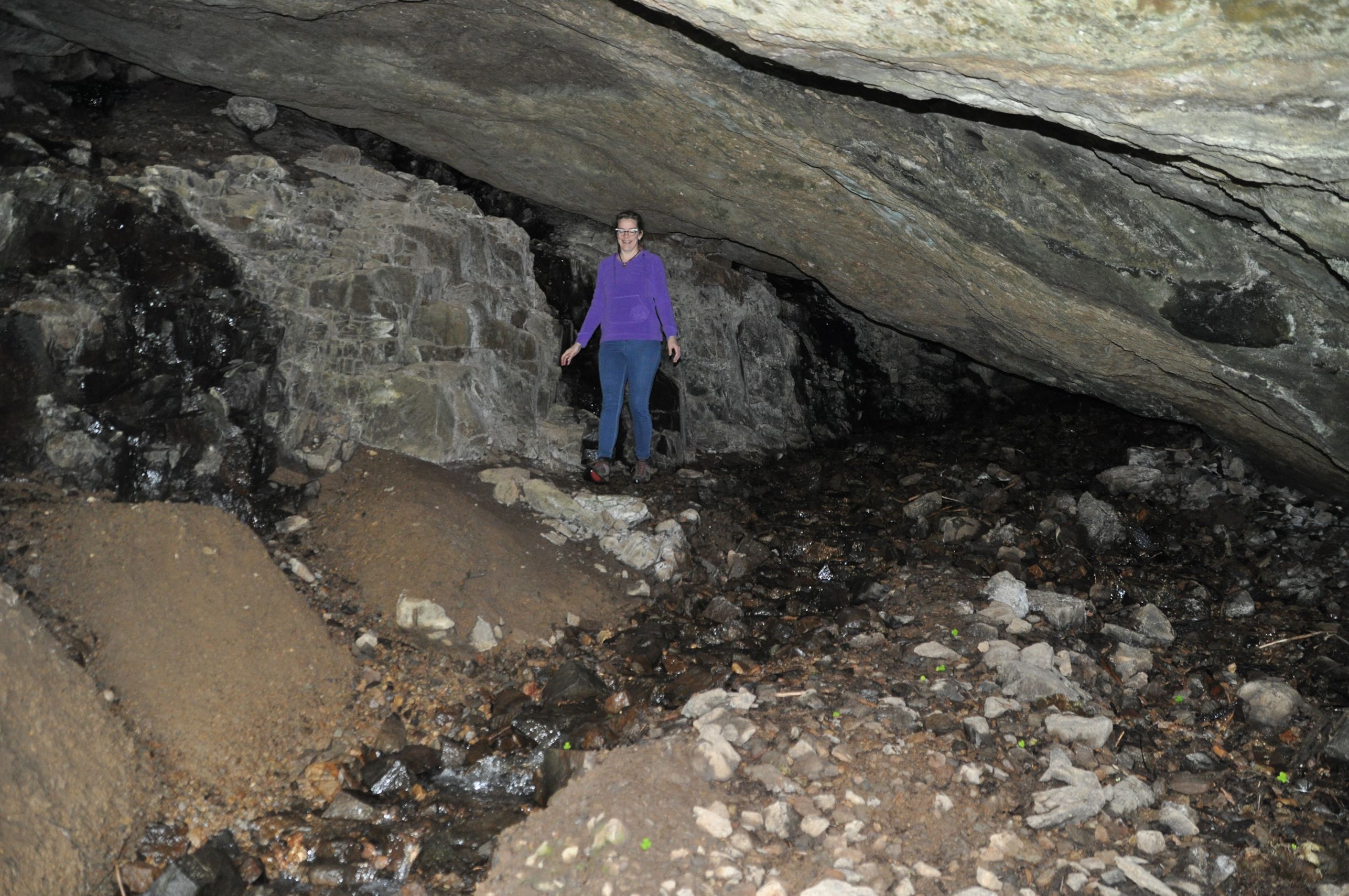
House Rock purportedly got its name for being a place of shelter for travelers along the wagon road. It was apparently large enough to cover multiple pioneer families. Soon we came upon it. The rock is indeed huge, and leaves a generous space beneath. However, there was a healthy-sized brook running through the sheltered area, fanning out across the small rocks beneath House Rock to wet as much ground as possible. I decided that if I had to shelter there, the first thing I would do is build a trench to keep the brook in one place, and free up the rest of the area for me and my family to try and stay dry.


Next we went seeking the Headwaters of the Metolius River, at Metolius Springs. This is a fascinating thing to see: the river simple bubbles out from beneath Black Butte, river-sized and immediately flowing freely. The theory is that when volcanic eruption caused Black Butte to form, it blocked an old river. The water now spreads out over a wide marshy area, and percolates through the porous volcanic rocks through the base of the butte, and presto! Instant river on the other side.

We moseyed on to the little town of Sisters after that. Outside of town we found a gravel road that followed a creek, and we picnicked while seated on an old log and watching Whychus Creek flow by. The clouds cleared and the sun warmed us, and we stayed for a couple hours after we ate, just soaking it up and talking.
By the time we got on the road again and reached Bend, we were ready to eat a real meal. Lucky for us, Bend has some really awesome places to eat. It’s a walkable town, and as we walked to find a restaurant, I found Wabi Sabi, a store packed full of fun Japanese stuff. Of course I had to go in. I bought a pendant necklace inspired by the manga Attack on Titan, that Tara is currently reading. I picked out a Totoro decal for me.
We decided to camp that night instead of find a hotel. Arno thought of a campground at McKay Crossing, and off we went. It’s only about 25 minutes south of Bend, but we got a late start after dinner and had to set up the tent in the dark.

The next morning we explored around the campsite, which included the lovely and unexpected McKay Crossing Falls. We walked to McKay Crossing, named for an old creek crossing (which is now a bridge – much easier). On the other side is a pretty good trail that follows Paulina Creek and gave us a new perspective of the falls.
Soon we had to head home. I wanted to get back in time to help Tara prepare for her AP test for Environmental Science scheduled first thing next morning (update: she thinks she did well on it, yay!), and we had many miles to travel in order to be home in time for studying and a good, healthy pre-test dinner.
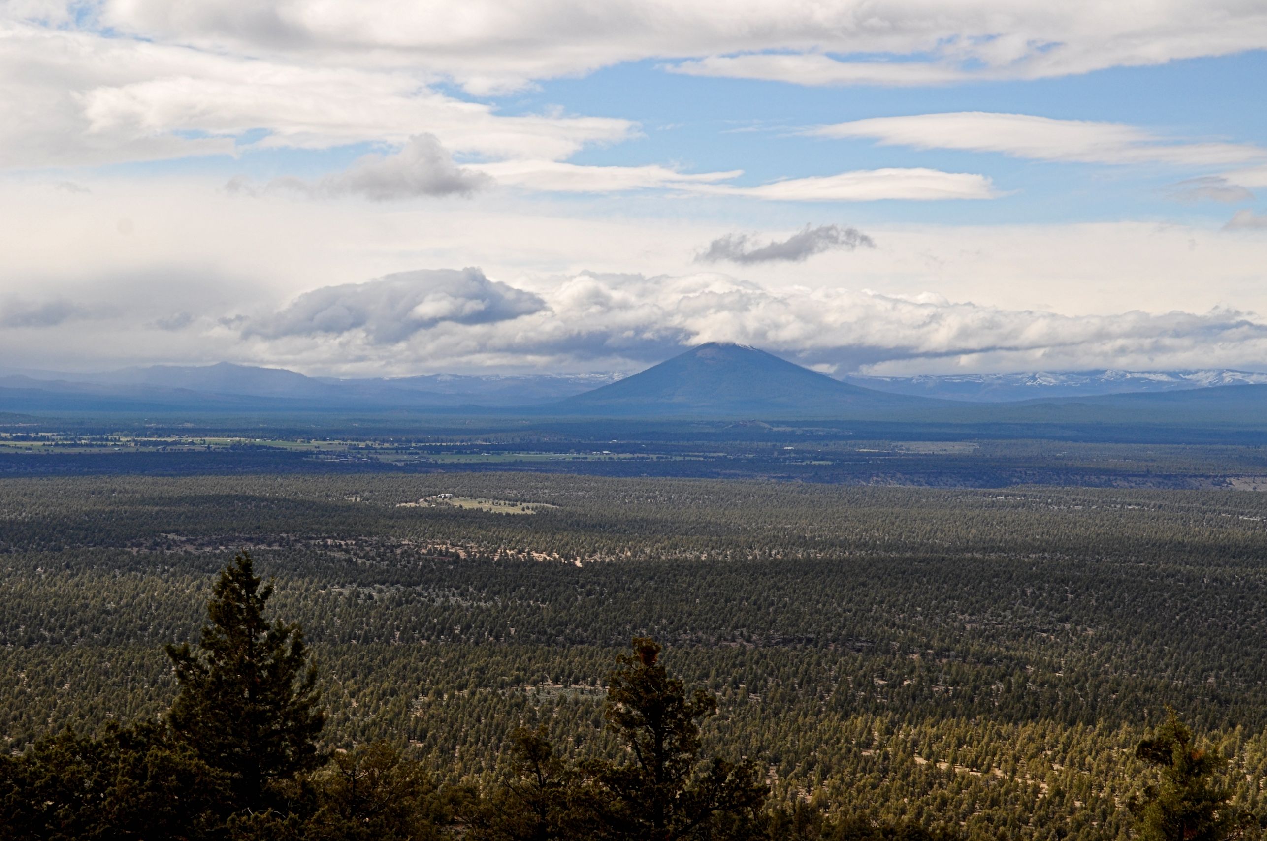
Stretching the weekend as long as possible, I found one more adventure to try from Cook’s book, and we found a rutty, dirt road to climb, outside of Redmond. The view from the top of Cline Buttes was really worth the trouble, and we got a pretty spectacular view of Black Butte, despite the clouds obscuring its top.


You all find the coolest places to hike and camp. House Rock is very cool, and check out those ferns right next to it. Huge!
And that landscape is beautiful, too
The Oregon landscape always leaves me in awe. I am so grateful to be able to live here. The ferns look practically prehistoric, don’t they? I’m thinking they seem larger because they were beside me on the trail, while the rock is in the distance. But still…they are some pretty big ferns.
I felt like i traveled along, Crystal. Another side trip you would love is to go straight south out of Sisters towards Broken Top Mt. Up about 10-12 miles is a beautiful small lake called Three Creeks Lake, and there are some great hiking trails up on McCarthu
r Rim just behind the lake. Several miles of the road is gravel right near the lake. The lake has several campgrounds. Dwight Late in the summer when all the snow is gone you can drive on through on a jeep road and come out at Mt Bachellor.
Thanks for the tip, Uncle Dwight! I’m glad you enjoyed reading my travelogue. I’ll look for Three Creeks Lake in the future. While in Sweet Home, a man also recommended that we drive out Sunnyside Rd behind Foster Lake for the views. I should give you a call prior to my next central Oregon trip, and see what else you can suggest!
Another beautiful place!
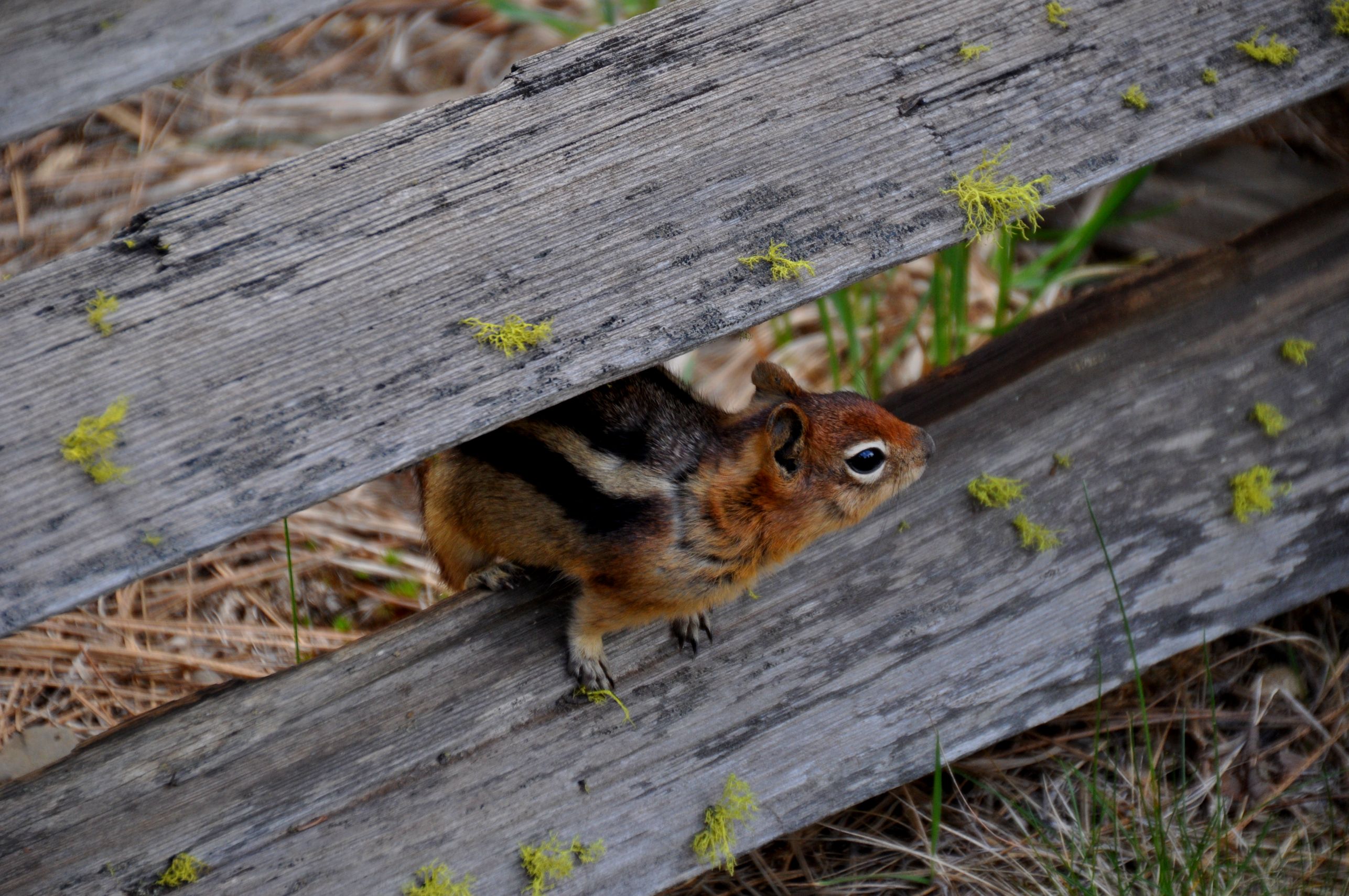
That’s a fantastic trail Crystal. Really fun to think you’re traveling on the same path as pioneers in the area. I like all the moss on the rocks too, looks like a scene out of a James Cameron movie. We stopped at a fast running river near Jasper on a very hot day. It was like instant air conditioning. I bet it felt good at the falls. loved the chipmunk too. It’s such a treat to see wildlife on a hike. Except for bears 😀 Which are a major concern near Jasper. We take bells and preferably bear spray too. Although, I’d probably die of fright before they were the suggested 18″ away, LOL
You are too funny! I’ve done so many backpacking trips in the mountains, that I’ve seen a lot of bears. Just the cute little black bears, no grizzlies. As soon as they see me they take off running, so they are not very scary. You know what scares me more is moose! I’ve come face to face with them on a trail and moose are HUGE! I have yet to see a cougar (or mountain lion or catamount or whatever you call them up north). They are so beautiful, but also really dangerous, because they will track you for fun, just like a cat.
You’re a brave on! On oil worker was just mauled to death by a black bear near Fort McMurray two weeks ago. They’re really hungry and grouchy when the first come from their hibernation. We saw fresh steaming pile of bear scat on our last trip to the mountains….my spidey senses started freaking out. Looking up the road, there were two bears just wondering across the road. Pretty happy to be in the truck. I waterskied past a swimming moose once (not on purpose). We call them cougars too, and yep, dangerous!