Until I met fellow Cherokee, Joe Cantrell, I thought that viewing pictographs was pretty straight-forward: one simply looked at pigment on a rock. I assumed that over time, the pigment would fade to our vision, and the image would be lost from then on. Joe has extended that lifespan for us. I’ll tell you about that, but first let me give some context for the pictographs we saw.
Our April Cherokee meeting was a field trip. (Our March meeting was a basket-weaving class) The tour was to a site that is not Cherokee, but a sacred site to one of our local Columbia River tribes.

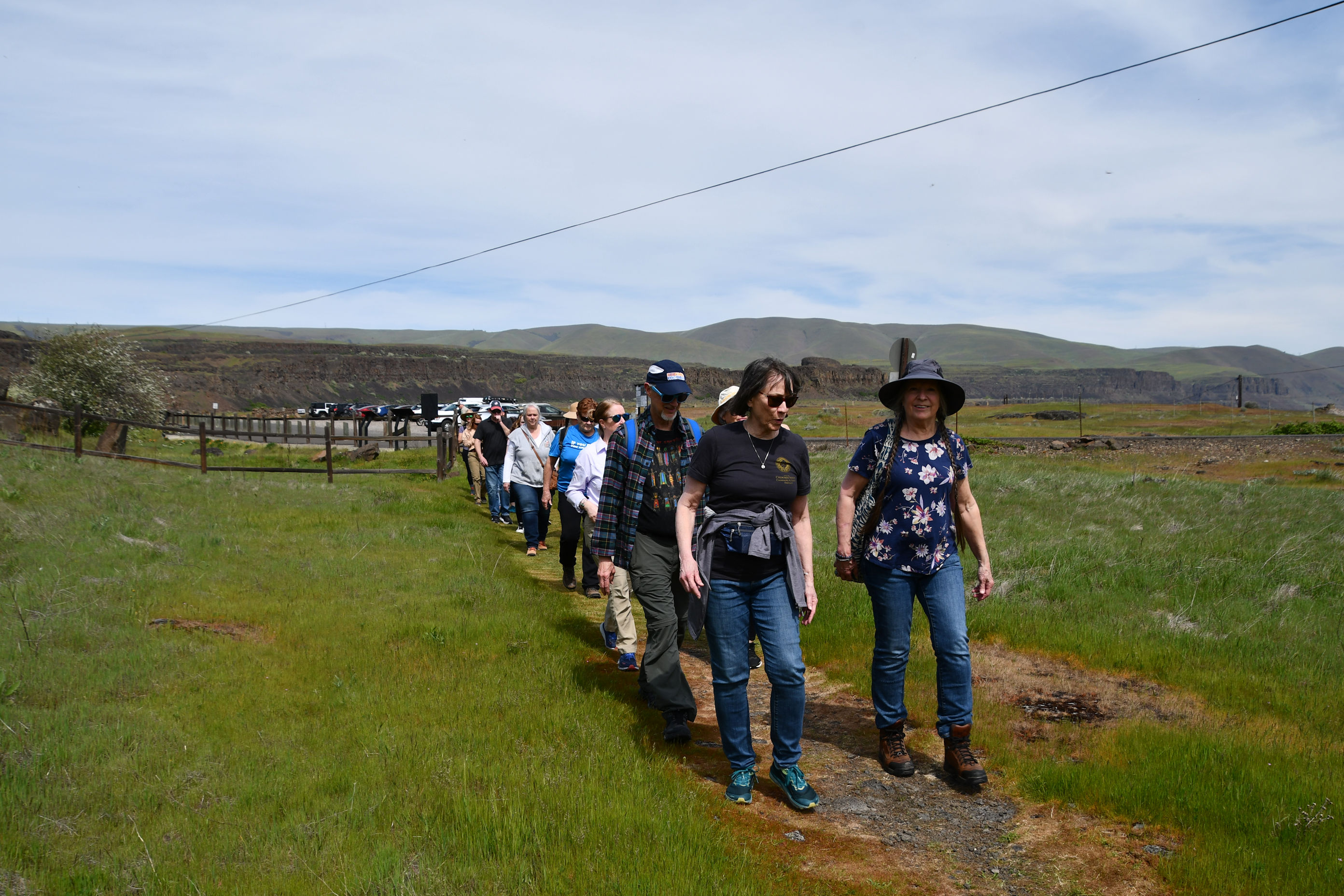
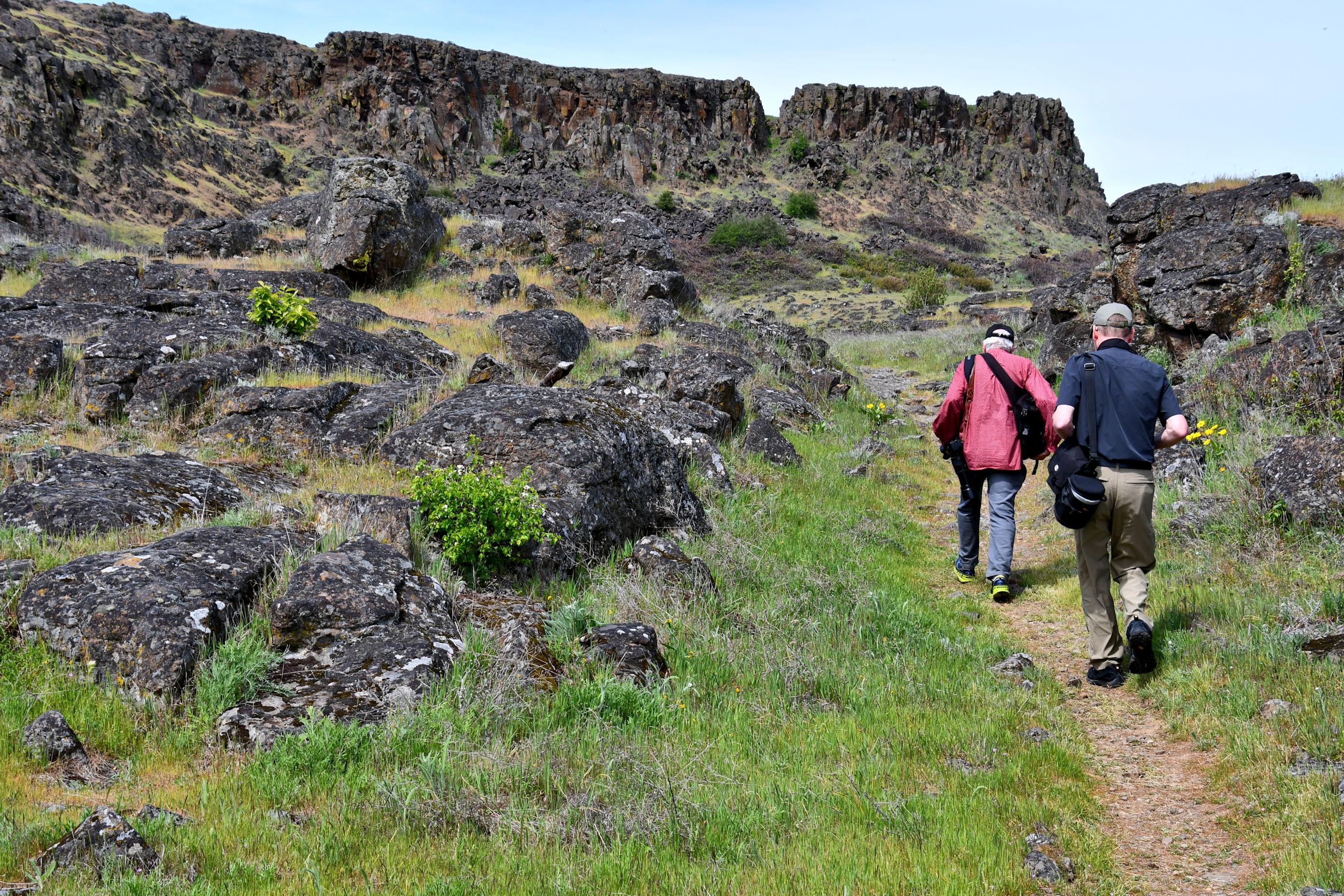
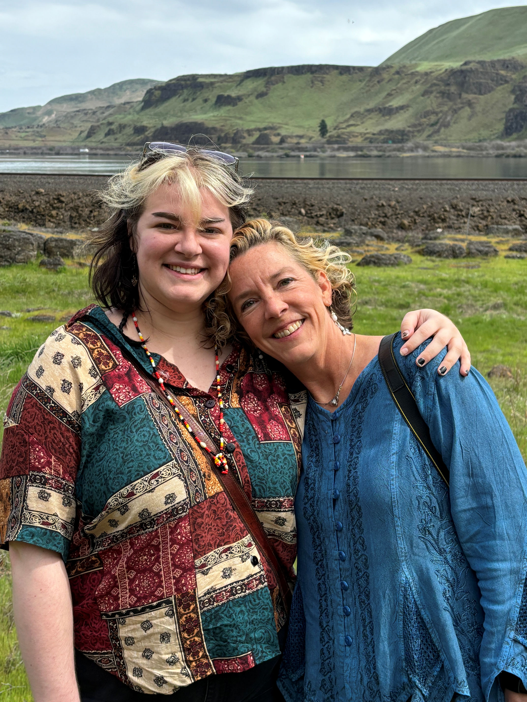
About 18 of us gathered at the trailhead and waited while our friend Joe gave a land acknowledgement. Then he brought out some tobacco to use as an offering at the sacred site, if anyone wanted to gift that. Many of us brought our own personal offerings. I brought a pheasant feather that I had found at another Native site – the Whitman Mission – on my birthday in January.
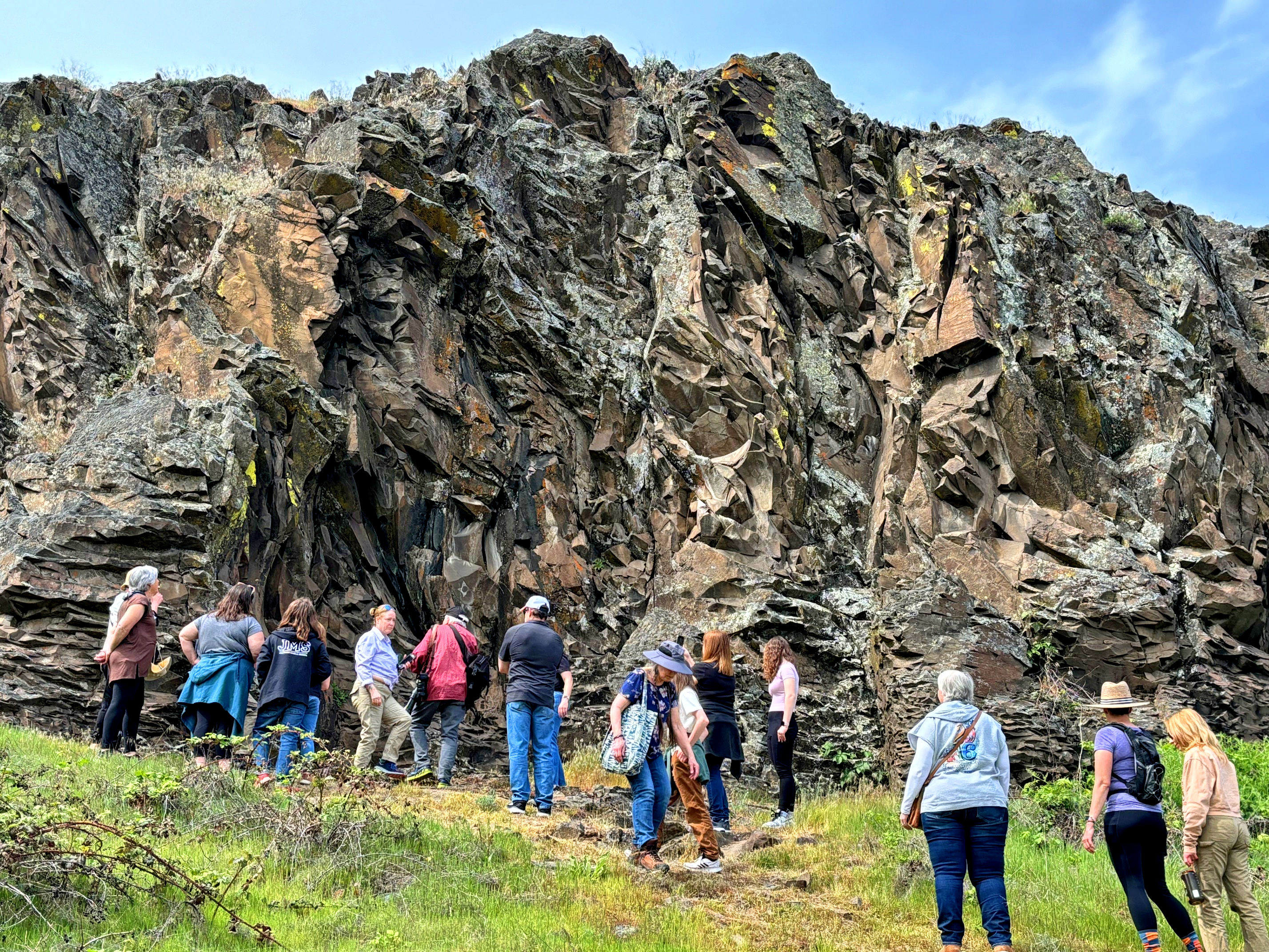
In 1993, vandalism at the site was of such concern that the pictographs are now protected by the State of Washington. The trail to reach them is locked and people can only visit with a park Ranger or an authorized docent. Those who are interested in seeing the site must call ahead and make an appointment with Columbia Hills State Park. We had both. Ranger Brock came to unlock for us, and Joe Cantrell is a docent.

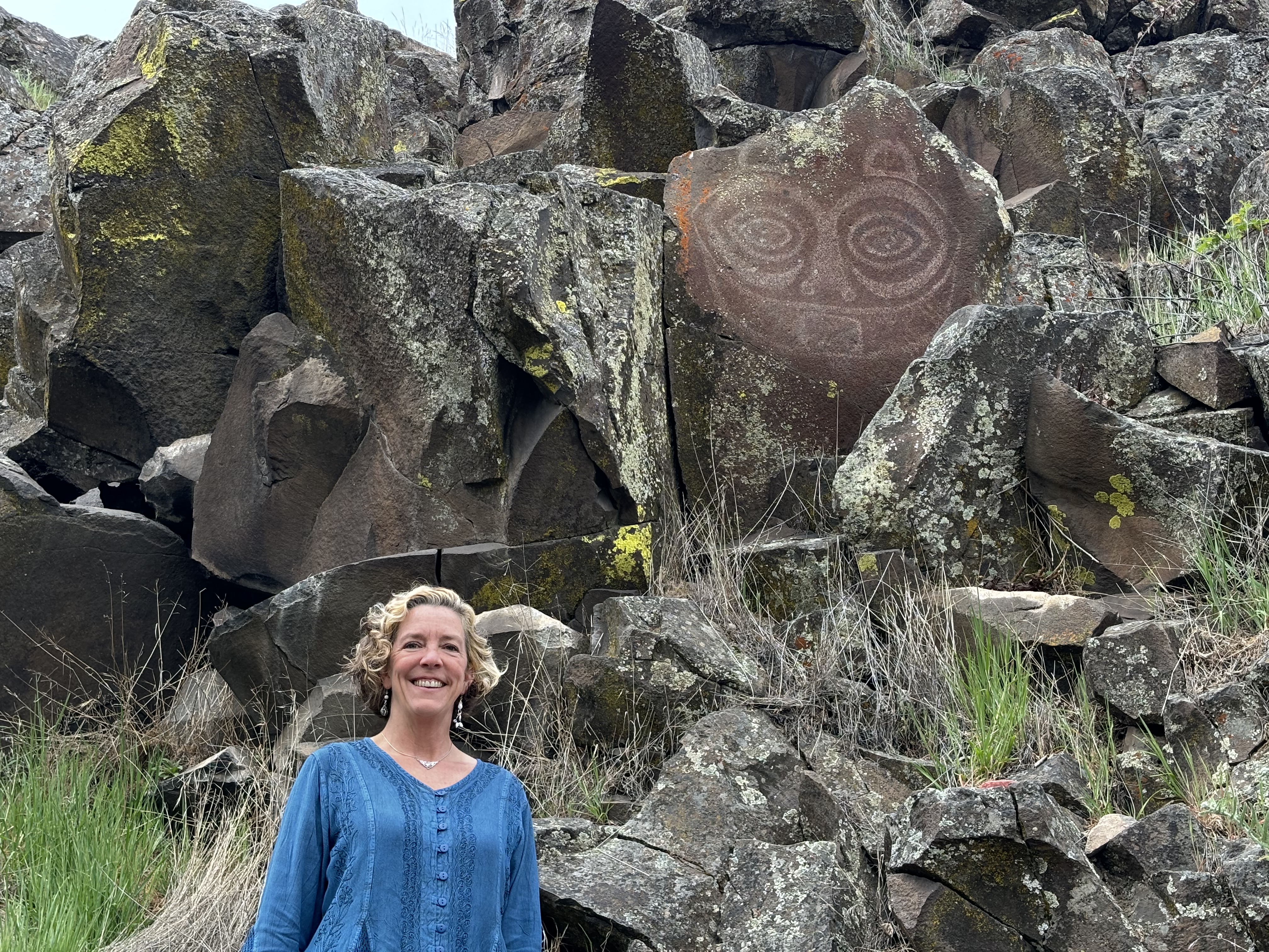
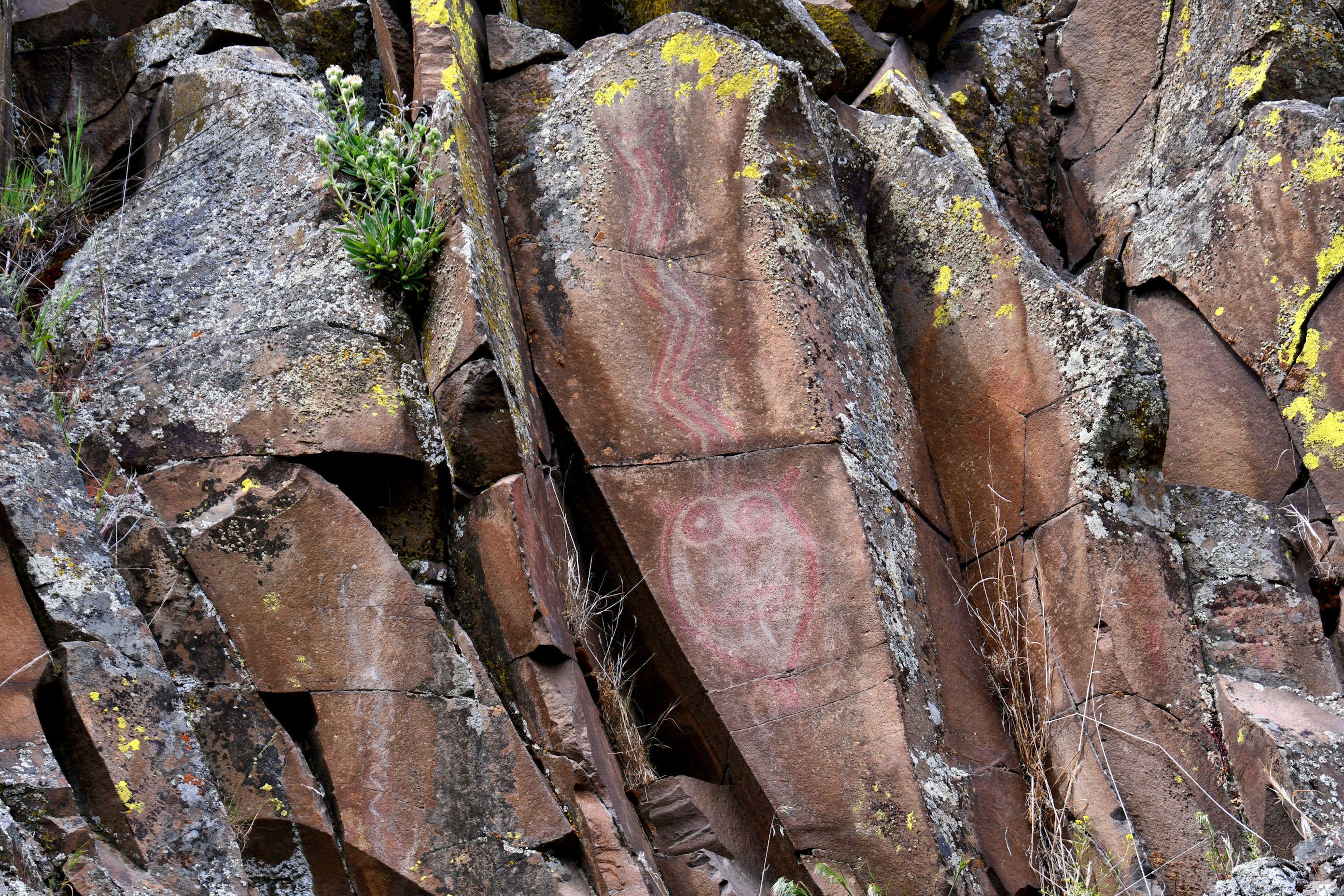
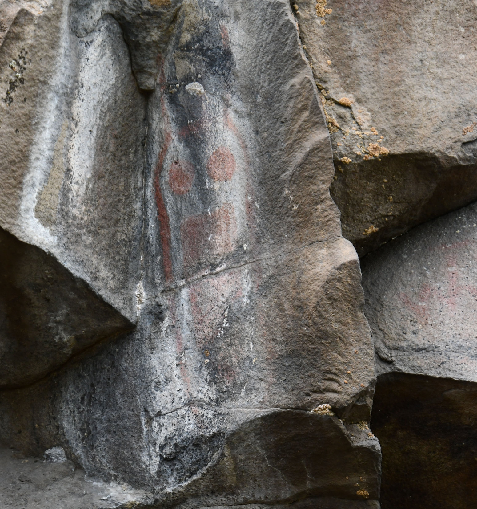
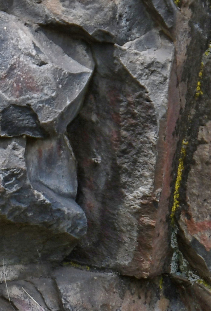
I don’t know the Wishram language, so I don’t know the exactly proper way to spell her name in their own syllabary, but Warm Springs Natives today write the anglicized version as: Tsagaglalal, and I will follow their lead. Tsagaglalal is the word in the Wishram language, for the character in this pictograph. Colloquially, most people know her as She-Who-Watches. Edward Curtis provides the earliest photograph of this pictograph that I could find, taken sometime around 1910.
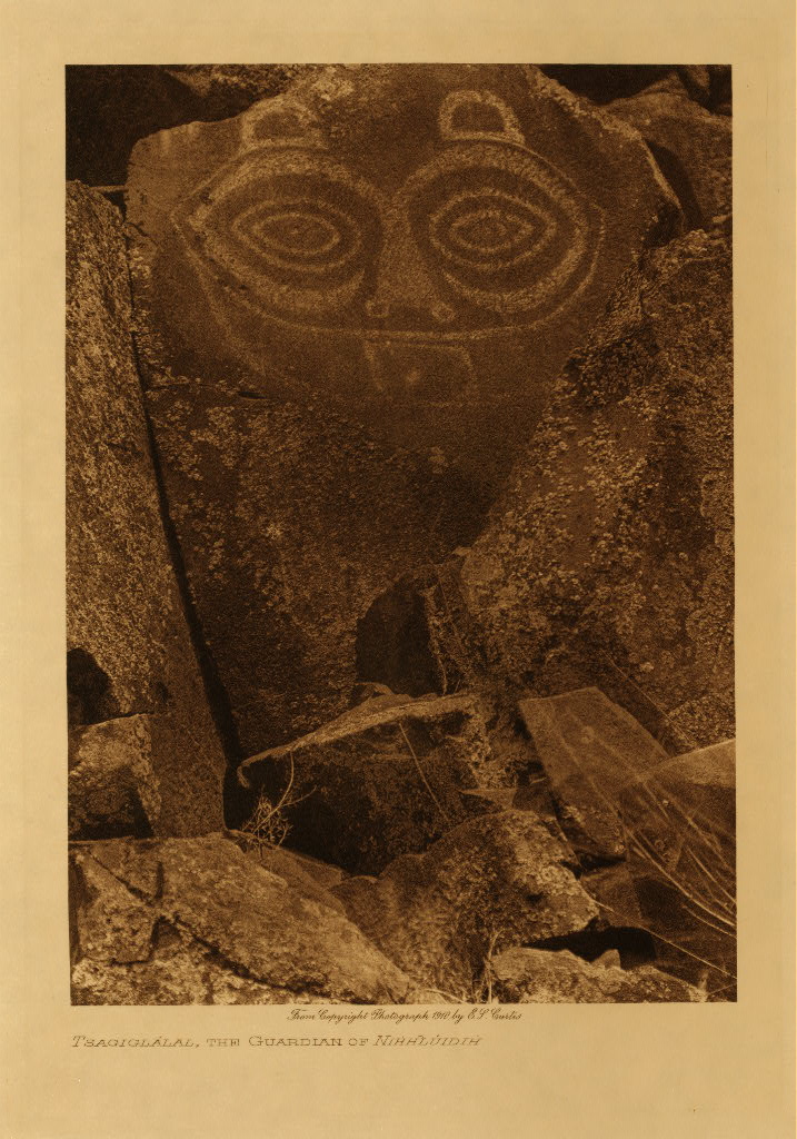
Curtis had a different spelling, but was referring to Nixluidix, the Wishram’s main village and trading spot. Following is the legend as told by Emory Strong in Stone Age on the Columbia River, 1959:
“A woman had a house where the village of Nihhluidih [Nixluidix] was later built. She was chief of all who lived in this region. That was long ago, before Coyote came up the river and changed things, and people were not yet real people. After a time coyote in his travels came to this place and asked the inhabitants if they were living well or ill. They sent him to their chief, who lived up in the rocks, where she could look down on the village and know all that was going on. Coyote climbed up to her home and asked: ‘What kind of living do you give these people? Do you treat them well, or are you one of those evil women?’ ‘I am teaching them how to live well and to build good houses,’ she said. Soon the world will change,’ said Coyote, ‘and women will no longer be chiefs.’ Then he changed her into a rock with the command, ‘You shall stay here and watch over the people who live here.’ All the people know that Tsagaglalae sees all things, for whenever they are looking at her those large eyes are watching them.”
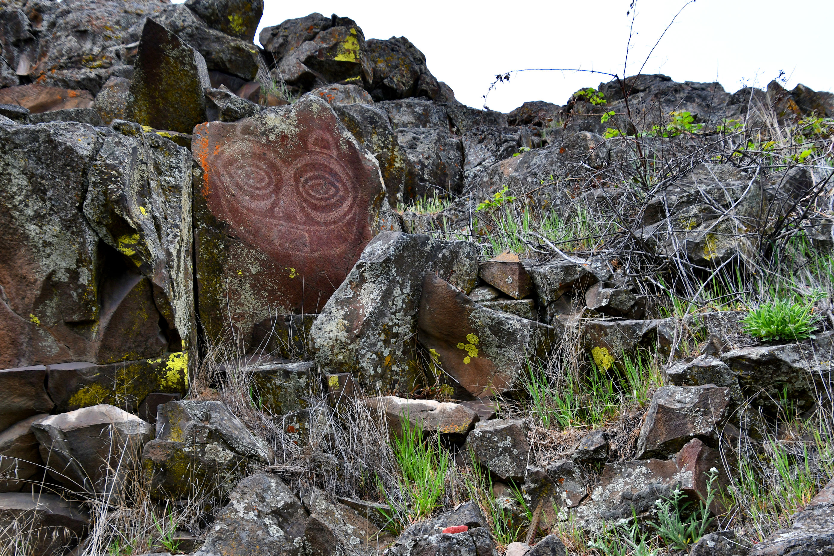
I found a website that says it is a combination of petroglyph (carved/hammered stone) and pictograph (pigment applied to stone). I could not see evidence of chipping, but it’s way up on a hill and I could not get a close look. So maybe it is both, which would be cool.
When Tsagaglalal was first cast in stone, the Columbia River was unblocked. This is at the site of the largest and most famous trading grounds in the entire region. Tribes would come from more than 500 miles away in every direction to gather at the falls on the river during salmon run season. There was a lot of fishing, yes, but better than that there was a pop-up market where ocean tribes traded their natural resources for stuff from the desert tribes, who traded for stuff from the mountain tribes, and naturally, everyone who didn’t already live here wanted some of that delicious salmon. I can only imagine there were feasts and dances and stories, matchmaking and catching up with friends and distant family, demonstrations of hunting skills and toolmaking. It must have been as good as any extended festival you’ve ever heard of. They had to invent a language, called Chinook Wawa, that everyone could learn so that they could communicate with each other.
Traditional Wishram fishing sites on the Columbia River, including this incredible rendezvous spot, called Celilo Falls, are now completely lost. In 1957, The Dalles Dam was completed, and it submerged the entire area, including a village of Natives, that had to be evacuated.
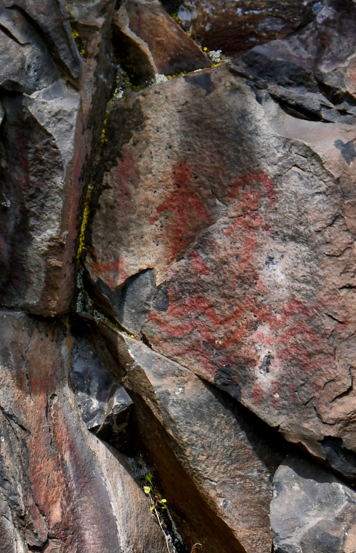
We separated into two groups to make it easier to get up close to the rocks, so I missed it when Ranger Brock pointed out the location of the former village of Nixluidix. The age of the pictographs at this site is estimated to be near 300 years old. This estimate doesn’t take into account the story of Coyote and the Chief, however, so I wonder how old the Wishram would say it is.
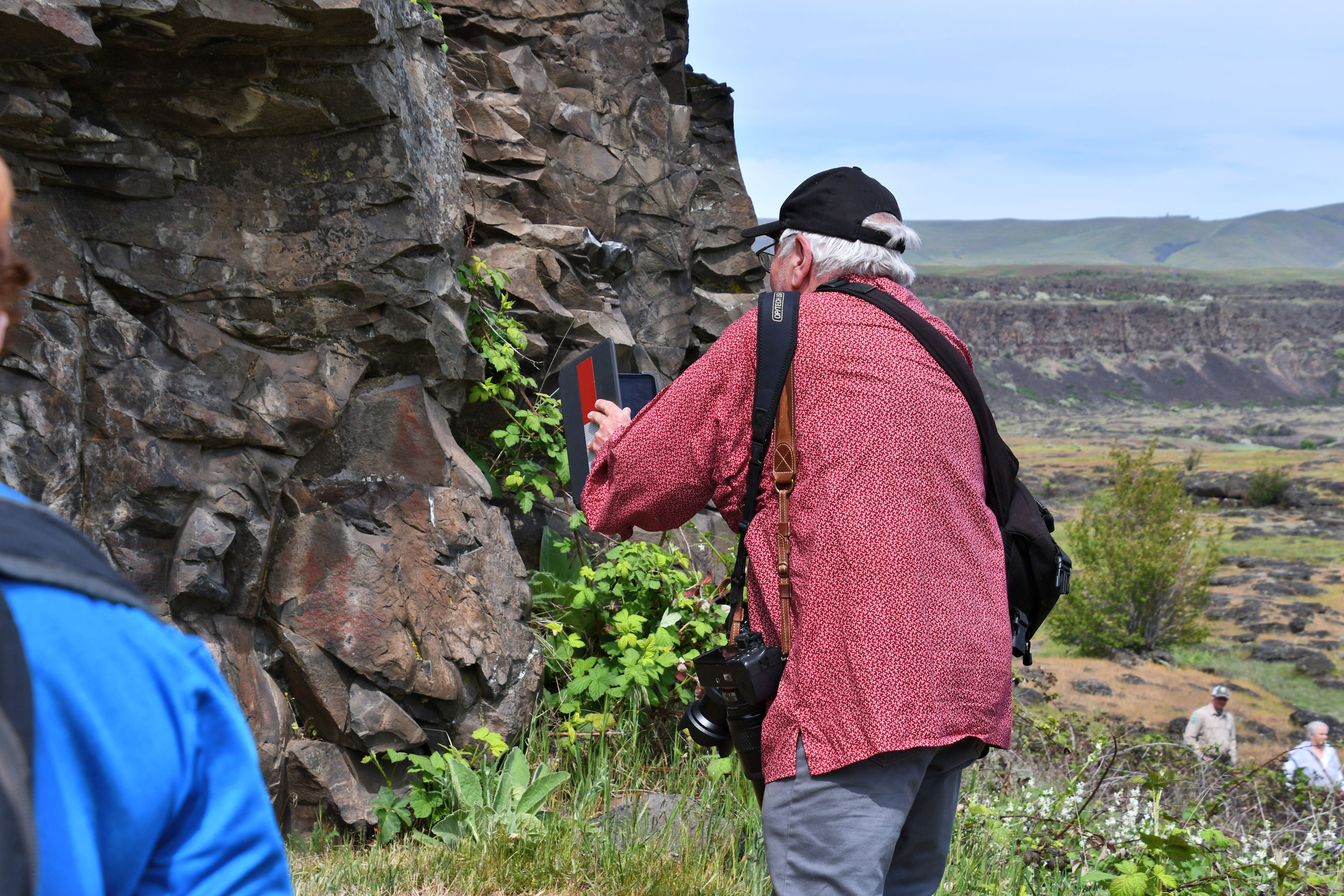
Once we arrived at the portion where there are pictographs, Joe had to teach us to see them. He pointed, and described the colours, the shapes, until we were spotting them on our own. He was patient, and waited till we got it and began feeling confident.

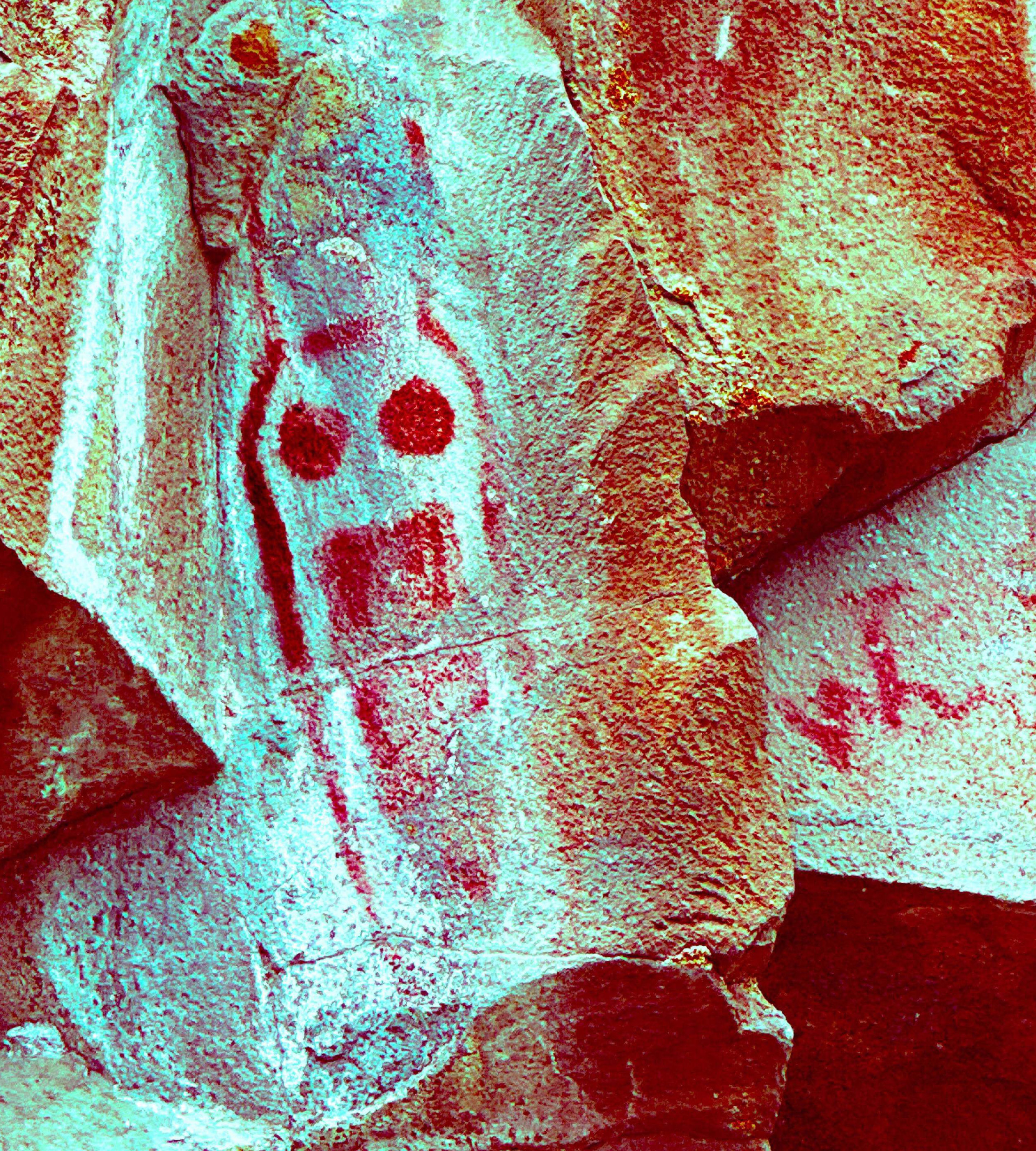
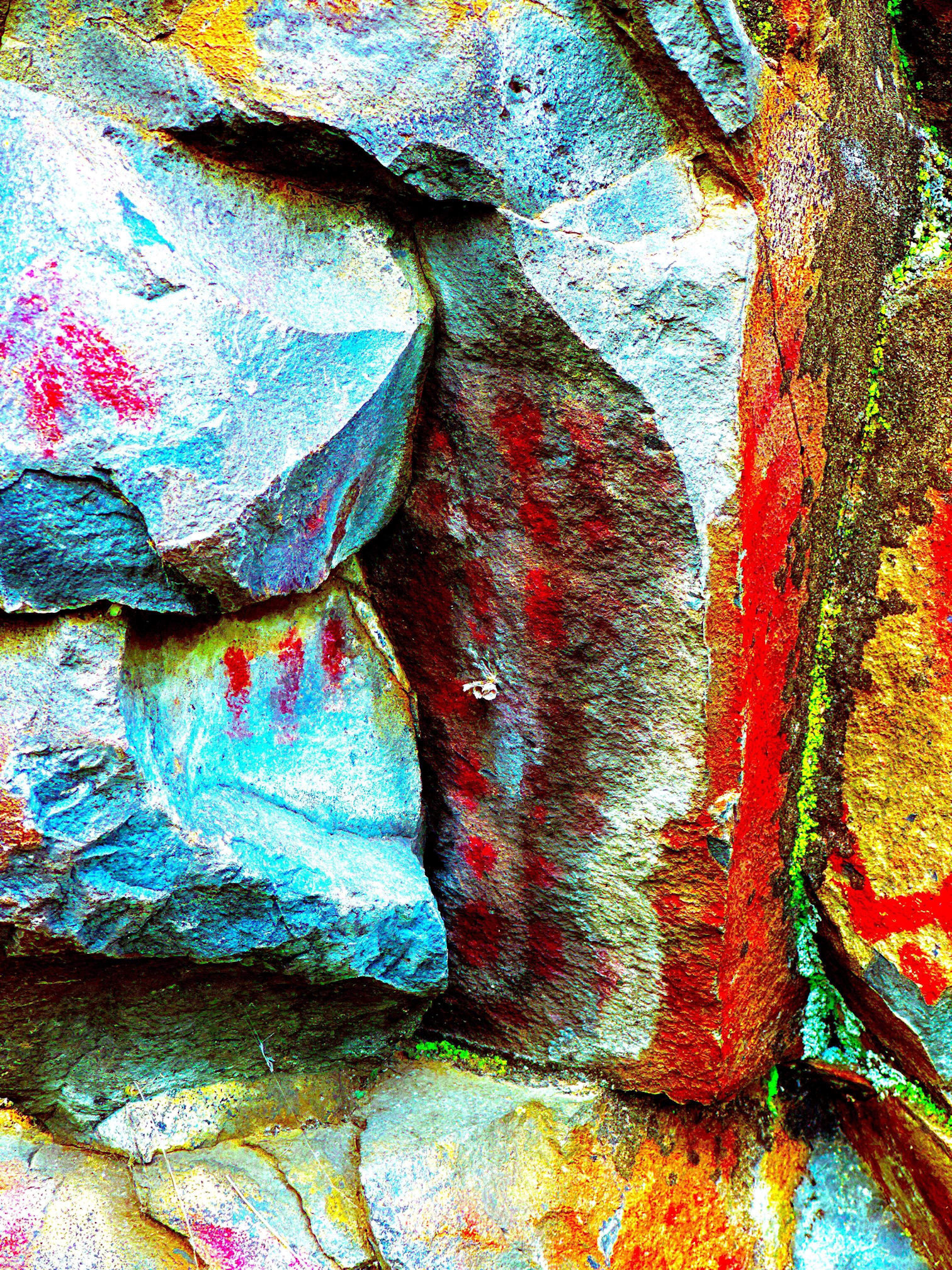
Then, Joe explained that he uses image editing software called DStretch. Originally developed as spy software for the US Government, it’s now available online. He takes a photo, then adjusts the colours, he said.

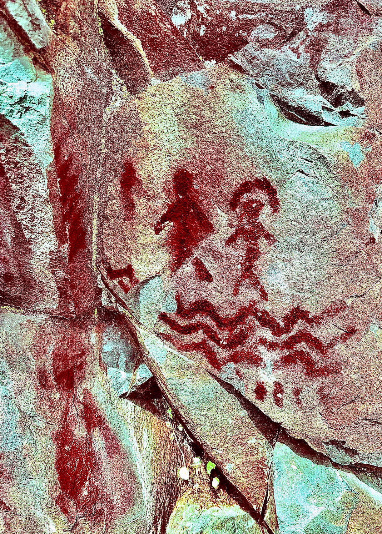
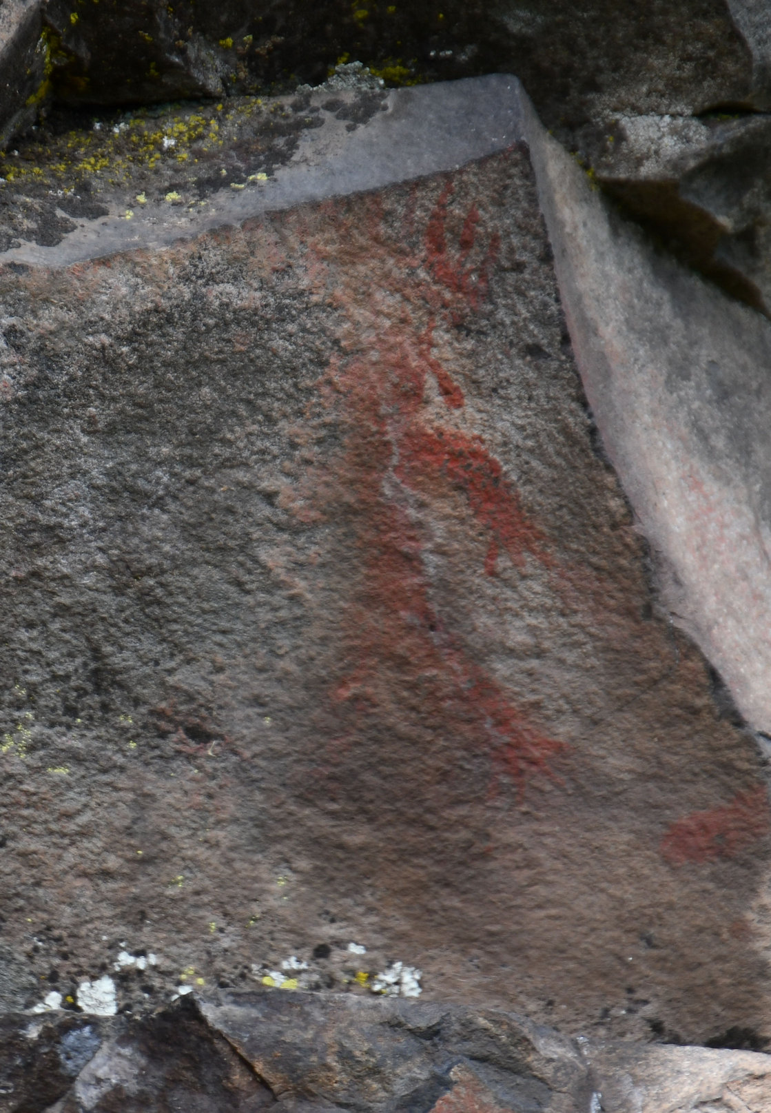
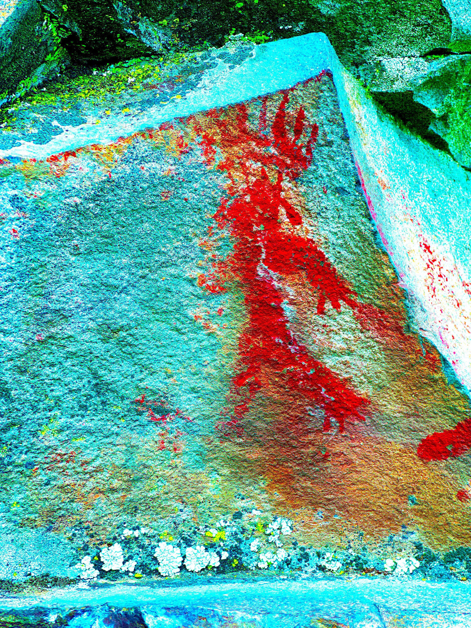
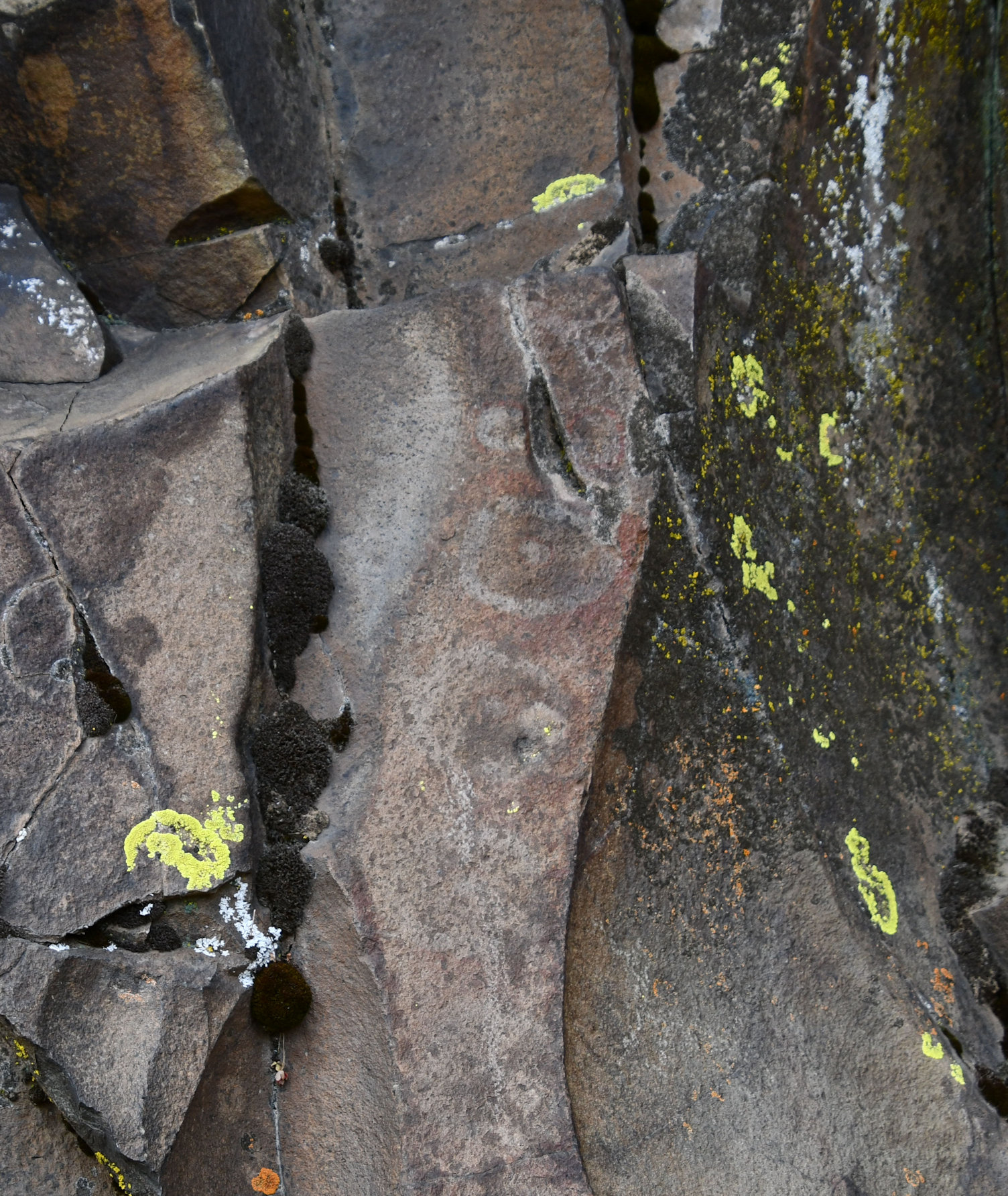
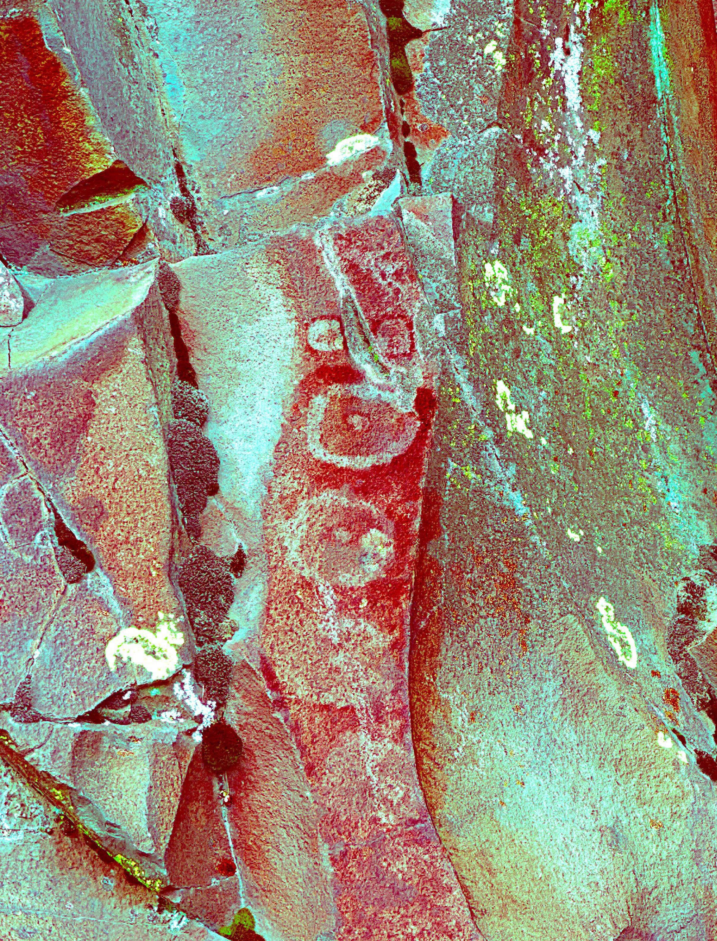
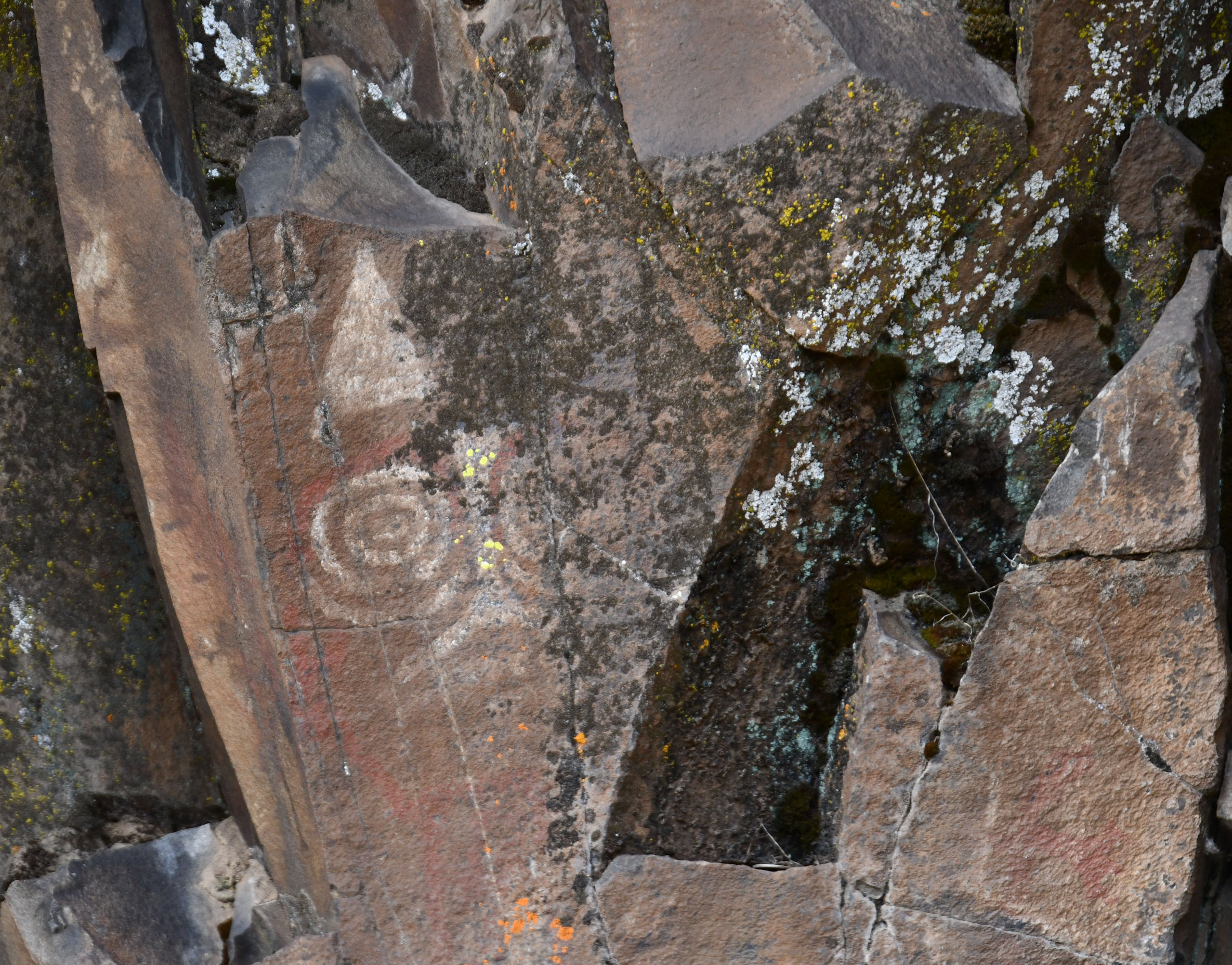
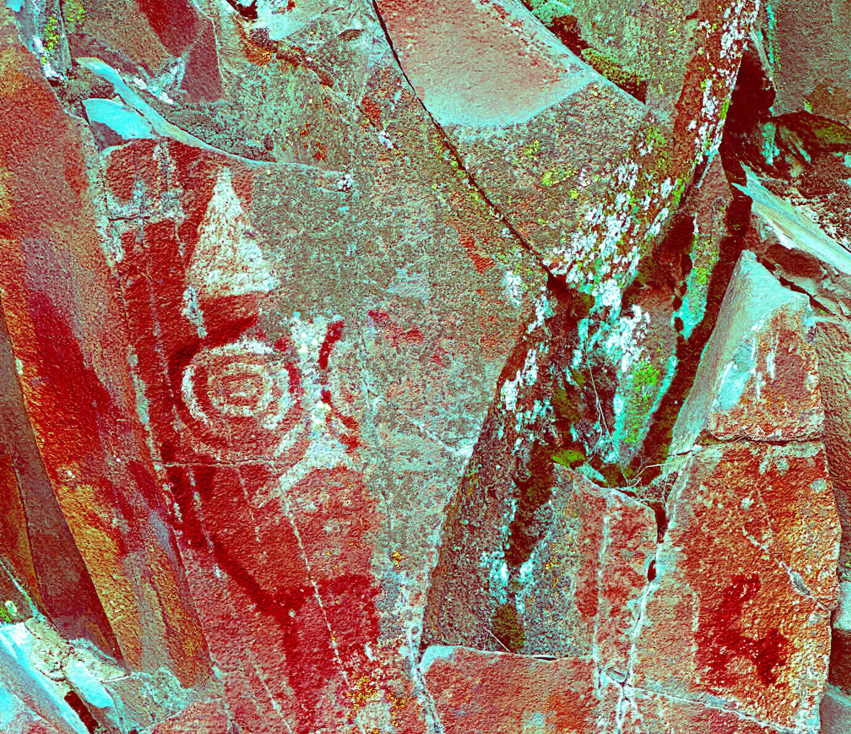
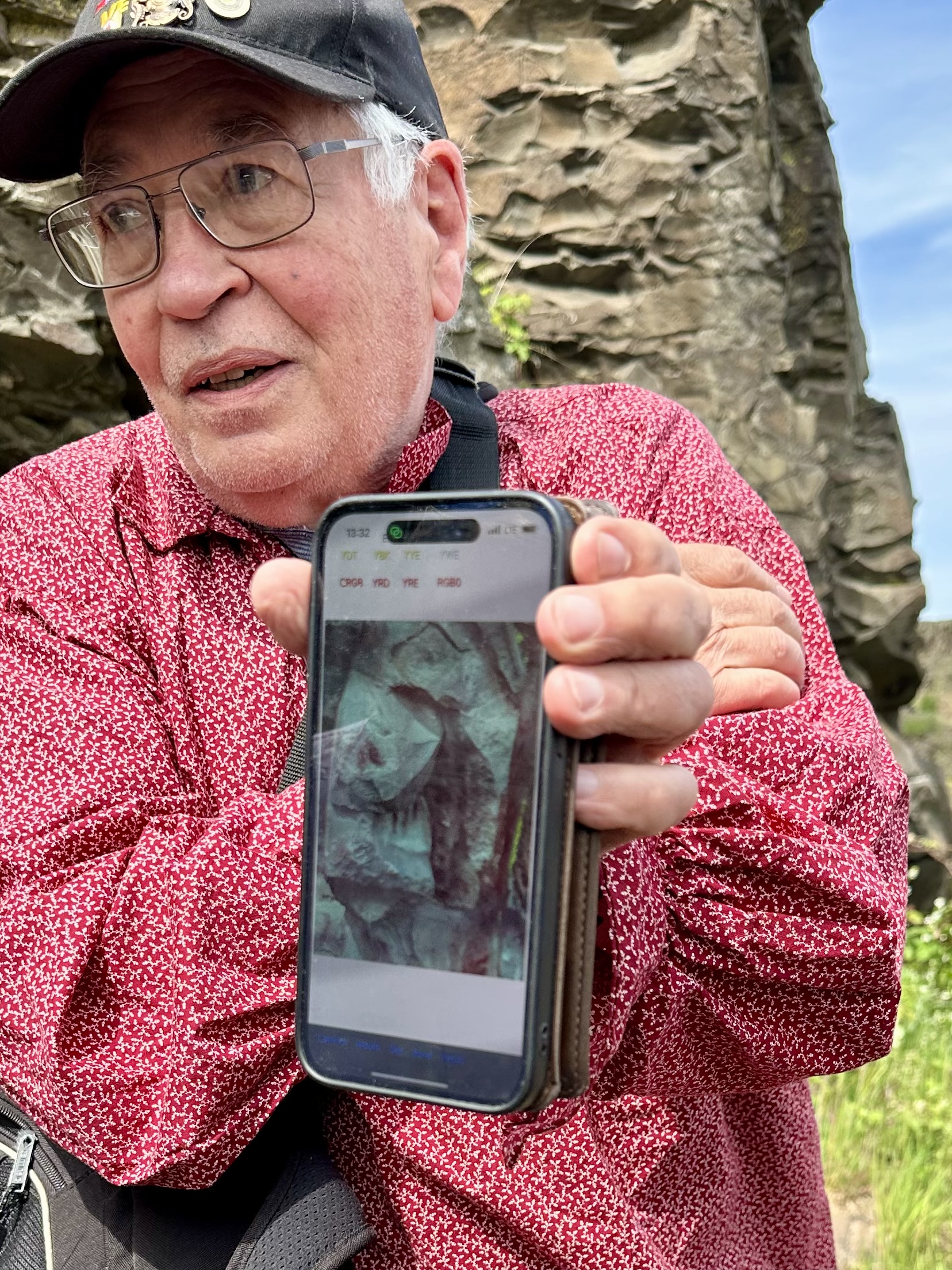
One really neat discovery is an apparent bird built from shadows cast in cracks in the stone. A few red marks can be seen, but you can’t really make much of it unless you consider the shadow too. Joe cautions us not to assign meaning to these paintings, because we cannot know what they were meant to represent. Then, he smiled and said in any case, he thinks it looks like a pelican. “They found the bird and gave it plumage,” he said.
I know that was a bunch of photos, but SO COOL, right?! I am blown away and I think this potential with DStretch is truly mind-blowing. There was one time when Kellen, my kid, oh- hey! I forgot to tell you that Kellen came with us!
Anyway, Kellen said they thought they saw something. Discussion ensued, no one could agree if it was a faded pictograph or not. I called Joe over and asked him to take a photo of the spot. A clear sunburst image burst to life from the screen of his phone. It was really, really neat. Our group gasped out loud.
It was an outstanding trip and several from the group commented on the spiritual feelings they had while being in this area. Joe asked us not to step off the trail because it was the home of our ancestors and we shouldn’t disturb it. When everyone had a good look and asked all the questions, we went back to the parking lot.

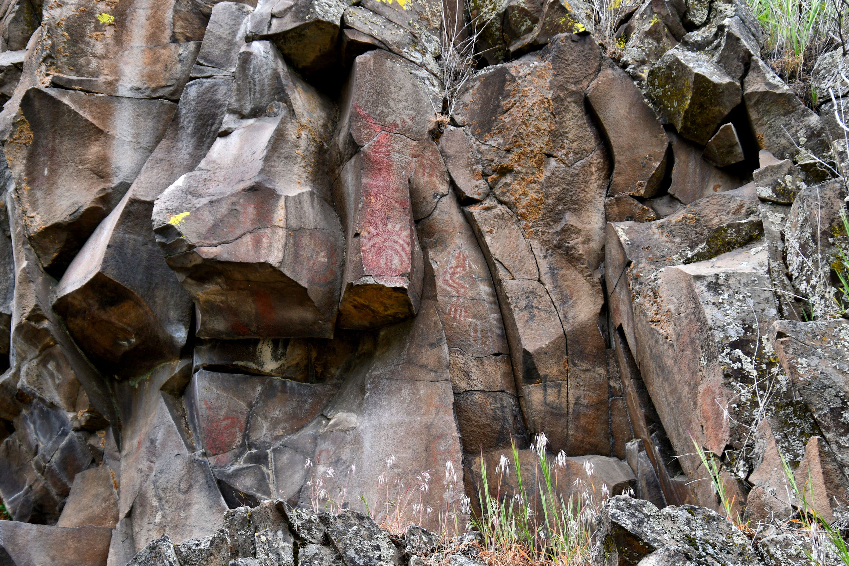
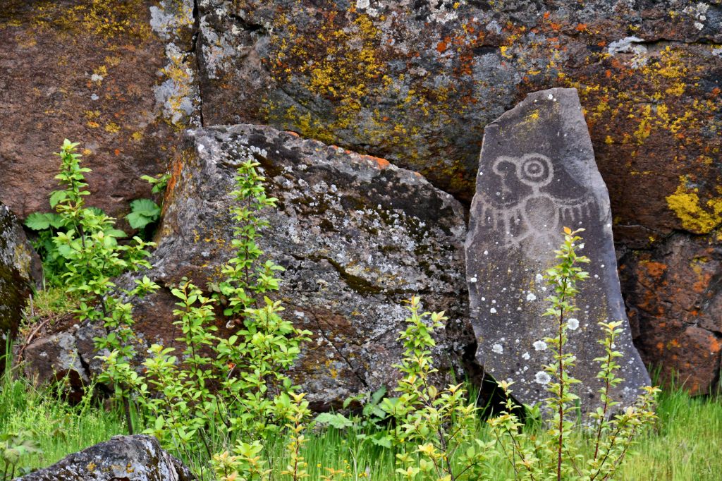
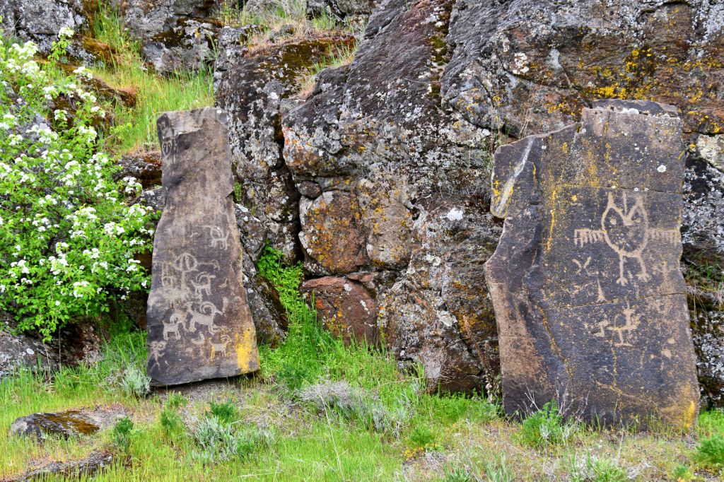
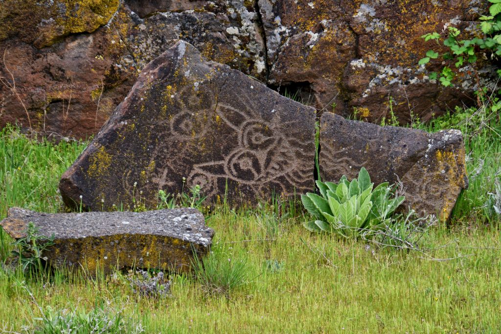
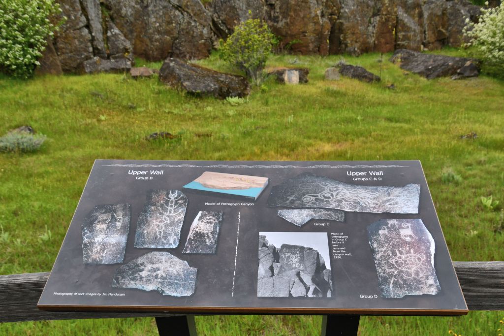
For anyone who goes to Columbia Hills State Park and has not had the chance to make an appointment, there are beautiful petroglyphs placed nearby on an easily accessible walking path. The following photos are from there:


I hope you enjoyed that short journey along the Columbia River. It was a rare and special perspective into a local park and local tribes, and I’m happy to have had the chance to experience it, and to share it with you.

Not your usual post about something like this. You had some great insights and describe things thoroughly, and it looks like you had a great guide for the trip.
Thank you, Lou. Yes, it seemed like an exceptional visit to me. I felt so fortunate. Joe is a good friend of mine, and kept me close. In that way, I was able to see a lot of what he was showing to people. And then he sent me all his DStretch photos after he got home. All of that is pretty neat. I am somewhat in awe still, of what he can do with the software manipulation of those images.
Great post, Crystal. As you know, Peggy and I travel far and wide in our search for petroglyphs and pictographs. These are dandies—Taking you back in time to another world where there are some things we understand, people being people, and other things that are mysteries and probably always will be. Plus there is the added advantage of just being out in nature! Looked like a good mother/daughter trip as well!
I wish I could get Joe to travel with you to one of your visits. His contributions were just amazing! If you are ever in the Columbia Gorge, I would be happy to show you this spot. But for now, I’ll content myself with seeing you at the coast very soon. 🙂
That would be special, Crystal.
We are making our way north! Right now we are at Pt. Reyes, one of our all-time favorite spots.
Amazing work by the ancients. Do you know what the pigments they used are made from?
I had to look it up, Brian, but this answer comes from the U.S. Forest Service: “Pictographs were made by mixing natural pigments such as hematite, limonite or charcoal with a binder like animal or vegetable fat, the white of an egg or blood.”
Thank you.
A lot of the pigments used in Australia are made from soil, red ochres mainly from the same soils, dehydrated iron oxide as well as hematite etc.
This was a tradeable commodity with traces of ochres from Central Australia found here on the coast
Very cool information, Brian. Thanks.
Wow. Pretty incredible. To do this walk with a guide is so perfect. I would definitely benefit from someone knowing the history and sharing a more personal perspective. I’ve seen the last set of photos that are from the park. Is there an old burial ground near there? Thanks for the tour. Great shot of you and Kellen ❤️
Hi Bonnie, I’m glad you’ve had a chance to visit this spot. We noticed the cemetery on the way out of the park and had all kinds of questions. I would like to go back with a Ranger, to get the Park Service side of it, and ask questions about the rest of the site, like the village site and the burial ground. I think it is a good photo of Kellen and me too. We were both having a good day and that makes for better pictures.
Remarkable. Thanks for sharing. I didn’t know about that software. I use Photoshop a lot to enhance original colours amongst other things. Dstrech (was it?) seems to be more powerful. Thanks for the tip
Brian, like you, I used my Corel Paint Shop Pro and made the pigment stand out better. However, yes, the software DStretch was developed for the US military spy operations, apparently, so it’s different than regular photo enhancement. You can visit the website where Joe got his copy at the link above, where I talked about it. The guy used to provide it for free, but with increased interest, he has been asking for a donation.
I’ll look it up, for another use. I have a few old documents from the family. Letters and cards with faded handwriting. I tried to enhance but it was no strong enough. Maybe dstretch will work.
Thanks for the tip Crystal.
Be good.
This blows my mind! Brian! What an excellent idea! I am totally going to remember this because I, too, have come across faded writing before.
👍🏻 (Old letters from your parents or grandparents in a trunk…)
What a fascinating post, Crystal. I especially love the explanation between petroglyph and pictograph. What a wonderful outing it must have been. It is exactly the kind of trip that would get me super excited.