My man and I needed some reconnection time and we decided to do what we were calling a “real hike.” As you know, we hit the trails often, in all the wonderful parks around the Portland area. It helps that his townhouse is right on the edge of some excellent city bike/walk trails through wildlife corridors in the Bethany neighborhood.
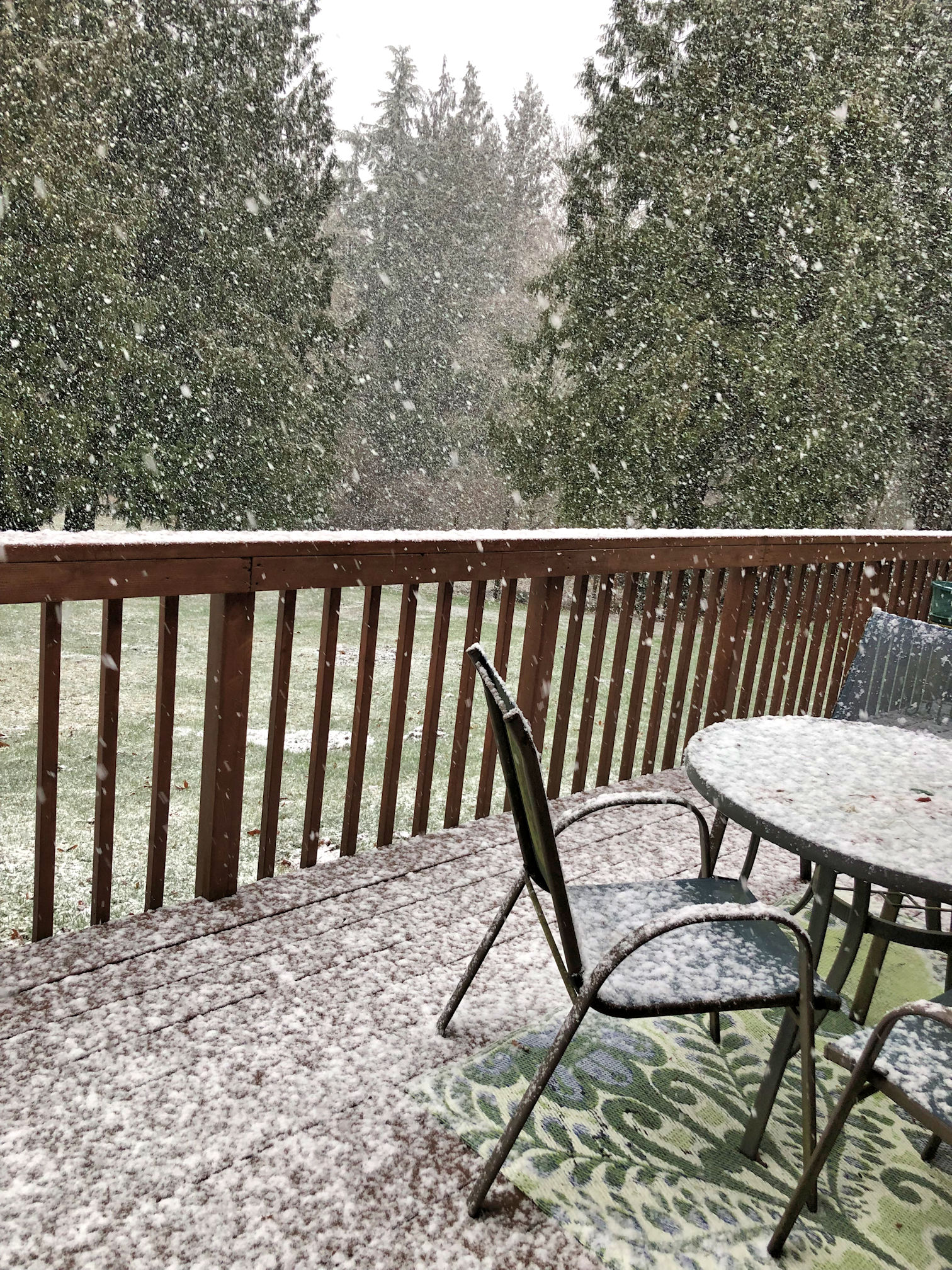
But. Those are not hikes, and we were missing them. All day long Saturday it snowed (thankfully nothing stuck), so on Sunday we dressed in winter clothes and hoped the rain on the coast would stop by the time we got there.
Trail reports from AllTrails.com regarding Ecola State Park sounded like heading north would result in less mud than trails to the south. We stopped for lattes at Safeway in Astoria and it was still raining, but our spirits were high. We parked at the Ecola Point Day Use Area and hiked north on the Indian Beach Trail. There was only a little light rain by that time, and we could see the sky was slowly clearing up, which was good because the air was foggy/misty which made visibility across the Pacific Ocean less clear than we would have wished.

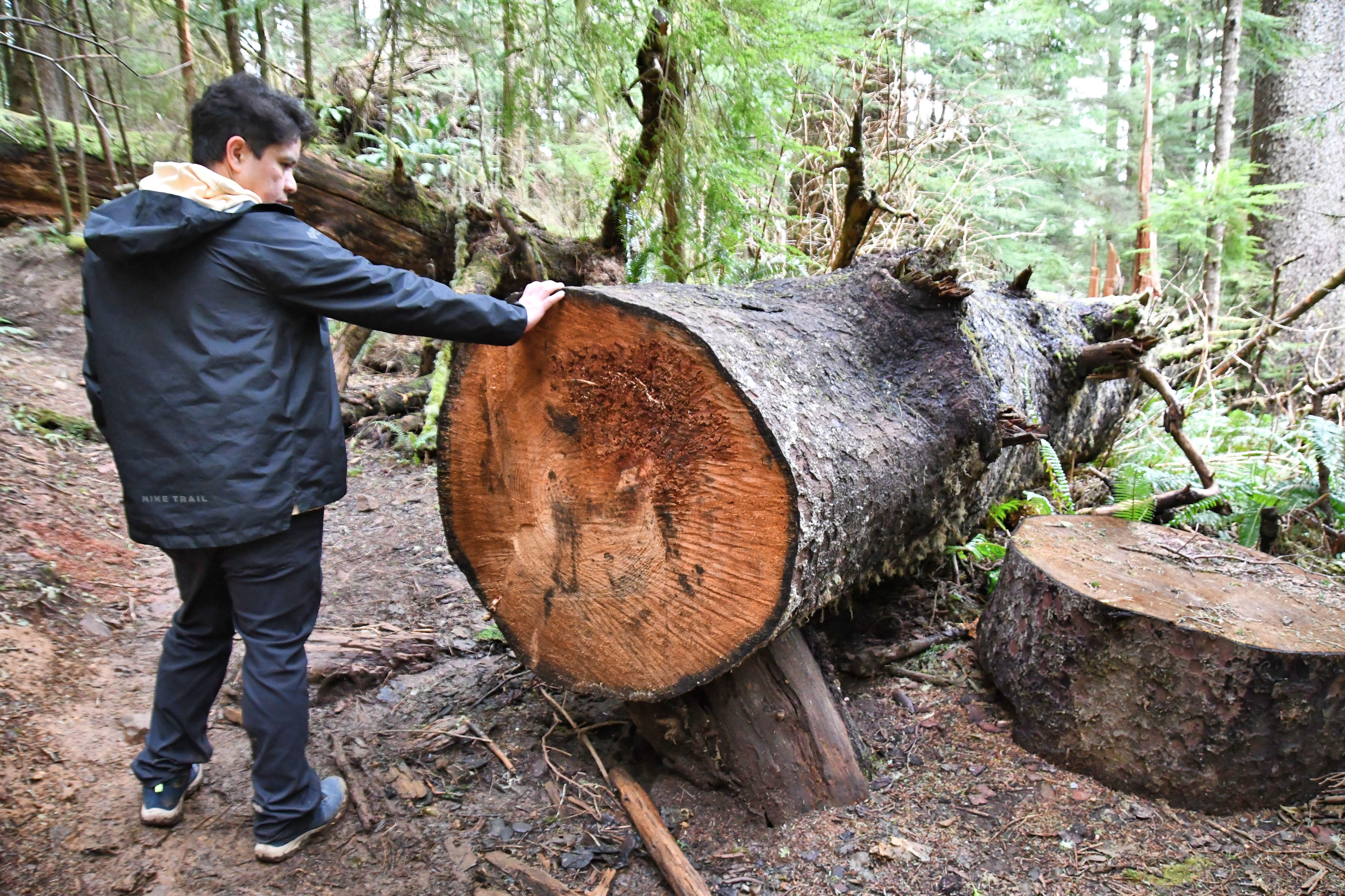
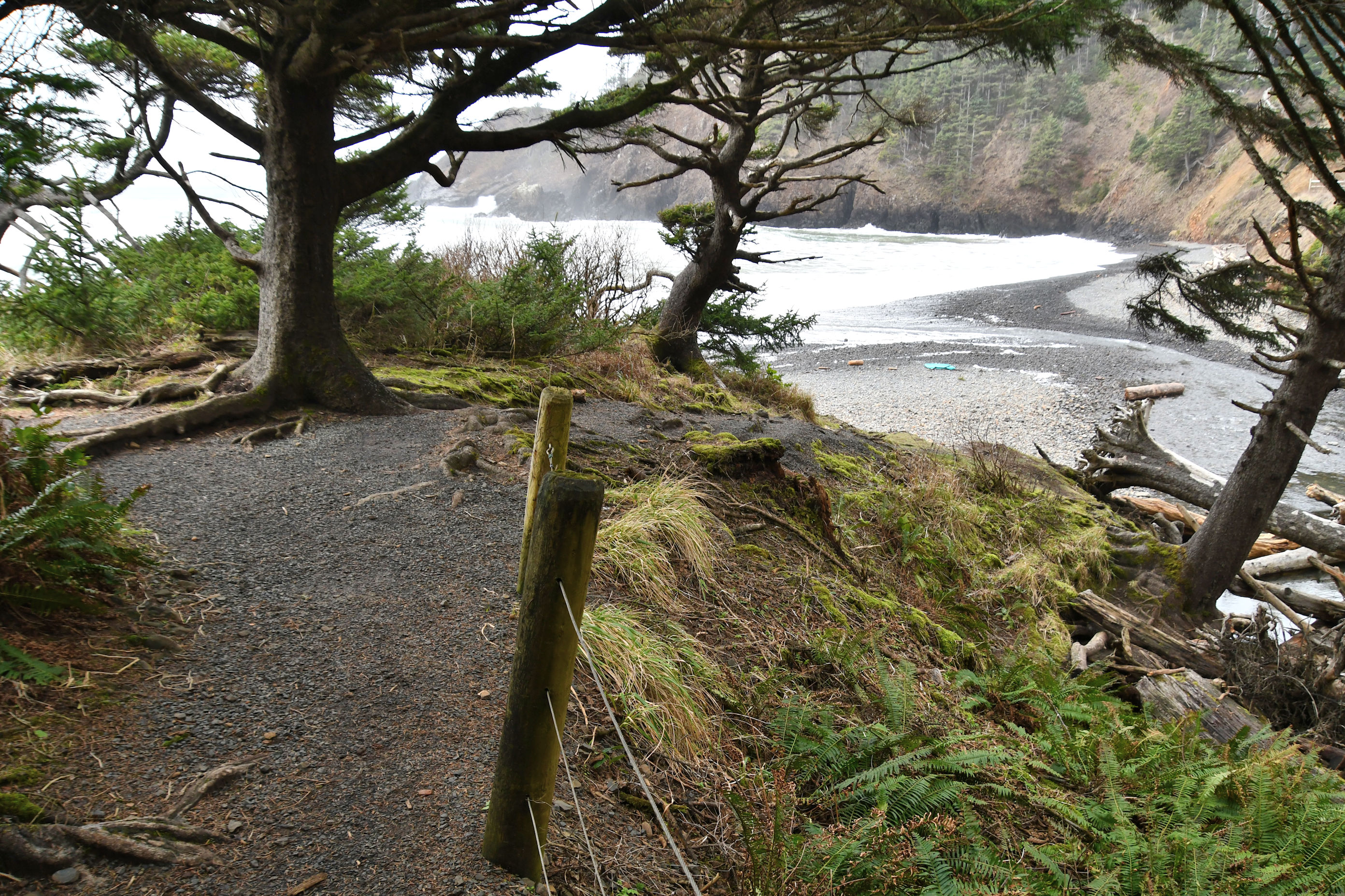
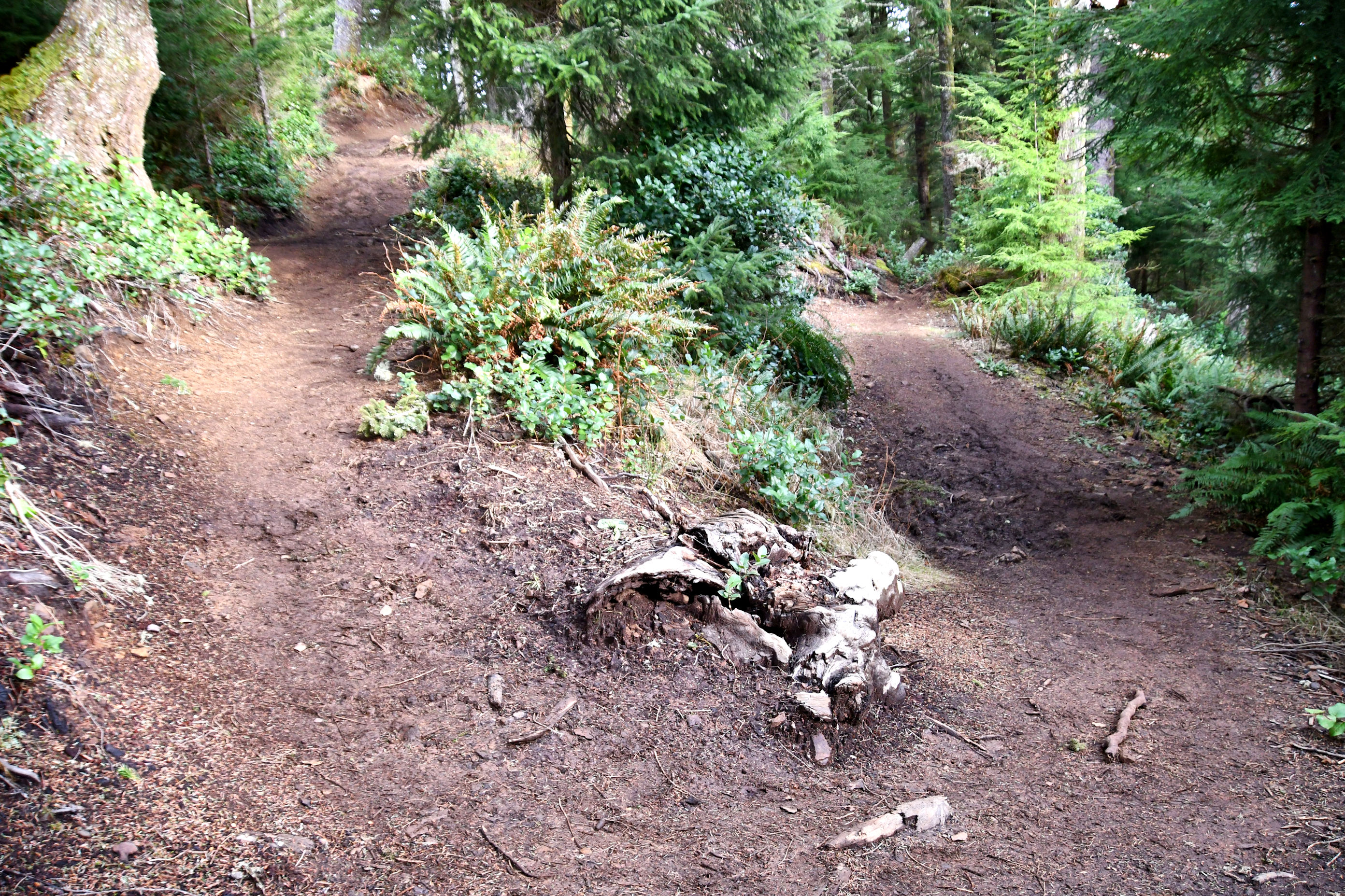
As you can see in the above images (which I lightened dramatically in my photo editing software) that the shore was misty and very dark but the sky did taunt us with promises of better weather. The trail was in pretty good shape for this time of year, and for having rained all day the previous day. Muddy conditions, but still passable, and lots of trees down over the trail, but they were all pretty easy to climb over.
It is a 2.1 mile (3.4 km) hike to Indian Beach. I could not find how it got its name, but there is a good chance the Indians it was named after were the ones who lived here at the time of European settlement, which were the Tillamook people, that included several bands of distinct Native groups. The name Tillamook shows up around this area in a lot of place names and brand names, like my favourite cheese, and the lighthouse.

There were lots of people on the trail, even at 10:30 am in the rain, when we started. Mostly adults, but at the last stage of the trail we walked an old military road, and there were families with small kids on that one. For whatever reason there were a lot of Russian-speaking hikers. There is a large Russian population in Portland. I assume it was coincidence that so many turned up at the same place on the same day. Lots of dogs. Even older people were braving the trail conditions, like one old man with a cane making his way slowly up a hill to an overlook spot. “You’re about to get to a great viewpoint,” I said to him as I passed. “So climbing over the tree was worth it?” he said back to me. We looked ahead, down the trail, and saw that he had just clambered over one of those big old trees, laid across the trail. “Absolutely!” I assured him. “You will love it!”


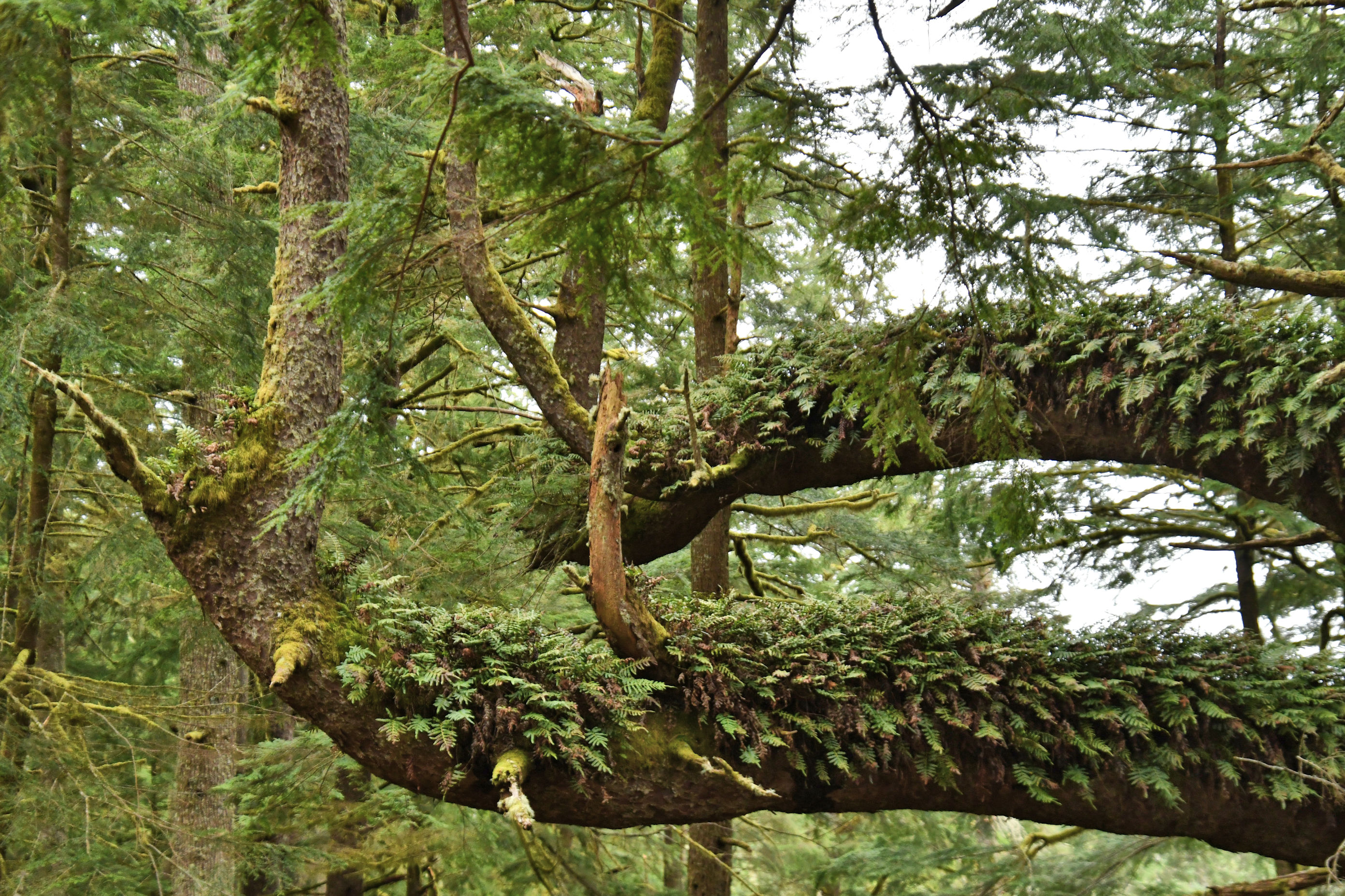
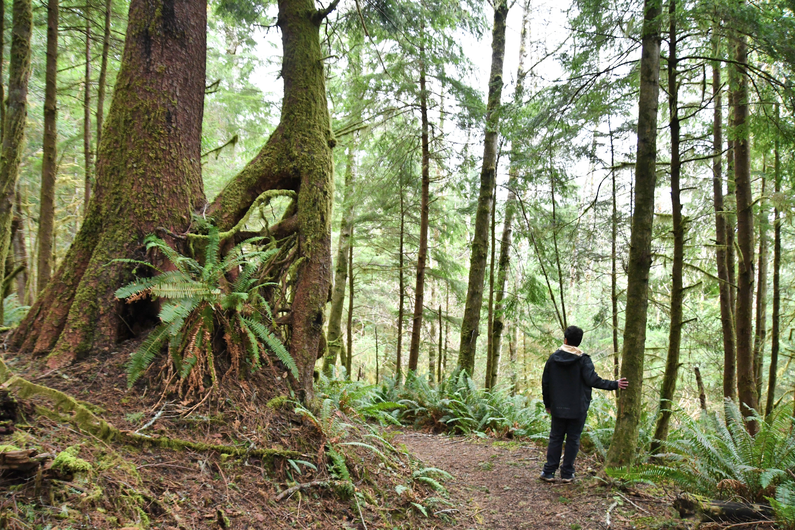
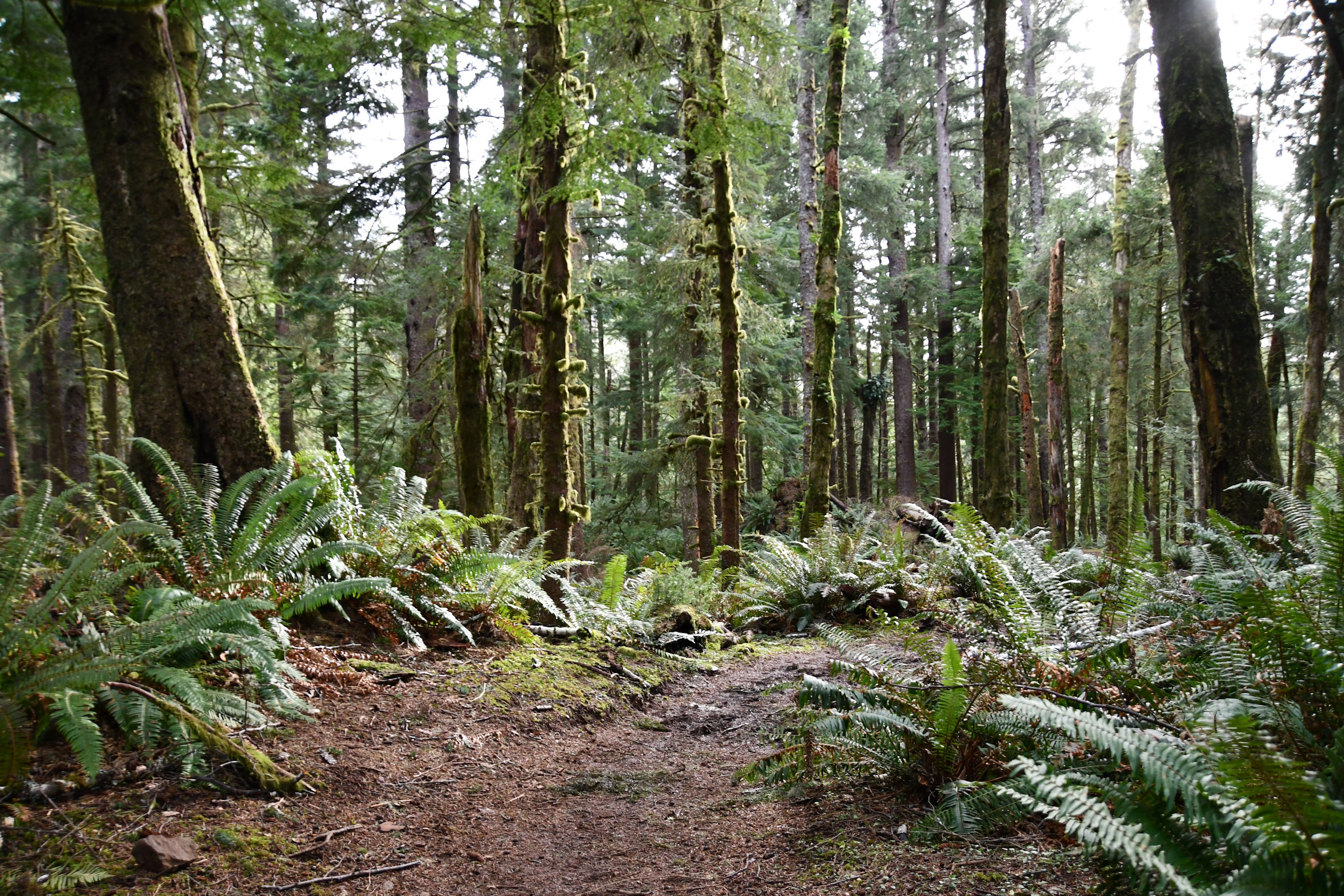
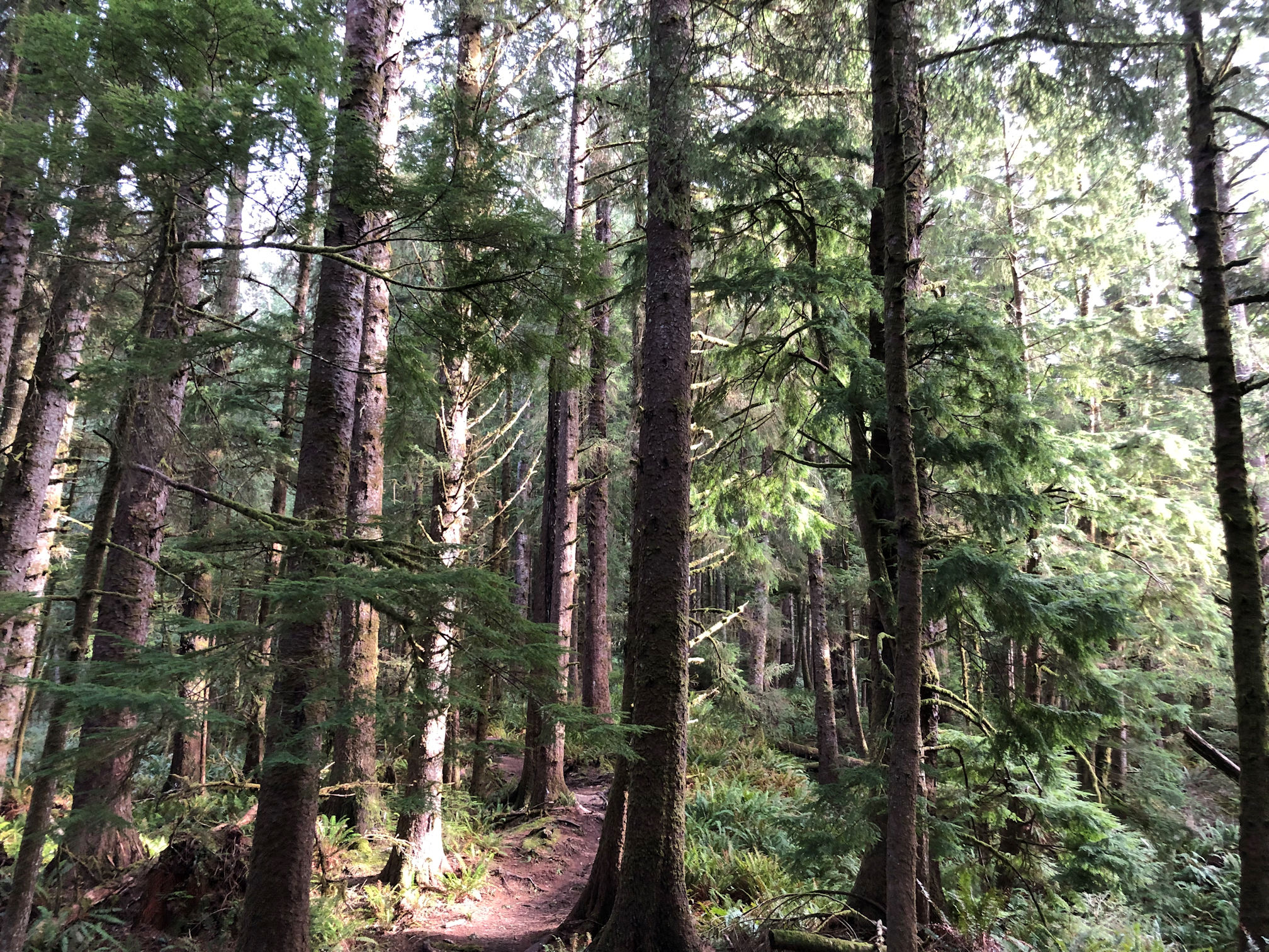
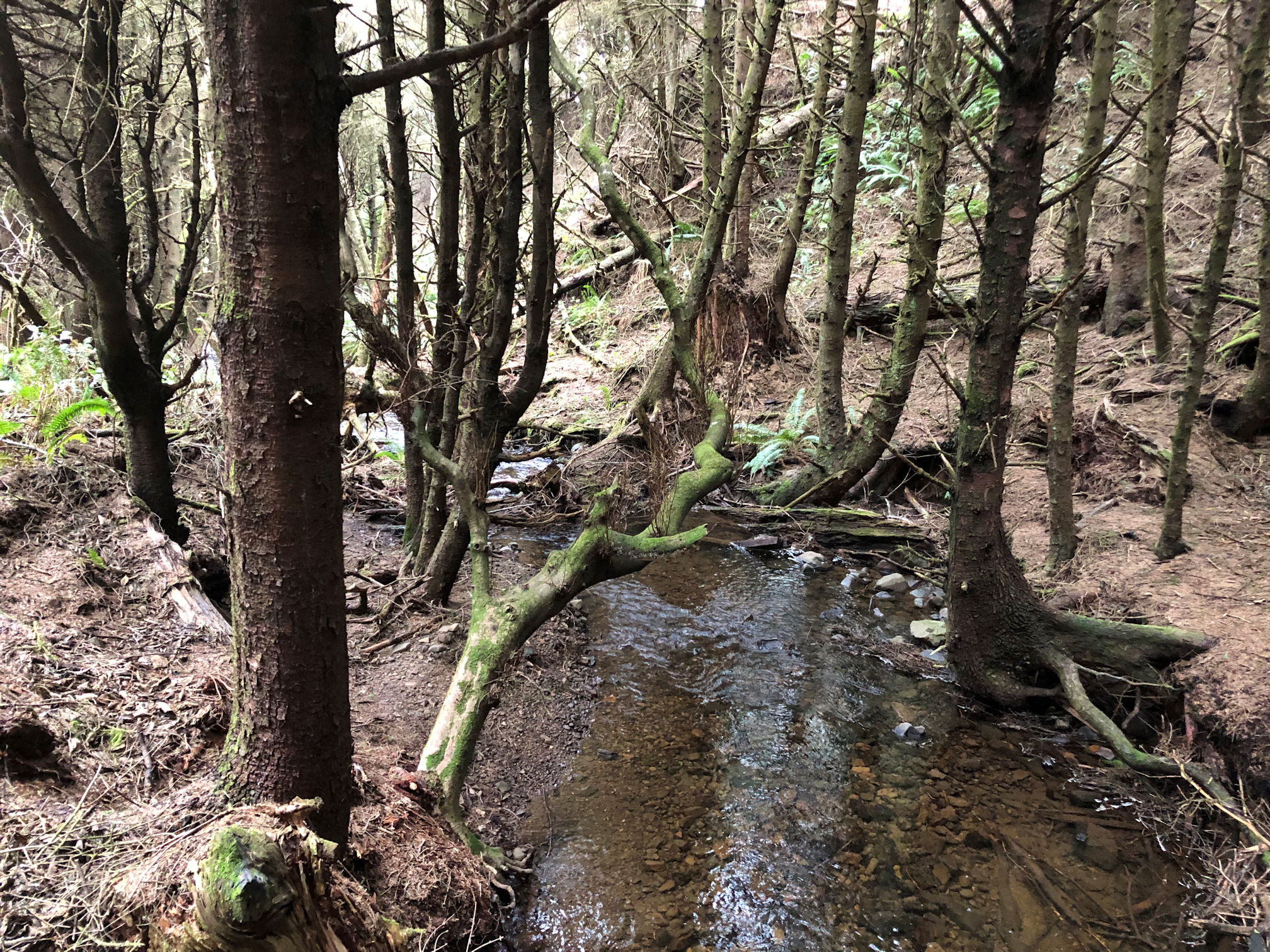
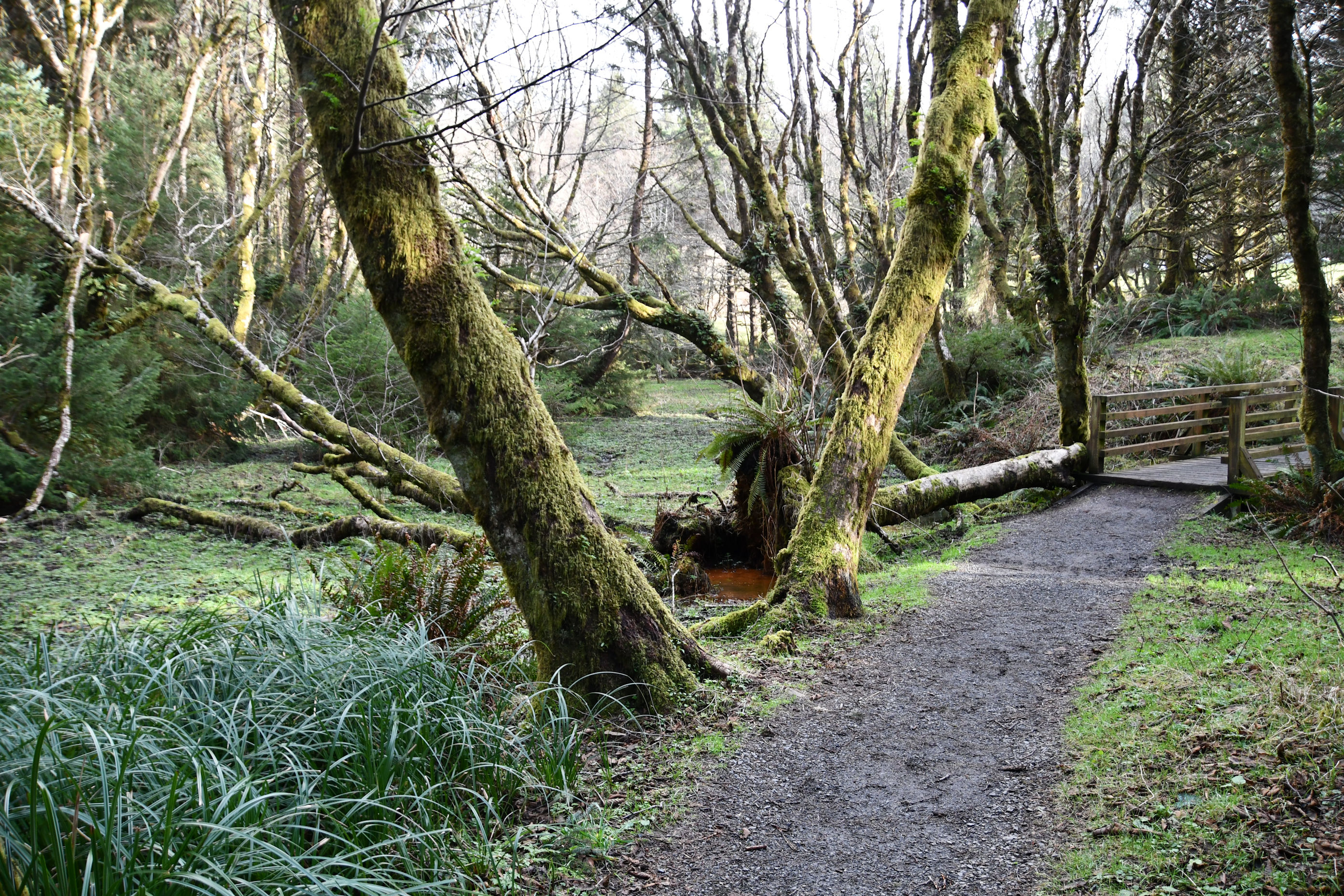
When we were too far from the Pacific Ocean to see it, we looked instead at the forest around us, and it was magnificent. Ecola State Park holds some gigantic old growth Sitka Spruce that literally stopped us in our tracks a couple of times. We tried to get photos with us in them, to give a sense of the size. Some of the best ones were too far away for us to be able to get close and give you some perspective. Like these:
But some were close to the trail and that made perspective easier.


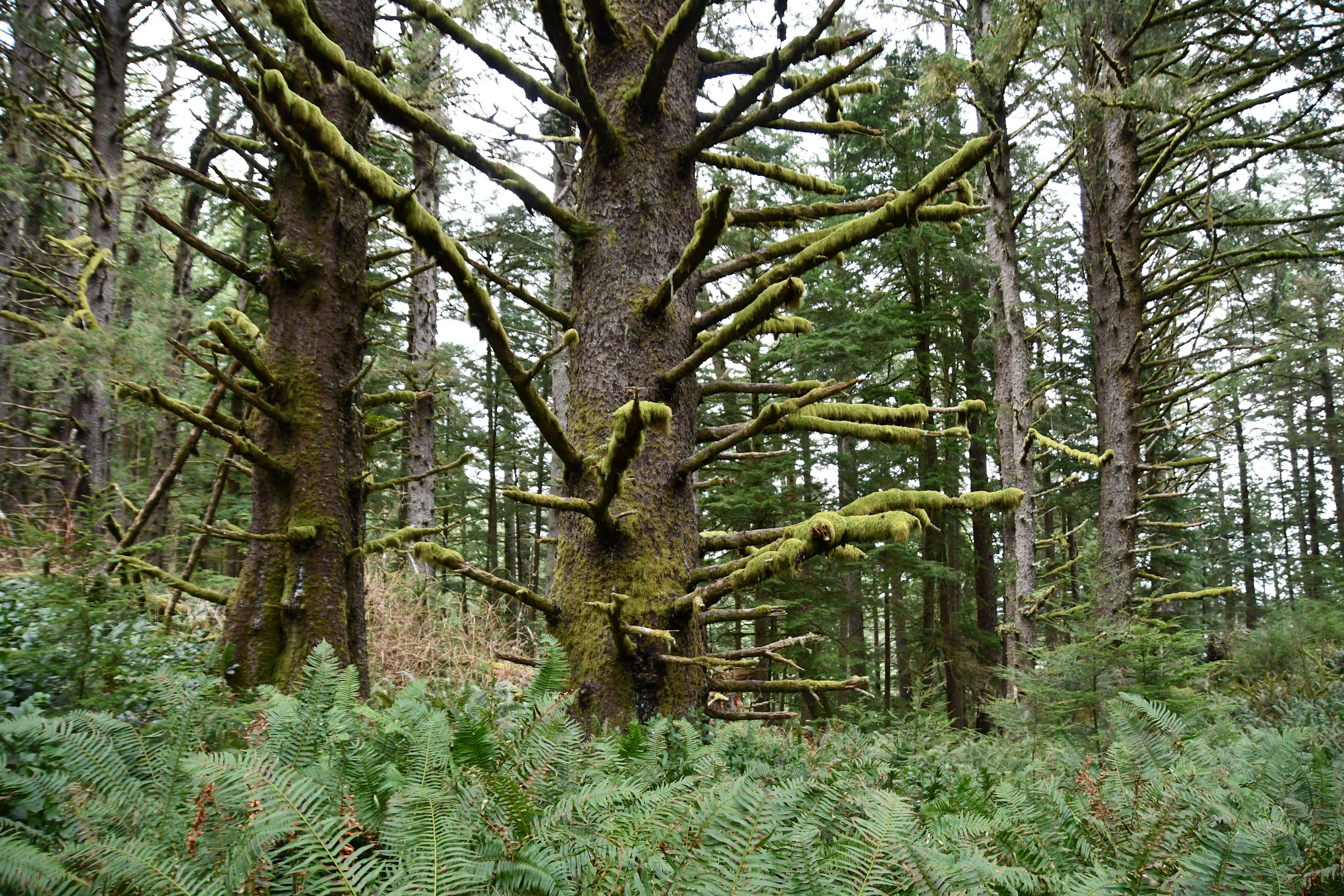
In addition to the fascinatingly large trees, the forest around us was especially beautiful.


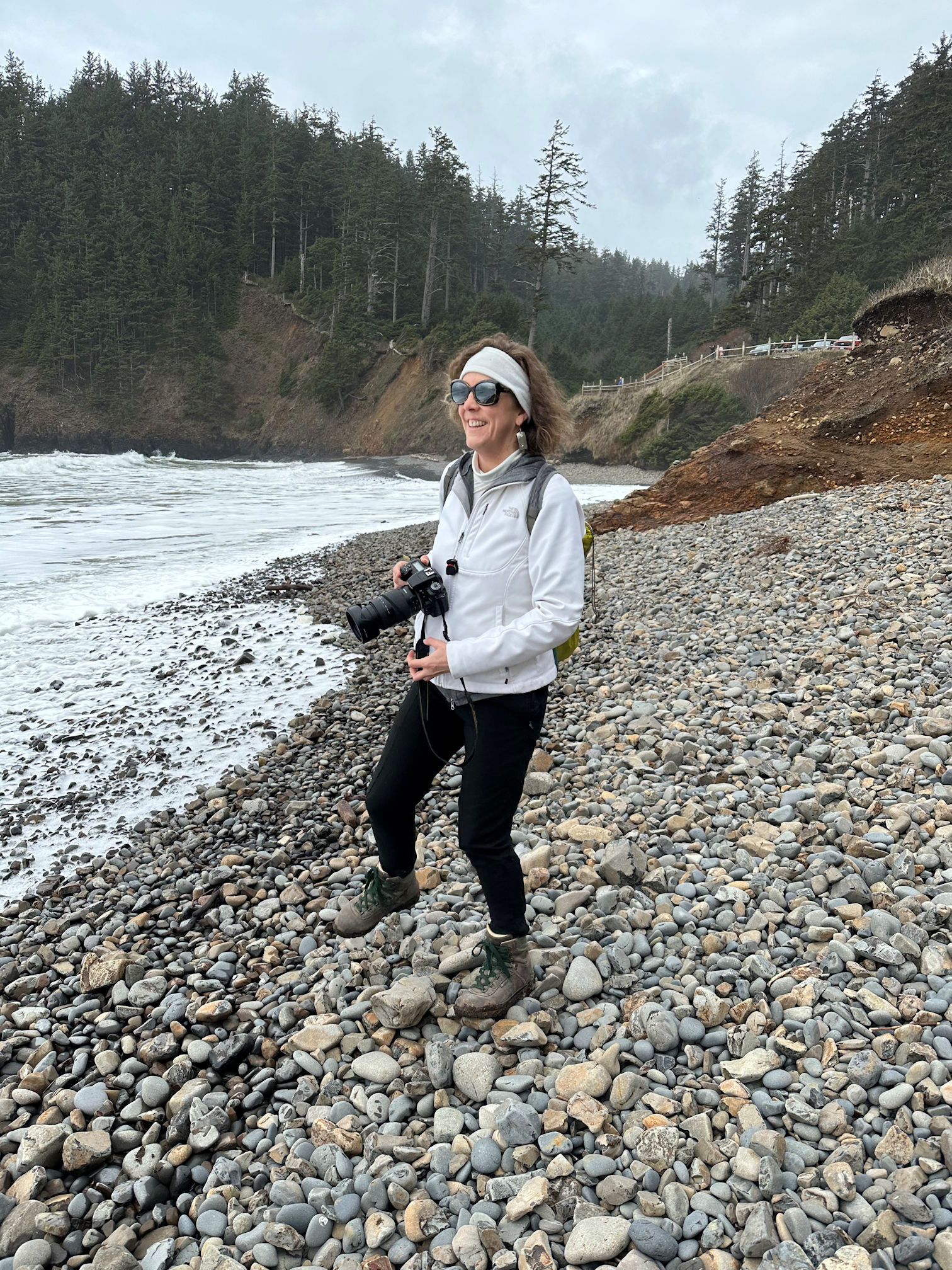
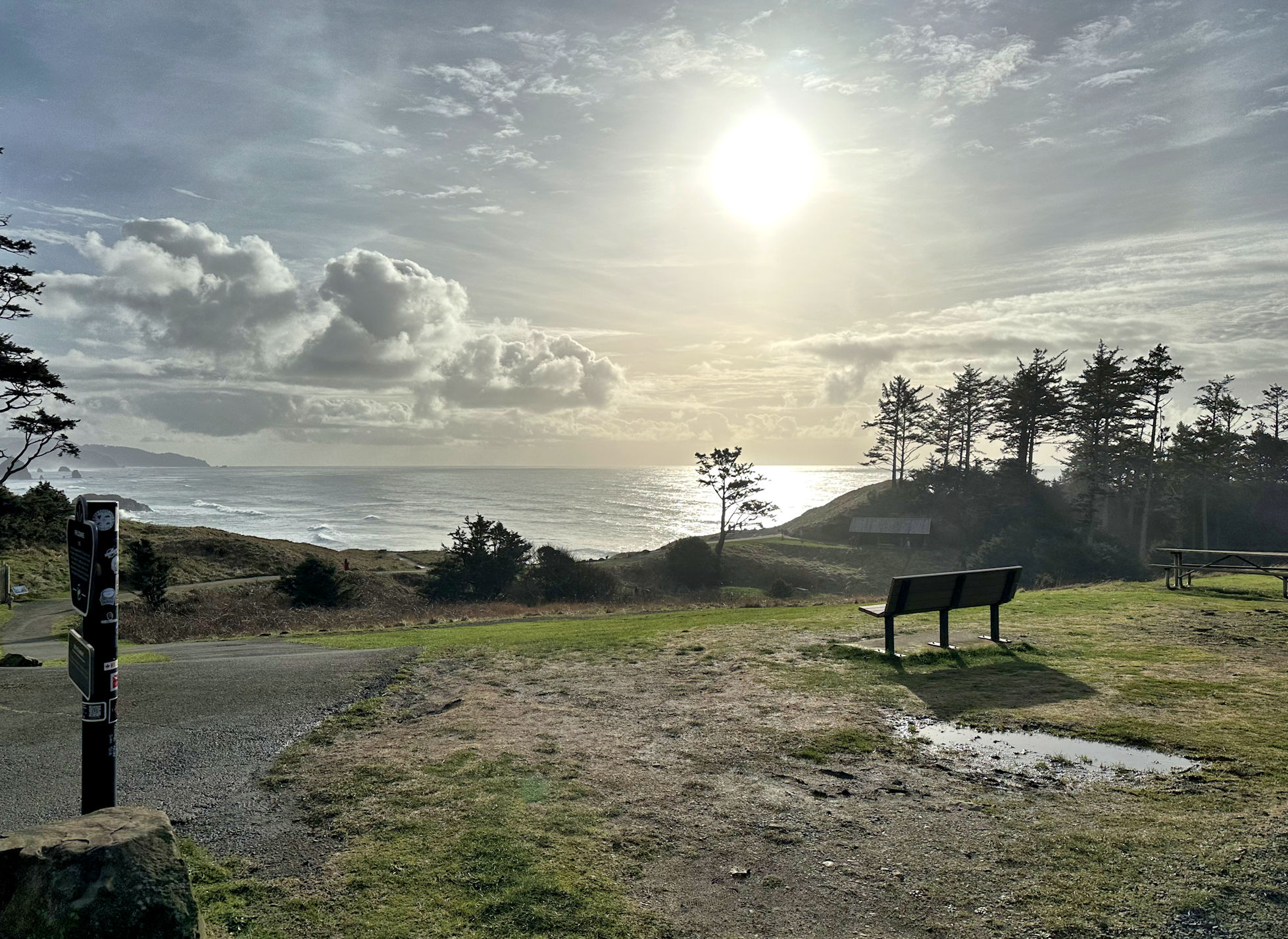
We stopped for snacks and to discard our own trash as well as trash we had found along the way. We used the public bathrooms so conveniently placed. The sky continued to brighten and we felt good, so off we went again.
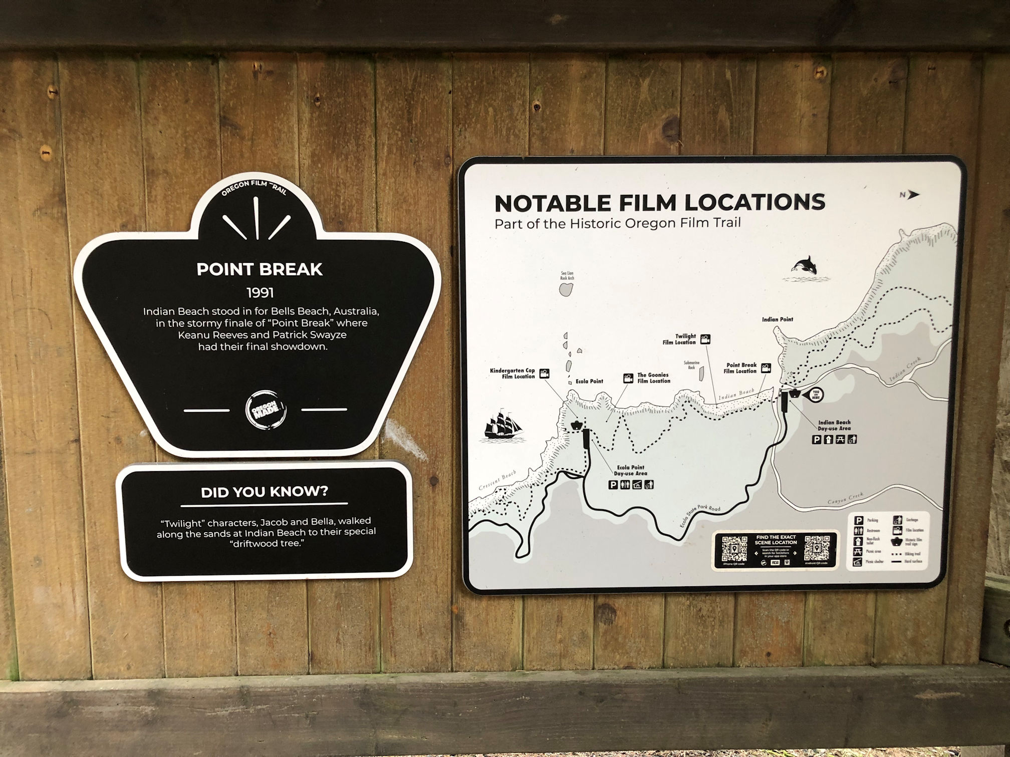
At the Indian Beach parking lot, the Clatsop Loop Trailhead leads north to the next attraction, which was another 2.5 miles (4 km) to a lighthouse overlook. At the trailhead is a sign that points to all the spots where movies were filmed on this beach. Point Break, Kindergarten Cop, Twilight, and Goonies.
A cool thing about this trail is that parts of it were walked by the original European explorers in the Corps of Discovery team. Famous explorers Lewis & Clark were at Ft. Clatsop and heard about a beached whale and wanted to get some of its blubber. A team of 12 hiked some of the same route we did to get to the beach. This was also the first time their Indian guide, 15-year-old Sacagawea, was allowed to see the sea that she had led them to. When the team led by Captain William Clark arrived, the whale had already been harvested by the Tillamooks, and they ended up buying whale blubber from the Natives.
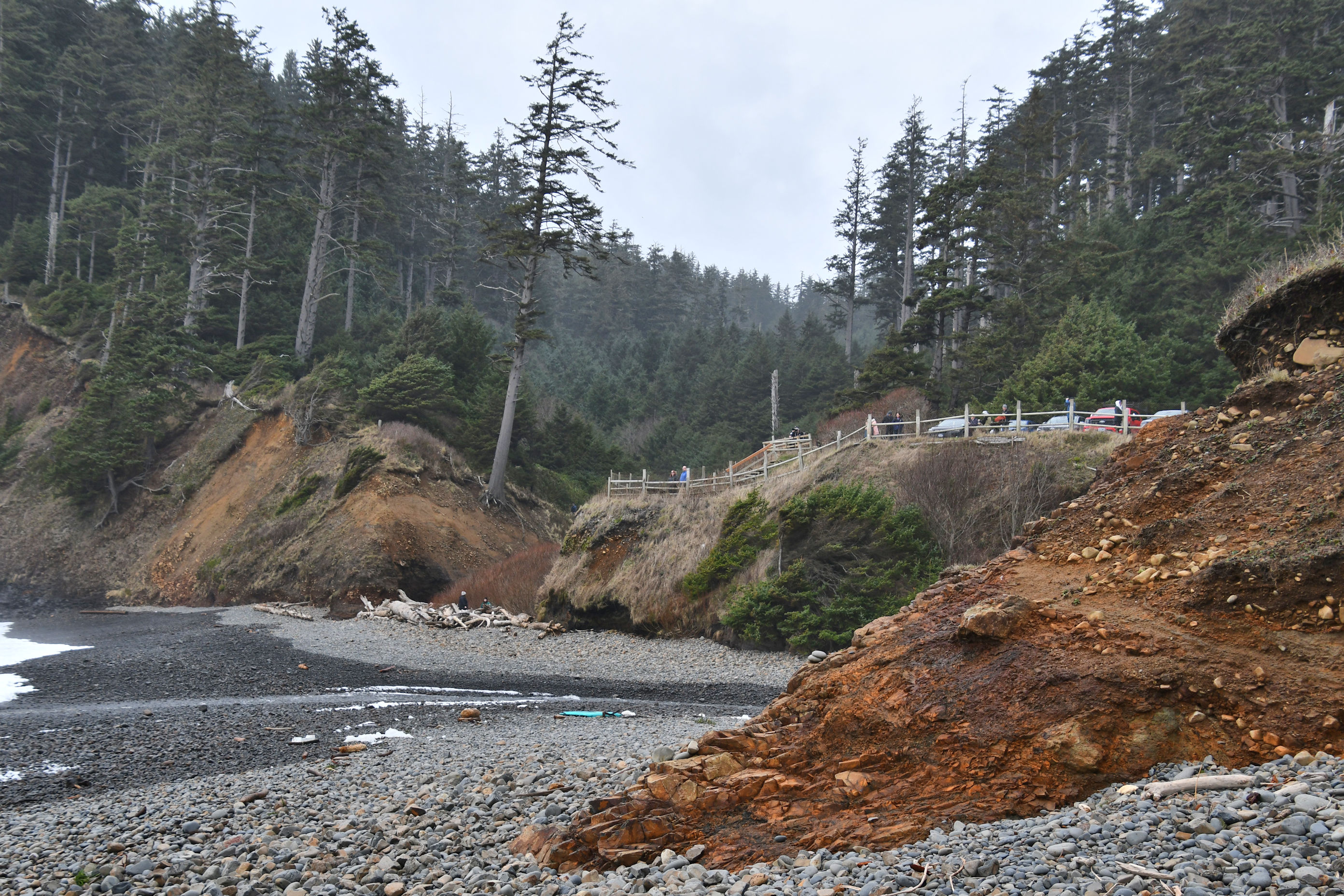
At the north end of the loop is a spur trail that heads to the sea, and we took it. First we walked through a Hiker’s Camp, which consists of three open wooden cabins, Adirondack-style, available for use by Oregon Coast Trail through hikers. Beyond that we saw concrete structures abandoned and covered in moss, and went directly off the trail to investigate!
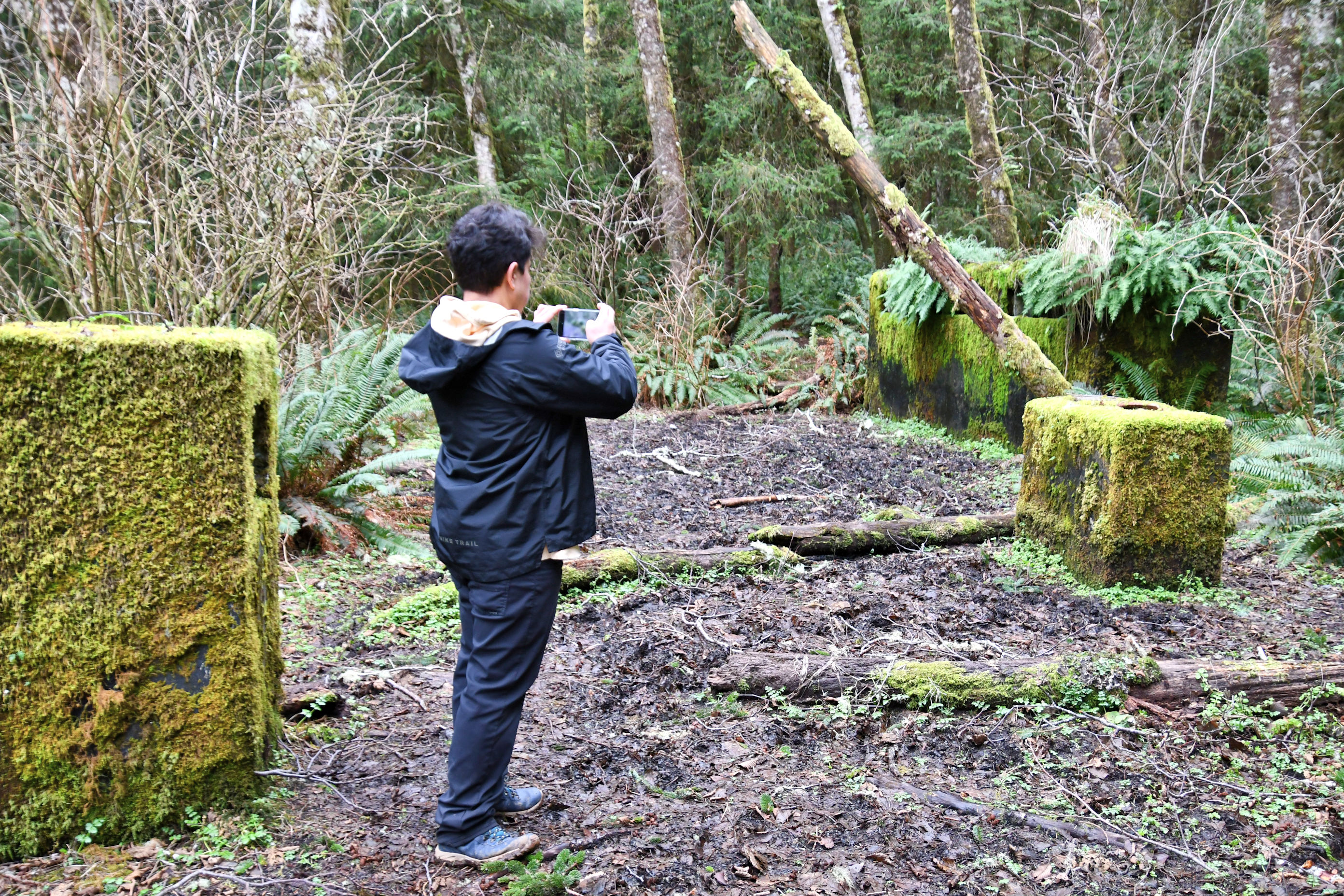
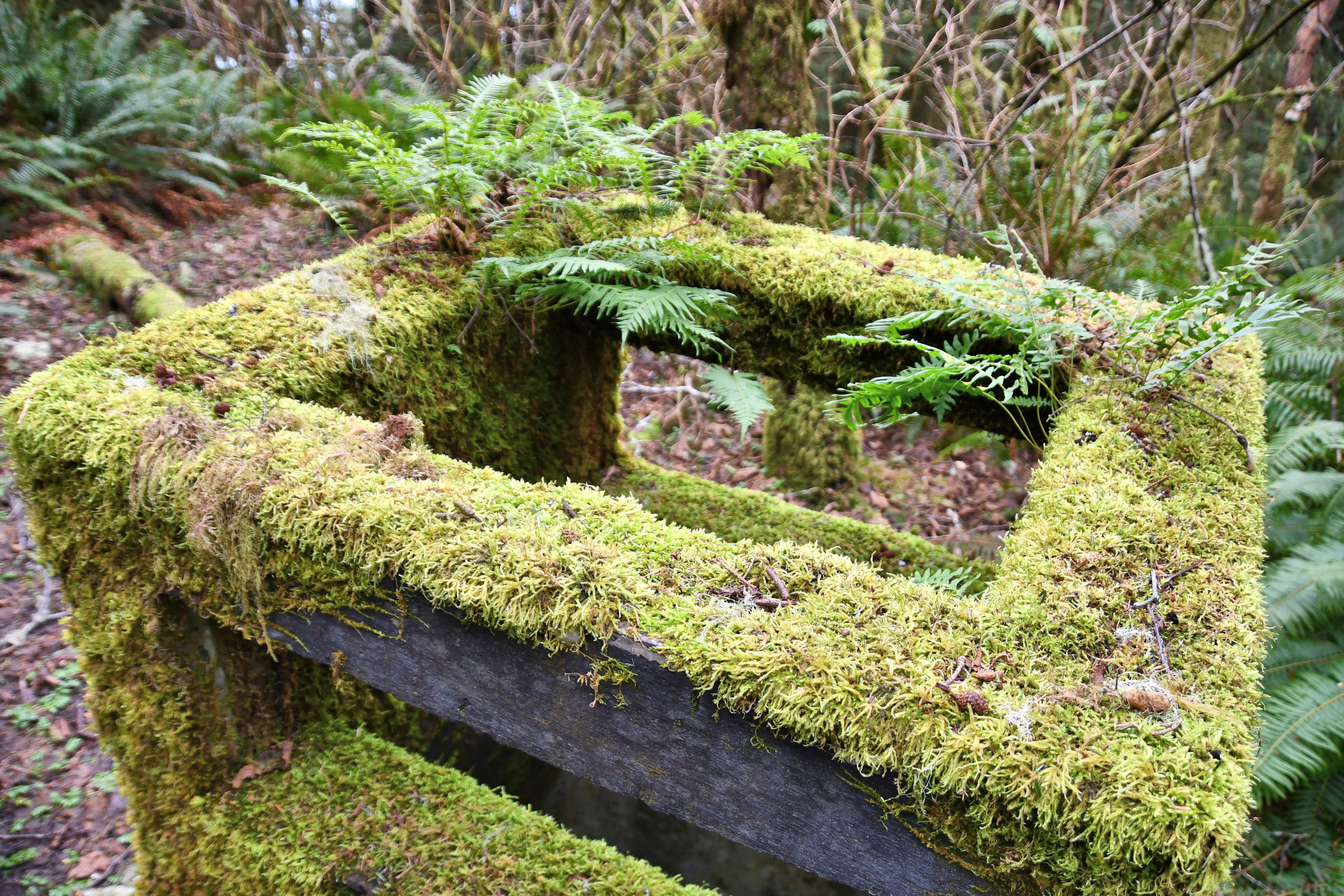


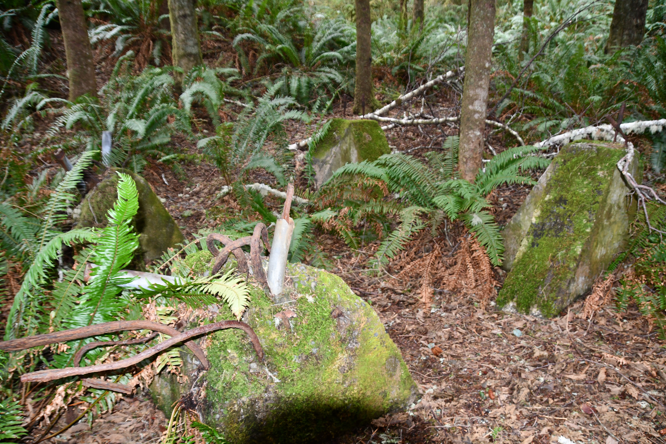
It turns out this land was originally used as a radar site in WWII and then used by the Air Force through at least the 1950s. Finding abandoned military bunkers along the coast is very common in Oregon, so it does not surprise me to stumble unknowingly upon this one.
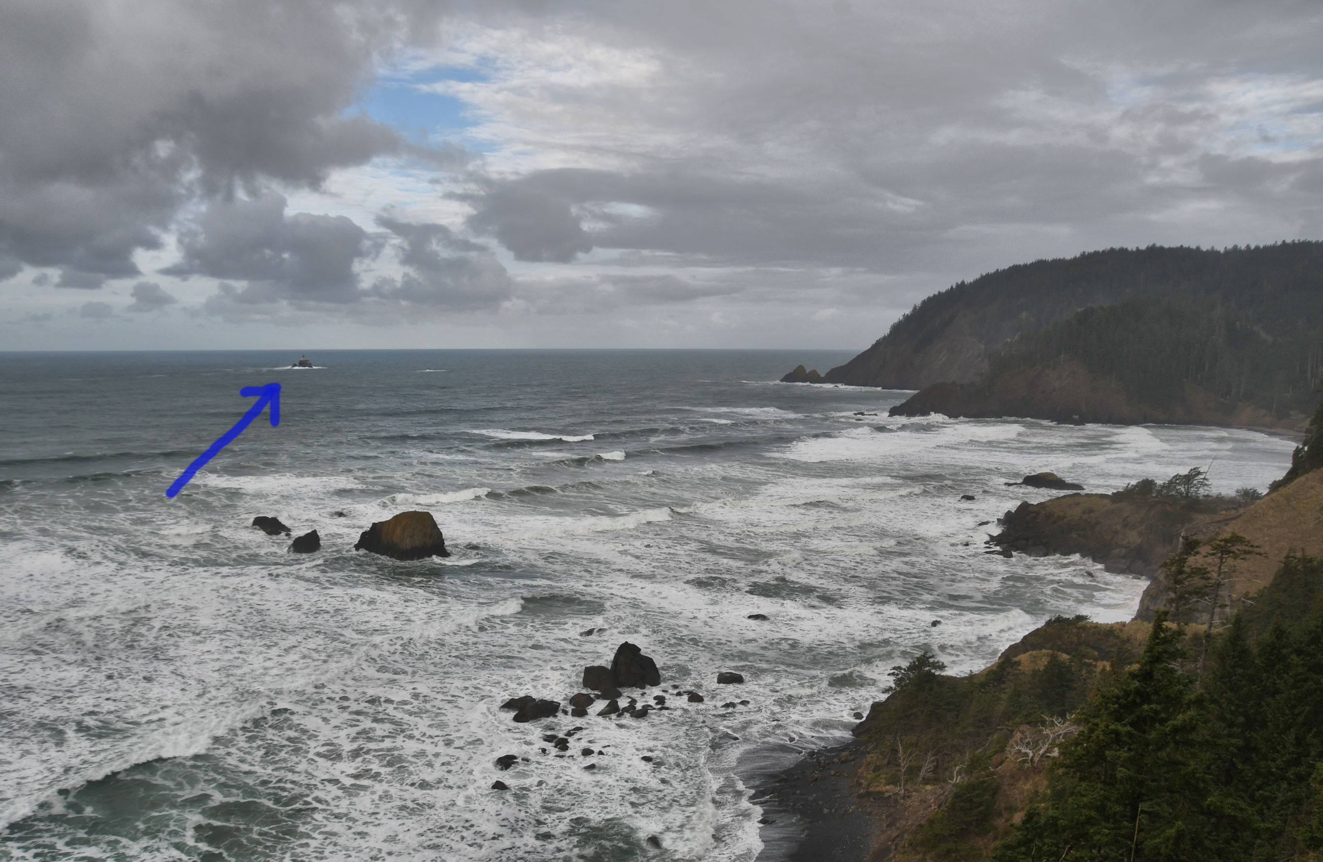
Beyond the abandoned bunkers we came to the edge of the land, and looked out over the sea.

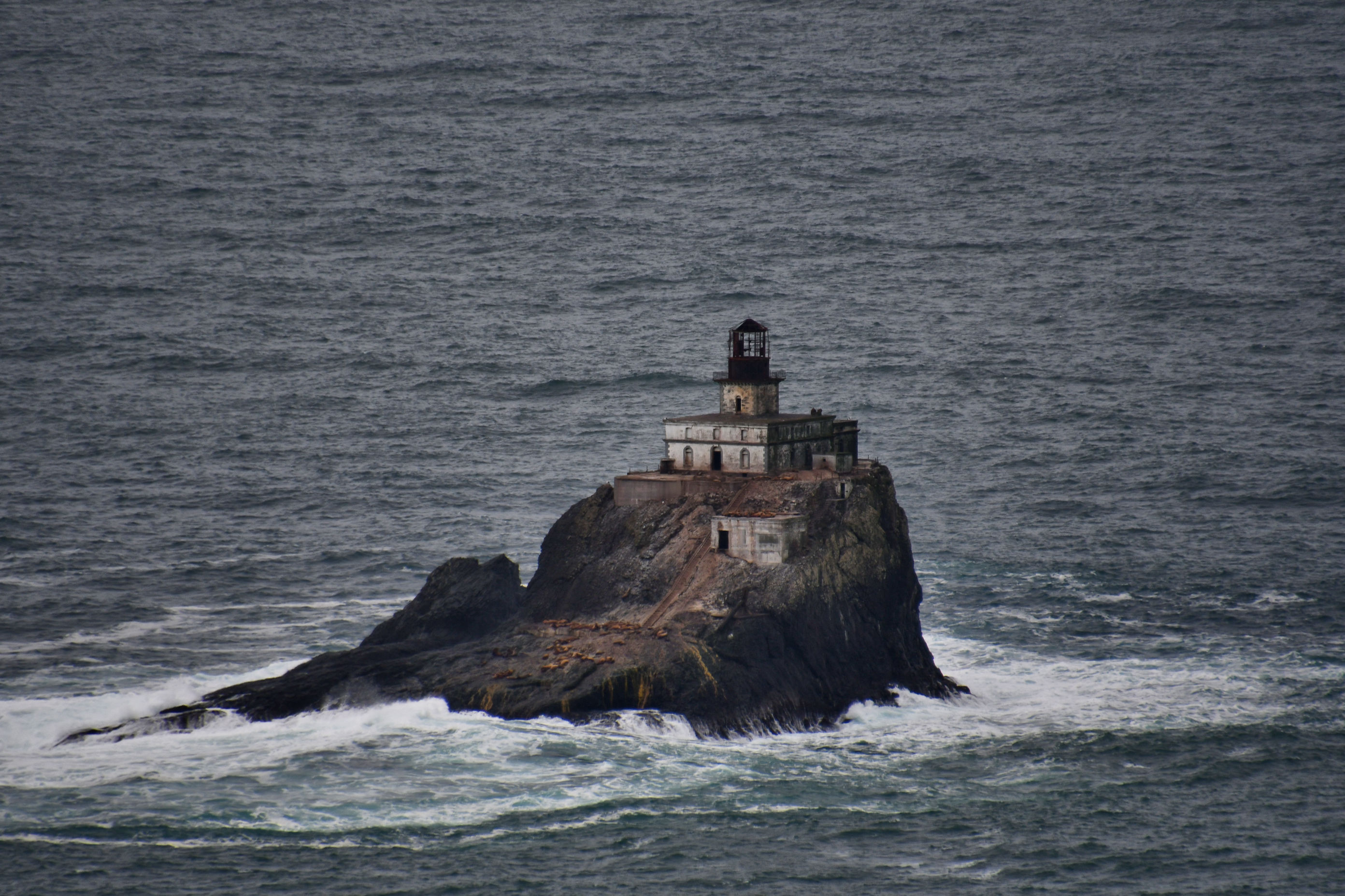
The Tillamook Lighthouse operated from 1881 to 1957 and earned herself the nickname of Terrible Tilly due to the extreme difficulties in getting to the post, maintaining the lighthouse in good functioning order, and the difficulties experienced by lighthouse keepers assigned here, but it was especially due to the ferocious storms that batter the island to this day. It is 62 feet tall and sits atop a rock nearly 100 feet in elevation, 1.2 miles west of the shore, and on more than one occasion storms and sea water bashed structures into the water. Despite all this, some keepers worked there many years. At the time operations ceased, it had been the most expensive lighthouse in the country to maintain and had been made obsolete by modern radar.
We turned to head back to the Jeep, now four and a half miles away from us. The return side of the loop we took was a smooth, flat road originally used by the military for servicing the radar site. There was no mud, no trees down that we had to climb over, and frankly, it was less interesting. We made the trek back to the Indian Beach Day Use Area quickly and stopped for more snacks. We had brought avocados with us because they needed to be eaten (yes, Manja wants to name me Travels With Avocado because I always seem to have one on me), some trail mix, and some biscotti. We had been sipping water all day from the bladder in my pack.


It was 9.2 miles (14.8 km) of trail, but with all our wandering off trail on the beaches and picnic tables and WWII bunkers and such, I’d say we completed 10 miles of hiking total. It felt amazing and we were very ready to sit down in the Jeep once we got back to her. Our next stop was FOOD and BEER at a place Pedro likes in Seaside.
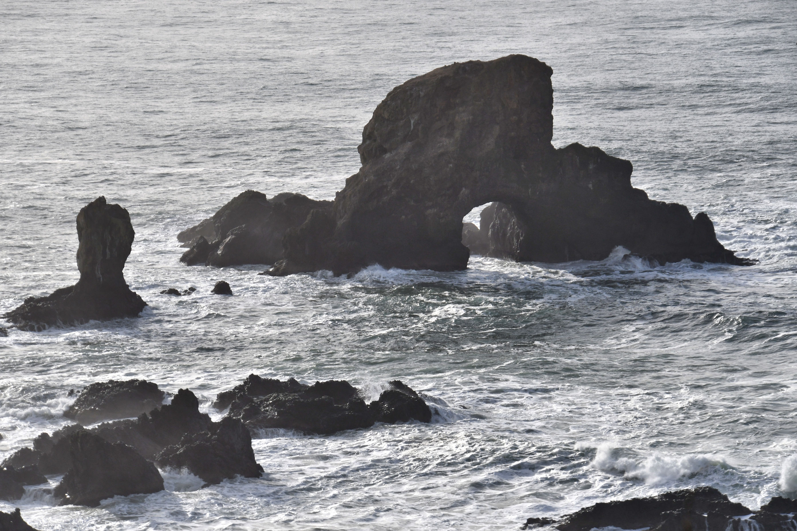
That night we rented Point Break and enjoyed it till we got to the final scene with Agent Utah and Bodie on the beach where they fight it out and Utah gets the cuffs on Bodie. For that scene, we sat upright and paid attention. Sure enough, we spotted Sea Lion Arch twice while they were fighting, and recognized the shape of the cliffs around them. The scene was supposedly in Australia, but now we know better.

So much history on this splendid hike; with your usual excellent photography. I like the view with the Russian family. I am sure you are right about the name of the beach.
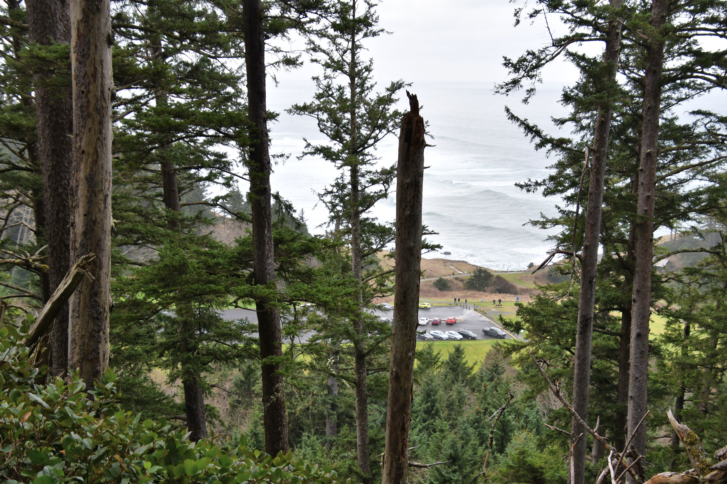
Thank you Derrick for singling out the photo with the family. It’s an example of how I take photos with my blog in mind. I think of ways to show you what I was experiencing, and I liked that scene with the sea glimpsed through the forest, and a family that had been hiking about the same speed as us for the past hour, reached it first and was enjoying the view.
What a great day that must have been! Terrific photos and I can just imagine the fresh forest scents and smells. Ah! That lighthouse is amazing. Are there restrictions for people trying to go out there to explore? Seems like it would be dangerous, but somehow irresistible for some.
Lenore, your questions intrigued me because of course you are right! That island must be so tempting to others, and yet dangerous because of the treacherous seas and no landing dock or even a sheltered cove of any kind. So I did some digging. While Tillamook Rock itself is part of the Oregon Islands National Wildlife Refuge, the lighthouse is privately owned by a woman who had a mortuary business and made the lighthouse into a columbarium. She sold space in it to store cremated remains. 33 peoples’ remains have been interred there, but as you alluded to, vandals broke in and ruined some of the property and stole two urns. Weird. Right now there are 31 urns there and the owner is selling the business, with the full intent of maintaining the columbarium. Because it’s a wildlife refuge, access must be limited and regulated by law, but I think it would be hard to enforce. The owner had to agree not to try to visit the island (which she does via helicopter) during certain times of year when birds are breeding there.
And smells! There was one place where a big Hemlock tree with lots of branches and fresh green needles had crashed across the trail. Hikers had to push through branches, holding onto and walking on needles. About the same time, Pedro and I said to each other, “It smells like Christmas!” ha ha There was also the smell of the sea, that I didn’t get so much in forest, but was surrounded by it when we walked on the beach.
What an awesome day! I’ve hiked a bit on the coast but not here. Reminiscent of Cape Falcon and Neahkhanie Mountain. The photos are an essay in themselves. Have you ever hiked at Saddle Mountain? I love that one too but I think it is still closed to recreation. I was just reading that a popular trail at Mt St Helens was closed due to a cougar sighting! Glad for your great trip report and visual treats. Might have to head this way soon! (Super fascinating about the columbarium. I have a place in Seattle, but how cool would it be to eternally rest your good bones in such an epic place!)
Didn’t you recently hike Saddle Mountain? I searched it out soon after and it was closed, and has remained closed through the pandemic. I have never hiked it. Yes, this hike reminded us of Cape Falcon, and Pedro at one point joked and said “happy anniversary” to me because it was nearly exactly two years since our first hike together ever, which was at Cape Falcon in January in the mud and cold, ha ha. You know the one I still haven’t done but have on my bucket list is Dog Mountain, in the Gorge. Have you hiked it? It’s regulated now on weekends but I think unrestricted on weekdays during wildflower season. I really want to get my butt out there this spring.
Haven’t been to Saddle Mountain since 2020. I love it there. I’ve been twice and eagerly await a third trip. I hiked Dog Mountain back in 2017 before all the fuss. We missed the flowers by a week and it was a cold, windy hike. Nice views, but unless I get there in flower prime time (and with hundreds of others …yuk), it’s not one I’d do again. There are so many other great hikes in the Gorge. I’m glad I did it, but it’s become too popular. I loved Cape Falcon. Nice history you have there!
I read this post at 6 am today but knew that I had to view the photos on my big screen as well. Just wonderful. Isn’t it amazing what a little light can do? I’m proud of you for doing this hike. It was quite a distance. This moss-covered world is astonishing. I’d take a million photos. And how clever are you for busting the Point Break locale! 😀
Oh, isn’t the moss so lovely? It’s everywhere here because of the wet, cool climate. Even though it’s pretty, it’s destructive too – moss on my roof, moss in the lawn, etc. I built a concrete brick wall for my garden three years ago and already the bricks are covered in moss and the wall looks like it’s been there for 50 years. That part I like. You’ll want your big screen for the next post too – sunset after our hike was incredible!
I know the destruction of humidity. The sea is right over there, as you know. And I completely forgot to mention how grand it is that you had your avocado with you!!
Oh yes, with the sea you get the salt, too. So rough on things on land. I am eating yet another avocado this morning. I may have an addiction. ❤
Haha, you have the best addictions!
🙂
Great trip, Crystal. Looks like you and Pedro had a blast. Peggy and I have explored the country around Tillamook. It’s quite beautiful. What’s not to love about the Northwest coast! Interesting history on the lighthouse. Never knew it. Speaking about Tillamook, we were quite pleased to find Tillamook ice cream here in Virginia. We always keep a carton in our freezer! 🙂 –Curt
I’m glad the Virginians know how good Tillamook ice cream is, and you two get to benefit! Personally, I’d take cheese over ice cream. Luckily I have a favourite cheddar on the East Coast too: Cabot. Between Cabot and Tillamook, I am cheesily satisfied. I think I recall your posts from the Tillamook area because of the rabbits. That was you, right? I have not yet seen them, but I keep an eye out any time I pass through.
Cabot is everywhere around here, Crystal. We eat lots of cheese. 🙂 But not much cheddar anymore. It was my go to cheese for years and years. The sharper the better.
Rabbits, yes. Between 2-3 miles south of Tillamook on the right at Pleasant Valley RV Park. –Curt
😍🔥
PNW beauty is unparalleled, isn’t it. Thank you for stopping by.
It’s okay my dear, it’s my pleasure meeting you here
I don’t think I’ve been back to Ecola since I went when we first moved to Portland, which suddenly is 8 years!! I must go back, as it’s a pretty easy day trip out there. So quintessential Oregon coast. Beautiful pics. Glad to learn about Tillamook rock too. How weird it was allowed to be a columbarium!
Eight years have flown by. You’ve lived in Portland as long as I’ve lived in Rainier, pining for Portland. Rather easy day trip to hike on the coast, you are right. I often save it for when the weather is yucky and more yucky weather is ahead: on the coast, rain and cold never stops it from being a magnificent hike. I agree with you about the columbarium – I never would have thought of that.
Honey thanks for the upvote here😍🙏
Thanks for the beautiful hike…
Hope all is well?
(Looks like it is)
My life is full, me and my loved ones are healthy and active, I have people to love, and I have people who love me. It’s really hard to ask for more out of life. ❤ How are you, Brian?
So happy for you. 🤗