A friend of mine from the Seattle area sent pics from Mt. St. Helens a week ago. It was so beautiful at Mt. St. Helens, with wildflowers and water flowing in the streams. I scolded myself for still not having hiked the mountain, which I can see as I leave the driveway of my house. So close, and yet so far.
I teased Andre and said I would bully him into going again one day. He said he’d be happy to go again, and if we do, it should be right away because the wildflowers were blooming and the creeks were still running. I said, “Sunday?” Et viola.
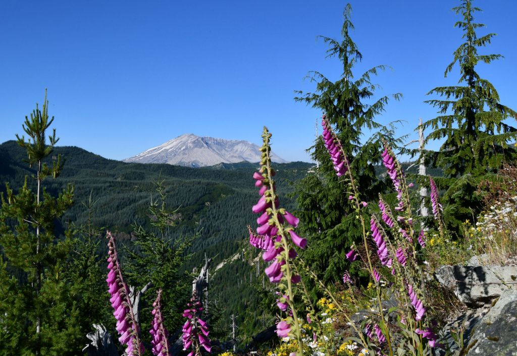
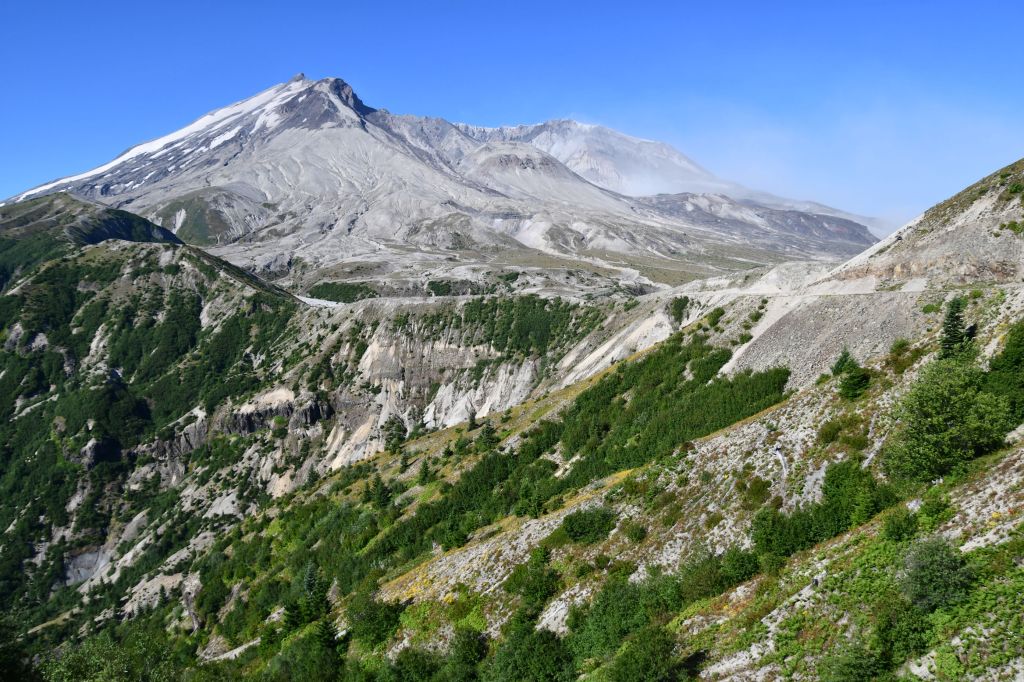
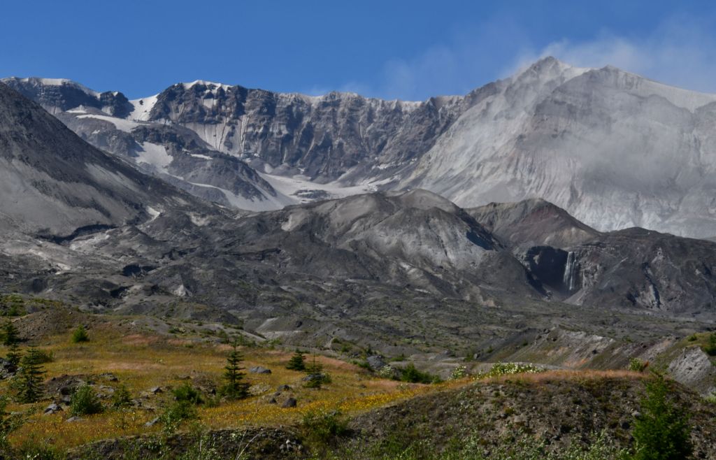
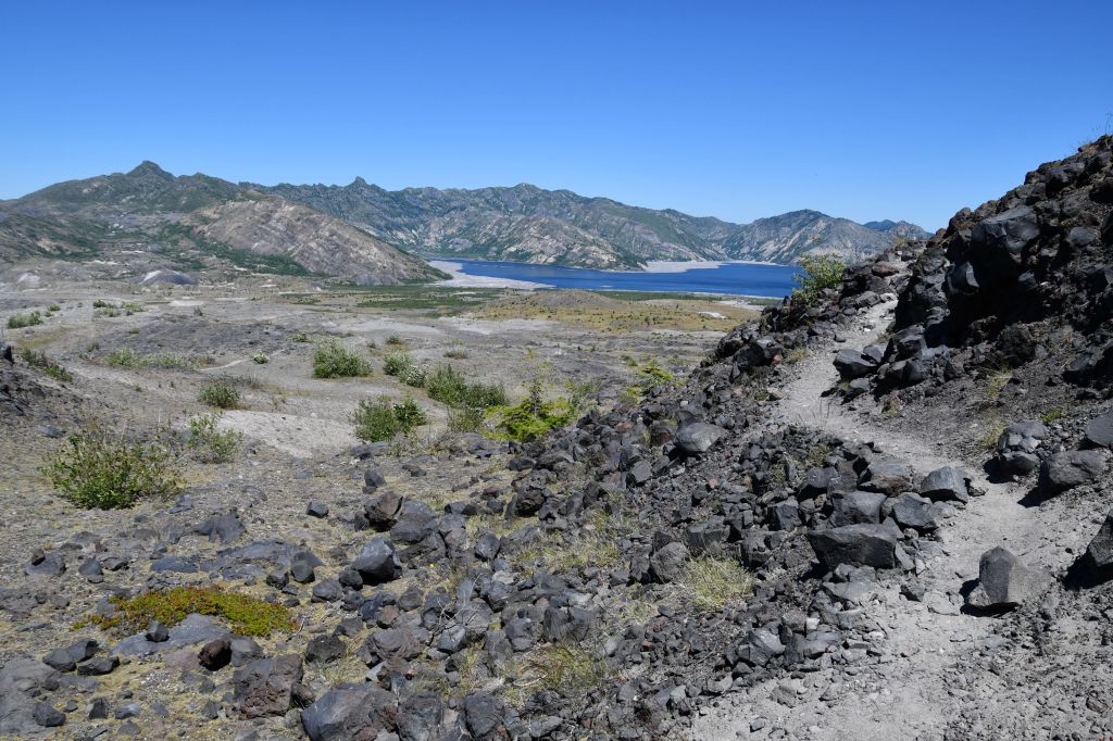
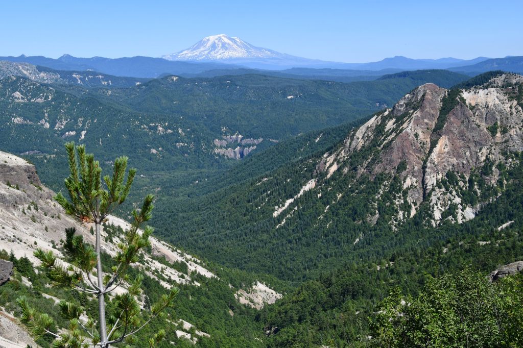
Mount St. Helens from one of the many viewpoint areas on the road up to Windy Point.
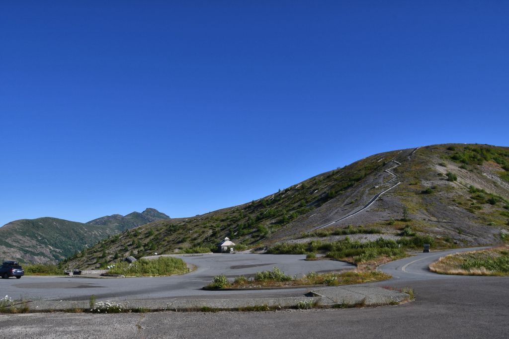
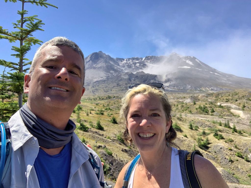
He drove south and I drove north and we met on Highway 12 and then rode together for the last 1 1/2 hours to Windy Ridge, on the east side of Mount St. Helens National Volcanic Monument. There is a large parking area there, some great overlook points, and a toilet. The wind tried to knock us around as we got all our gear together, but we won the battle and before 9am we hit the trail.
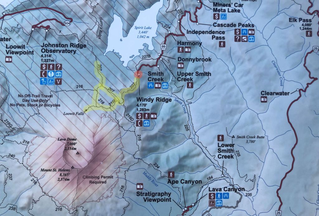
This map is at the trailhead at Windy Ridge. I marked the parking area in red, then highlighted in yellow the parts of the trails we walked.The parking area and toilet at Windy Ridge. Can you get enough of that blue sky? You can see that at 8:45 a.m., we had the place practically to ourselves. The trail up to the lookout point on that hill is more elusive than it seems. Every time I come here, the wind is fierce and I have not felt safe climbing that hill. One day I will. Andre and I enjoyed the views at Windy Ridge before we started our hike.
At first the wind made me irritable. It was almost hard to talk to each other with clothes flapping around us and hair in my mouth. I ditched my sun hat immediately. If you look at the map, you see the trail first heads south along the side of the ridge, then curves west. When we went west, that took us out of the worst wind. When we crossed the ridge and went down into the valley, we passed out of the wind entirely. Then, with the sun in my eyes, I missed my hat.
Everyone around here knows the date the mountain blew, and remembers where they were when it happened and has a story to tell about it. But for those of you who don’t have this special connection, it was May 18, 1980. At 8:32 a.m., there was an almost horizontal explosion to the north, accompanied by the world’s largest landslide in recorded history, and a pyroclastic flow (hot gas and volcanic rock) that crashed through the valley.
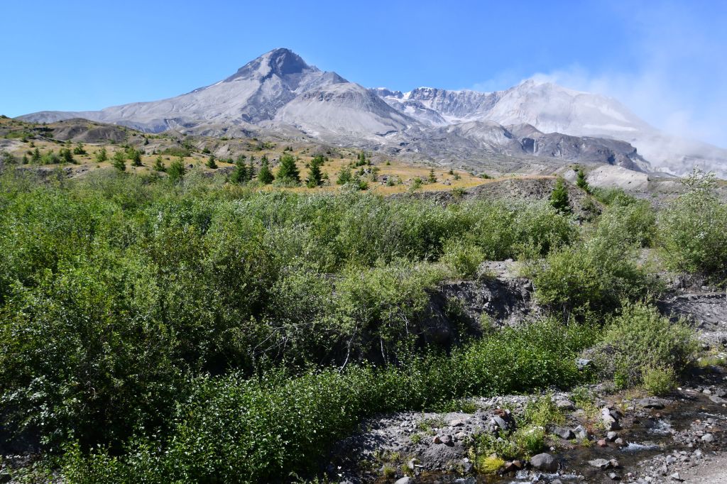
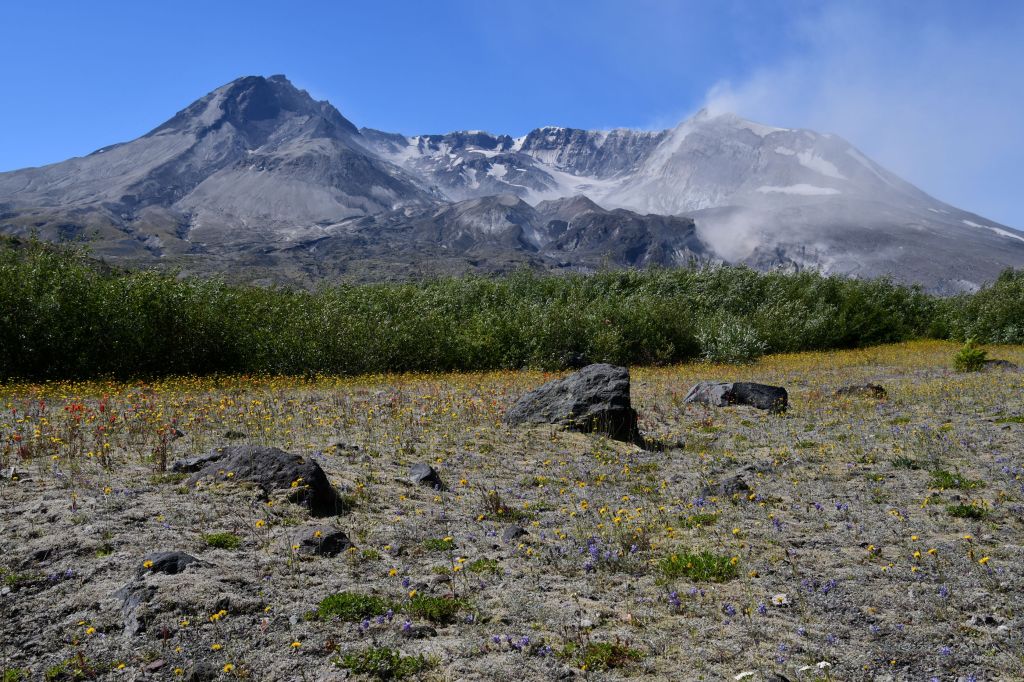
Forty years later I find it amazing both that there is so much life here now, and conversely, that I can still see the devastating effects of the volcanic eruption.
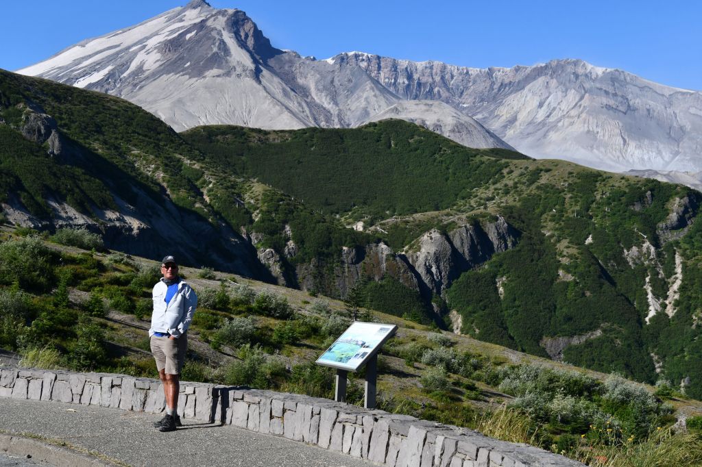
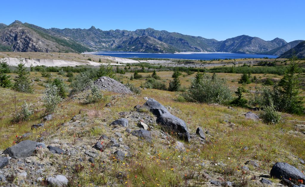
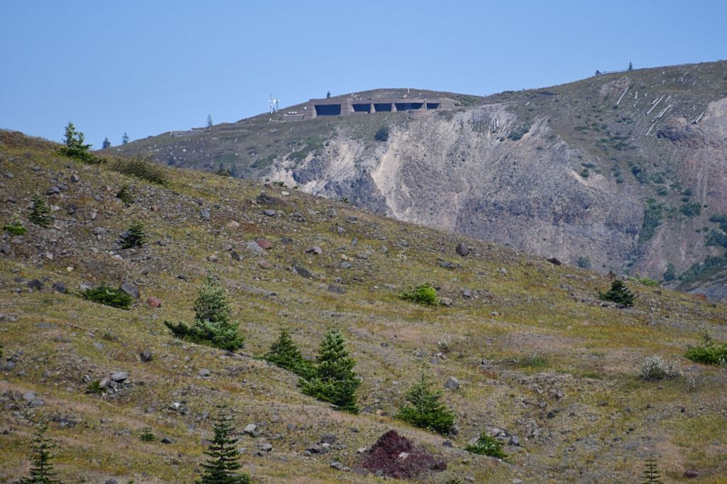
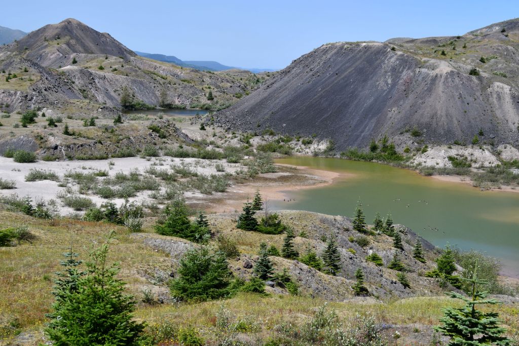
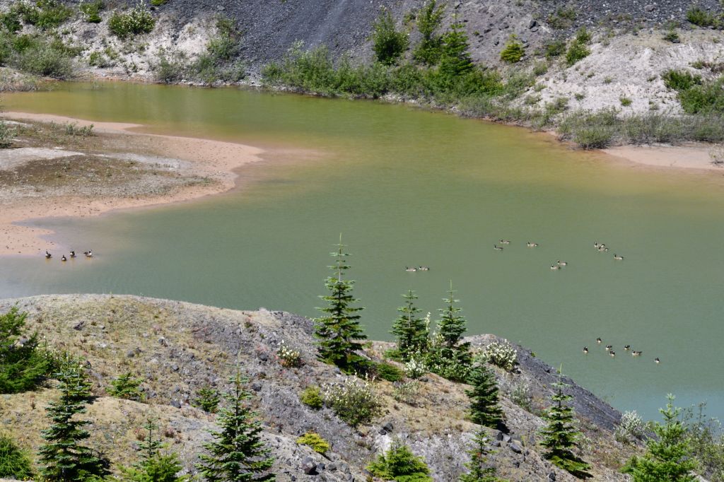
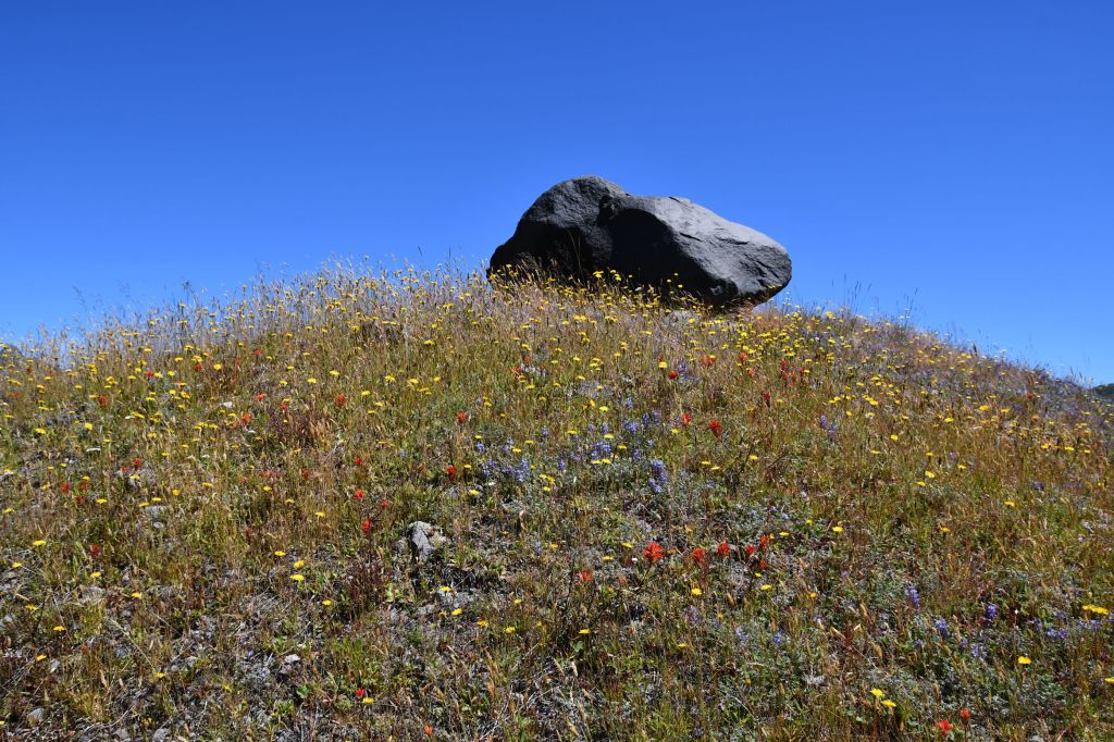
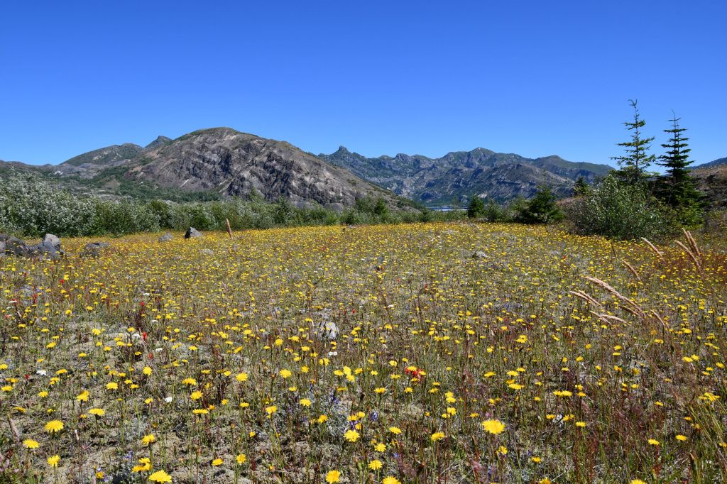
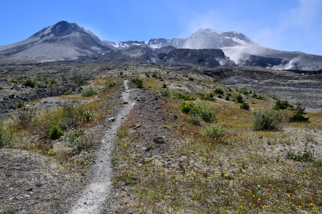
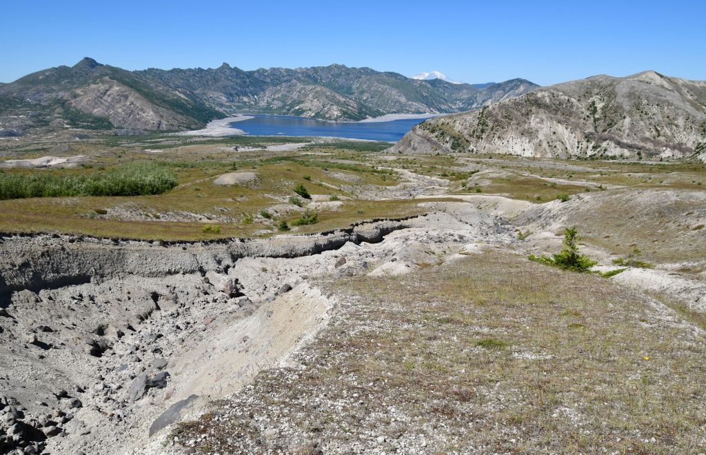
The beginning of the trail (you can see the flat horizontal line of it above, right middle) hugs the east slopes of the ridge before crossing over the saddle (center of photo) and heading west into the foothills.Me standing in the saddle, taking a pic of Mt. Adams. The morning light was poor that direction, and I made a mental note to check out this view on the way back.We first walked north through the valley, and were treated with some views of Spirit Lake.From there we spotted the Johnson Ridge Observatory, which is noted on the map above.We came across two small lakes out in the valley between Johnson Ridge Observatory and Mount St. Helens. This one was populated with Canada geese.Canada geese enjoy some distancing from humans.We were both captivated by this scene. It looks so artistic, with the single boulder on the exact crest of a hill, surrounded in blues, reds, yellows, and greens.
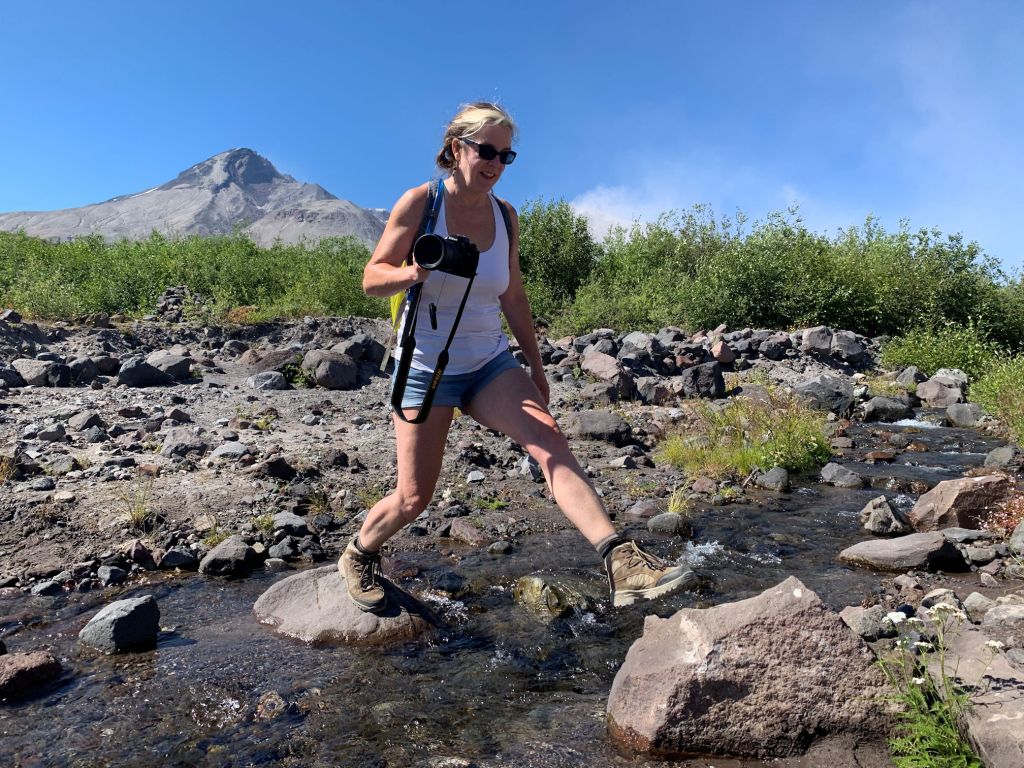
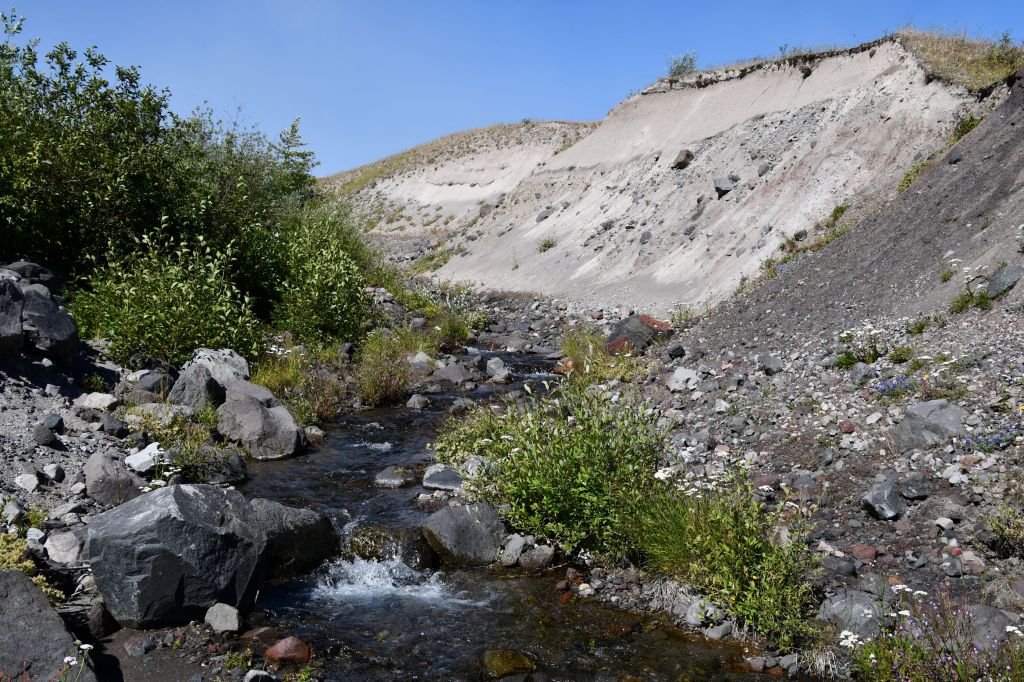
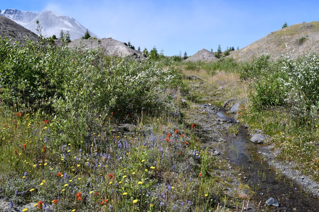
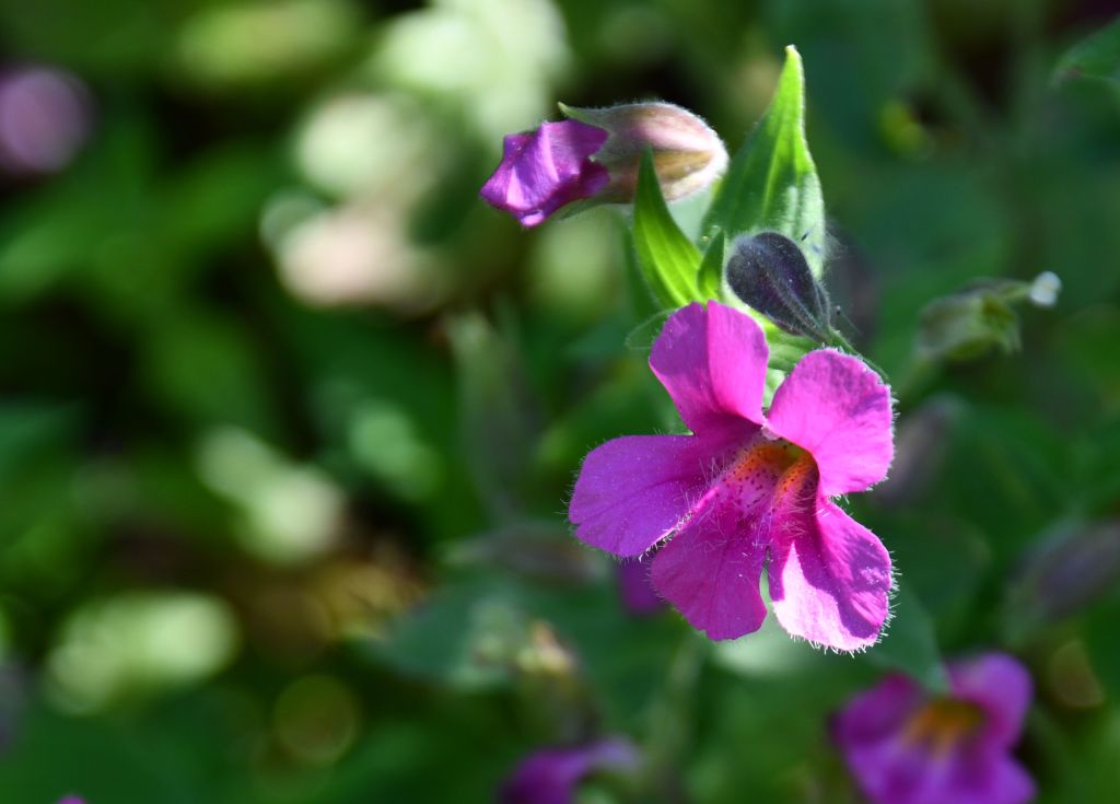
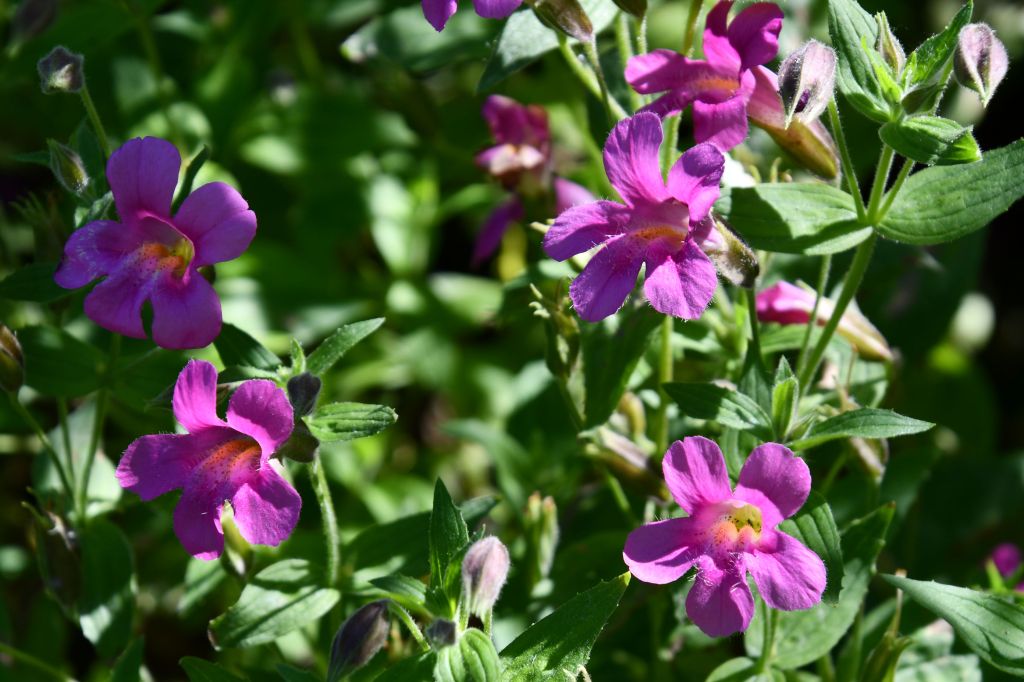
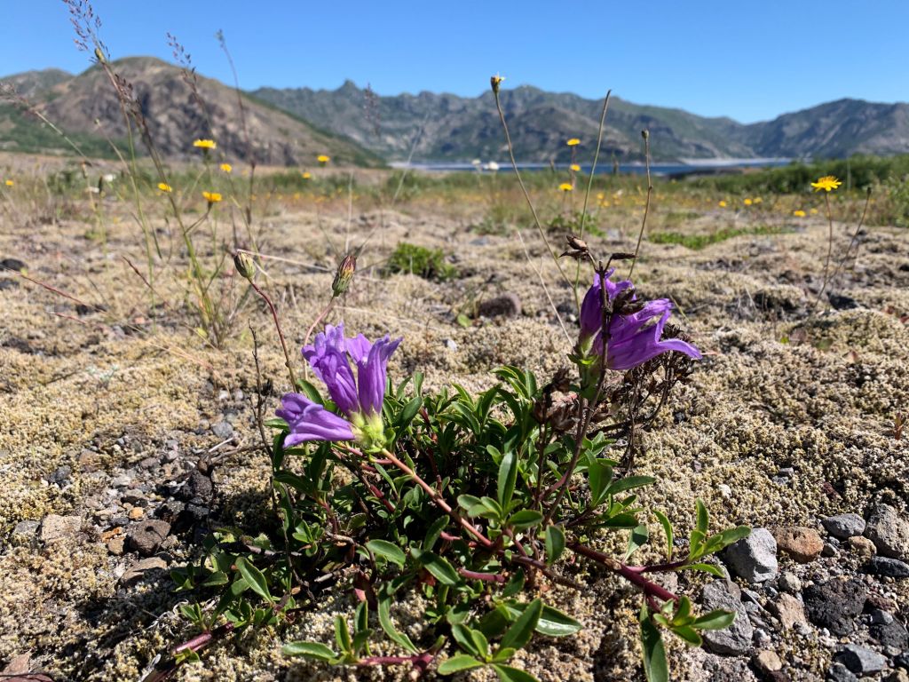
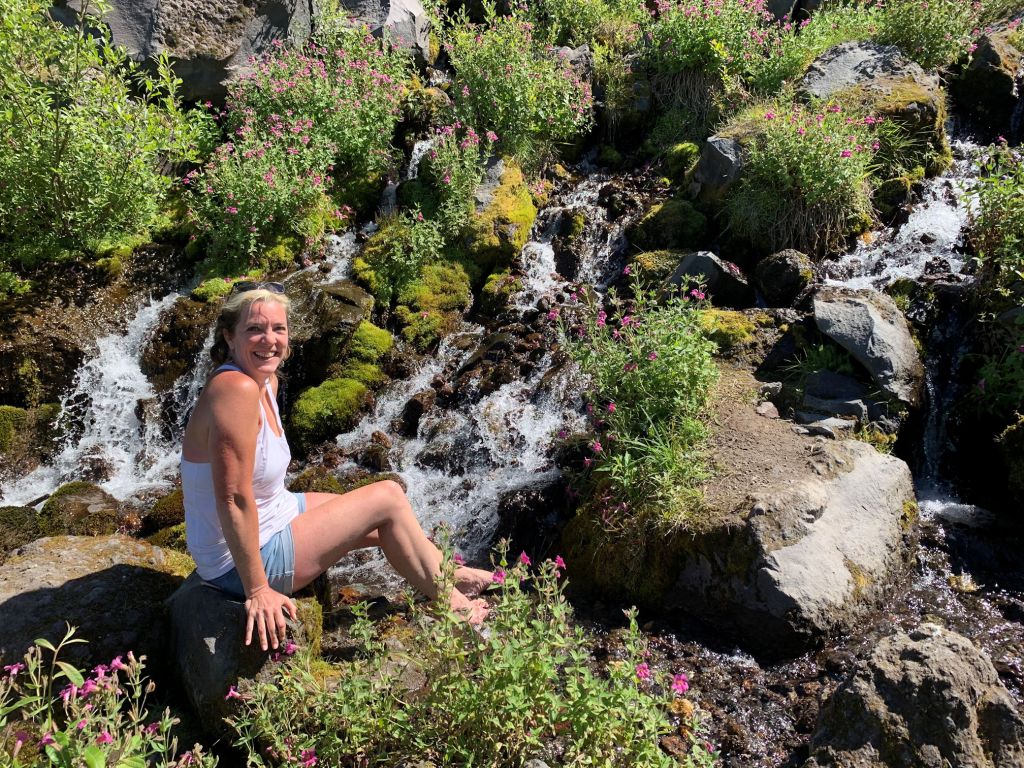
We crossed a surprising number of little creeks formed with snowmelt. These will dry up in a few weeks. In the meantime, they are feeding the wildflowers and expanding areas of brush, and even supporting a few brave and sturdy trees.The creeks are carving through hummocks of ash.Here’s another creek that is just about to dry up. We pulled off our shoes and socks and let the crisp, cool water refresh our feet.There were wildflowers blooming in profusion along most parts of our hike.
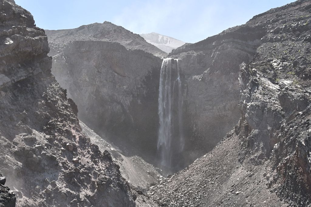
After wandering around in the valley, splashing in the creeks, and stopping for snacks and conversation, we packed up and turned around and headed south toward the mountain. In the distance we could see a waterfall, and that was our next destination.
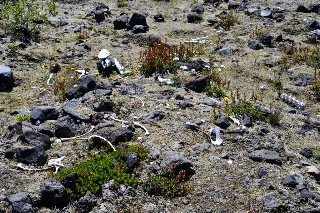
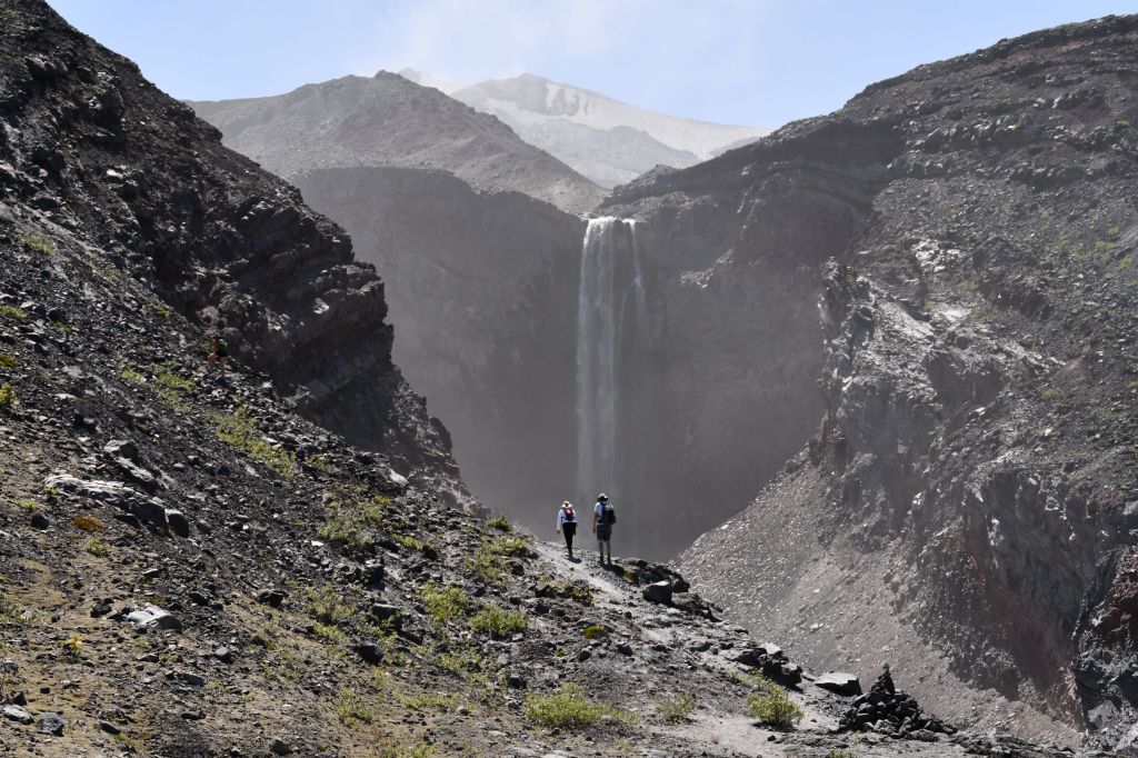
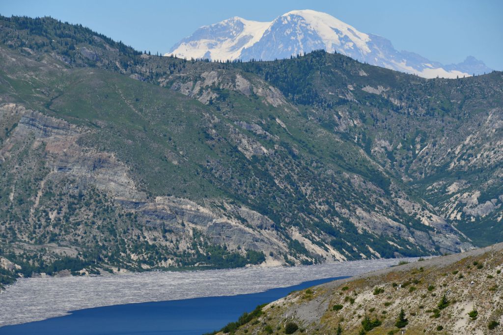
Can you spot Loowit Falls? It’s middle right in the photo. This photo shows something remarkable: the world’s youngest glacier, and the only known glacier that is actually growing in size. In the center of the crater, you can see the new mound that emerged since 1980. Between the mound and the ridge on the right, you can see an ice field. That is Crater Glacier.Though we were sheltered from the wind while we were in the foothills, the winds continued brisk in the higher elevations, as evidenced by the ash and dust swirling inside the crater. The dark azure skies were east of the mountain, anywhere the blue begins to pale, that’s because of all the airborne ash.The trailhead started high, then we dropped into the valley. But when it was time to see the falls, we had to do our first elevation climbs of the day.I was delighted by these scattered and bleached bones. Not sure what the animal was. Maybe too large for a deer. It could have been an elk.The trail led us up and out of all the greenery. We looked down below onto Spirit Lake, and across all the areas we had just wandered through.The landscape nearer the crater was otherworldly. Andre said it looks like Nepal; so maybe just other-countryly. I am disproportionately excited that there is a waterfall this huge and impressive to be found at the edges of the crater. Up here it was very windy again, and there were regular small rockfalls kicking up dust. I had a hard time getting a somewhat clear photo of the falls.I am grateful to these two for arriving just before us, and providing some perspective. The trail dead ends right where they are standing.One last photo of Nepal er, I mean the Moon, ah, um that is Loowit Falls.
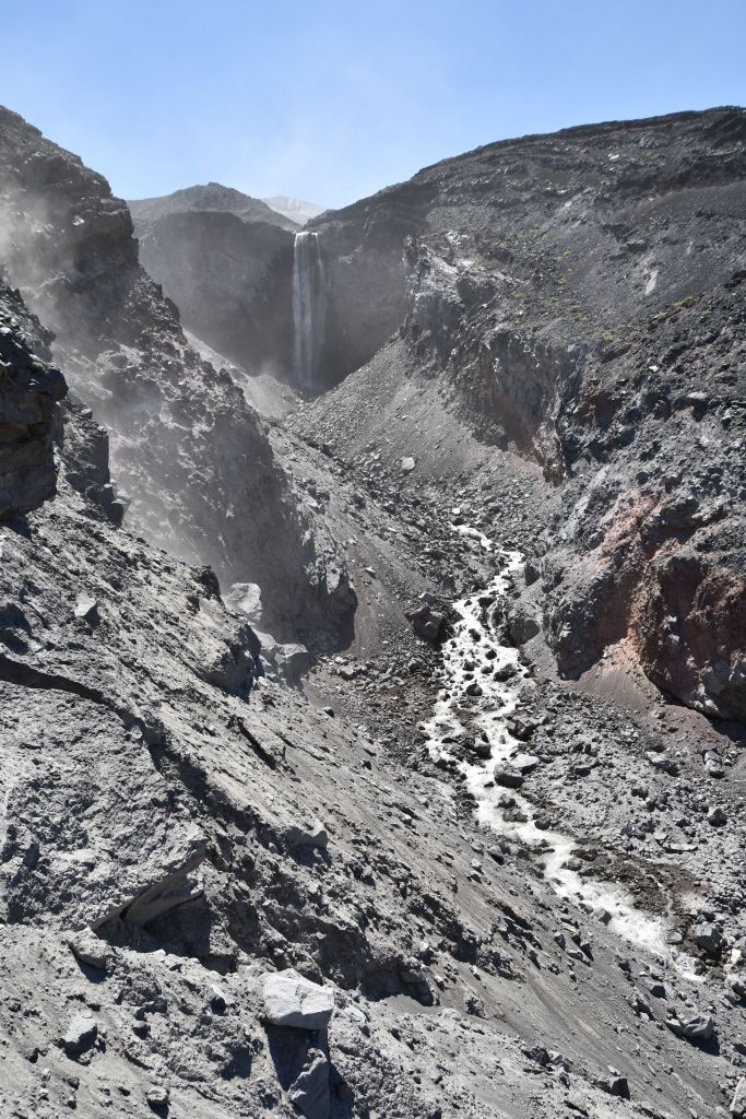
The termination of the trail was mostly on grey pumice and boulders in the direct sunlight. We rested, but not for long. Soon after we came across the largest stream we had seen that day, and though we were tired and thinking about the cold beers in the cooler in Andre’s car at the parking lot…we ended up staying here a bit. Andre filtered some water and we swapped out warm dregs for icy cold snowmelt water in our water bladders. I put my feet in again. It was so cold it was like a shock. But a good shock, since we had been six hours in the driving sun at this point. We washed the salt off our faces and doused our heads in the water. It gave us the morale boost we needed to finish up the last couple miles to get home.
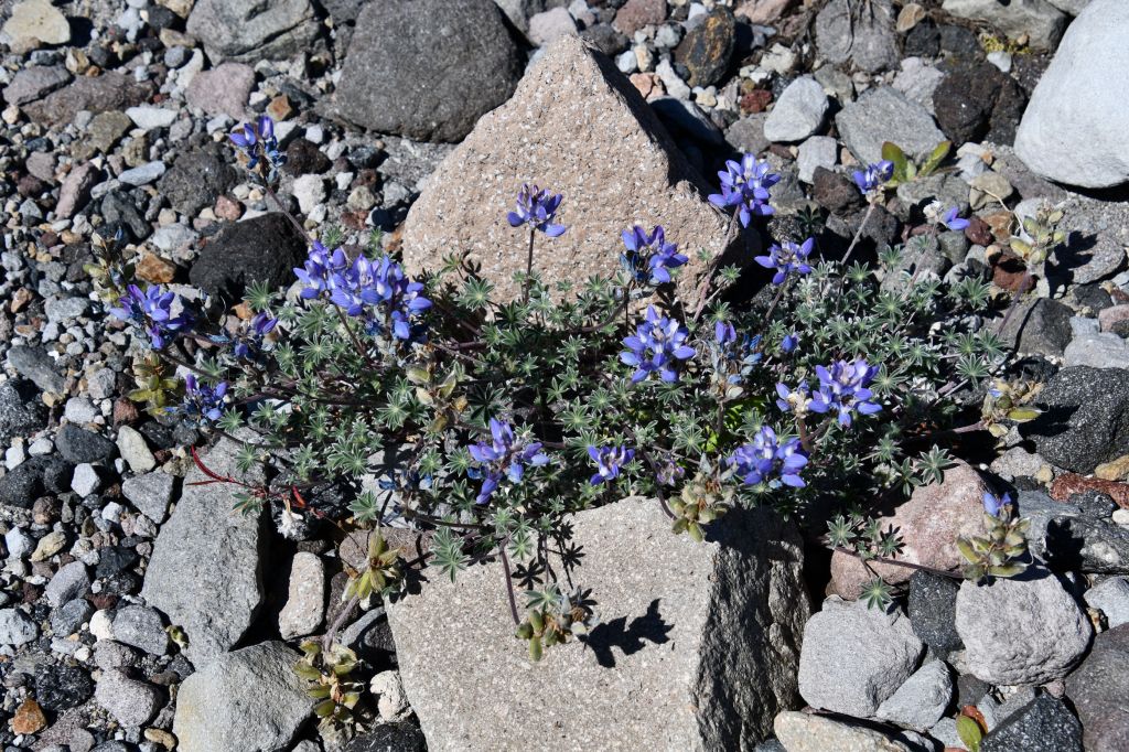
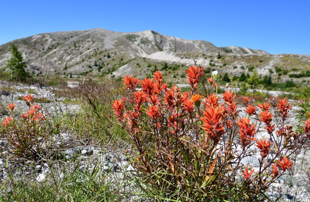
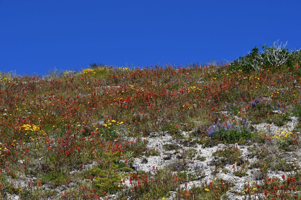
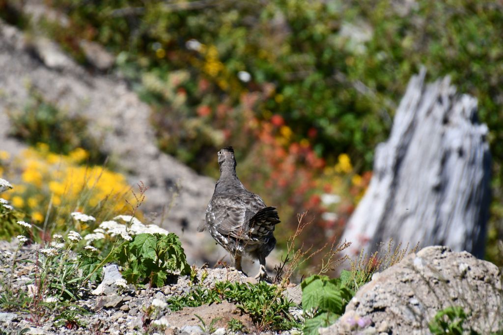
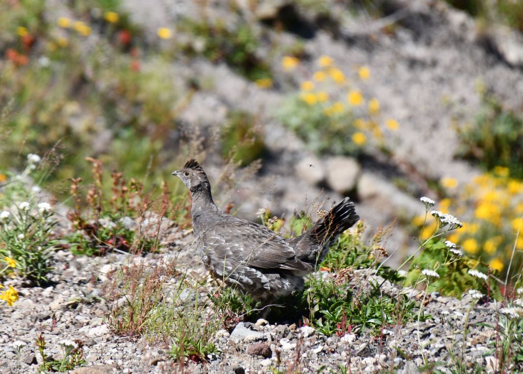
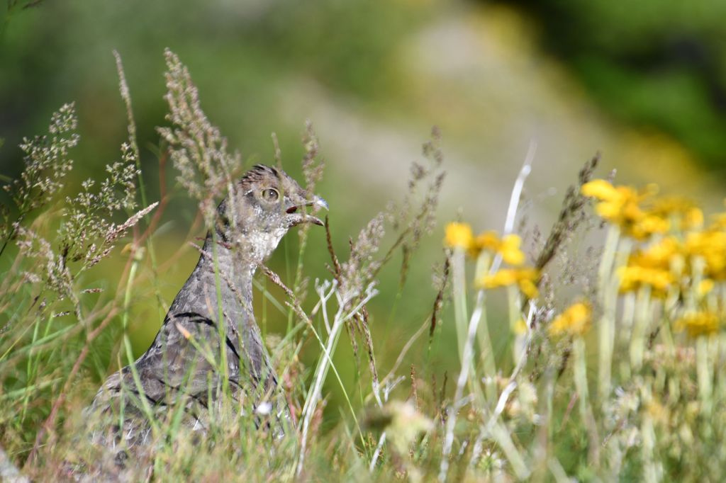
I don’t care how cold it is, I’m putting my feet in. You can see the pink on my shoulders and forehead here. I’m still feeling that today, two days later.At our highest elevation, at Loowit Falls, we reached 4,575 feet (1394 m). From the trail on the way back we finally spotted Mt. Rainier, 50 miles to our north. See it there, behind the lake?NOW you can see it! Thanks to my fancy schmancy zoom lens. The silver stuff floating on Spirit Lake is the somehow not decomposed mat of logs blown in there May 18, 1980. Yes, those are thousands of trees floating on top of the lake, that have been there for 40 years.Even though my feet were killing me, it was ninety million degrees out (32 million C), and I was starting to yawn after 7 1/2 hours of hiking, all that was not enough to keep me from awed delight at the neverending profusion of wildflower colours. Indian paintbrush, lupine, dandelions, daisies, snap-dragon-looking things, Queen Anne’s Lace, yarrow, and more I can’t identify.When we crested the saddle again, I saw that I was right: the light on Mt. Adams is much better later in the day.We had one last bit of excitement for the day, when a chicken ran along the side of the trail in front of us. On closer inspection, it looks more like a Dusky Grouse. Sadly, I only ever got a shot of it from it’s back end, because it was trying to escape us.In this shot I think I can almost identify it as a male. The sun is playing tricks, but if the ends of the tailfeathers are light grey, as they seem to be, that might mean this is a male.He found some grass to hide in as we passed. By the look of the open beak, I’m guessing this poor grouse agrees with me that it felt ninety million degrees out.
We gave a quiet little cheer and a half-raised fist, but that’s all the energy we could muster at the sight of the car at the lot. First order of business when we got back was to get the hot boots off and switch to sandals. We had lots of food and chilled drinks, but the wind had eased a little by then which allowed the biting flies to swarm. I sat in the shade and drank coconut water, water, and beer (thanks Andre!) until I had been bitten about 27 times. Then I announced I had had enough. Andre agreed. We skipped the picnic and drove the hour and a half back to Morton and had Mexican food and margaritas in a real restaurant. Of course, everyone had masks on except while eating, and every other table was roped off, but an actual restaurant nonetheless.
Well-earned Mexican food and margaritas, Crystal! That was quite a hike. Even more so on a hot, windy day. Great photos. Peggy and I had similar thoughts when few visited several years ago. Rather amazing that there are still trees floating on Spirit Lake. I would think that they would be waterlogged by now and resting on the bottom. –Curt
I wonder if there are also trees on the bottom of the lake. And I wonder what causes logs to float vs. sink. And I wonder why they haven’t decomposed. Are you two back from Florida?
We have another month on the road, Crystal. 🙂 Logs can stay submerged for a log time. Think of the Ancient Greek and Roman ships they find. Waterlogged trees can also be harvested for their lumber, depending on the wood. –Curt
Wow … What a post !!!
Beautiful images and informative notes …
It really feels great to read about outdoor adventures and see the bright and sunny skies.
This lock down phase is really frustrating with the uncertainty of when we will be able to move around freely.
Thank you so much for sharing and have a great day, Crystal 🙂
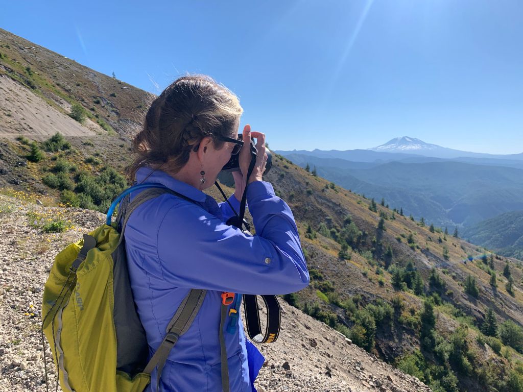
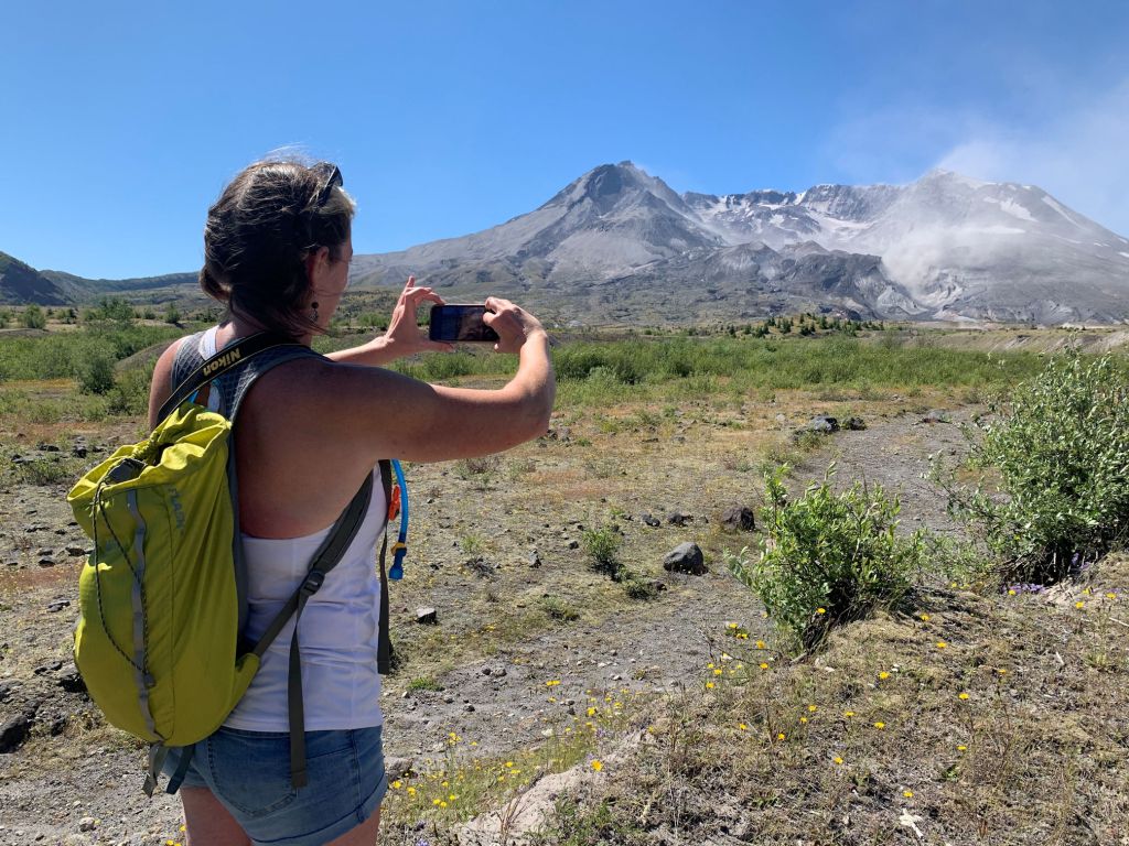
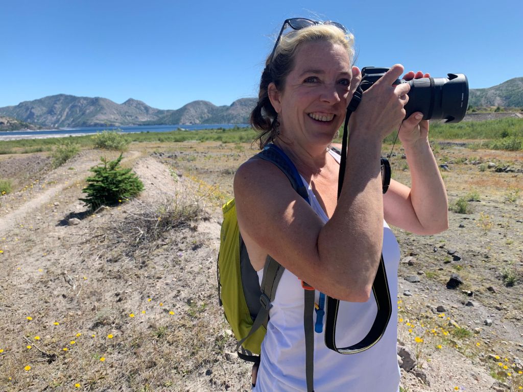
Sreejith, it’s great to hear from you. I hope you are well, despite lockdown. Yes, I keep leaving the house to go hiking. A lot of our nature trails in my region are open for hiking, with cautions to socially distance. Most trails have few people and keeping apart is easy. Many people hike with masks, and when the trails are narrow, we take care to step off the trail and give each other lots of space when we pass. Thank you for the compliments on my photos. It was a lovely day and I was having fun with photos. It was also fun to have a photographer friend with me for a change, so there are finally photos of me too. 🙂
I just discovered your blog and found it to be very interesting and beautiful. The photos are beautiful and the descriptions are enlightening. I will definitely be sure to follow more of your adventures in the near future. I hope you’re staying safe out there during these crazy times. I hope you have a wonderful rest of your day!
How gorgeous is that? It reminds me of my Alps. I’d climb that if I still could. Your shoulders got pink for not having covered them, ha! I remember seeing some photos of the explosion when very young and am terrified of volcanos ever since. And I’m glad to hear of a growing glacier. After reading The End of Ice this is a big surprise.
You have been reading so many posts!! My goodness! yes, this mountain was beautiful. It stands alone, and thus is remarkable on the landscape, even though the top is blown off. I, too, was surprised to hear about the growing glacier. There’s at least one, then. I know most glaciers are disappearing at a rapid rate. Like Glacier National Park, in Montana, almost has no glaciers anymore. I did not read The End of Ice, but I can imagine the sad tale it tells.

Quite a trek and quite a story about the eruption. Well photographed as always
It was a long day. We both got tired and sunburned, but it was worth it. 🙂
Well-earned Mexican food and margaritas, Crystal! That was quite a hike. Even more so on a hot, windy day. Great photos. Peggy and I had similar thoughts when few visited several years ago. Rather amazing that there are still trees floating on Spirit Lake. I would think that they would be waterlogged by now and resting on the bottom. –Curt
I wonder if there are also trees on the bottom of the lake. And I wonder what causes logs to float vs. sink. And I wonder why they haven’t decomposed. Are you two back from Florida?
We have another month on the road, Crystal. 🙂 Logs can stay submerged for a log time. Think of the Ancient Greek and Roman ships they find. Waterlogged trees can also be harvested for their lumber, depending on the wood. –Curt
Wow … What a post !!!
Beautiful images and informative notes …
It really feels great to read about outdoor adventures and see the bright and sunny skies.
This lock down phase is really frustrating with the uncertainty of when we will be able to move around freely.
Thank you so much for sharing and have a great day, Crystal 🙂
Sreejith, it’s great to hear from you. I hope you are well, despite lockdown. Yes, I keep leaving the house to go hiking. A lot of our nature trails in my region are open for hiking, with cautions to socially distance. Most trails have few people and keeping apart is easy. Many people hike with masks, and when the trails are narrow, we take care to step off the trail and give each other lots of space when we pass. Thank you for the compliments on my photos. It was a lovely day and I was having fun with photos. It was also fun to have a photographer friend with me for a change, so there are finally photos of me too. 🙂
Having a photographer friend with us really helps, I always misses it when I travel with my friends 😦
They enjoy each moment and I am always look for photography opportunities 🙂
But, when I travel with my wife, I can be assure of some pleasing photos of mine getting captured 🙂
Traveling with your wife is an excellent opportunity, my friend. One day I’ll have a partner who travels with me, too! ❤
Awesome post about the area with some great photos showcasing the amazing place, both the landscape and the wildflowers (and waterfall)
We were there in 2004 and unfortunately did not get to do much hiking.
Thank you so much for your comment. It is an amazing place, I’m glad you think so. The landscape caught my breath over and over.
Hi Crystal,
I just discovered your blog and found it to be very interesting and beautiful. The photos are beautiful and the descriptions are enlightening. I will definitely be sure to follow more of your adventures in the near future. I hope you’re staying safe out there during these crazy times. I hope you have a wonderful rest of your day!
Kind Regards,
Maddie
Thanks for stopping by and leaving such a great message, Maddie! I love telling stories, so I’m sure there will be lots more. ❤
How gorgeous is that? It reminds me of my Alps. I’d climb that if I still could. Your shoulders got pink for not having covered them, ha! I remember seeing some photos of the explosion when very young and am terrified of volcanos ever since. And I’m glad to hear of a growing glacier. After reading The End of Ice this is a big surprise.
You have been reading so many posts!! My goodness! yes, this mountain was beautiful. It stands alone, and thus is remarkable on the landscape, even though the top is blown off. I, too, was surprised to hear about the growing glacier. There’s at least one, then. I know most glaciers are disappearing at a rapid rate. Like Glacier National Park, in Montana, almost has no glaciers anymore. I did not read The End of Ice, but I can imagine the sad tale it tells.