
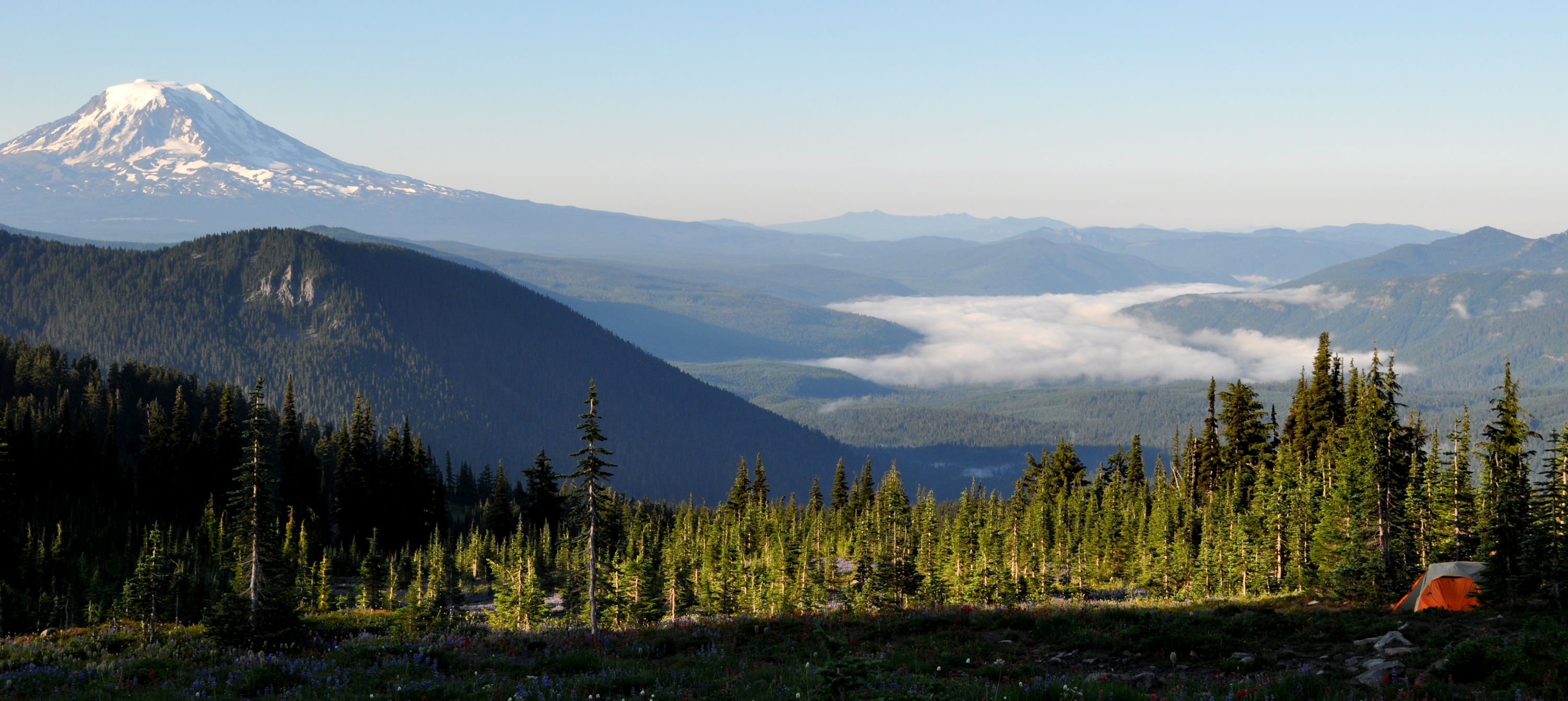
Morning was astonishingly beautiful, because we finally got to see Mt. Adams without the top obscured in clouds. And got a nice view of Mount Saint Helens, because the sun was hitting it right. Volcanoes: I love them! Fog had formed in the valley and seeped away from us into the Columbia River Valley as we watched. It was fun talking with Arno about fog formation and fog “movement,” as I pulled out my dusty NWS memories. Fog doesn’t actually flow through a drainage, as it appears, and it was kind of cool to be science-y smart with my geeky boyfriend for a change. His job is smack in the middle of science and technology (UAVs), while mine is medical disability benefits. I like showing off, and it’s hard to brag about hip replacements and accident verification.

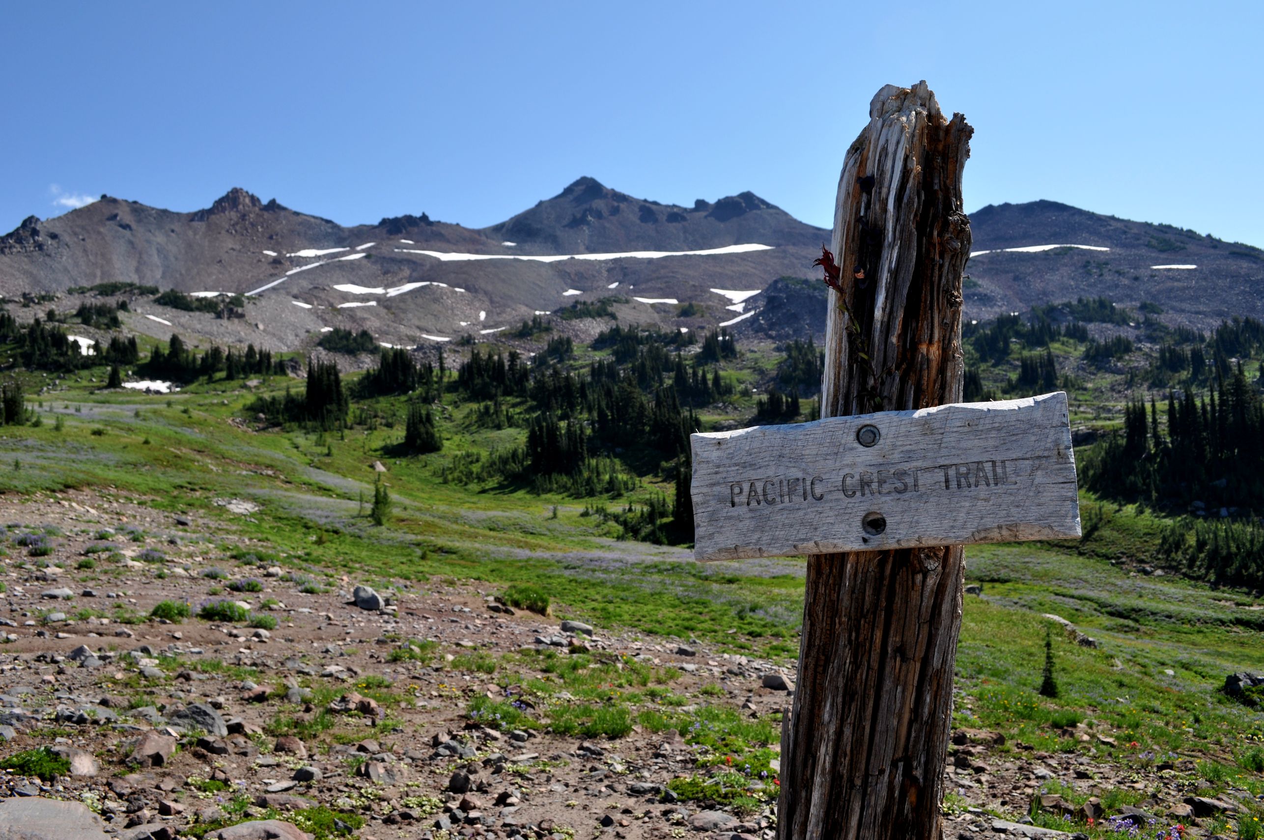
Arno is the mountaineer (but my high school mascot was The Mountaineers!), and I humored him by agreeing to climb Old Snowy Mountain, the nearest peak to us, for our Saturday excursion. We loaded very lightly in daypack gear, set out, and….gosh if we didn’t hit the Pacific Crest Trail (PCT) immediately. Turns out, we were supposed to take a hard left at the Lily Flats Trail yesterday, which was the way to Goat Lake. Lily Flats Trail parallels the PCT, and we had taken one of the short connector trails. Now, our map made so much more sense.
It meant we were much closer to Old Snowy Mountain than we thought, but it also meant a 9-mile hike out on Sunday. But that’s tomorrow, and today we are mountain climbing. Did I mention I’m not big on mountain climbing?
Keywords: Scary? High? Amateur?
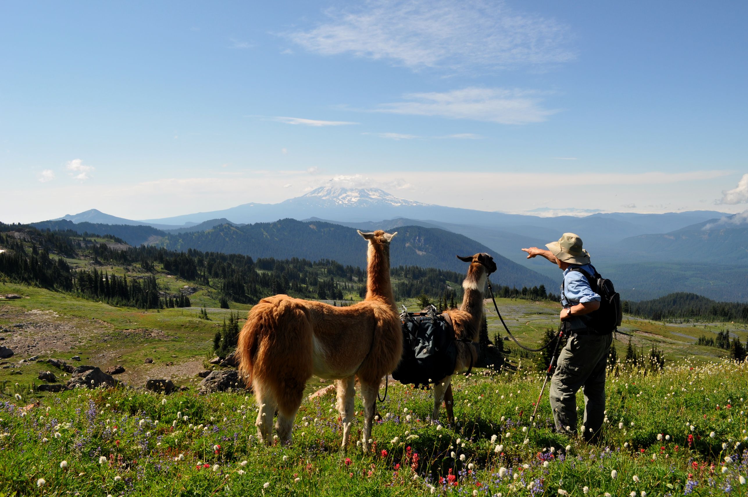
Well, on the way we realized we were in Argentina, when we spotted the llamas. Snow, exposed rocks, alpine air, high elevation+llamas=Argentina.
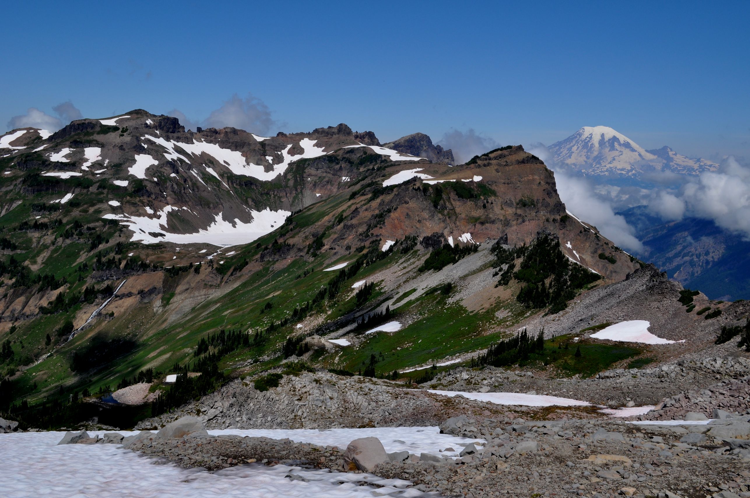
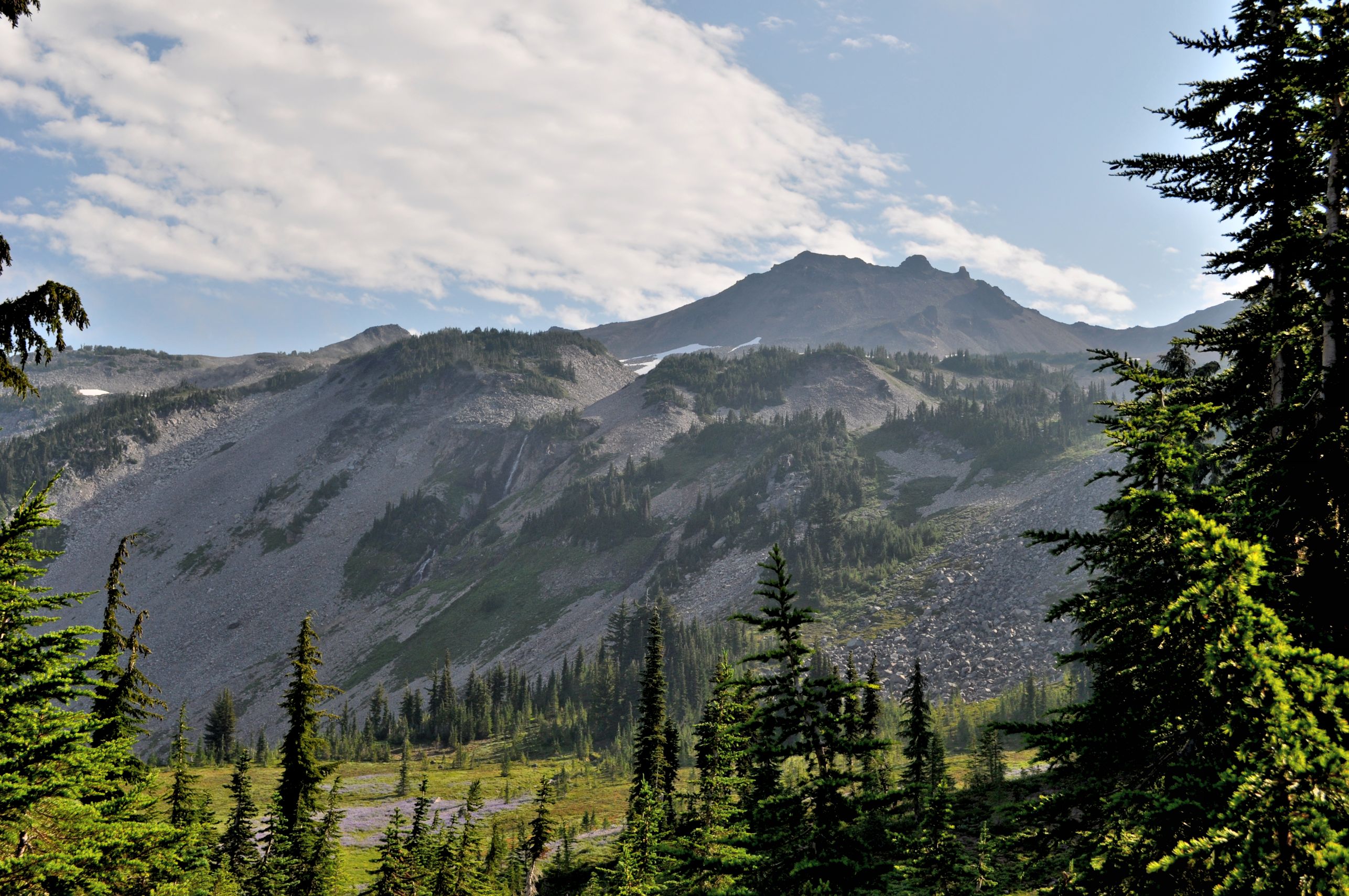
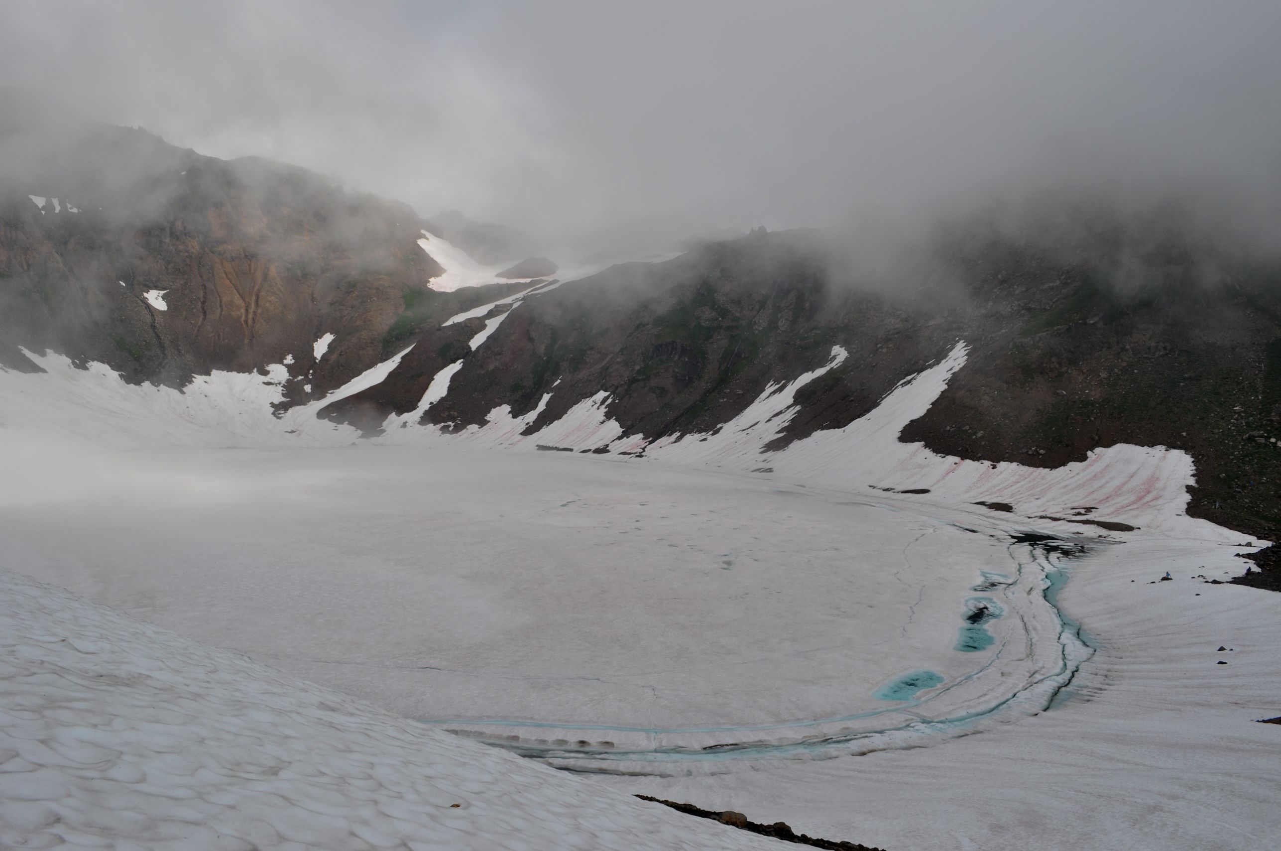
We climbed across large snow fields (the trail crosses the Packwood Glacier), over many gurgling creeks, across meadows and beneath rocky peaks. We soon spotted Goat Lake. It’s totally frozen over still. In August! I was glad we hadn’t made it all the way there to camp, as we had considered. Then I got my visual stimulation payoff before I even had to climb the dang mountain peak. Mount Rainier! Holy Mother that’s a beautiful volcano. Three volcanoes in one day! Look at the crazy steep valley.

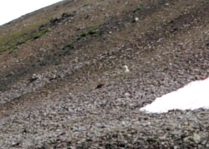
This place is named after goats, for the mountain goats said to frequent the area. We were hoping for goats the whole trip. Someone casually pointed down the hill: “There is a goat,” as though it were obvious. You be the judge.
It’s pretty exciting for me to hike along the Pacific Crest Trail, called the PCT by locals. This is our West Coast equivalent of the Appalachian Trail (2,180 miles and crossing 14 states). The Pacific Crest Trail is 2,665 miles long, begins at the Mexico border and ends at the Canada border, and crosses the states of California, Oregon, and Washington. Just three states. We make ’em big out here. I’ve mentioned before that I want to hike the entire thing someday.
While at the ridgeline, Arno walked out onto the McCall glacier. The glaciers we were on today looked more like snowfields.


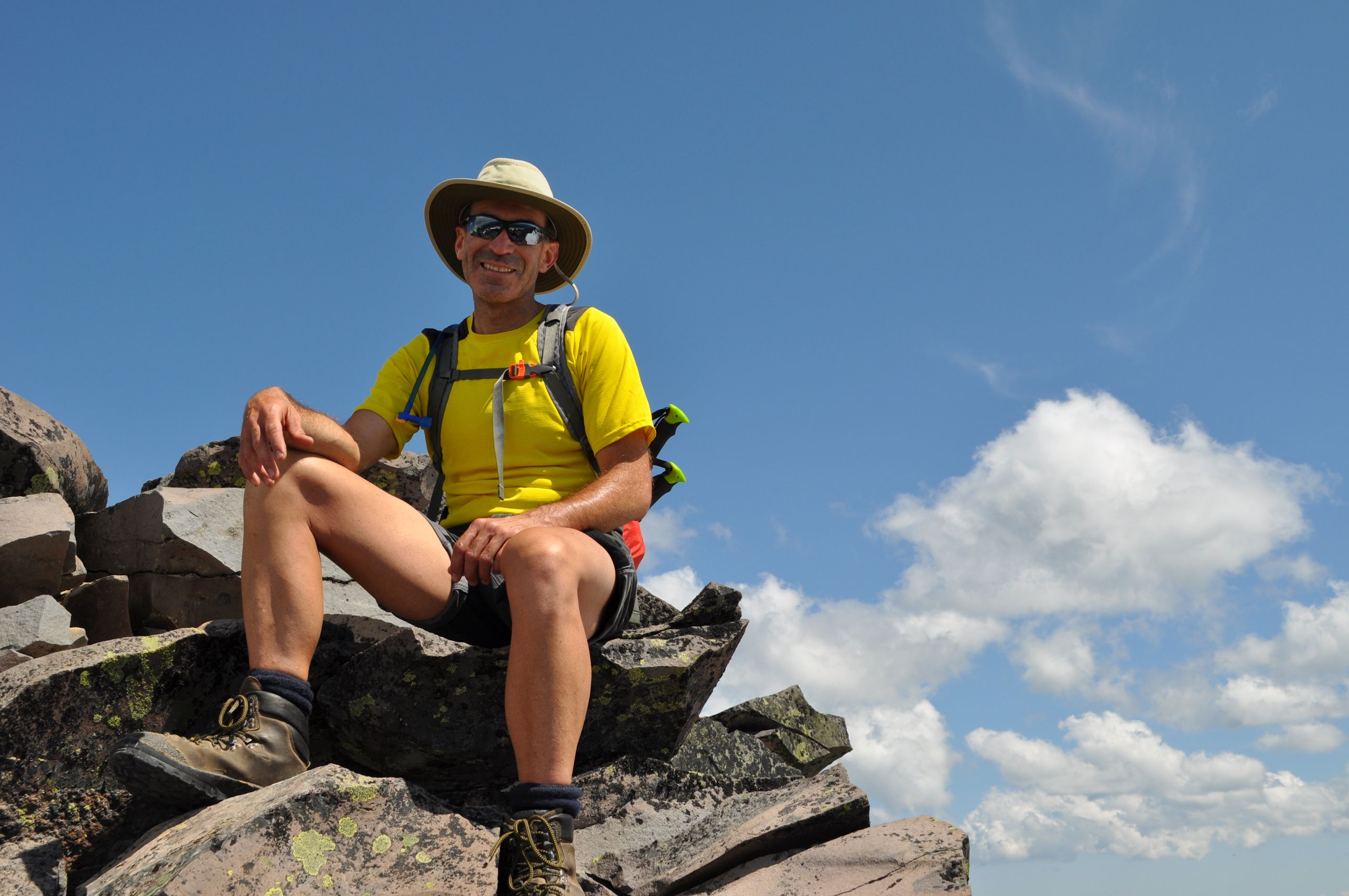
The highest Washington point along the PCT is 7650 feet, and a short distance from where we spotted the “goat.” We left the trail and headed sharply uphill to aim for the peak of Old Snowy Mountain, topping out at 7930 feet. We had climbed another 1500 feet from our tent.
I get so nervous climbing, but I also get irritated and impatient with myself for being scared. I want to scuttle up the side without pounding heart and sweaty hands. My technique is not to look anywhere but my next few steps, not to think about it, and to go as fast as I can so it will be over with quickly.

Then we made the long trek back down. I had talked Arno into carrying lunch with us, because I was worried about how long it would take me to get up the mountain and down again. We stopped on a delicious high ledge around 7000 feet, and had some smoked salmon and pasta for lunch and were still sorta full when we made it all the way back to camp. For a light dinner, I baked brie in red wine and brown sugar with apricots, and we had that with the rest of the wine.
Only minor thunder rumbles in the night, and for our concerted efforts to stake down our tent against a possible storm, we suffered a few mere gusts and a sprinkling of rain. We slept much better and were able to get up early.
We packed up the whole camp, ate breakfast, drank our Peets coffee, and were hiking before 8 am. Not knowing the trail, I wanted a really early start to make sure we got home at a reasonable time. It stayed wet and mostly cloudy all day, but it remained an excellent day to be on the trail.
Goat Lake was not as lovely as it could have been, since it was frozen still, and the few spare campsites up there were not at all as inviting as ours had been. The trail remained partially obscured due to snow, and we scrambled around till we got out of the cirque. Our trail out was along Goat Ridge, and offered splendid views of the valley from the east side rather than the west side, where we had spent the previous two days.
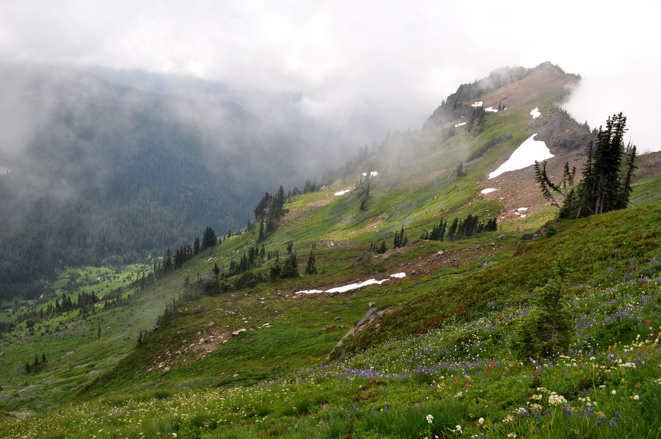
We crossed over Goat Ridge into the Jordan Creek basin, and that was the end of our views. The entire valley was socked in for the entire day. We beat feet downhill and my bum knee did not fail me (whee!). We stopped for burritos for lunch: filled with reconstituted beans with fresh avocado, chilies, and cheese – yum!
Around 3pm we spotted reflections off the vehicles parked at the trailhead. We had arrived earlier than expected, and made it back to Portland by 6pm. Not too shabby. The biggest loss of the trip: Arno left his REI trekking poles leaned against the truck as he changed into fresh clothes in the parking lot. Then we drove off. D’oh!

I have no idea how I missed these two posts, but I’m so glad that I finally found them! The photos are stunning! and the one of the Llamas (it seems that they are looking off to wear their guide is telling them to look). In just 2 short days you saw Mt Rainier, Mt St Helens, and so many other mountains and glaciers. wow … I’m kind of in awe way over here in Virginia!
I’m glad you liked my photos in Goat Rocks. I think this is the most beautiful place I’ve ever hiked through. I’ve never hiked or camped in Virginia, or anywhere near there. So whenever I do that, I’ll tap your brain for some good spots to see. I like to think of East Coast mountains as an older version of what’s out here, so maybe Virginia’s volcanoes are still there, just worn down and covered in trees. 🙂