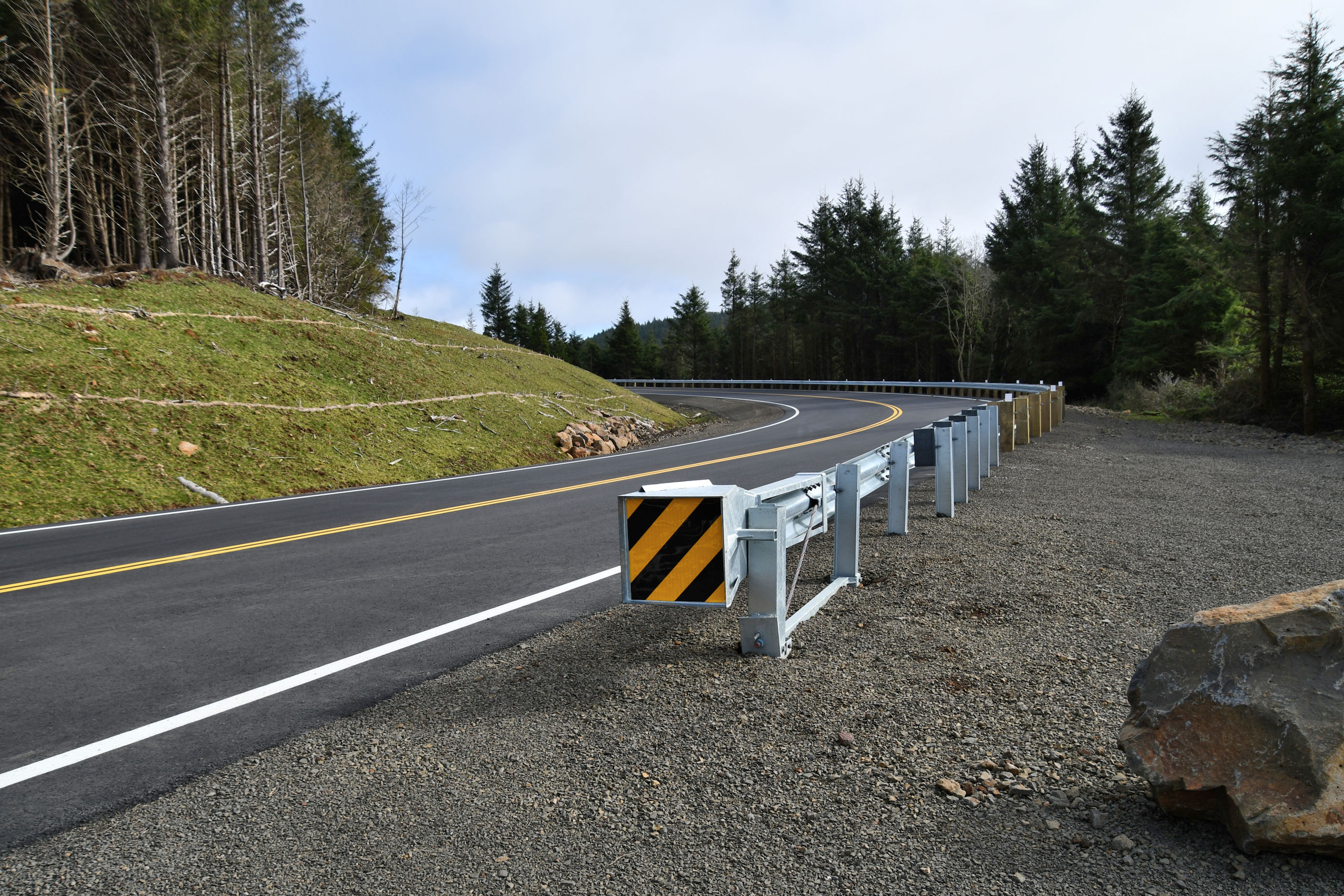
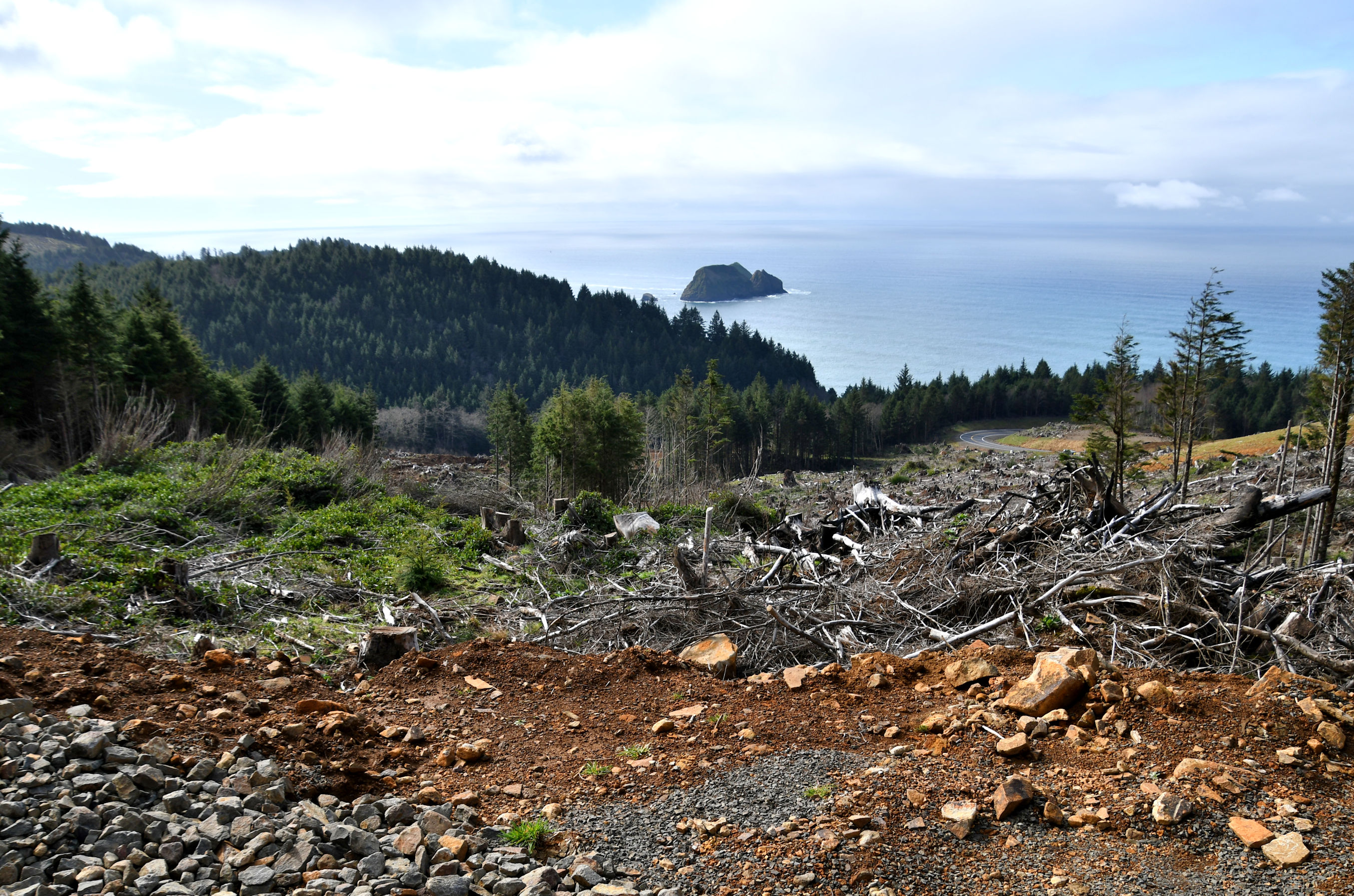
Saturday, February 24, the weather was good, and Pedro and I decided to hike the cape trail nearby. For as often as we have hiked trails along the coast, Cape Meares State Park was one that neither of us had hiked. We followed a clearly brand new highway to the cape, wondering if this new route out of Tillamook was constructed due to frequent landslides on the coast that wreck the roads every winter. This one did provide us with an impressive vista on the way, as you see in the photo below.
We parked first in a small gravel lot right at the turn off for the lighthouse road. The trailhead for beach access is there, and since it was the first thing was saw, we hit that trail first thing. The parking area was at the top of the cliff, and the trail pretty much zig zagged down to the beach.
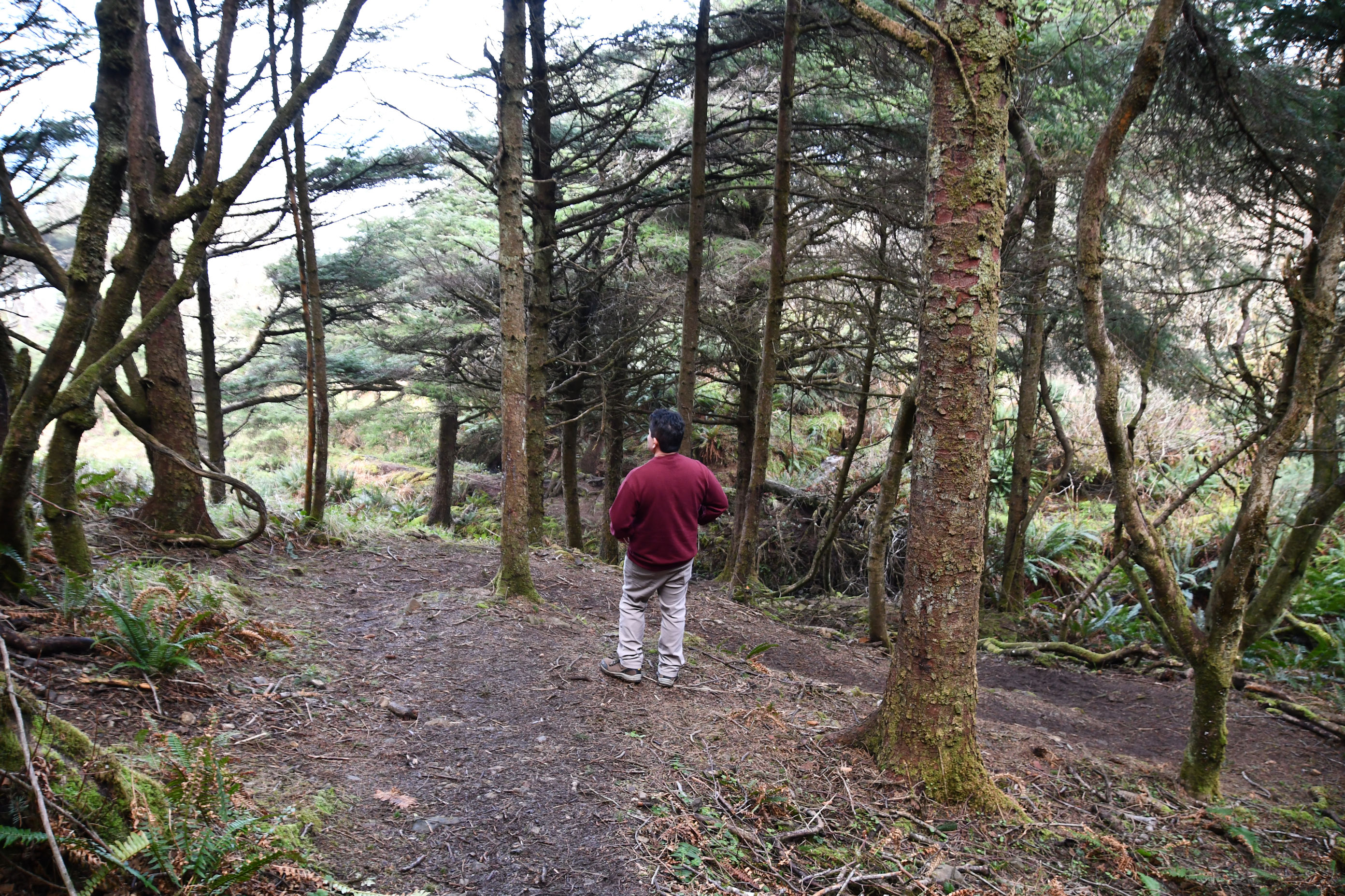
The trail showed evidence of fallen trees due to winter storms. Many trees had fallen across the trail, and were either cleared away with a chainsaw, or the trail was re-routed around the fallen tree and debris. We got a sense of how bad the storms were with one tree in particular.
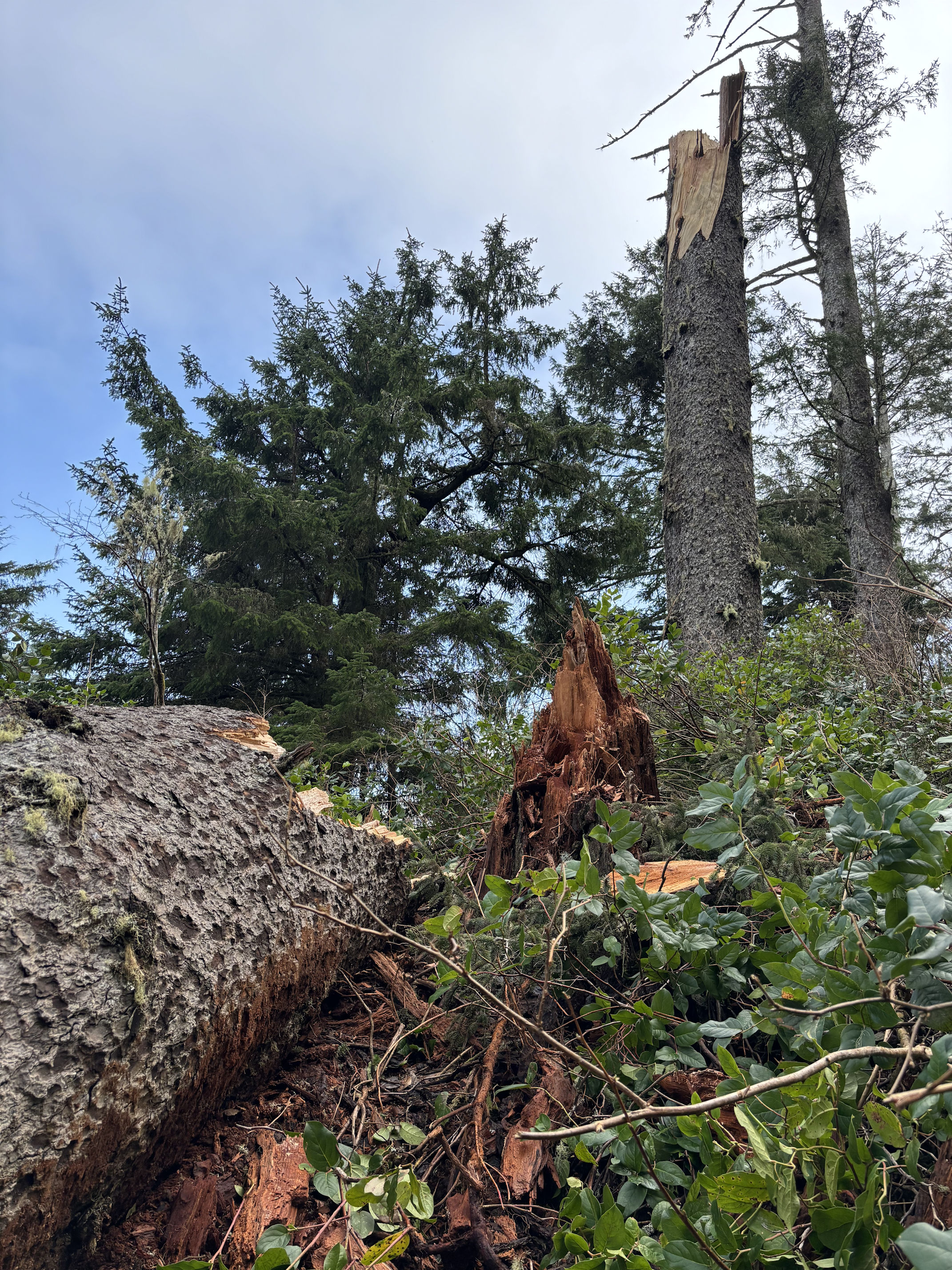
When a tree snaps off its trunk this high above the ground, that is usually because of wind. It takes a pretty massive wind event to do this to a healthy tree. But it takes something even stronger to snap a tree of this size. It’s giant! Chainsaws had cut a path through it and I stood beside it to model.
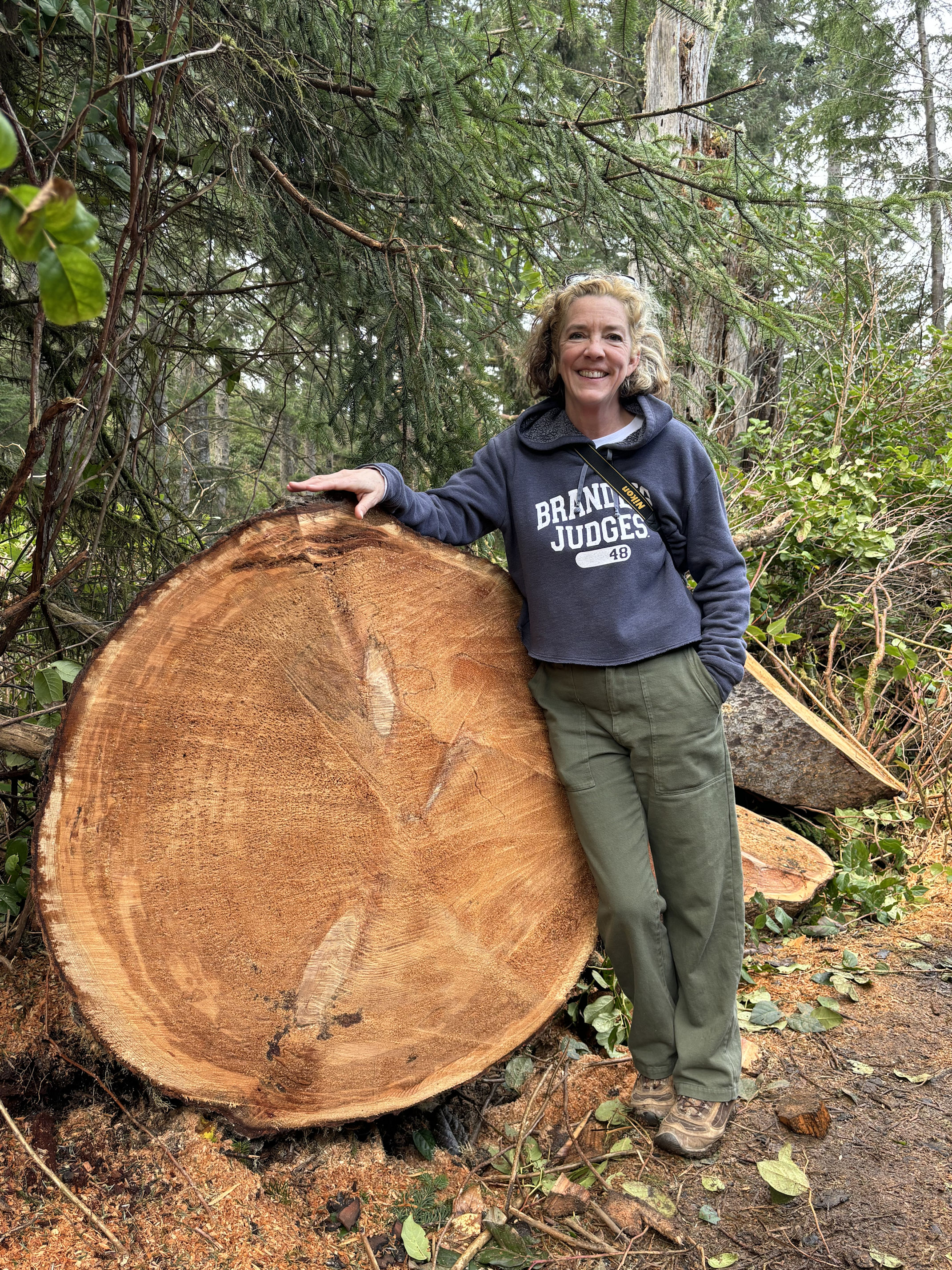
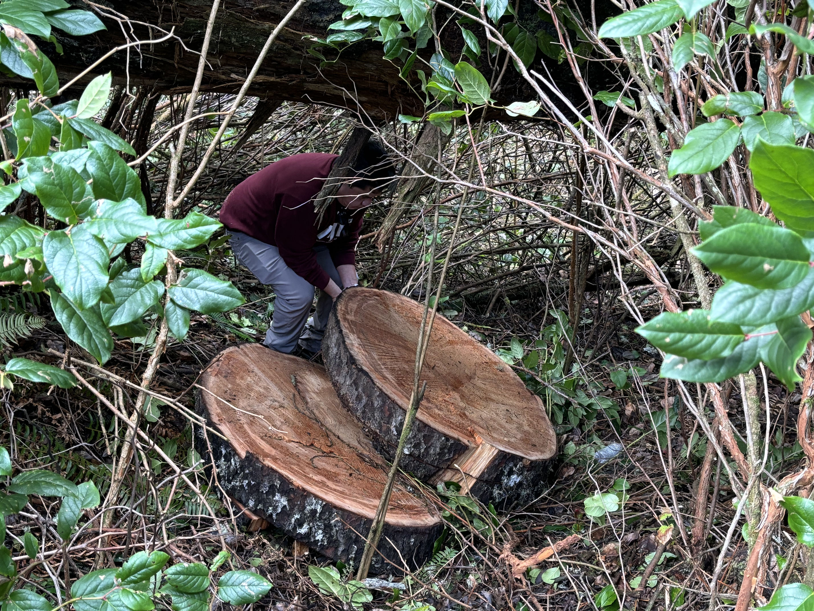
We walked farther along the trail and saw some more pieces of it, cut into discs and rolled off the trail. They were massive and I took a photo.

I looked at the photos in my camera, and realized that these discs do not look remarkable. I asked Pedro to climb down the hill and provide some perspective. We were curious about how hard it would be to roll them back up the hill, and maybe roll one into the Jeep to take home. But nope. No, that would be impossible for the two of us.
Eventually, we had descended all the way down the very steep cliff to the shore of the Pacific Ocean.

At the beach, we were treated to a view of a couple sitting on the only bench, with a floatation buoy behind them. They were not speaking, just sitting there taking in the view. The couple stayed there the entire time we were at the beach. As we left, I explained that it was a great scene from behind, and offered to take their photo. The woman handed me her phone and I took a few shots for them. It looked better in person. Maybe that’s because the sound of waves crashing and the smell of salted sea in the air doesn’t come through well in photos. (wink)

We climbed down the last little cliff and enjoyed the beach below the couple.


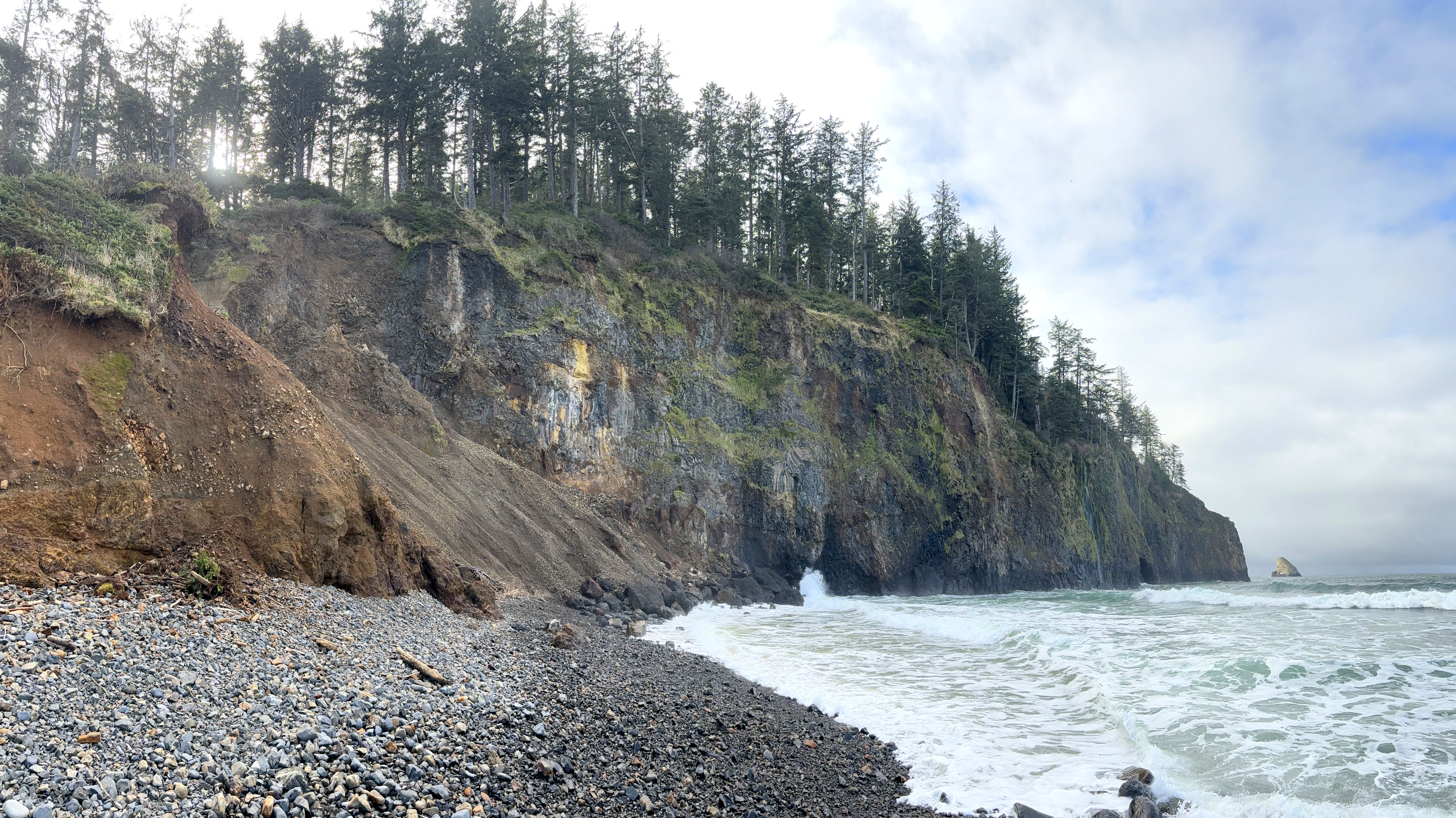
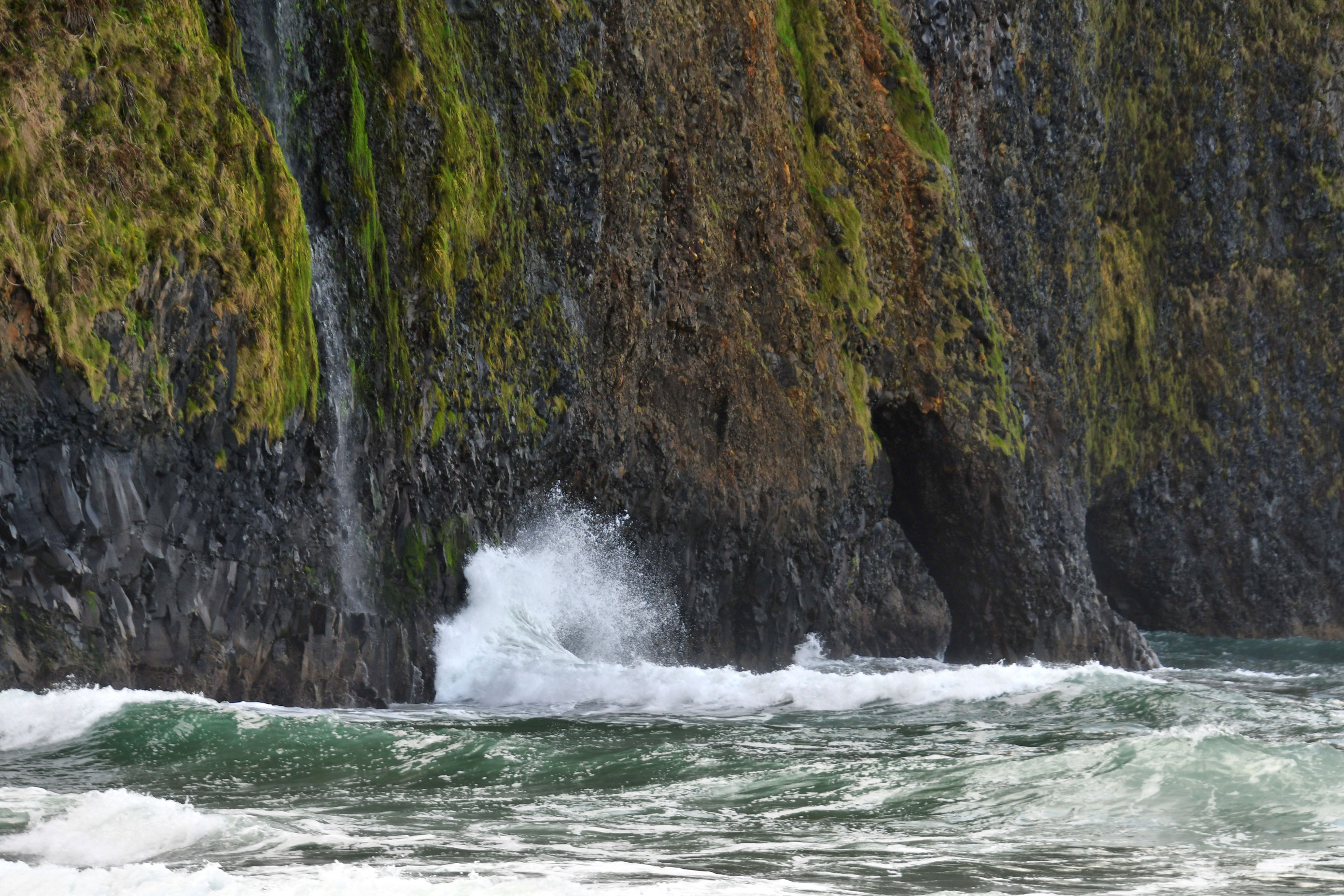
We stood for some time on the rocky beach and listening to the clicking of the rocks as the waves rolled them around and against each other. We gazed out to the horizon and wished for more heat as the cool sun peeked through the low clouds. We watched waves upon waves crashing against the wall. And then I noticed an arch!
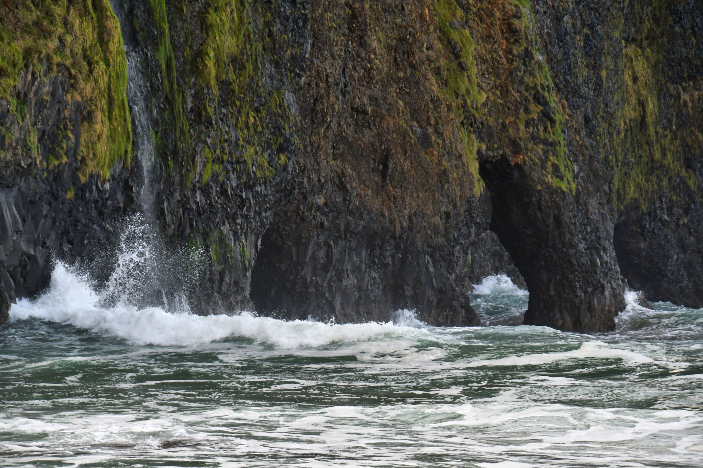

Off the tip of the cape we spotted a rock illuminated in the weak sunlight. I zoomed in with my camera and was able to see a fishing boat. Now, on my computer, I am able to look at it all on a big screen, and I see a cloud of birds circling the fishing boat. We’ve got a whole scene here at Pyramid Rock that my unassisted eyes couldn’t even see.

When we had absorbed enough of the crashing waves to sustain us, we turned back and climbed the zig zags again, back up to the top of the cliff. We hopped into the Jeep and drove down Lighthouse Road to the paved parking lot for Cape Meares State Scenic Viewpoint. In that parking lot was a new structure that caught my eye. It must have been built within the last few months, because the wood was barely weathered.


Inside the structure are information boards inside about a variety of topics, including common whales seen off shore here, the names of all the lighthouses along the coast, and threatened species of flora and fauna to look for and to cherish. From the paved parking lot, there are two more trails. One to see the Octopus Tree and one to see the Cape Meares Lighthouse. On the way, one passes the Viewpoint.


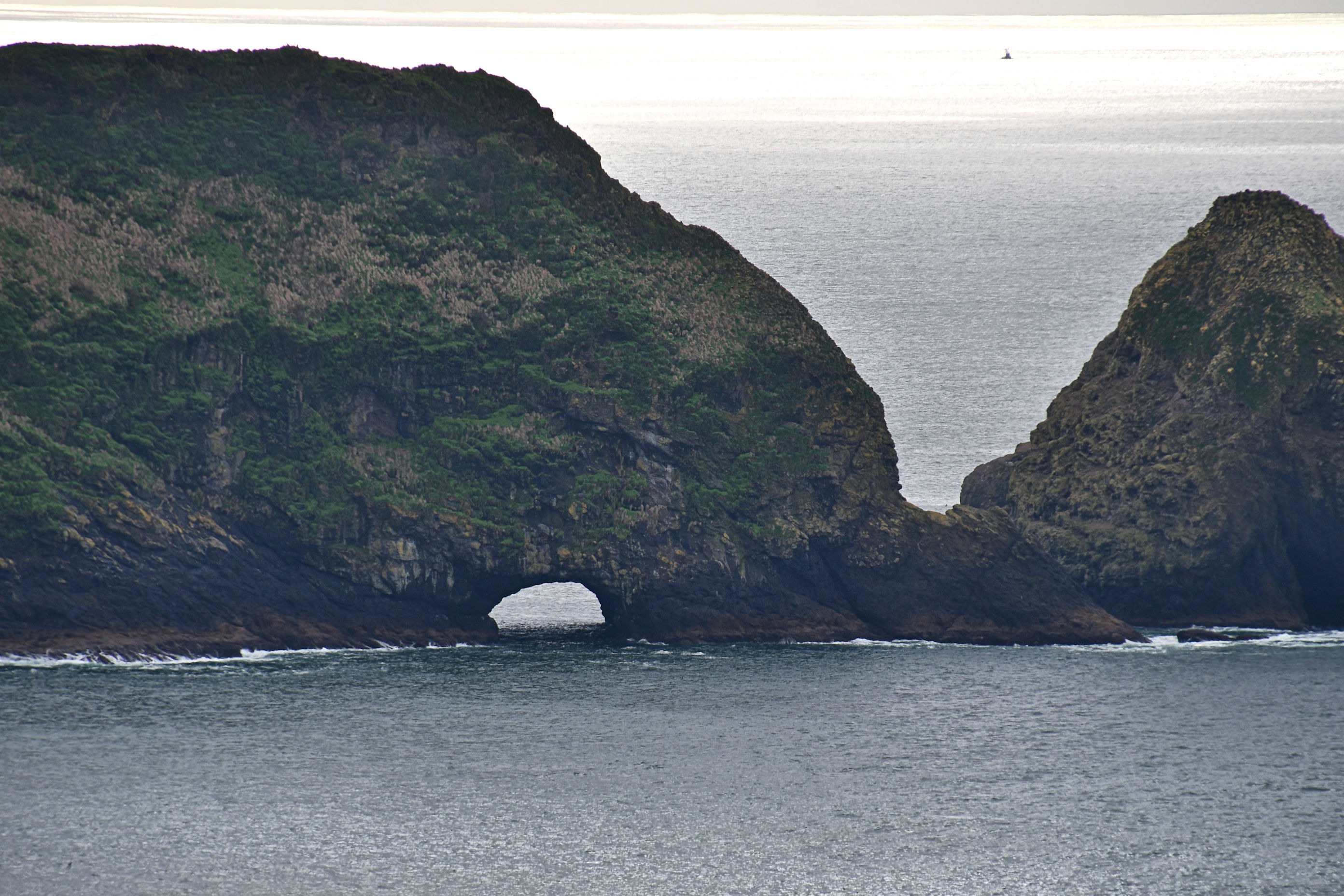
The sea stacks above make up a 15-acre protected area called Three Arch Rocks National Wildlife Refuge. Based on the name, I’m wondering if there is a third arch I did not see. In any case, this spot is pretty cool. From their website: “It is closed year round to the public due to the sensitive nesting habitat it protects for seabirds and marine mammals. In October of 1907, Three Arch Rocks National Wildlife Refuge was established as the first National Wildlife Refuge west of the Mississippi River largely due to the efforts of two young conservationists: William L. Finley and Herman Bohlman. Today it sustains the largest and most diverse seabird colony in Oregon and is an important breeding site for Steller sea lions.”
We followed the Octopus Tree trail. I had heard of the tree, but couldn’t remember seeing it, and neither of us recalled what it was. So off we went and found the Octopus Tree. I can see how it earned its name.

A sign at the base of the tree says that no one is sure what caused this tree to have such a shape. Theories include intentional shaping by Native Americans, which I find curious. I wonder what local tribe members think caused this? And Why? It’s a Sitka Spruce that is more than 46 feet in circumference and 105 feet tall. It is estimated to be 250-300 years old, and is designated an Oregon Heritage Tree.

Beyond the tree is another great overlook:

Next we went the other direction, on the Lighthouse Trail. I’m sorry this blog post is so long! There was a lot to see at this one stop. Unlike the muddy, root-booby-trapped trail that zig zagged down a steep cliff that we hiked first, the remaining trails are paved, with only gentle slopes, and easy. Just so you know: a visit to Cape Meares is appropriate for most people of most abilities. We saw very young and very old there, people using walking devices, people walking while using their phones, kids running every which way, dogs mostly on leashes, seagulls, birders, whale watchers, lighthouse watchers….it was neat to see how the (relatively) good weather had brought so many people outside.


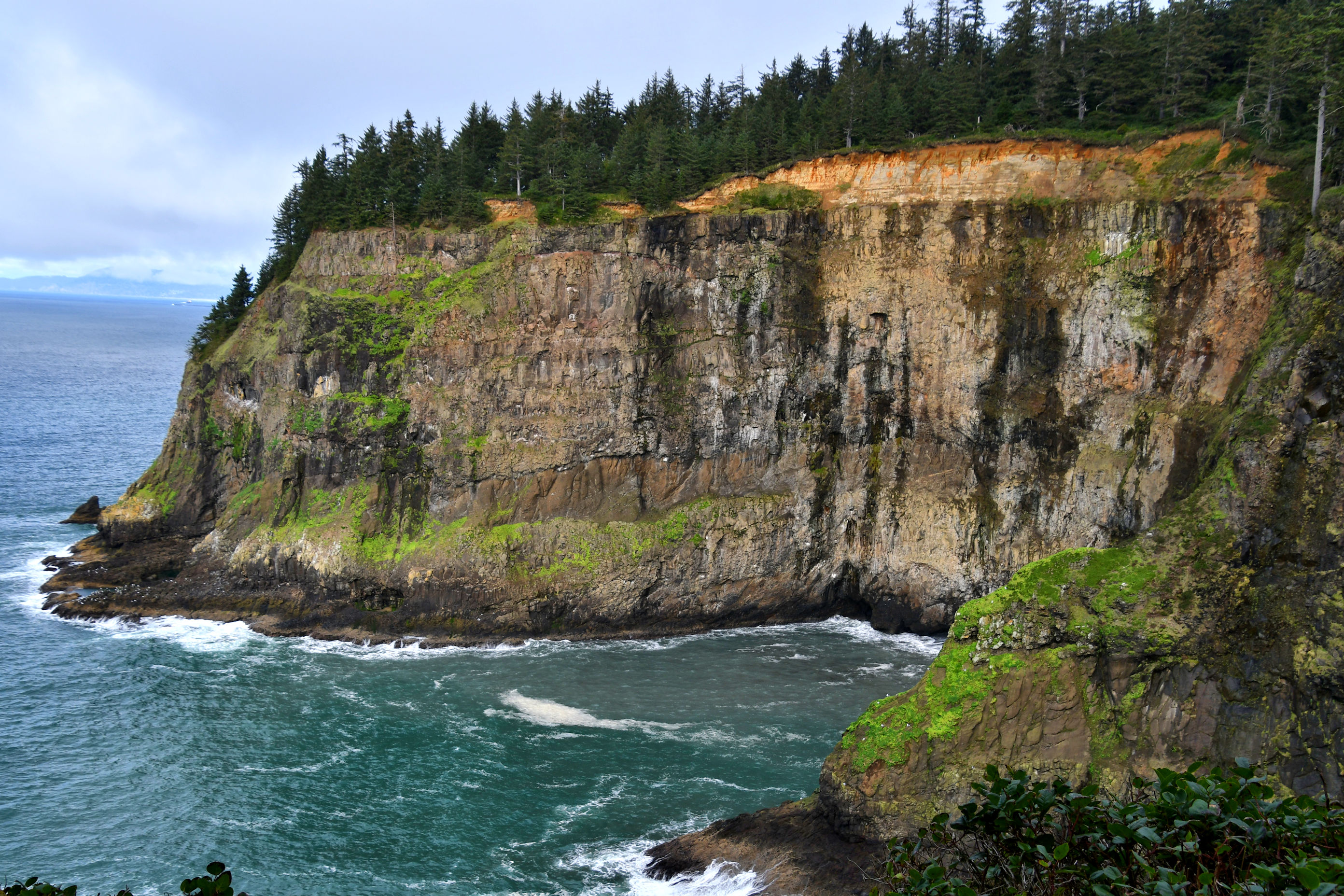
The lighthouse trail is a loop, so we took the other path back to the car. This afforded us new views of the cliffs we had hiked down earlier.

This was a sufficient amount of trails, and we called it good and set off in search of a different kind of sustenance.

Wonderful hike thanks Crystal. Loved Pedro “perspective provider.” 😂 and that tree is huge. Good on Pedro for having a go 😁
Glad you liked my little joke, haha! The tree is outstanding. I am eager to learn more about it, like, how to get the whole thing into a photo! ha!
Another splendidly photographed tour. Those sawn tree pictures really show the devastation; that couple will treasure their pictures; the Three Arches Rocks reminds me of our town of Sevenoaks, named for its 7 trees – after our great storm of 1987 it has only one left
Oh the story of losing six of the seven oaks; how disappointing. Even though a storm is a part of nature, I hate it when very old trees are destroyed. I hope that couple likes the photos. I didn’t ask. We were on our way out, so I took the photos, handed back the camera, and we walked away. Since it was my idea, I wanted to give them the freedom to not like the scene as much as I did. 🙂
Whoa. I love a good beach hike. Especially the kind that give you perspectives from the cliffs above. I’ve done Falcon Cape and Neahkahnie but never this. Gorgeous views. Will be interested in hearing if you learn more about the Octopus Tree. Cool stuff.
Cape Falcon is a good one! That was my very first hike with Pedro, during the early pandemic when everyone was afraid of everyone else, and a lot of us were hiking as our only acceptable activity. We had known each other about a week. Good memories. 🙂
Peggy and I have visited most of the places you featured today. I remember being particularly impressed with the Octopus Tree. I recalled more native lore related to it regarding canoes, so I looked it up. This is what I found: “Some believe that the huge Sitka spruce was simply shaped by natural conditions such as extreme weather. However, it was Native Americans in the area who trained the tree into its cage-like assortment of thick vertical trunks. Such trees are common in the Pacific Northwest, and are known as culturally modified trees. Native Americans created the tree to hold canoes with corpses, in a practice known as “tree burial.” Culturally modified trees were also made to mark important places.”
Oof I remember that hike down to the beach. It was way too muddy at the time for us to navigate, and too steep – and we had to quit halfway down. Glad to see what it looks like!
It’s a nice little beach, and rocky, so that the waves going out make those wonderful clickity clackity sounds. I just love that. The trail seems to be kept up pretty well, and used, despite all the mess created over the winter. You’ll probably get a chance to try it again someday, hopefully in a drier season. ❤